Archive for the ‘Metropolitan Avenue Bridge’ Category
northward pull
Wednesday, the dusk of the week.

– photo by Mitch Waxman
One can affirm that the Metropolitan Avenue Bridge is still there, as of last week. A small but double basculed draw bridge which spans the English Kills tributary of the fabled Newtown Creek, Metropolitan Avenue Bridge is 3.1 miles from the East River. You don’t see much in the way of maritime traffic back here, but there’s usually a tug and fuel barge found at the Bayside fuel depot’s bulkheads.
One would advise the curious that the shoreline is crumbling, and you want to be REALLY careful anywhere near the ragged edge of the land if you don’t want to end up immersed in Newtown Creek’s most polluted section. If you’re not being careful, the dice will roll and it’s either going to be X-Man or Liver Cancer for you.

– photo by Mitch Waxman
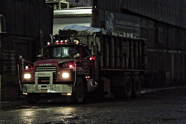
A couple of old fuel trucks are permanently stationed hereabouts, which endlessly fascinate me with their late 20th century design cues and onboard signage.
The burning thermonuclear eye of god itself was dipping behind Manhattan just as I arrived at the bridge, which served as my turnaround point on this particular walk. One does not decide in advance on where the pivot takes place, but it is often considered. That’s the thing about the street grid surrounding Newtown Creek – there’s so many dead ends and cul de sacs, which aren’t a big deal when you’re in a vehicle, but if on foot you need to factor them into your route.

– photo by Mitch Waxman
It was when I pivoted that the roar of powerful engines was heard. Frankly, I thought that a massive nocturnal bit of construction might be afoot due to the noise which was clearly audible even with my headphones in and Black Sabbath playing. It was approaching the sound levels encountered nearby the helicopter landing pads you encounter on the east side of Manhattan.
More on the tumult tomorrow.
Note: I’m writing this and several of the posts you’re going to see for the next week at the beginning of the week of Monday, September 28th. My plan is to continue doing my solo photo walks around LIC and the Newtown Creek in the dead of night as long as that’s feasible. If you continue to see regular updates here, that means everything is kosher as far as health and well being. If the blog stops updating, it means that things have gone badly for a humble narrator.
“follow” me on Twitter- @newtownpentacle
Buy a book!
“In the Shadows at Newtown Creek,” an 88 page softcover 8.5×11 magazine format photo book by Mitch Waxman, is now on sale at blurb.com for $30.
formula filled
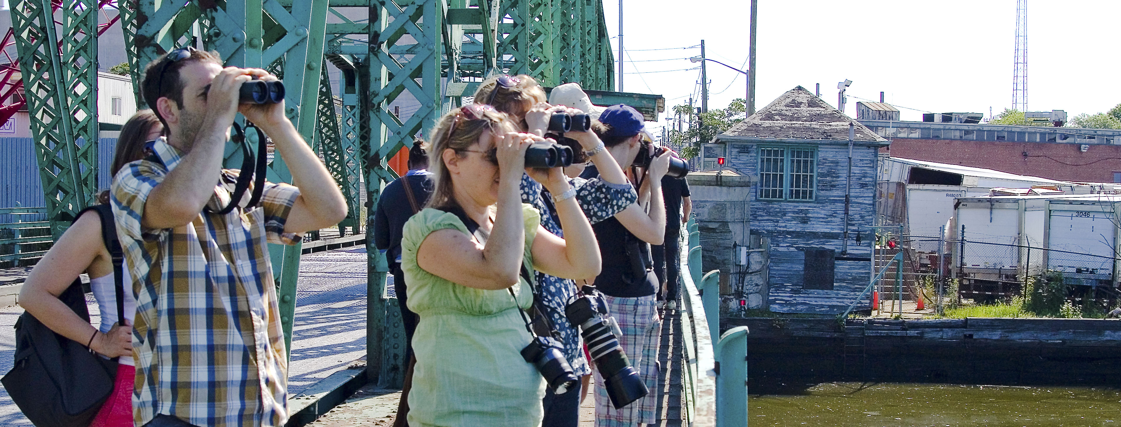
My creek also puts on a show when I’ve been away from her too long.
– photo by Mitch Waxman
One of my practices, developed over the last decade or so, is to take a Newtown Creek break periodically and “allow my liver to return to a normal size.” I’m joking about the liver, but one does enjoy a bit of detox occasionally, and allowing the poisons I’ve accrued a chance to leach out. This is a luxury one enjoys, as he doesn’t live along Newtown Creek, others aren’t so lucky. Pictured above is roll on/ roll off garbage truck carrying a bin, spotted at a waste transfer station owned by a friend of mine which fairly straddles the border of Brooklyn and Queens.
– photo by Mitch Waxman
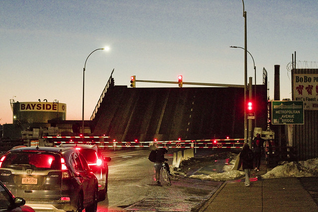
Marching along Metropolitan Avenue, one squealed with delight as the Metropolitan Avenue Bridge began to open. This used to be quite a frequent occurrence “back in the day.” These days there’s only one regular maritime customer back here on the English Kills tributary, which is Bayside Fuel.

– photo by Mitch Waxman
The timing of the bridge opening was bizarre, occurring at precisely the time of one of the heaviest traffic intervals in this section of North Brooklyn, about 6:30 p.m.

– photo by Mitch Waxman
That odd timing, however, allowed one to stand in the middle of Metropolitan Avenue without getting squished.

– photo by Mitch Waxman
I believe that the tug pictured above is the Mary H., which normally handles the Bayside duty, but it’s hard to say as I didn’t get any of its markings. I did manage to focus in on the captain in his wheelhouse, however, so “win.”
As a note, the Metropolitan Avenue Bridge spans the English Kills tributary of the larger Newtown Creek at a navigational mark 3.4 miles eastwards of the East River. Metropolitan Avenue was originally created as a private toll road about 1814, and was called the Williamsburgh and Jamaica Turnpike. The owners of the toll road, and the original bridge, were two brothers whose family name was Masters. That’s why you’ll occasionally see references to the road as the “Masters Turnpike” and the “Masters Bridge” in the historical record, if like me, you stay up until 4 in the morning reading old municipal journals and reports from the Chambers of Commerce of Brooklyn or Queens.

– photo by Mitch Waxman
My conceit is to call this area of Newtown Creek surrounding the Metropolitan Avenue Bridge “DUMABO.” That’s short for “Down Under the Metropolitan Avenue Bridge,” as I believe we need to be ahead of the real estate people on these sorts of things.
“follow” me on Twitter- @newtownpentacle
hidden laboratory
It’s International Cheese Day, for the industrialized and lactose tolerant nations of this planet.

– photo by Mitch Waxman
3.4 miles from the East River is a spot which one refers to as DUMABO – or Down Under the Metropolitan Avenue Bridge Onramp. The first bridge over the flowing waters of English Kills was erected here (slightly to the west, actually) in 1814 and was privately owned by the Masters brothers, so it was accordingly referred to as the “Masters Bridge.” Historic sources indicate this spot as being, during the colonial to civil war period, the demarcation point between salt and fresh water on the English Kills tributary of the fabulous Newtown Creek. Shellfish were described as being found in “great abundance.” It was once known as White’s Dock, for the vulgarly curious. The precursor of the modern day Metropolitan Avenue Bridge was built in the 1870’s, and the modern bridge (much altered) was erected in 1931.
The fresh water was being fed into English Kills by upland springs and streams in nearby Bushwick that flowed downhill into it, and by ground water entering it from the bottom. Back in 1814, Metropolitan Avenue was just a wooden plank toll road rising up from the swamps, and it was called the “Williamsburgh and Jamaica Turnpike road.” The springs and streams of Bushwick are what attracted beer breweries like the Ulmer people to a then German speaking rural neighborhood to ply their trade, but I digress. The fat renderers and acid factories began to show up in the 1830’s and 40’s around these parts, and notably – Peter Cooper’s “pestilential” glue factory, where Jello was invented, was just a few blocks away.

– photo by Mitch Waxman
NYC DOT has been doing a bunch of work at this spot recently, some sort of construction that they attached to the bridge itself. Unfortunately, they didn’t do anything about the loose soil on the shoreline, nor the decaying wooden bulkheads holding that shoreline in place. Of course, not many people come back here, but it would have been fairly easy to fall into English Kills given the rotting shoreline when the shot above was captured.

– photo by Mitch Waxman
That’s the Mary H. tug, tied up to the Bayside Fuel Depot bulkheads, just east of the Metropolitan Avenue Bridge. This is pretty much the extent of serious maritime access to English Kills given the black mayonnaise/sediment mound situation that gobbles up operational draught and depth. The green wall with all the kit on top is Waste Management’s Varick Street Waste Transfer Station. The Waste Management facility handles predominantly “putrescent” or black bag garbage for the NYC Department of Sanitation, which is processed on site and then loaded onto the so called “garbage train” which travels on the tracks of LIRR’s Bushwick Branch to Fresh Pond and then over the Hell Gate Bridge to points unknown.
Seriously, unknown. I’ve asked and was told “homeland security” precluded the dissemination of where NYC’s garbage is dumped.

– photo by Mitch Waxman
One headed up Varick Street towards industrial Bushwick from Metropolitan Avenue, where this spectacular salt dome structure was encountered. Seriously, no sarcasm is offered, this was a visually interesting and somewhat elegant solution to the problem. The rest of the neighborhood is dull, weathered, depressing. It’s nice to see a bit of color and style on display for something so pedestrian. It’s right next door to the Waste Management facility on Varick Avenue.

– photo by Mitch Waxman
The streets in this section, just south and east of Newtown Creek, are industrial in the extreme. Heavy trucking, the garbage industrial complex… suffice to say that the roadways aren’t exactly bike or pedestrian friendly, and that they are in a sorry state of repair. Watch your step hereabouts, and never cross in front of a driveway without first taking a look. This part of the Newtown Creek watershed is what the band Metallica was likely describing with their “death magnetic” album. There’s “ghost bikes” everywhere you look, the air is a poisonous fume…
Yep, it’s pretty much Tolkien’s Mordor back here.

– photo by Mitch Waxman
Turning off of Varick, I found myself wandering down Stewart Avenue and onto Randolph Street towards the undefended border of Brooklyn and Queens and that hazy industrial borderland which can either be called Ridgewood, East Williamsburg, or Bushwick – depending on whom you ask. Saying that, move quickly through this area, don’t talk to anyone, and certainly do not ask them questions if they speak to you. I would expand on why, but I’d again be told that I’ve seen too many movies, by some rich guy that moved to Hipster Bushwick from Connecticut less than six months ago who is trying to connect with a local art or club scene that they heard about on Instagram.
Of course, I couldn’t have more inconspicuous – the only person for about a square mile not wearing a safety vest and hard hat, and instead clad in a filthy black raincoat flapping about in the poison wind while waving a camera about.

– photo by Mitch Waxman
Speaking of the Bushwick Branch of the LIRR, which carries the garbage train from Bushwick into Queens and its mysterious destination on the continent, it’s just beyond that fence in the shot above. It’s been a while since I wandered through here, and those corrugated fences you see are fairly new, as evinced by a near total lack of graffiti. Back to the implied presence of criminally inclined individuals who are organized into a structure which one might define as a “crew” or a “family,” I’d point out the total lack of graffiti on a visible fence line in North Brooklyn – the high end graffiti capital of these United States.
Go ask someone who grew up in Brooklyn or Queens what that means.
Nevertheless, as is always the case when wandering through the industrial zones surrounding the fabled Newtown Creek, that horrible inhuman thing with the three loved burning eye that cannot possibly exist in the sapphire megalith of Long Island City was watching. It sees all, owns all, knows all.
More to come, next week, at this – your Newtown Pentacle.
“follow” me on Twitter- @newtownpentacle
The 2013 Spring and Summer Tours Schedule
“follow” me on Twitter at @newtownpentacle
– photo by Mai Armstrong
Want to see something cool?
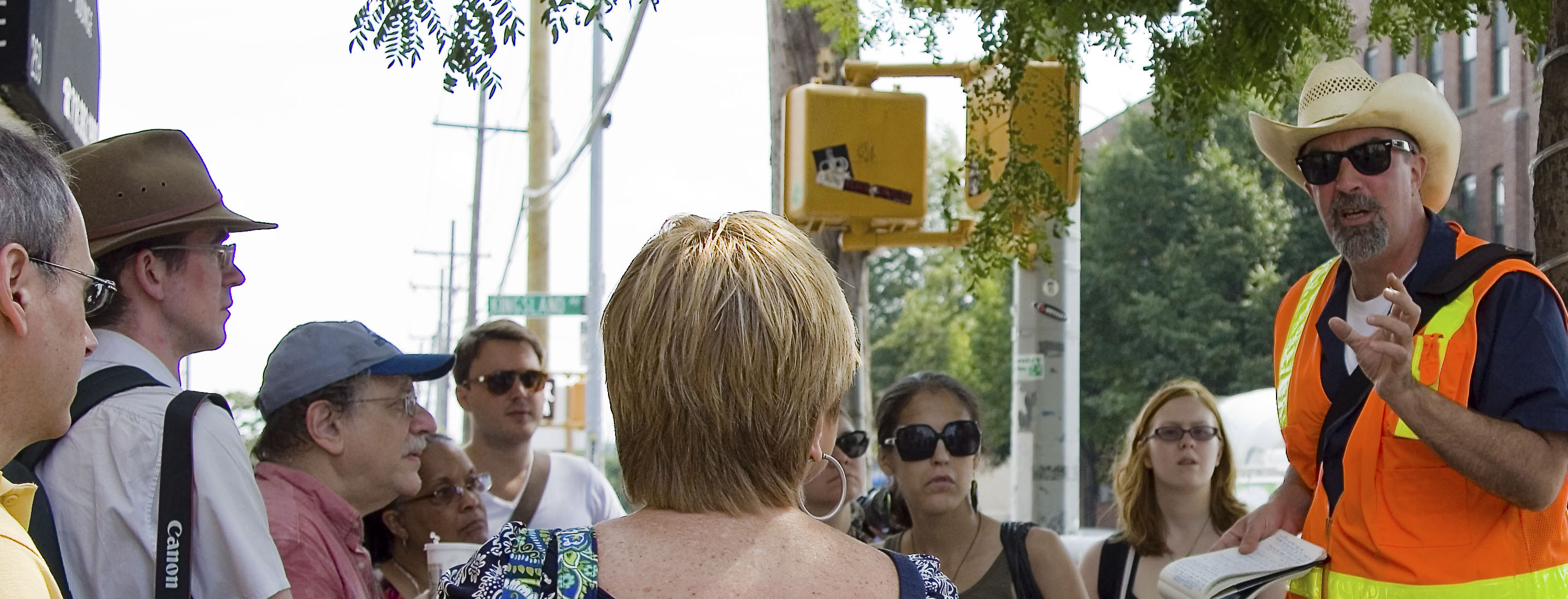
Odds are that a bunch of the folks who will be reading this might have no idea who Mitch Waxman is, why they should come along with him on a tour of some weird neighborhood in Brooklyn or Queens or Staten Island, nor what a Newtown Creek or Kill Van Kull are- let alone where. Who is this weirdo?
Check out the “bio” page here at Newtown Pentacle, or this profile of me from the NY Times published in 2012. My tours of Newtown Creek have garnered no small amount of interest from the fourth estate- whether it be DNAInfo, untappedcities.com, Queens Chronicle, newyorkview.net, the 22blog, photobycateblog.com, or Queensnyc, and I’ve turned up in a bunch of media reports, documentaries, and been interviewed for multitudinous reports on the lamentable history of the Newtown Creek.
Most recently, it was National Geographic and Curbed. Attendees on my tours come from a variety of backgrounds- photographers, history and rail buffs, maritime enthusiasts, and there always seems to be an odd and welcome concentration of elected officials and journalists about.
What is with this guy?
I’m the Newtown Creek Alliance Historian, Official Photographer and Steering Committee member of the Working Harbor Committee, a member of the Newtown Creek Monitoring Committee and the Newtown Creek CAG, and am also a member of the Kosciuszko Bridge Stakeholders Advisory Committee. Newtown Pentacle, this blog, has been steadily published since 2009. I live in Astoria, Queens with my wife and our little dog, Zuzu.
In just the last few years, I have exposed thousands of people to the Newtown Creek, and its incredible history. This is where the industrial revolution actually happened, along this 3.8 mile long waterway that defines the border of Brooklyn and Queens.
– photo by Mai Armstrong
In 2013, continuing relationships with Atlas Obscura, Newtown Creek Alliance, and the Working Harbor Committee (as well as friends like the Metropolitan Waterfront Alliance, and others) allow me to offer the following schedule. Live ticketing links will be made available as they come online, and all dates are subject to cancellation or rescheduling due to weather or unforeseen circumstance. There are 6 unique walking tours listed here, and one boat trip in which I will be the principal speaker.
Private tours are possible, schedule permitting, and can be arranged by contacting me here. Last year, for instance, several private University classes engaged me for a day at the Creek, as did a few private groups. As mentioned, contact me and we will figure something out if you’ve got a meetup group, college class, or special request.
Here then, is my official schedule as it stands right now. There will likely be a few additions as time goes on, which I will let you know about as they occur. Best to subscribe to this blog (top right, email subscription) or “follow” me on Twitter @newtownpentacle for news.
In April, 2013- There will be a brand new tour of Greenpoint debuted, which I call “Glittering Realms.”
Glittering Realms– Saturday, April 20, 2013
Newtown Creek walking tour with Mitch Waxman and Atlas Obscura, tickets now on sale.
In May, 2013- We start off with 13 Steps around Dutch Kills, go to the Insalubrious Valley, visit DUKBO, and finish off the month with a Working Harbor boat tour.
13 Steps around Dutch Kills– Saturday, May 4, 2013
Newtown Creek walking tour with Mitch Waxman and Atlas Obscura, tickets now on sale.
Parks and Petroleum- Sunday, May 12, 2013
Newtown Creek walking tour with Mitch Waxman and Newtown Creek Alliance, tickets on sale soon.
The Insalubrious Valley- Saturday, May 25, 2013
Newtown Creek walking tour with Mitch Waxman and Atlas Obscura, tickets on sale soon.
Hidden Harbor: Newtown Creek tour with Mitch Waxman – Sunday, May 26,2013
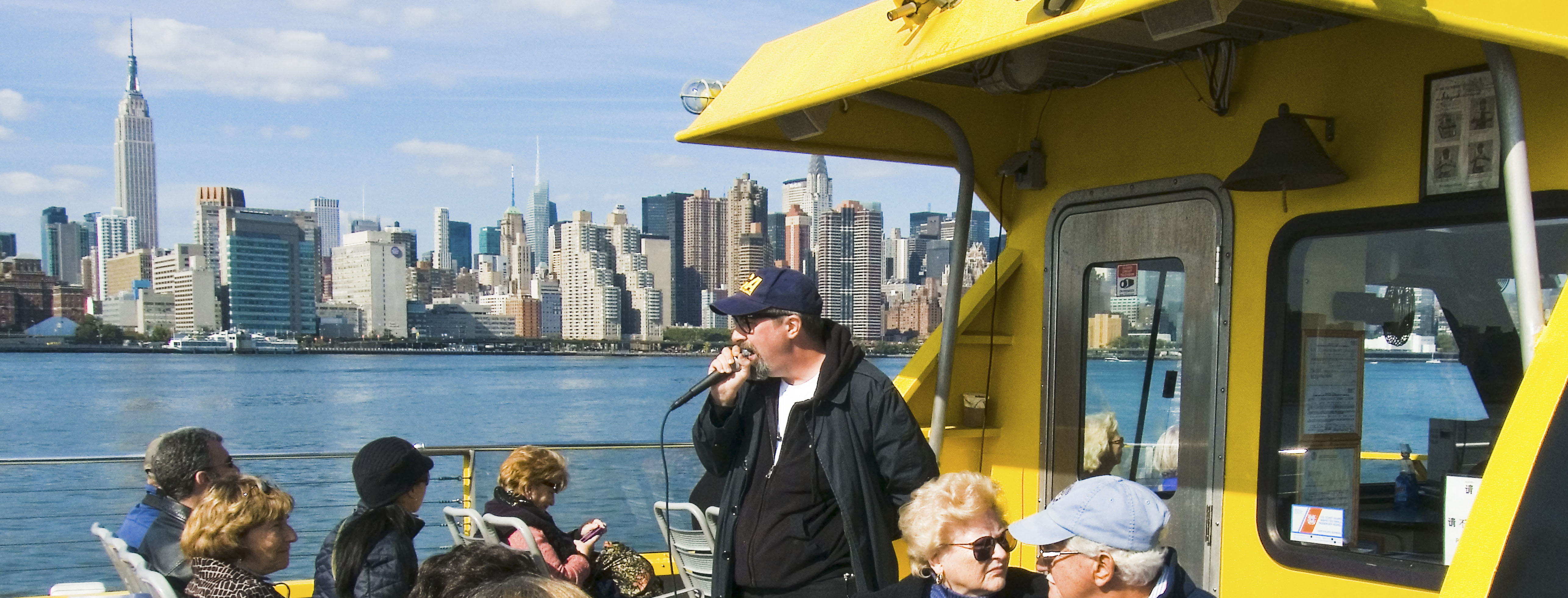
Boat tour presented by the Working Harbor Committee,
Limited seating available, order advance tickets now. Group rates available.
– photo by Mai Armstrong
In June, 2013- We visit the Poison Cauldron, return to the Insalubrious Valley, and check out the Kill Van Kull.
The Poison Cauldron- Saturday, June 15, 2013
Newtown Creek walking tour with Mitch Waxman and Atlas Obscura, tickets on sale soon.
Kill Van Kull- Saturday, June 22, 2013
Staten Island walking tour with Mitch Waxman and Working Harbor Committee, tickets on sale soon.
The Insalubrious Valley- Saturday, June 29, 2013
Newtown Creek walking tour with Mitch Waxman and Newtown Creek Alliance, tickets on sale soon.
In July, 2013- We visit Queens’s Hunters Point with a brand new tour. I might have another offering or two for you, but nothing I can speak about quite yet.
Modern Corridor- Saturday, July 13, 2013
Newtown Creek walking tour with Mitch Waxman and Atlas Obscura, tickets on sale soon.
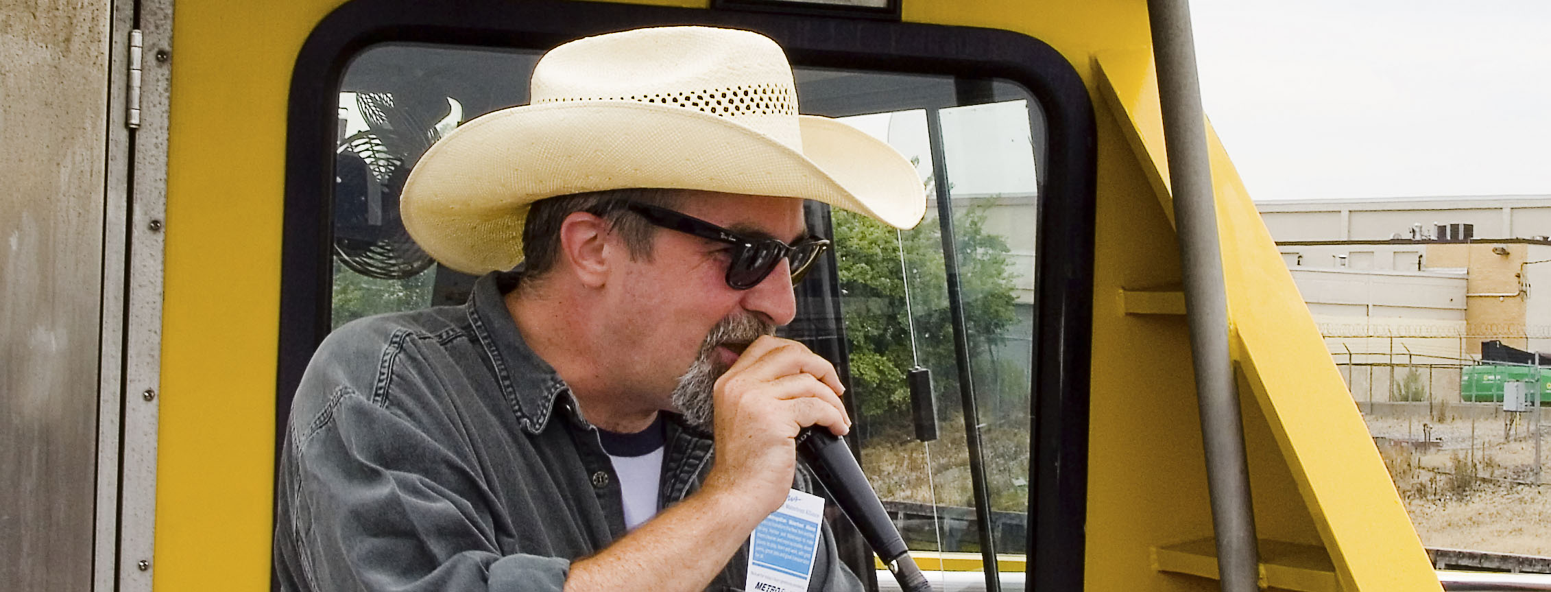
– photo by Mai Armstrong
In August, 2013- We return to the Poison Cauldron, repeat the 13 steps, and the Kill Van Kull walks.
Kill Van Kull- Saturday, August 10, 2013
Staten Island walking tour with Mitch Waxman and Working Harbor Committee, tickets on sale soon.
13 Steps around Dutch Kills- Saturday, August 17, 2013
Newtown Creek walking tour with Mitch Waxman and Newtown Creek Alliance, tickets on sale soon.
The Poison Cauldron- Saturday, August 24, 2013
Newtown Creek walking tour with Mitch Waxman and Atlas Obscura, tickets on sale soon.
There are a few other dates coming in the fall, and a couple of more summer events which are still being discussed, but I’ll let you know more about them in coming posts.
Also, I will definitely be onboard but not on the microphone during the Working Harbor Committee “Beyond Sandy” Hidden Harbor tours on Tuesday nights, all summer. Hope you can come along.
The Smelling Committee

– photo by Mitch Waxman
As long time readers will recall, in the fall of 2010, the Newtown Creek Alliance and the Working Harbor Committee received a grant from the NYCEF fund of the Hudson River Foundation to conduct 4 boat tours of Newtown Creek. The plan was to do two ticketed tours for the public (the tickets were available at a steeply discounted rate), one for educators, and one for “the elected’s” of the watershed. The first three went off without a hitch, but the fourth was postponed due to the tragic helicopter crash on the East River which occurred just as we were about to board the boat.
Last Friday, the 4th of May, we accomplished the fourth tour with a modern day “Smelling Committee” onboard.
from “Annual Report of the Department of Health of the City of Brooklyn for the year 1895”, courtesy google books
Whereas, Complaint has been made to the Governor of the State of New York during the year 1894 by the citizens and residents of the Town of Newtown and the City of Brooklyn, relating to the existence of public nuisances on or near Newtown Creek, jeopardizing the health and comfort of the people in the vicinity thereof, and the Hon. Roswell P. Flower, Governor of the State of New York, did thereupon, on the 2d day of August, 1894, pursuant to Chapter 661, of the Laws of 1893, require, order and direct the State Board of Health to examine into the alleged nuiscances, and to report the result thereof…

– photo by Mitch Waxman
Important to the mission was attendance of officials from both sides of the Creek. The “center of gravity” for the advocacy of the Newtown Creek has historically been in Greenpoint, but that doesn’t mean that the folks on the Queens side haven’t been paying attention. Pictured above are Michael Gianaris and Jimmy Van Bramer, and both were anxious to visit this hidden part of their districts.

– photo by Mitch Waxman
As luck would have it, we passed by one of the many workboats which have been operating along the Newtown Creek of late. These workboats, hailing from Millers Launch on Staten Island, are carrying contractors and employees of the Federal Environmental Protection Agency who are collecting samples of the so called “black mayonnaise” sediments for laboratory analysis.

– photo by Mitch Waxman
You cannot fix something unless you understand it, and the EPA has scheduled an exhaustive “scoping period” during which a series of such tests will be performed. Since January, I have personally witnessed dozens of such operations- ranging from towing a sonar buoy up and down the waterway to establish a subsurface topographical map, to the group onboard this vessel who seemed to operating a hand operated dredge to bring materials up into the light.
Notice that the folks directly handling the sediments are wearing protective garments.

– photo by Mitch Waxman
A Newtown Creek Alliance member, Phillip Musegaas of Riverkeeper fame came along to inform about and describe the legal and policy issues surrounding the Greenpoint Oil Spill, Superfund, or any of the myriad points of law which surround the Newtown Creek. That’s Phillip on the right.
I should mention that Council Member Stephen Levin of Greenpoint was onboard as well, but was forced to stay in the cabin and deal with urgent business in his district via phone.

– photo by Mitch Waxman
A decision which I’ve been keeping to is to not bring “civilians” all the way back to English Kills on these boat tours, but this “Smelling Committee” was no mere interested group and accordingly we entered into the heart of darkness- God’s Gift to Pain itself. This is as bad as it gets along the Newtown Creek, a stinking and fetid miasma poisoned with sewage and urban runoff surrounded by waste transfer stations.
In the distance is one of the largest CSO’s in the entire city, and the Montrose Avenue Rail Bridge of the LIRR’s Bushwick Branch.

– photo by Mitch Waxman
Not just elected officials were onboard, of course, representatives of a veritable alphabet soup of three lettered agencies were also invited. Additionally, local leaders- such as Tom Bornemann from the Ridgewood Democratic Club (pictured above, in sunglasses) accompanied the tour. The microphone was passed amongst us, with Kate Zidar (NCA’s executive director), Michael Heimbinder (NCA’s chair), Laura Hoffman (Newtown Creek Monitoring Committee), Phillip Musegaas (Riverkeeper), Penny Lee (City Planning), and myself narrating at various legs of the trip.

– photo by Mitch Waxman
Pictured above are Assemblyman Joe Lentol of Greenpoint, Council Member Jimmy Van Bramer of Queens, Working Harbor Development Director Meg Black, Council Member Diana Reyna of Brooklyn, a gentleman who I’m embarrassed to say I can’t identify, and State Senator Michael Gianaris.

– photo by Mitch Waxman
The Smelling Committee of 2012 encountered a Newtown Creek swollen by days of rain, replete with oil slicks and “floatables” contamination. The term floatables is used to describe everything from stray bits of lumber and tree limbs to cast off plastic bottles and wind blown trash carried in the water, by the way. The trip was 2 hours in length, and accomplished onboard a NY Water Taxi vessel. It left from Pier 17 in Manahattan at four in the afternoon and returned at six, proceeding some three and one half miles into the Newtown Creek and required the opening of the Metropolitan Avenue Bridge.

– photo by Mitch Waxman
Along the way, sites of legal or popular interest were pointed out- including the future of the Arch Street Yard, the Hunters Point South development, SimsMetal, the Newtown Creek Waste Water Treatment Plant, the Greenpoint petroleum district, the Blissville Oil spill, the Greenpoint Oil Spill, the Phelps Dodge site, the Kosciuszko Bridge, the CSO issue, the role of Newtown Creek as a mass employer, the maritime potential of the Creek and its potential for eliminating a significant amount of trucking activity, its myriad waste transfer stations, and the plans which EPA have for the place.

– photo by Mitch Waxman
Crass observers in the antiquarian community and political operatives in both boroughs will sneer at efforts such as this, the aim of which was to create a common sense of purpose and to identify issues regarding the Creek for both the Queens and Brooklyn political establishments. Ridgewood and Bushwick, Maspeth and Greenpoint, Williamsburg and Long Island City- all parts of the Newtown Creek watershed have more in common with each other than they do with neighboring districts in either borough. They are blessed with one of the finest industrial waterfronts in the world, but cursed by its past. What the Newtown Creek will look like in fifty years time is beginning to be discussed, and it was time for this “congress of the creek” to be convened.
So much of what the people in high office know of this place is influenced by dire reportage and dry testimony, and it can be easy to overlook the past, present, and future of this maritime superhighway if you haven’t experienced it first hand.
Especially from the water.

– photo by Mitch Waxman
Several times have I witnessed the effect that this place has on first time visitors, a transformation of expression and demeanor overtakes them.
Hardened New Yorkers all, the Newtown Creek nevertheless explodes all expectations and an expression of wonderment forms upon their faces. They come to see toxic waste dumps and oil spills, but instead find Herons, Egrets, and Cormorants nesting in the broken cement of abandoned industrial bulkheads. They witness the miles wide vistas and wide open view of the City of New York from its very navel, and are thunderstruck that such a place exists- this “Insalubrious Valley” of the Newtown Creek watershed.
Every time I start to narrate on one of these tours, my first utterance is always “this is not the world you know…”.
I’m happy to say that due to the Working Harbor Committee, Newtown Creek Alliance, and the NYCEF Fund of the Hudson River Foundation- the Smelling Committee of 2012 knows this corner of the world a little bit better.
What will come of it?
Others will have to answer that, for your humble narrator must remain without and is cursed to merely observe such matters. Always, an outsider.


