Highland Park Resovoir
Wednesday

– photo by Mitch Waxman
That’s the 117 million gallon ‘Reservoir One’ pictured above, at Pittsburgh’s Highland Park. The region’s water and sewer people style themselves as pgH20, and they’re the Pittsburgh equivalent of NYC’s Department of Environmental Protection – or DEP – whom long time readers have endured multitudinous descriptions delineating both the infamy and charm of that organization here at Newtown Pentacle.
For you New Yorkers – the DEP is annually budgeted at $1.6 billion, and is committed to spend some $24.3 billion on capital improvements to their system on top of that, just in the next decade. Pay attention to this “black box,” somebody.
The reservoir, here in a suburb of Pittsburgh, is surrounded first by a walkway and then by a large park which also incorporates the city zoo and aquarium. The enveloping neighborhood is, I’m told, also called Highland Park and boy oh boy is this a pretty town, with gorgeous housing stock surrounding the park. This is literally just up the hill from the location on the Allegheny River which started up yesterday’s post about Lock and Dam 2. Of course, when I say “just up the hill” in Pittsburgh, we’re talking Mayan pyramid up. The reservoir is at an elevation of 1,030 feet above sea level, and the lock and dam I visited was at an elevation of 721 feet, so that would be about 25-30 building stories differentially.

– photo by Mitch Waxman
There were all sorts of humans milling about, in their impermanence, so to remove any sign of life from these shots I set myself up for long exposures and got all artsy fartsy. That’s how you get those long mirror surface reflections, with long exposures of at least 20-30 seconds. Also, unless one of the humans stands stock still like a statue they disappear.
As opined yesterday, one remote scouts using Google maps’ satellite views to look for interesting things and locales which might be within reach of a humble narrator. In this case, it was a “what the hell is that” followed by “hey, there’s a parking lot.” Now that I’m a car guy, having a safe and legal spot to park the Mobile Oppression Platform has become part of my deal. Luckily, Pittsburgh doesn’t pretend that bike lanes can fix the universe nor do they opine that cars are the reason that housing is unaffordable. Instead, there’s places to park your car which adjoin safe and maintained trails for recreation and exercise.
Distributed load multi modal transportation network is the term you’re looking for. So’s acknowledging that people have kids, or mobility issues, and that public infrastructure like parks HAS GOT TO BE ACCESSIBLE BY PEOPLE WHO AREN’T NECESSARILY ABLE TO WALK OR RIDE A BIKE. You need to have places to bring and park vehicles. There is no one size fits all answer to anything when you’re discussing access to a public place.
Sorry, still scarred from being the Transportation Chair of a Community Board in Queens.

– photo by Mitch Waxman
One spent about a half hour at the reservoir, pulling shots from various angles. The locals were wandering about on bikes and on foot, and I even spotted a couple of other blokes tugging their cameras about, but they were preparing to do some sort of portrait shoot with a video component from the look of their gear. We chatted briefly, Sony shooters.
A humble narrator has long used little strips of gaff tape to cover up the bright white Canon logos on my camera, ever since I had to retouch the reflection out of the eyes of somebody I was taking a picture of. Also, the evil people are clever, and also have google on their phones and can thereby figure out what your gear is worth and if you’re worth robbing. Why not camouflage that Canon or Nikon logo?

– photo by Mitch Waxman
There were several signs forbidding certain things on the walkway – litter, smoking, dogs – all of which were prosaic cautions given this reservoir is full of what’s going to be used as drinking water. Where HQ is found in Dormont, the water system has been privatized and is controlled by a corporate entity called “American Water” which is apparently a fairly large corporation that I never heard of before moving here.
Pennsylvania politics flips hard “Red” or hard “Blue” during the various election cycles. Currently it’s in a blue phase. The reds ok’d fracking and a bunch of other ugly stuff, whereas the blues… man… this sort of thing really sounds like the last days of the Roman republic doesn’t it? If memory serves, for them it was Blues and Greens.

– photo by Mitch Waxman
Luckily, I’ve managed to avoid having just about any political conversation at all so far. Let’s face it, it’s only a matter of time until I blunder into some sort of situation where I find myself in a “political room” but I really want to stay the hell out of all that until I have to. I’ve had enough of that for a while. You should see the look on the Pennsylvanian’s faces when I mention that my Congress member used to be AOC, back in Astoria.
At any rate… Highland Park in Pittsburgh…

– photo by Mitch Waxman
On my way back to the MOP, I cracked out this shot of the Highland Park’s formal entrance with its columnar accoutrements.
In yesterday’s post about Lock and Dam 2, I mentioned that a diversion of about an hour occurred in between my circling of the river infrastructure. Highland Park reservoir was where that diversion occurred.
Tomorrow, more from the corridors of the Allegheny River.
“follow” me on Twitter- @newtownpentacle
Buy a book!
“In the Shadows at Newtown Creek,” an 88 page softcover 8.5×11 magazine format photo book by Mitch Waxman, is now on sale at blurb.com for $30.
Lock and Dam too, Allegheny River
Tuesday
– photo by Mitch Waxman
The 1932 vintage Allegheny River Lock and Dam No. 2 (aka Highland Park Lock and Dam) along the Allegheny River drew my interest recently. The St. Patrick’s day flood of 1936 in Pittsburgh, which is part of the same climatological event that drowned nearby Johnstown, resulted in a lot of Federal attention to the rivers surrounding Pittsburgh. The United States Army Corps of Engineers got busy planning a solution after the Flood Control Acts of 1936 and 1938 were passed by Congress. The USACE realized flood control over the Allegheny River after the Kinzua Dam was completed in 1965. Of course, they’ve got three rivers to worry about here (four, actually) and there’s similar USACE infrastructure found on both the Ohio and Monongahela Rivers.
It seems that the USACE design creates about 24 miles of level navigable water on the three rivers, which is referred to as the “Pittsburgh Pool,” and the water level is meant to be some 710 feet above sea level. When a ship navigates into this particular Allegheny River lock, it’s raised or lowered 11 feet from the pool’s altitude depending on direction. There’s a long series of these fixed crest dams and boat locks on the Allegheny River leading all the way back to the Kinzua Dam, which is on the New York side of Pennsylvania’s northern border.
Pennsylvania is wild, man.
– photo by Mitch Waxman
After becoming interested in this sort of infrastructural goodness, I began the usual scouring of Google maps’ satellite views for potential locations from which I could get a look at the thing in action and maybe even set up the tripod for a few “low and slows.”
That sounds bad, doesn’t it? I mean long exposure, tripod mounted landscape shots, not any of the things you could slot “low and slow” into. Aww, that sounds even worse…
“Highland Park Dam Overlook” is what it says this spot is called on Google maps, and after following a Google street view truck’s ride into the area, I decided that this would be the first of several nearby spots where I’d try to find some points of view and maybe the odd natural composition or two.

– photo by Mitch Waxman
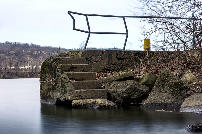
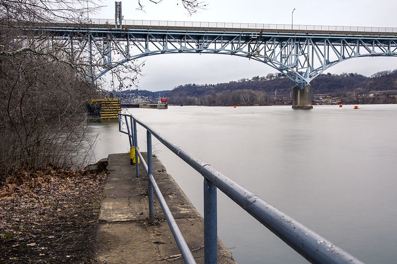
The furthest out into the water, and the closest clear shot of the Lock and Dam I could get near in this Overlook section, was literally the spot pictured above – on a chunk of what was probably 90 year old concrete sticking out into the Allegheny River. The 1937 vintage bridge in the shot is called the Highland Park Bridge.
I did walk down to the gates of the USACE compound which operates the machinery of the lock, but it was all chain link with barbed wire with security cameras there. I made a mental note to try and charm the pants off of whomever is in charge of this stuff and strive to get some future access for photos from them. I’ve done it before.

– photo by Mitch Waxman
I had to drive a bit of a circuitous route to hit my list of “POV’s,” and since something else that I wanted a look at was found along this route, I diverted away from my lock and dam fever for about an hour. More on that tomorrow.
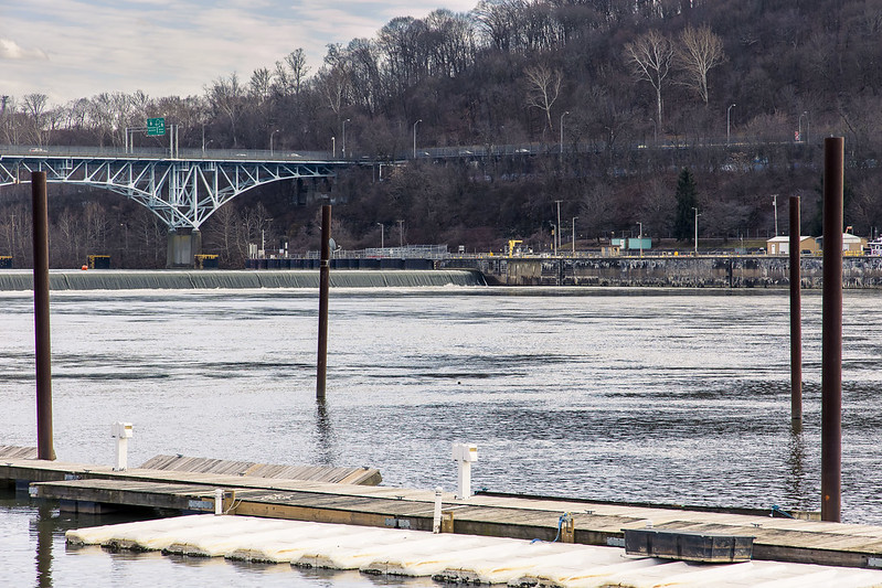
One arrived at another previously remote scouted location for the point of view above after the diversion. That dark line in the water is a fixed crest dam, a concrete structure in the water column which introduces an 11 foot drop in elevation to the Allegheny River. The USACE maintains a minimum depth of nine feet for the Allegheny, it’s deeper in many places, but that’s a lot of water cascading about.
I had a couple of other locations marked down, including a few other potential points of view on the opposite shoreline. I hopped into the Mobile Oppression Platform and crossed the Highland Park Bridge, heading into the community of Sharpsburg.
– photo by Mitch Waxman
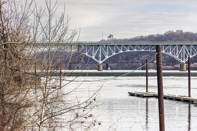
Somebody probably wasn’t supposed to be where he was, while shooting these last two shots. Saying that, the property definitely seemed to be out of business or abandoned, but the former occupants left their “no trespassing” signs behind. That’s my story. I pulled the MOP over, cracked out a couple of shots, and then moved on.
The scouting area I’ve been looking at and writing about, since relocating to Pennsylvania, forms a rough circle with circumference points no further than a 30 minute drive from HQ, which is located about 4.5 miles from Downtown Pittsburgh. Using HQ as the center of that circle, I’ve been exploring triangular “pizza slice” sections of the new surroundings, slice by slice. Nerd.
– photo by Mitch Waxman
I was too far away to get a decent shot of it, but right after this shot, a tug and barge appeared and began to navigate into the lock. Wow.
As mentioned, in yesterday’s post, we’ve had a run of wet and snowy weather here in Pittsburgh for the last week. I know this is shocking news for late January. All the shots you’re seeing in this week’s six picture posts were frenetically gathered in a single day. Whew!
More tomorrow, from the Paris of Appalachia, at your Newtown Pentacle.
“follow” me on Twitter- @newtownpentacle
Buy a book!
“In the Shadows at Newtown Creek,” an 88 page softcover 8.5×11 magazine format photo book by Mitch Waxman, is now on sale at blurb.com for $30.
Snow, rain, snow
Monday
– photo by Mitch Waxman
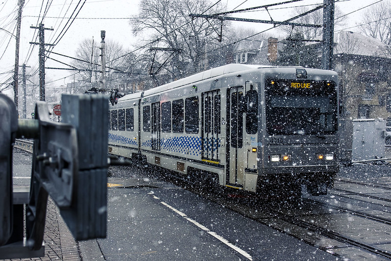
The best way to describe the previous week’s weather here in Pittsburgh is simply “last Tuesday was the day it didn’t rain or snow.” Saying that, a humble narrator was busy with mundanities so it wasn’t too much of a deal. One thing I can report to all of you back in Fun City is that I drove over to a local variant of the Department of Motor Vehicles, dubbed as the Pennsylvania Department of Transportation or “PennDOT Driver’s License Center” to transfer my New York State Driver’s License over to a Pennsylvania one in accordance with local statutes. Based on years of experience with NYS’s best analogue of a Soviet toilet paper distributorship, I figured my DMV or PennDOT experience would be miserable and frustrating.
45 minutes later I was walking to the Mobile Oppression Platform with a freshly printed Pennsylvania driver’s license in my wallet. Just had to fill out a few forms, pay a $36.75 fee, and done. The people working there were nice, helpful, and the process clear.
Y’know, when you’ve been drinking dirty water your whole life and somebody hands you a glass of crystal clear earth juice instead…
– photo by Mitch Waxman
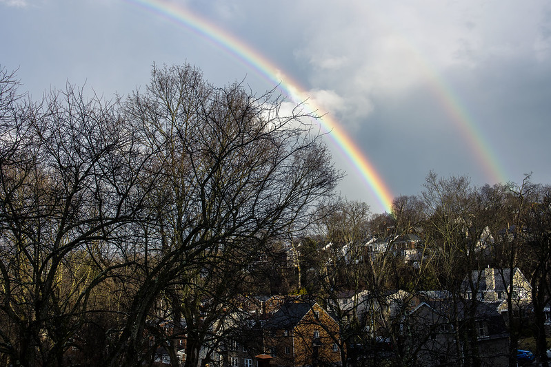
One hung around HQ during the inclement weather, mostly. A friend from New York was in town on Monday last and I got to spend a bit of time with a familiar face, which was nice. One day, after a particularly heavy wave of precipitation blasted though, the double rainbow pictured above was observed over Dormont, where HQ is now found.
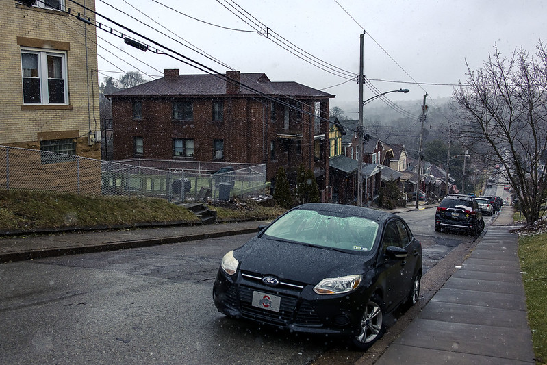
Today’s post breaks format a bit, with a three photo post. Tomorrow, we go back to the usual vulgarity with six shots. As mentioned, the weather has been… well… not fierce, but I’m still not at all used to driving out here on these crazy serpentine roadways with their steep hills and especially so when it’s icy. Take an inch of snow, pour a few hours of rain on it, then drop the temperature below freezing – that’s how you get me to stay home and not drive around.
– photo by Mitch Waxman
Pittsburgh is actually deficient at this moment, in terms of its annual averages, for snowfall but it has been fairly chilly. It is, after all, January. As you’re reading this, one is likely behind the wheel of the MOP, heading towards the bureaucratic entity that handles car registration and license plate issuance in Pennsylvania. As soon as that bit of business is handled, the entire “escape from New York City” process will have wound down and can be declared accomplished. There’s still a few things to do, notably rebuilding my office workstation which died a few years ago at the start of Covid. I’ve been working off of a fairly underpowered laptop the last couple of years, which has been sufficient but just so.
Tomorrow, I’m taking you along with me on another scouting mission, this one along the Allegheny River. Remember how I said I was “kvelling” to get a look at one of the several lock and dam locations operated by the United States Army Corps of Engineers? Well…
“follow” me on Twitter- @newtownpentacle
Buy a book!
“In the Shadows at Newtown Creek,” an 88 page softcover 8.5×11 magazine format photo book by Mitch Waxman, is now on sale at blurb.com for $30.
Investigating the GAP, part three
Friday

– photo by Mitch Waxman
The Mon Valley Works – Edgar Thomson Plant. That’s what the U.S. Steel outfit calls this steel mill, parts of which date back to 1875 and Andrew Carnegie. It’s where the United States’ first Bessemer Converter was installed, and is a cornerstone of our American story.
Having never witnessed this sort of thing in person before, the Mon Valley Works absolutely blows my mind. Wow. I’ve seen Battleships, and Air Craft Carriers, and mega massive sewer plants, and power generating stations, and petroleum refineries, and waste transfer stations, and port infrastructure – but I’ve never seen anything like this before. Blown.

– photo by Mitch Waxman
I had carried all the gear I use with me onto the Great Allegheny Passage trail, and got busy with the tripod and everything else as soon as a decent point of view of the Mon Valley Works appeared. Next time I visit the GAP, I’m planning on entering the trail from the Duquesne side to explore what you can see from that set of angles.
I’m also going to return to this position for early morning and late afternoon light when it warms up a bit, but I fear that spring and summer will create problems for me due to the vegetation being clad with leaves.
– photo by Mitch Waxman
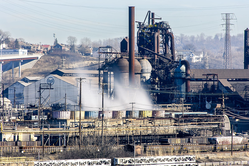
Even across the Monongahela River, and pretty distant, the Mon Valley Works are loud. Massive fans are at work for the heat exchangers, and the furnaces also are beaming out vibration and sound. The plant is also pumping out a terrific amount of sulfur dioxide, as it runs off coke and coal, so there’s a smell of rotten eggs which is omnipresent in the air.
I’m told that air quality in the Pittsburgh area can be awful, largely because of these coal fired heavy industries. So much so that there’s a website which tracks the plumes of pollutants that the three big steel mills pump into the atmosphere. Prevailing wind and economic geography decide who gets to breathe the stuff in. These steel mills, however, form and produce the building blocks for other industrial sectors, and always have. Somebody always pays the price for “progress.” It’s something to remind yourself about as you consume new manufactured products in the manner of a raging wildfire.
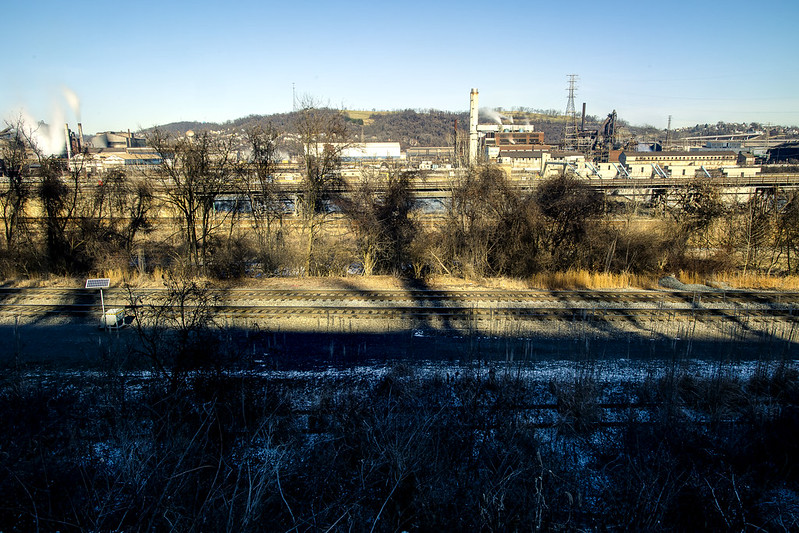
– photo by Mitch Waxman
On the side of the Monongahela River that the GAP trail follows, you’re a pretty decent distance away from the shoreline. I did a wide shot to illustrate that, and to pass on the advice that if you want to get shots of the plant, bring a zoom lens with a not insignificant range.
As mentioned, those trees are going to block out the view during the warmer months. This was my turnaround point for this walk, as I’d have about another 4 miles to walk to get back to the Mobile Oppression Platform (my nickname for the car) which was parked at the Homestead Pump House. How did I come up with “Mobile Oppression Platform”? First, I owe a debt to the writers of the Futurama cartoon, secondly… have you ever talked to the bicycle people in Queens? Ever heard a car described as a two ton murder machine? I have, and took inspiration from the bellicose posturing they offered. If “two wheels good, four wheels bad” is your motto, I figured I’d give my car a name to piss you off. I’m a Dick like that.
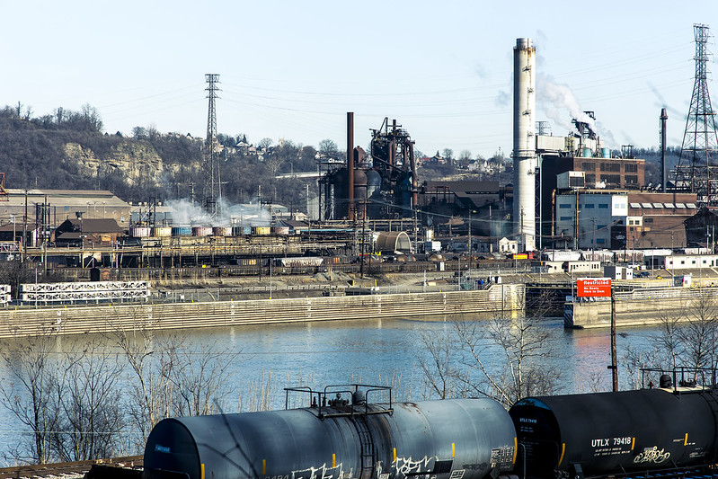
– photo by Mitch Waxman
There’s so many things I want to get close up to in the shot above, including the Army Corps of Engineers lock and dam at the right side of the shot. After a disastrous flood in the 1930’s, the USACE installed a series of locks and dams on the rivers leading to Pittsburgh to control the waters. There are multiple USACE lock and dam facilities in the Pittsburgh area which I’m “kvelling” to get closer to.
I packed up my more esoteric gear after this one, reverted back to handheld shooting mode, and started retracing my steps back to the Mobile Oppression Platform in Homestead and my ride back to HQ.

– photo by Mitch Waxman
On my way, I cracked out a few more shots, and was passing by the defunct Carrie Furnace just as the light became a bit kinder. As mentioned in the first of these posts, it was fantastic to walk a fairly long distance again. It’s been a couple of months, what with the move and the setting up of housekeeping and all that, since I’ve had the chance to just scuttle about and see these sort of things.
Next week, something different at this – your Newtown Pentacle.
“follow” me on Twitter- @newtownpentacle
Buy a book!
“In the Shadows at Newtown Creek,” an 88 page softcover 8.5×11 magazine format photo book by Mitch Waxman, is now on sale at blurb.com for $30.
Investigating the GAP, part two
Thursday
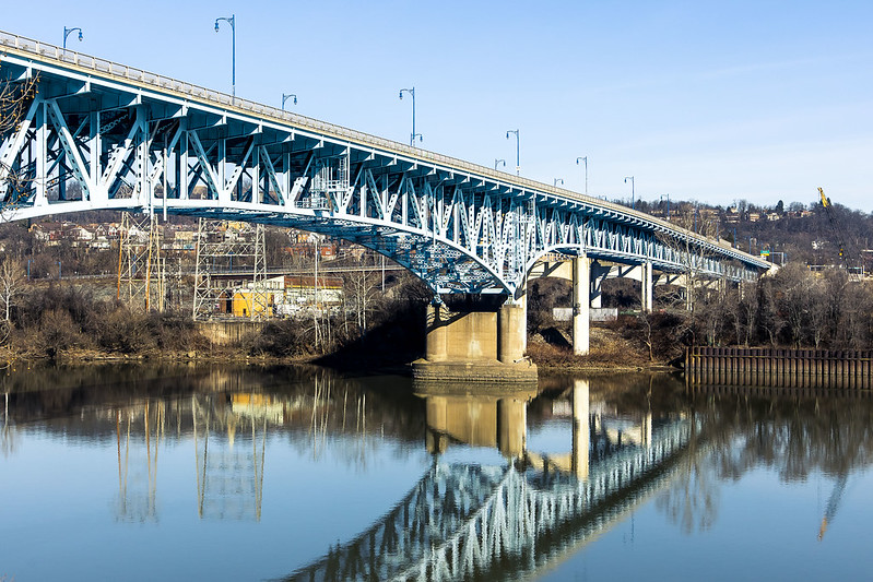
– photo by Mitch Waxman
As described yesterday, one parked the Mobile Oppression Platform at the Homestead Pump House’s parking lot and began a longish walk on the Great Allegheny Passage “rail-to-trail” pathway. Rail to trail is one of the options for what to do with the right of way of a railroad line which is no longer active. In the case of the GAP, the rail bed has seen the ties and actual rails removed and the ground either paved or covered with crushed limestone. It’s an easy walk, due to the grading that the rail engineers employed when laying out these right of ways (ROW), which is essentially a change of one foot in elevation for every hundred feet horizontally. The GAP trail in the Pittsburgh area which I was on starts in Homestead and doesn’t re-emerge onto the streets until you reach the community of Duquesne, which is many miles away.
I had a destination and “turn around point” in mind, for this scouting mission, which was more or less equidistant between Homestead and Duquesne. This trail was thereby fairly easy walking, and there was lots to see along the Monongahela River, which the GAP trail follows.

– photo by Mitch Waxman
Back in NYC, I’d often be asked where I’d want to go if time travel were possible. My response is usually “if you stepped out of your time machine into the late 19th century NYC, you’d have a knife slid into you within about 15 minutes.” Here in Pittsburgh, other than dodging freight trains hauling coal and coke at breakneck speeds, you’d have a different time travel problem – breathing. There are still operating steel plants here, but their emissions are a fraction of what would have once been found along the Monongahela Valley. I should mention that the emissions are an ongoing problem, however, and that the U.S. Steel people are often fined for violations of the Clean Air Act.
Mark Twain’s quote about Pittsburgh in 1884 reads “After our show, last night, we visited Mount Washington and took a bird’s eye view of your city by moonlight. With the moon soft and mellow floating in the heavens we sauntered about the mount, and looked down on the lake of fire and flame. It looked like a miniature hell with the lid off. It was a vision. A wonderful vision. It tended to frighten. The view is not as deliciously beautiful as one would suppose. If one can be calm and resolute, he can look upon the picture and still live. Otherwise, your city is a beauty.”
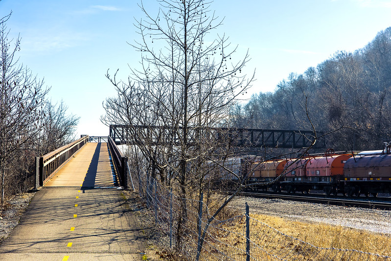
– photo by Mitch Waxman
About a mile or so onto the trail, an overpass bridge is encountered, one which I’m told was added to the equation when the GAP trail was created. It allows transit over the active freight tracks the GAP follows from Homestead, and on the other side of the thing the trail continues along on an earthen shelf set in along a steep slope.
This bridge was one of the things which drew me in, what a great place to observe and photograph trains from, huh?

– photo by Mitch Waxman
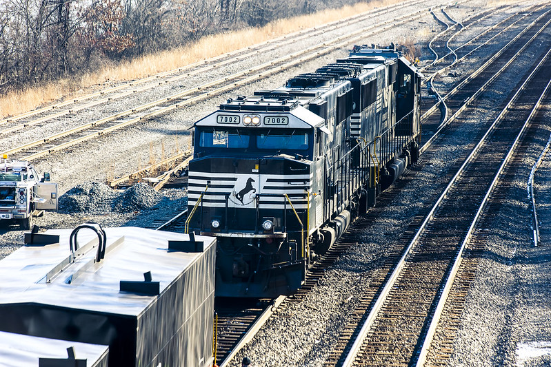
Norfolk Southern, like CSX, emerged as a dominant player in American Rail after the Conrail years and was formed out of several smaller operations. Their rolling stock heraldry is black and white, with a horse rearing up in silhouette acting as their logo. They’re pretty active in this region, and others.
There was a train set just sitting and waiting for its engine to show up, which luckily enough happened just as I surmounted the overpass bridge. A couple of workers were flipping the track switches around, and the engine was moving into position to couple with the train set.
– photo by Mitch Waxman
One could have stood on that overpass all day, photographing the comings and goings of the rail people. I probably will when the weather is warmer and I’ve packed a lunch. For this scouting mission, however, I still had a fairly decent amount of walking to do before I got to what I was actually seeking.
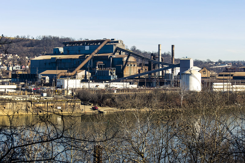
I haven’t been the same since visiting Braddock and seeing the Mon Valley Works steel plant. A need not unlike hunger demanded that I photograph it, which was a difficult thing to do from the landward side in Braddock. I wanted the river in the shot, as well. The GAP is the first location I’ve found so far that allows for this.
– photo by Mitch Waxman
I generally scuttle along at a comfortable pace, covering about two and change miles in an hour. Two hours into this walk, I finally arrived where I wanted to be. I had to find spots where the tree line wasn’t occluding my view of the U.S. Steel Mon Valley Works, but that did it take me long.
Tomorrow, the sort of shots I was looking for.
“follow” me on Twitter- @newtownpentacle
Buy a book!
“In the Shadows at Newtown Creek,” an 88 page softcover 8.5×11 magazine format photo book by Mitch Waxman, is now on sale at blurb.com for $30.


