Posts Tagged ‘DUGSBO’
Project Firebox 50

– photo by Mitch Waxman
Lying in wait, mere steps from the fabled Newtown Creek, sits this centurion. Caring not for the sloppy manner in which its duty scarlet is maintained, nor the obsequious graffitis which deface and detract from department patina and regulations. There is only the mission.
It waits, ever ready, to announce that trouble has arrived and to issue a clarion call.
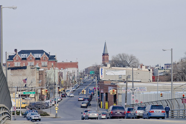
antique bridge

– photo by Mitch Waxman
To be seen by so many diminishes me.
Seeking solace, one such as myself can only find succor and peace in those hinterland angles found between neighborhoods- or boroughs. Neither tick nor tock, Brooklyn nor Queens, the concrete devastations found in these places are nepenthe. Often do I find that my steps have carried me in some inexorable and unconscious fashion to the Grand Street Bridge, spanning the lamentable waters of the Newtown Creek itself.
DUGSBO has been calling to me (Down Under the Grand Street Bridge Onramp) again.
from nyc.gov
The bridge is located between Gardner Avenue in Brooklyn and 47th Street in Queens. The Grand Street Bridge is a 69.2m long swing type bridge with a steel truss superstructure. The general appearance of the bridge remains the same as when it was opened in 1903. The bridge provides a channel with a horizontal clearance of 17.7m and a vertical clearance, in the closed position, of 3.0m at MHW and 4.6m at MLW. The bridge structure carries a two-lane two-way vehicular roadway with sidewalks on either side. The roadway width on the bridge is 6.0m and the sidewalks are 1.8m wide. The height restriction is 4.1m. The approach roadways are wider than the bridge roadway. For example, the width of Grand Avenue at the east approach to the bridge (near 47th Street) is 15.11m.
The first bridge on this site, opened in 1875, quickly became dilapidated due to improper maintenance. Its replacement, opened in 1890, was declared by the War Department in 1898 to be “an obstruction to navigation.” Following a thorough study, a plan was adopted in 1899 to improve the bridge and its approaches. The current bridge was opened on February 5, 1903 at a cost of $174,937.

– photo by Mitch Waxman
This is close to the cartographic end of the actual “Newtown Creek”, although the English Kills tributary slithers forth into Brooklyn and slouches roughly toward Bushwick from this spot. Truncated wetlands, the canalized bulkheads and present shape of the waterway were established by the Army Corps of Engineers in the early 20th century, eradicating any semblance to what the Mespat, Dutch, or English knew the place to look like.
There used to be a nearby island, called Mussel, which the Federal authorities spent no small amount of effort on eradicating from common memory, for instance.
The East Branch, as the water on the eastern side of the Grand Street Bridge is called, continues a short distance and terminates in a complex of sewage infrastructure which underlies Metropolitan Avenue.
from 1920’s Port of New York Annual, courtesy google books
Newtown Creek is a tidal arm of the East River, and forms the boundary between the Boroughs of Brooklyn and Queens, New York City. The mouth of the creek is nearly opposite 34th Street, Manhattan, and 4 miles northeast from the Battery. Its length is about 4 miles, with width varying from 125 to 200 feet.
About 2.75 miles above its mouth it divides into two branches, termed the East Branch and English Kills, or West Branch. About 4,000 feet above the mouth a tributary, Dutch Kills, 4,450 feet long, enters the creek from the east, and almost directly opposite another tributary, Whale Creek, 2,000 feet long, enters it from the west. Maspeth Creek, 3,550 feet long, branches off to the southward 2.25 miles below the mouth of the creek. Mussel Island, included in the existing project for removal, is situated just above the junction of Maspeth Creek with the main stream. The drainage area embraces about 7 square miles, for the most part densely built up along the banks of the creek.
Previous projects.—The original project was adopted by the river and harbor act of June 14, 1880, and was modified and extended by the river and harbor acts of July 5, 1884, and June 3, 1886. A total of $527,530.58 had been expended on the modified project prior to the adoption of the existing project on March 2, 1919.
The amount spent for new work and maintenance can not be separately stated with accuracy, the division in the early years being intermediate. An approximate estimate is that $401,260.51 were applied to new work and $126,270.07 to maintenance.
Existing project.—This provides for a channel 20 feet deep at mean low water in Newtown Creek, including Dutch Kills, Maspeth Creek, and English Kills, and of the following widths: 250 feet wide at the entrance to Newtown Creek, narrowing to 150 feet, and continuing with this width to the Grand Street Bridge on the East Branch, and thence 125 feet wide to Metropolitan Avenue on said branch, including the removal of Mussel Island; 150 feet wide in English Kills, or West Branch, to the Metropolitan Avenue Bridge across said branch, including the easing of bonds; 100 feet wide for a distance of 2,000 feet up Maspeth Creek; and 75 to 100 feet wide for a distance of 2,800 feet up Dutch Kills, with a turning basin at the head, and for the collection and removal of drift. The total length of channel included in the project is about 25,000 feet.

– photo by Mitch Waxman
Traffic, of an automotive sort, courses through and defines this locale. On the Brooklyn side, the neighborhood is called East Williamsburg and on the Queens side it’s an ancient community called Maspeth. There used to a light electric rail running through here and across the bridge, which contemporaneous sources referred to as “a streetcar” (trolley to we moderns), along Grand Street. It allowed for expansion of the great human hive in both directions, which allowed workers to get to and from the dark satanic mills of the industrial age.
Today, there’s a city bus which follows an ancient route of cart and horse, later travelled by streetcar and trolley.
Back during the days of industry, however, the preferred methodology for shipping freight was either rail or barge, not inefficient automotive conveyance.
also from nyc.gov
The highest volume Brooklyn-Queens highway was the Kosciuszko Bridge on the Brooklyn-Queens Expressway, with two-way daily volume of 190,800 vehicles, 32.0% of all traffic on the monitored thoroughfares and 71.4% of Newtown Creek crossings. Belt Parkway (Shore Parkway) was second with 155,600 vehicles per day, 26.1% of the total recorded screenline traffic.

– photo by Mitch Waxman
One of the great shames about the modern era along the Newtown Creek, often remarked upon at this- your Newtown Pentacle, is that so few of the industries based along the water utilize the bulkheaded shorelines lining their properties for their intended purpose.
Instead, the vast majority of stakeholders in the watershed are truck based businesses.
Soot paints the walls, and a bizarre “colour“- not part of any familiar palette or wholesome hue- but instead like something from outer (or perhaps out of) space- stains the vegetation and building stock with a queer sort of iridescence.
from nyc.gov
During the 47 years from 1963 to 2010, daily traffic crossing Newtown Creek increased 66.5%, to 267,100 from 160,400. Volumes increased on all four facilities: Kosciuszko Bridge up 86.7% to 190,800 from 102,200; J.J. Byrne Memorial Bridge up 51.5% to 26,700 from 17,600; Pulaski Bridge up 29.5% to 37,000 from 28,600; Grand Street Bridge up 5.3% to 12,700 from 12,000.

– photo by Mitch Waxman
Overheard murmurs, carelessly spoken in my company by the Manhattan elites, have revealed that -as early as 2004 (see page 75)– plans to replace this centenarian structure were being drawn. Statisticians have compiled numerical data, engineers have produced dire reports, and described the need for a newer, wider, and distinctly static vehicle bridge to be installed on this spot. Heavy trucks, the presence of a nearby MTA bus garage, and an ever increasing number of automobiles are cited as causatives.
Personal experience offers that when a city bus or fully loaded truck speeds across the structure, often far in excess of the posted speed limit, the 1903 vintage swing bridge cavitates, trembles, and vibrates tremendously.
from Mayor Low’s Administration in New York at Google Books.

– photo by Mitch Waxman
Given that which flows, lugubrious and languid, below- the kinetics of the Grand Street Bridge dancing in its casements can be quite disconcerting. It is something which one grows used to, however, despite the sure knowledge that when confronting the water and sediments of this part of the Newtown Creek- a single question crowds out all other thoughts in the minds of vehicle borne transient, pedestrian, or casual visitor alike…
Who can guess, all there is, that might be buried down there?
from Annual report of the State Department of Health of New York. 1896, courtesy google books
_______________________________________________________________________________
Also:
June 23rd, 2012- Atlas Obscura Thirteen Steps around Dutch Kills walk

– photo by Mitch Waxman
The “Obscura Day” Thirteen Steps around Dutch Kills tour proved that the efficacy and charms of the Newtown Creek’s least known tributary, with its myriad points of interest, could cause a large group to overlook my various inadequacies and failings. The folks at Atlas Obscura, which is a fantastic website worthy of your attentions (btw), have asked me to repeat the tour on the 23rd of June- also a Saturday.
for June 23rd tickets, click here for the Atlas Obscura ticketing page
June 30th, 2012- Working Harbor Committee Kill Van Kull walk

– photo by Mitch Waxman
My various interests out on the sixth borough, NY Harbor, have brought me into association with the Working Harbor Committee. A member of the group’s Steering Committee- I also serve as the “official” group photographer, am chairman and principal narrator of their annual Newtown Creek Boat Tour, and occasionally speak on the microphone during other tours (mainly the Brooklyn one). This year, the group has branched out into terrestrial explorations to compliment the intense and extant schedule of boat tours, and I’m going to be leading a Kill Van Kull walking tour that should be a lot of fun.
The Kill Van Kull, or tugboat alley as its known to we harbor rats, is a tidal strait that defines the border of Staten Island and New Jersey. A busy and highly industrialized waterfront, Working Harbor’s popular “Hidden Harbor – Newark Bay” boat tours provide water access to the Kill, but what is it like on the landward side?
Starting at the St. George Staten Island Ferry terminal, join WHC Steering Committee member Mitch Waxman for a walk up the Kill Van Kull via Staten Islands Richmond Terrace. You’ll encounter unrivaled views of the maritime traffic on the Kill itself, as well as the hidden past of the maritime communities which line it’s shores. Surprising and historic neighborhoods, an abandoned railway, and tales of prohibition era bootleggers await.
The tour will start at 11, sharp, and you must be on (at least) the 10:30 AM Staten Island Ferry to meet the group at St. George. Again, plan for transportation changes and unexpected weirdness to be revealed to you at MTA.info.
for June 30th tickets, click here for the Working Harbor Committee ticketing page
July 8th, 2012- Atlas Obscura Walking Tour- The Insalubrious Valley

– photo by Mitch Waxman
Newtown Creek Alliance historian Mitch Waxman will be leading a walk through the industrial heartlands of New York City, exploring the insalubrious valley of the Newtown Creek.
The currently undefended border of Brooklyn and Queens, and the place where the Industrial Revolution actually happened, provides a dramatic and picturesque setting for this exploration. We’ll be visiting two movable bridges, the still standing remains of an early 19th century highway, and a forgotten tributary of the larger waterway. As we walk along the Newtown Creek and explore the “wrong side of the tracks” – you’ll hear tales of the early chemical industry, “Dead Animal and Night Soil Wharfs”, colonial era heretics and witches and the coming of the railroad. The tour concludes at the famed Clinton Diner in Maspeth- where scenes from the Martin Scorcese movie “Goodfellas” were shot. Lunch at Clinton Diner is included with the ticket.
Details/special instructions.
Meetup at the corner of Grand Street and Morgan Avenue in Brooklyn at 11 a.m. on July 8, 2012. The L train serves a station at Bushwick Avenue and Grand Street, and the Q54 and Q59 bus lines stop nearby as well. Check MTA.info as ongoing weekend construction often causes delays and interruptions. Drivers, it would be wise to leave your vehicle in the vicinity of the Clinton Diner in Maspeth, Queens or near the start of the walk at Grand St. and Morgan Avenue (you can pick up the bus to Brooklyn nearby the Clinton Diner).
Be prepared: We’ll be encountering broken pavement, sometimes heavy truck traffic as we move through a virtual urban desert. Dress and pack appropriately for hiking, closed-toe shoes are highly recommended.
Clinton Diner Menu:
- Cheese burger deluxe
- Grilled chicken over garden salad
- Turkey BLT triple decker sandwich with fries
- Spaghetti with tomato sauce or butter
- Greek salad medium
- Greek Salad wrap with French fries
- Can of soda or 16oz bottle of Poland Spring
for July 8th tickets, click here for the Atlas Obscura ticketing page
July 22nd, 2012- Working Harbor Committee Newtown Creek Boat Tour
 |
Many people know about the environmental issues facing Newtown Creek, but did you know that the Creek was once the busiest waterway in North America, carrying more industrial tonnage than the entire Mississippi River?
You’ll learn much more when Working Harbor Committee’s maritime historians and harbor experts
put it all in context during a Hidden Harbor Tours: Newtown Creek Exploration.
The heart of industrial New York, Newtown Creek was home port to hundreds of tugboats (one of which is the historic WO Decker). It was also an international destination for oceangoing ships and a vast intermodal shipping and manufacturing hub that employed hundreds of thousands of people. Forming the border of Brooklyn and Queens for nearly three miles, five great cities grew rich along the Newtown Creek’s bulkheads — Greenpoint, Willamsburg, Bushwick, Long Island City and Manhattan itself. The waterway is still a vital part of the harbor and the Working Harbor Committee (WHC) is proud to present this tour as part of the celebration of their tenth anniversary year.
Mitch Waxman, a member of WHC’s steering committee and the group’s official photographer, also serves with the Newtown Creek Alliance as its group Historian. In addition to working on WHC’s boat tours of the Creek, Mitch offers a regular lineup of popular walking tours, and presents a series of well-attended slideshows for political, governmental, antiquarian, historical and school groups. His website — newtownpentacle.com — chronicles his adventures along the Newtown Creek and in the greater Working Harbor.
He was recently profiled in the NY Times Metro section, check out the article here.
Upcoming tour: Hidden Harbor Tours: Newtown Creek Exploration.
On July 22nd, Mitch shares his unique point of view and deep understanding of the past, present and future conditions of the Newtown Creek as the narrator and expedition leader for this years Hidden Harbor Tours: Newtown Creek exploration.
Our NY Water Taxi leaves from South Street Seaport at 11 a.m. (sharp) on a three hour tour of the Newtown Creek. From the East River we’ll move into the Newtown Creek where we’ll explore explore vast amounts of maritime infrastructure, see many movable bridges and discover the very heart of the Hidden Harbor.
Limited seating available, get your tickets today.
 |
|||||||||||||||
|
|||||||||||||||

obscure and cryptical

– photo by Mitch Waxman
Another “Now and then” posting for you today, Lords and Ladies of Newtown, and today it’s arguably my favorite of all the bridges of Newtown Creek- the atavist Grand Street Bridge spanning the currently undefended border of Brooklyn and Queens. The shot above is from the water, as recreating the 1910 era shot below (from the bulkheads of the eastern brooklyn side) would require probable trespass- which in our modern day age of the Terror War might subject one to legal penalties such as exsanguination or some time spent in “the boot“.

– photo from Engineering magazine, Volume 38, 1910- courtesy google books
While it does seem true that the Grand Street Bridge has changed little in the intervening century, the primary difference between then and now is that it doesn’t function as a swing bridge very often these days. The stalwart engineers and mechanics of the DOT do open it for maintenance periodically, but the City has petitioned the Coast Guard to abandon such actions due to lack of industrial need and expense of operation.
For a prior posting which will tell you literally EVERYTHING about the Grand Street Bridge and environs- an area I call DUGSBO- Down Under the Grand Street Bridge Onramp- click here
Also:

– photo by Mitch Waxman
An NCA event, which I for one am pretty stoked about:
April NCA meeting hosts Dr. Eric Sanderson
Thursday, April 26, 2012 at 6pm
Ridgewood Democratic Club, 6070 Putnam Avenue, Ridgewood, NY 11385
In addition to important updates from our members – in particular the Bioremedition Workgroup has been very busy! – we will be hosting a special presentation on the “Historical Ecology of Newtown Creek”.
Dr. Eric Sanderson, senior conservation ecologist at the Wildlife Conservation Society and author of “Mannahatta: A Natural History of New York City” (Abrams, 2009), will describe recent studies of the historical ecology of Newtown Creek, describing the original wetlands, creek channels, topography and vegetation of the area. He will show a series of 18th and 19th century maps of the watershed of the creek and discuss the process of synthesizing them into an integrated ecological picture that can be used to inform and inspire natural restoration and cultural appreciation of the Newtown Creek watershed. This work is part of the Welikia Project (welikia.org), an investigation into the historical ecology of the five boroughs of New York City and surrounding waters. The Welikia Project on Newtown Creek is funded by The NYCEF Newtown Creek Fund of the Hudson River Foundation.
And this Saturday,

Obscura Day 2012, Thirteen Steps around Dutch Kills
Saturday April 28th, 10 a.m.
Your humble narrator will be narrating humbly at this year’s Obscura Day event on April 28th, leading a walking tour of Dutch Kills. There are a few tickets left, so grab them while you can.
“Found less than one mile from the East River, Dutch Kills is home to four movable (and one fixed span) bridges, including one of only two retractible bridges remaining in New York City. Dutch Kills is considered to be the central artery of industrial Long Island City and is ringed with enormous factory buildings, titan rail yards — it’s where the industrial revolution actually happened. Bring your camera, as the tour will be revealing an incredible landscape along this section of the troubled Newtown Creek Watershed.”
For tickets and full details, click here :
obscuraday.com/events/thirteen-steps-dutch-kills-newtown-creek-exploration
thickening twilight
– photo by Mitch Waxman
Sickened by weariness and a youth misspent, your humble narrator nevertheless has been tormenting himself lately with regret and guilty nonsense. “Not working hard enough” is omnipresent in my mind these days, and accordingly, the length and depth of my wanderings through the Creeklands have expanded. A lack of physical exercise is deadly to a poor specimen like myself, something which is difficult during the winter months due to that certain allergy to cold which has manifested – and which has become amplified- in recent years.
It’s amazing the ways that your body changes as you grow older, sometimes it seems as if there’s some feeble alien creature within that is pushing and tearing a path to the outside world through your very flesh.
from hplovecraft.com
Y’ha-nthlei was not destroyed when the upper-earth men shot death into the sea. It was hurt, but not destroyed. The Deep Ones could never be destroyed, even though the palaeogean magic of the forgotten Old Ones might sometimes check them. For the present they would rest; but some day, if they remembered, they would rise again for the tribute Great Cthulhu craved. It would be a city greater than Innsmouth next time.

– photo by Mitch Waxman
Carrying forth, however, is something compelled rather than desired. My team of doctors has advised me of decaying homeostasis, entropic processes, and general decline. Their suggestions are to step up, exert more effort, and seek even greater frequency for these long walks while avoiding the pleasures and poisons of the west. Luckily, the ancient pathways and avenues which surround and inform that nearby slick of languid infamy known as the Newtown Creek supply ample locations to inspect, never failing to intimate some hidden meaning or vaguely shadowed terror.
Who can guess, all there is, that might be buried down there?
from hplovecraft.com
“The nethermost caverns,” wrote the mad Arab, “are not for the fathoming of eyes that see; for their marvels are strange and terrific. Cursed the ground where dead thoughts live new and oddly bodied, and evil the mind that is held by no head. Wisely did Ibn Schacabao say, that happy is the tomb where no wizard hath lain, and happy the town at night whose wizards are all ashes. For it is of old rumour that the soul of the devil-bought hastes not from his charnel clay, but fats and instructs the very worm that gnaws; till out of corruption horrid life springs, and the dull scavengers of earth wax crafty to vex it and swell monstrous to plague it. Great holes secretly are digged where earth’s pores ought to suffice, and things have learnt to walk that ought to crawl.
– photo by Mitch Waxman
Paranoid wonderings, lunatic ideations, unnameable desires- all haunt me during the seemingly aimless steps. Delusions of self importance, hubris, and vast ennui are my only companions on these often cobbled streets. A discarded landscape with a lost history, this is a place given to the dead, the diseased, the barren… a perfect home for one such as myself. There seems to be a current in the air, a taste of anxiety on the tip of my tongue which is all pervasive, and it feels as if something is about to happen.
Ahh… I’m all effed up.
from hplovecraft.com
I do not recall distinctly when it began, but it was months ago. The general tension was horrible. To a season of political and social upheaval was added a strange and brooding apprehension of hideous physical danger; a danger widespread and all-embracing, such a danger as may be imagined only in the most terrible phantasms of the night. I recall that the people went about with pale and worried faces, and whispered warnings and prophecies which no one dared consciously repeat or acknowledge to himself that he had heard. A sense of monstrous guilt was upon the land, and out of the abysses between the stars swept chill currents that made men shiver in dark and lonely places. There was a daemoniac alteration in the sequence of the seasons—the autumn heat lingered fearsomely, and everyone felt that the world and perhaps the universe had passed from the control of known gods or forces to that of gods or forces which were unknown.
life, matter, and vitality

– photo by Mitch Waxman
Paramount in my apprehensions about this unremembered walk- which began at St. Patrick’s Old Cathedral, continued down Delancey Street, went over the Williamsburg Bridge, staged into Williamsburg, and continued up Grand Street in the direction of that assassination of joy called the Newtown Creek- is the ideation that something happened to me in the ancient church.
Remember, this unknown fellow from the interwebs offered me information which is dearly sought, the location of a certain interment lost in the ghoulish multitudes of Calvary Cemetery which I have spent too much time searching for. When my anonymous assignee walked into the church with two troglodyte ruffians, I panicked and fled… but a nagging suspicion that something else might have happened in there torments me.

– photo by Mitch Waxman
Could a mere intuition have sent me into this flaming paroxysm of cowardly flight, carrying me blind miles in a stupor? A delicate constitution and deep physical cowardice are my hallmarks, yes, but a multiple mile flight which propelled me across most of the eastern districts of Brooklyn? Nevertheless, according to my camera card, I had nevertheless returned to the loathsome lands of the Newtown Creek and was standing upon the Metropolitan Avenue Bridge once again.
The coincidental concurrence of my route with certain long forgotten street car (trolley) routes continues to intrigue me as I write this in the sober and controlled environment of Newtown Pentacle HQ.

– photo by Mitch Waxman
The tugboat which is often noticed here is the “Mary H.” which runs fuel barges from the outer harbor to the Bayside Oil depot located on Metropolitan Avenue itself, near it’s junction with Grand Street. The section of the Creek visible in these shots is actually a tributary, called English Kills. Two ancient pathways, which we call Grand St. and Metropolitan Avenue these days, cross each other here at a sharp angle.
Metropolitan was formerly known as the Williamsburgh and Jamaica Turnpike, and it connected Newtown in Queens with the Eastern District of Brooklyn- Bushwick, Williamsburg, and Greenpoint. The crossing of Grand and Metropolitan was also one of the stops on the New York and Manhattan Beach Railroad, its depot would have found at the foot of Greenpoint’s Quay Street in 1912.

– photo by Mitch Waxman
A theory which guides me of late requires a paradigm shift in thought and perception, simply put- the older communities of western Queens and north western Brooklyn have more in common with each other than they do with the boroughs they reside in. In earlier times, before the bridges, intimate (and railroad) ties knit these communities together and Bushwick has more in common with Astoria than it does with Flatbush.
The unifying principal, the organizing principal in fact, was access to the waterfront not just at the East River- but all along the various creeks and kills which once penetrated inland. The culture which grew along Sunswick and Newtown and Bushwick Creeks is lost to time and shifting populations, buried beneath centuries of concrete and the remnants of long vanished industry.

– photo by Mitch Waxman
It would seem that your humble narrator continued down Grand Street from Metropolitan, toward the border of Brooklyn and Queens at the Grand Street Bridge, and area I dare to call DUGSBO- Down Under the Grand Street Bridge Onramp.
This section of the City of Greater New York, incidentally, is called East Williamsburg by modern cartographers.

– photo by Mitch Waxman
Fear exists in my heart for the noble little Grand Street Bridge, as modern traffic races across it’s delicate mechanisms. Long has it been since boat traffic has crossed it, the last official opening was in 2002. One misstep by a careless trucker and this historic structure would require replacement, no doubt by an economical fixed span.
Who speaks for it, save I? It deserves a better advocate.

– photo by Mitch Waxman
An oddity and relict vehicle appears next in this fever dream found on my camera’s memory card, which is most probably a 1940 Ford Deluxe Coupe. It appears to be a loving restoration, although a powerful and enigmatic auto like this should either be painted black or fire engine red in my eyes.
What do I know, after all, I’m some guy who gets scared of strangers in the City and then wanders around the boroughs in a haze of panic and all the while I’m taking pictures that I don’t remember taking…

– photo by Mitch Waxman
It’s actually funny, considering that in this odd state which I was suffering from, that when seeking a safe haven my subconscious mind bought me here to the Newtown Creek. It has been some time since warnings and admonishments to newcomers about this place have been offered at this- your Newtown Pentacle.
Irresponsible of me, in fact.
This carrion relict of a forgotten age is not the world you know, and those rules and conventions which govern the City that encompasses it’s district do not always apply here. Trucks and railroads operate at high speed along these streets, the very air you breathe is a fume, and there are malign forces long thought dead or neutered which still thrive here. The ground is a broken minefield of powdered glass and tetanus tainted metal, and just below the surface is a writhing agglutination of the very worst stuff that the 20th century ever managed to conjure. Who can guess all there is, that might be buried down there?
Welcome to the Newtown Creek.
Note: apologies for the absent updates this last week, but the City of Water Day Newtown Creek Tour and Magic Lantern Show seriously drained my strength. To be seen by so many diminishes me.


