Posts Tagged ‘Moon Township’
Montour Trail, part 2
Friday
– photo by Mitch Waxman
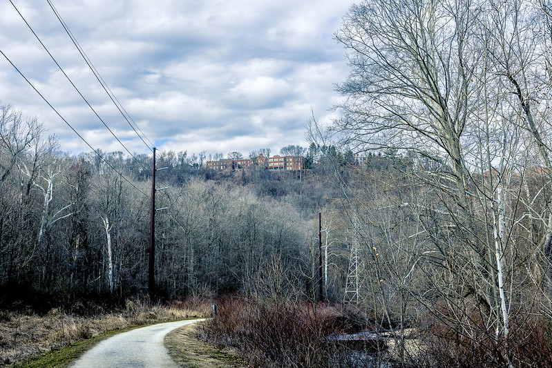
As described yesterday, one recently spent an afternoon at the head of the Montour Trail, with mile zero of the rail trail being found in the Pittsburgh suburb of Coraopolis. I scuttled from the parking lot at mile zero to about two and a half miles down the line, then turned around and headed back. Along the way, there were several interesting POV’s, so I deployed the tripod and attached a filter to my lens, and then got busy.
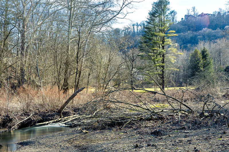
The “undistinguished” waterway seen flowing throughout today’s post is called Montour Run.

– photo by Mitch Waxman
There were lots of fallen trees in the stream. I decided to affix an ND filter to the lens to slow down the light and allow the water to photograph as a mirror. There were several ‘desire paths’ which had been created by people’s feet that led off the Montour Trail and down to the banks of the waterway.
For the most part, it was seldom more than a couple/three feet deep, but the water was flowing pretty quickly. This created a lot of visual distraction, hence the desire to “mirrorize” the surface.

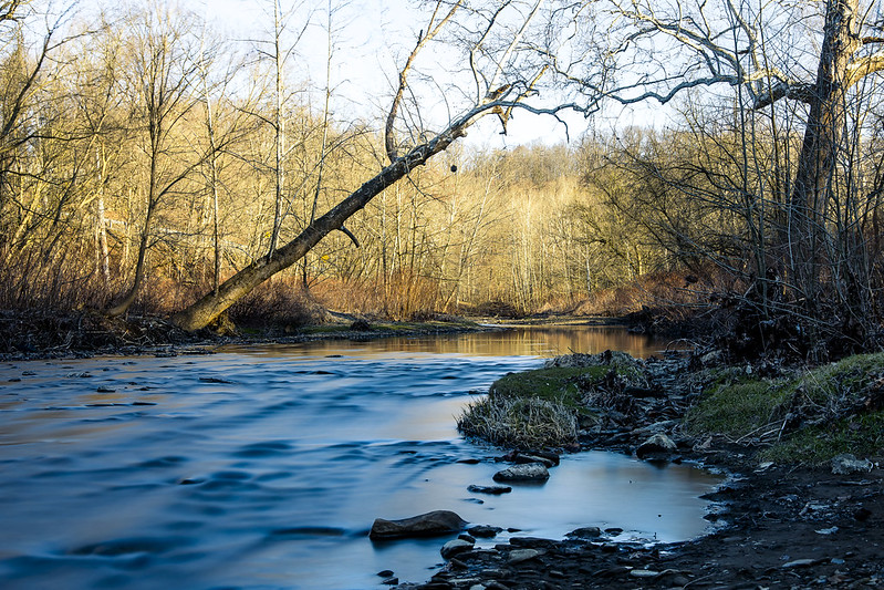
– photo by Mitch Waxman
There was one area in particular which caught my attention, a basin of sorts where the water spread out nearby the overpasses of a nearby highway. For these shots, two of the legs of my tripod were actually standing in the water. I had to shimmy down a somewhat natural and quite muddy slope for these.
Worth it.

– photo by Mitch Waxman
One has been watching YouTube videos offered by bicycle riders, usually GoPro helmet cam type presentations, of Montour Trail trips. This is part of my remote scouting regime. It lets me know if there’s something specific on any one section of the trail that I might want to seek out (there are rail tunnels and bridges down the line!) and others that I’d want to avoid (the airport connector section of the Montour seems pretty horrific if you’re on foot).
Ultimately, I’m intrigued by all of this. This is EXACTLY the sort of proposal which we Newtown Creek aficionados have been proposing to the powers that be in NYC regarding the Montauk Cutoff for nearly a decade. Deaf ears, back in NYC, unless you start your sentence with “affordable housing.”
– photo by Mitch Waxman
One thing I’ve discovered here in “ridge and valley” country is that the burning thermonuclear eye of god itself may be setting at the same time or later than it does back where I’m from, but because of the terrain the sunset occurs in a quicker interval than it does in a comparatively flat and oceanic terrain. Here, the orb drops behind a hill and you’re done right quick.
Saying that, there’s some serious theatrical level lighting going on during these moments.

– photo by Mitch Waxman
One looks forward to more explorations of these amazing examples of lateral thinking, regarding the post industrial utilization and conversion of private property into a public recreational space, which can be found here in Western Pennsylvania.
Back next week with something else.
“follow” me on Twitter- @newtownpentacle
Buy a book!
“In the Shadows at Newtown Creek,” an 88 page softcover 8.5×11 magazine format photo book by Mitch Waxman, is now on sale at blurb.com for $30.
Montour Trail, part 1
Thursday

– photo by Mitch Waxman
There’s a huge network of rail trails in the Pittsburgh area, something which has caught my attentions a few times. Rail Trails follow the “right of way” of some bankrupt railroad which is long gone, whereupon some combination of Governmental and community organizations converted the former trackways into public spaces and parkland. A few weeks ago, I visited a section of the Great Allegheny Passage or “GAP,” which was described here, here, and here. Additionally, visits to the Three Rivers Heritage and Hot Metal trails, as well as the Eliza Furnace Trail, are described. One is slowly becoming aware of the fairly vast network of these rail trails which snake around Pittsburgh.
Last week, I paid a visit to a suburb of Pittsburgh called Coraopolis where the Montour Trail, which follows the path of the defunct Montour Railroad, begins.
I’d visited a couple of sections of the Montour very briefly back in January, in a place called McDonald, where it intersects with another rail trail called the Panhandle. There’s also a Montour trailhead in Clairton, nearby one of the Steel Mills. Wow.

– photo by Mitch Waxman
I parked the Mobile Oppression Platform (the Toyota) at the head of the trail at a lot maintained for visitors nearby the Montour Trail’s zero mile marker. There was a Porta Potty there. One gathered the camera gear off of the back seat of the MOP and set off for a medium sized scuttle. This time around, I had two zoom lenses and a tripod with me. One lens on the camera, the other (a 70-300) in the bag. I’d say that about 75-80% were shot with my 24-105 mm lens.
Speaking of shooting, the first mile or so of the Montour Trail allows you egress between the property of two shooting ranges. For the entire first mile and a half, you’ll hear non stop rifle fire. This was excellent. There was so much gunfire going on that it sounded like a rock beat was playing. USA!

– photo by Mitch Waxman
These trails are very easy walking, and a lot of people were biking through, and most of them were sort of pleasant. The custom here is to say hello to strangers, or at least nod at them, while passing by. It’s somewhat ritualized, this friendly thing. As a lifelong New Yorker, this acknowledgment of other’s existence is weird, but when in Rome…
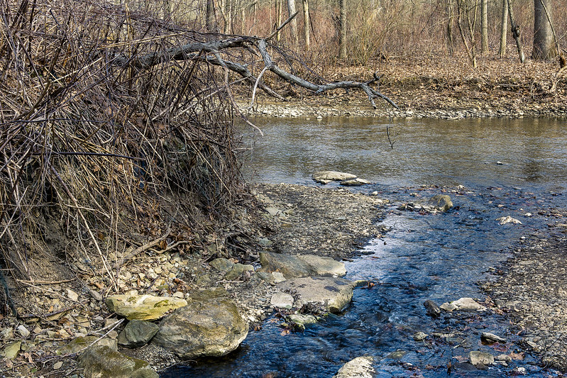
The surface of the trail is mostly crushed limestone but there’s patches of pavement here and there. The grading of the thing is in accordance with the railroad standard of gaining no more than one foot of elevation for every hundred feet that’s crossed horizontally, which is where that “easy walking” observation comes in. A small waterbody was running alongside the trail berm that once carried rails, called Montour Run. In places, the water looked fairly deep. Signage indicated that the run was stocked with trout. There were a bunch of informal trails leading off the Montour which people had graded with their feet. In urban design circles, these sort of corridors are called “desire paths.”
– photo by Mitch Waxman
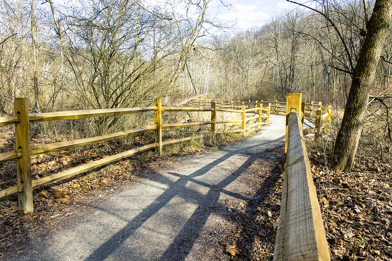
Roughly two miles from where I started, the Montour Trail intersects with a natural conservation area and a set of side trails maintained by the Hollow Oak Land Trust. One wandered into the Hollow Oak zone for about a half hour, and enjoyed the landscape. I’m definitely coming back to this one in the spring when all of those sticks have leaves on them.
A lot of shallow water was cascading about, running down out of the woods and eventually joining the Montour Run.
– photo by Mitch Waxman
A crew of volunteers was at work when I was there, maintaining the trail and clearing brush. This was my turnaround point for the walk, as I ultimately had to back track to the zero mile point to get back to the car. The Montour Trail ultimately goes to Maryland, so it’s clearly not something I’m going to walk all in one go.
The other side trails which branch off of the Montour are going to also get some attention in the fullness of time, but as mentioned many times – one is still scouting.
– photo by Mitch Waxman
After hitting the turnaround point, roughly two and a half miles from the start, one began heading to the MOP. I had noted a few spots which were visually promising on my way to the turnaround point, and since it was now a good time of day – late afternoon – for light…
More tomorrow at this – your Newtown Pentacle.
“follow” me on Twitter- @newtownpentacle
Buy a book!
“In the Shadows at Newtown Creek,” an 88 page softcover 8.5×11 magazine format photo book by Mitch Waxman, is now on sale at blurb.com for $30.


