Posts Tagged ‘Pickman’
disreputably nourished
Wednesday

– photo by Mitch Waxman
October 11th saw me conducting a small walking tour for a couple of friends of First Calvary Cemetery.
I haven’t been able to conduct any commercial tours of Calvary for quite a while now, due to a cease and desist letter which the Roman Catholic Church sent me. I actually consider that to be a feather in my cap.

– photo by Mitch Waxman
October 13th was a rainy day, and night, so I lingered at HQ and shot a few portraits of the Bodega across the street from my porch.
I had an invite to a fundraiser party in Williamsburg the next day, and planned on getting to Brooklyn the long way around.
– photo by Mitch Waxman
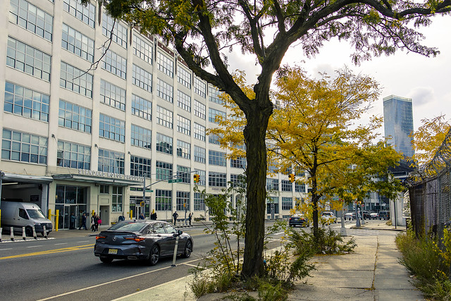
October 17th, one left HQ and started trekking towards Brooklyn. I didn’t have too much else going on, so a photowalk was on order for the day. The rain was coming and going, but I had an umbrella.
My plan was to walk for three or four subway stops to Court Square, and then use the G line subway to complete the trip.

– photo by Mitch Waxman
Yeah, yeah, yeah. I could have taken the train the whole way from Astoria and just transferred – but where’s the fun in that?
I actually wandered pretty far afield of my intended path, and ended up – as usual – in the neighborhood surrounding Dutch Kills in LIC on my way.
– photo by Mitch Waxman
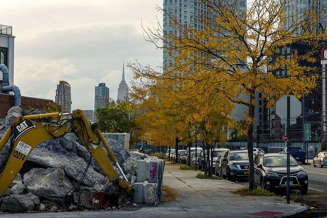
Foliage. That’s my excuse. Fall foliage.
The party I was heading to was for the Evergreen outfit, which is one of the groups that Newtown Creek Alliance is allies with. They’re a “BID” or Business Improvement District group which advocates for the industrial zone of North Brooklyn. Nice bunch of people, and it was a good party with lots of friends in attendance. In the end, I just walked to Williamsburg from LIC.

– photo by Mitch Waxman
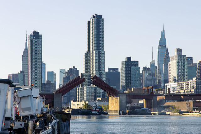
At some point after the party, the rain became somewhat intense, so I made my way to the subway and caught the G.
Y’know what? That was probably the last time that I’d ever be riding the G train. After all, my entire world changed a couple of days later.
“follow” me on Twitter- @newtownpentacle
Buy a book!
“In the Shadows at Newtown Creek,” an 88 page softcover 8.5×11 magazine format photo book by Mitch Waxman, is now on sale at blurb.com for $30.
noxious heap
Tuesday
– photo by Mitch Waxman
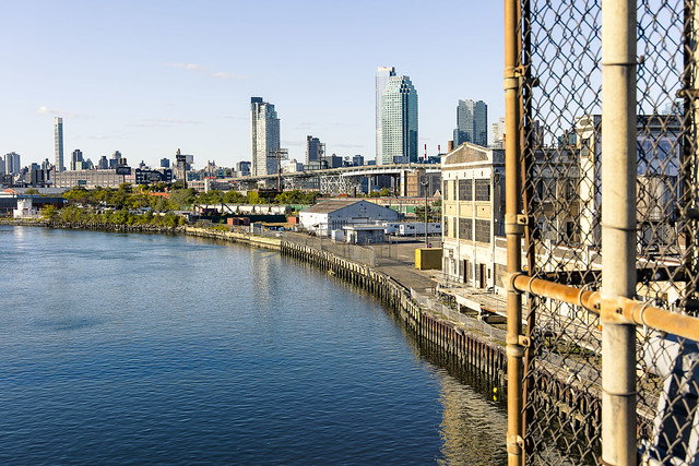
Continuing with the sights witnessed along a longish scuttle on October 8th, a humble narrator found himself crossing the Greenpoint Avenue Bridge and heading towards Brooklyn’s Greenpoint section.
That’s my beloved Newtown Creek in the shot above. About 1.3 miles back from the East River.
– photo by Mitch Waxman
Kingsland Avenue is in the process of being redesigned in response to the opening of Phase 3 of the Newtown Creek Nature Walk at the sewer plant, which has brought lots and lots of pedestrian and bike traffic to the former entirely industrial street. As always seems to be the case these days, NYC DOT’s traffic engineers has managed to imagine up the worst possible design, and implemented it in a piecemeal and inconsistently thought out fashion.
Somebody else’s problem now. I’m done fighting City Hall.
– photo by Mitch Waxman
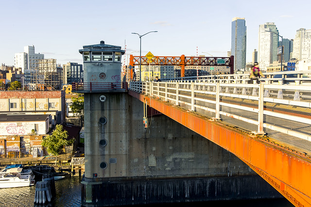
At the Nature Walk, which hugs the water facing side of the Sewer Plant, the Pulaski Bridge opening for a passing tug was observed.
Somebody recognized me, and I was having a conversation with them while climbing on a fence. They were clearly afraid that I was going to fall in the water while doing so, but there you are.
– photo by Mitch Waxman
The next section of my walk involved attaining the Pulaski Bridge’s pedestrian path. Which carried me back out of Brooklyn and into Queens’ Long Island City section.
One briefly considered hopping on the subway, but it was a beautiful day and I just kept on scuttling.
– photo by Mitch Waxman
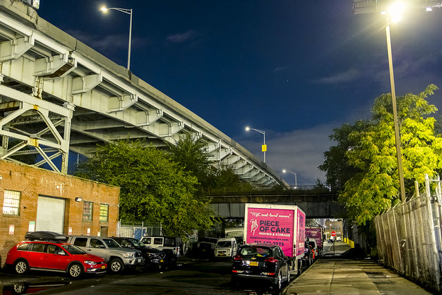
One headed eastwards on Jackson Avenue, heading towards Astoria.
“Every time might be the last time.”

– photo by Mitch Waxman
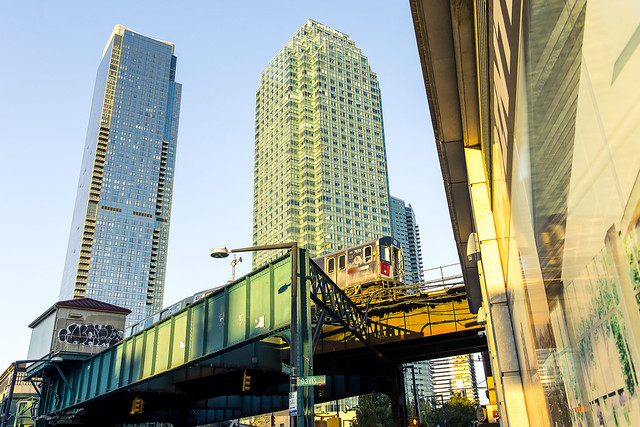
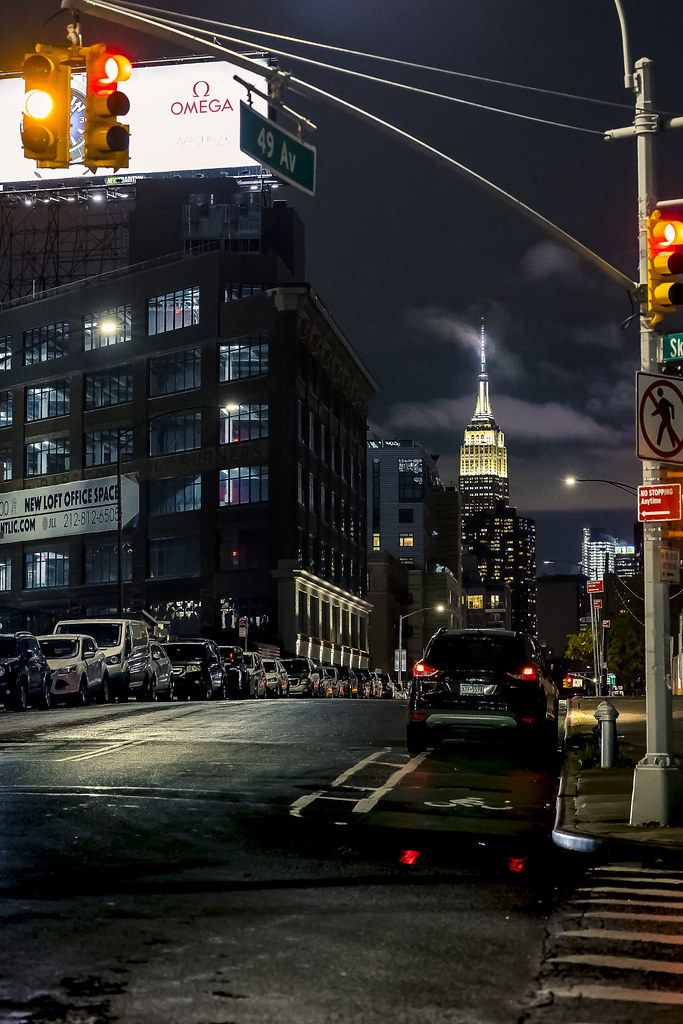
Queens Plaza has become absolutely unrecognizable at this point. The few remaining industrial buildings and warehouses which survived the reconstruction of the area have finally been consumed by the real estate frenzy.
Tomorrow – something a bit different, at this – your Newtown Pentacle.
“follow” me on Twitter- @newtownpentacle
Buy a book!
“In the Shadows at Newtown Creek,” an 88 page softcover 8.5×11 magazine format photo book by Mitch Waxman, is now on sale at blurb.com for $30.
slate tombstone
Monday

– photo by Mitch Waxman
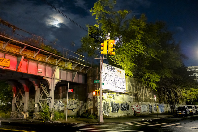
October 8th was one of the days in Long Island City that passerby might have noticed a pile of black sackcloth being carried along by the wind. Closer inspection would have revealed a humble narrator clothed in his street cassock, a filthy black raincoat flapping about in the poison breeze. One was enjoying an afternoon constitutional, and occasionally startling the elderly and their dogs if they gazed upon my countenance while passing by. A face for radio, that’s me.
One was feeling particularly invigorated, and it was a beautiful day for a stroll over to a hopelessly polluted industrial zone.

– photo by Mitch Waxman
Somebody left their shop door open, and I cracked out an exposure or two of the scene within while shambling past. Neat!
In accordance with recent policy shifts here at HQ in Astoria, one had timed the walk for the late afternoon. This was around 5 p.m., give or take. In October, the burning thermonuclear eye of god itself lobs about in the sky at fortuitous angularities relative to the street grid of New York City. Not so much in January, so take advantage when you can.

– photo by Mitch Waxman
One of the torments which my friends endure revolves around me having led them through over hill and dale and onto hell’s favorite streets, baking in the sun the whole way, whereupon I present them with a description of our destination as being “only 2-3 miles more to go” followed by “but, it’s all down hill from here.” To wit: the shot above. Several of you reading this just groaned.
What you’re actually looking at above is the hydrological reservoir and surrounding sloped basin of the Dutch Kills tributary of Newtown Creek. The flat lowlands around the waterway were wetlands, or “waste meadows” as they called them in the old days. Behind me, and further up the hill from where I was standing, is Greenpoint Avenue. Greenpoint Avenue connects with, and used to incorporate Roosevelt Avenue, which went all the way to Flushing back in the days of the decadent Dutch in the form of a turnpike. Greenpoint Avenue was set up as a high ground ridge road which connected two isolated waterfront colonies separated by bogs, swamps, and grass land.

– photo by Mitch Waxman
1940 is when the monstrosity pictured above, which largely follows Borden Avenue’s far more ancient path, was opened for traffic. Formerly, the horse or oxen drawn traffic followed Borden or Hunters Point Avenue on its path to the East River, where ferry or boat transport would complete the journey of passengers or cargo to Manhattan from Queens. Back then, there were shops and restaurants and inns along the route. Houses too, a few blocks back.
When the City bound traffic disappeared onto the Long Island Expressway and into the similarly aged Queens Midtown Tunnel, it blighted the area, and an already onerous catalog of industries in this area got worse in terms of character and pollution.

– photo by Mitch Waxman
When you’re on the south side of the Long Island Expressway, you’ve entered Blissville. That’s the name of the neighborhood. Really.
This neighborhood, and many of its residents, have a special place in my heart. I like having beers at Bantry Bay on Greenpoint Avenue, and I can point you at a very comfortable socialist bench nearby Review Avenue (it was donated to the Blissville Community by the campaign of Jonathan Bailey, who ran as a Democratic Socialist for City Council in the last cycle, so “socialist bench.”)
I am unaware of any public furniture donations to Blissville from the Republican Candidate for the seat, Marvin Jeffcoat.

– photo by Mitch Waxman
One such as myself is probably the only person in Brooklyn or Queens happy to see the Greenpoint Avenue Bridge opening at 5:30 p.m. on a weekday, but there you are. I enjoyed the show, and waited patiently, unlike everybody else, for the thing to resume “bridging” after it finished “drawbridging.”
More tomorrow.
“follow” me on Twitter- @newtownpentacle
Buy a book!
“In the Shadows at Newtown Creek,” an 88 page softcover 8.5×11 magazine format photo book by Mitch Waxman, is now on sale at blurb.com for $30.
amorphous blight
Friday
– photo by Mitch Waxman
A few somewhat random shots from the end of a longish walk, depicting scenes familiar and loved.
Things I’m likely not going to be witnessing again.
– photo by Mitch Waxman
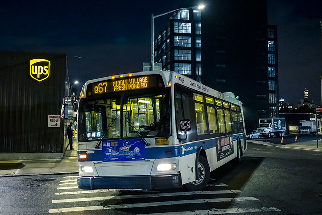
The empty corridor in Long Island City, an industrial zone blighted by the presence of the Long Island Expressway, which has suddenly become incredibly busy due to the pandemic influenced explosion of activity by last mile shipping companies like FedEx and UPS.
15 years ago, this empty corridor hosted a series of homeless camps built around shacks and abandoned cars.
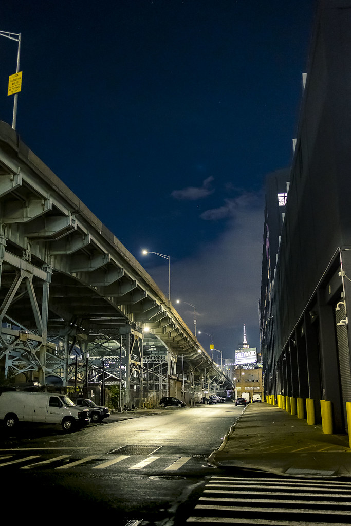
– photo by Mitch Waxman
It was scary here, and particularly so at night. Not because of the homeless population, who are – generally speaking – not a threat to passerby. It was a deserted area, where young men from surrounding residential neighborhoods would gather to plan the nefarious part of their nights.
LIC is one of the photographic wonderlands which I’ve been absolutely honored to record.
– photo by Mitch Waxman
The Montauk Cutoff, which are abandoned LIRR rail tracks. My friends and I have been trying for years to get MTA to officially open the space to the public, despite the fact that the public uses them regularly as it is.
I was heading for the 7 line stop a few blocks away.
– photo by Mitch Waxman
Views like the ones found in LIC are just unique. Especially so when the ground is saturated with moisture after a week of rain.
NYC never looks as good as it does when it’s wet.

– photo by Mitch Waxman
The 7 carried me to Queensboro Plaza, where a transfer to the Astoria line W train was enacted and soon I was at 31st street and Broadway.
One scuttled down Broadway towards HQ, lost in a fog of recollections and memories. All the people… all the times good and bad…
“follow” me on Twitter- @newtownpentacle
Buy a book!
“In the Shadows at Newtown Creek,” an 88 page softcover 8.5×11 magazine format photo book by Mitch Waxman, is now on sale at blurb.com for $30.
final peril
Thursday
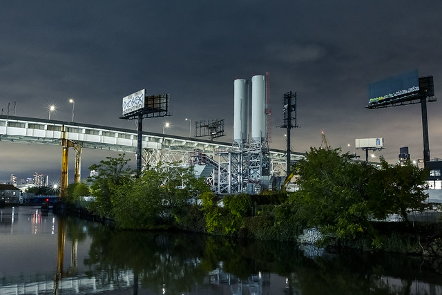
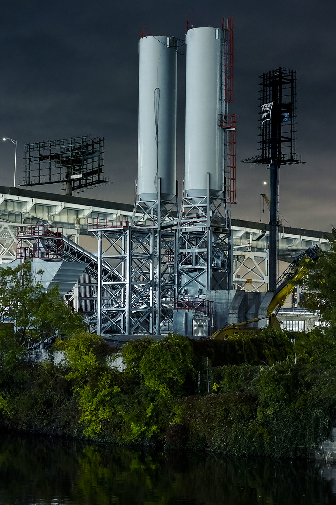
– photo by Mitch Waxman
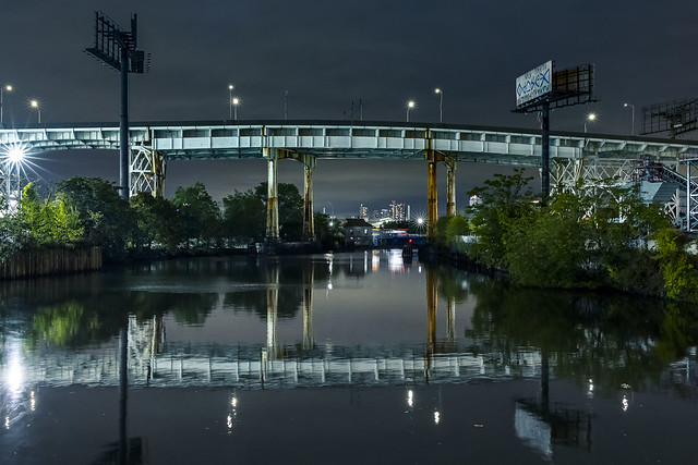
“Every time might be the last time.” Dutch Kills, where I’ve spent so much time and effort over the last 15 years, is pictured in today’s post. I can’t help but be reminiscent.
The broiling hot summer days bringing tours through here, those frigid frost bitten mornings standing on one of these bridges with a camera and tripod waiting for the sun to rise, the late night walks, the scary moments of actual peril when I found myself confronted with the baser aspects of the street…
– photo by Mitch Waxman
I’ll never forget the first time, when I followed a Google maps pathway here from Astoria. “Hey, I’m going to go check out this Newtown Creek joint I’ve heard about” is what I said to Our Lady of the Pentacle when leaving the house. “Be careful” she said. That’s how it started.
The warning to “be careful” always strikes me oddly. I’m the very definition of careful in everything I do. It can be offered that one of the biggest flaws in my personality is the amount of care I display, embed into, and enact in my daily round. My “care” actually borders on neuroticism. I take the OSHA motto of “how can I get hurt” that they drill into the industrial world quite seriously. Before I cross a street, I look three times, not two.
– photo by Mitch Waxman
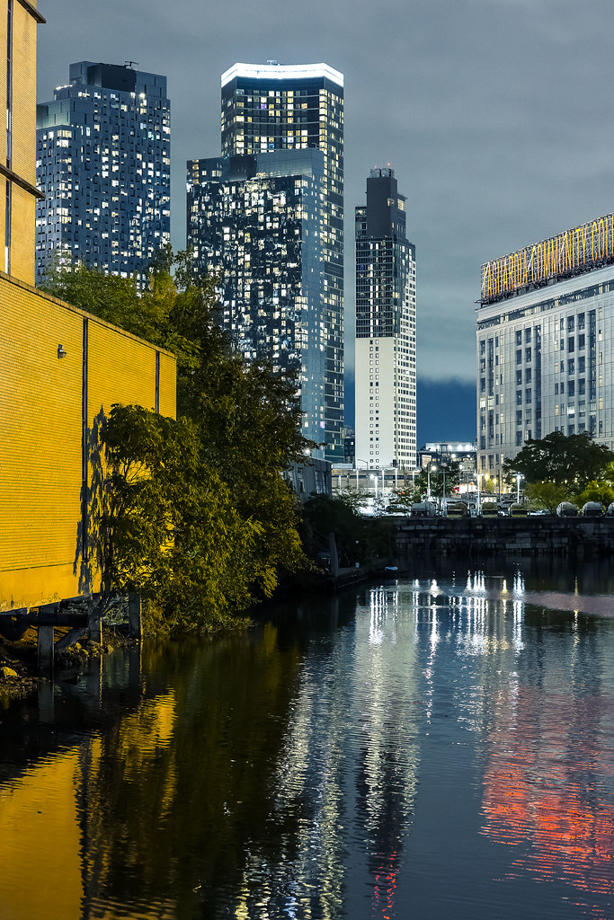
That’s my tree of paradise in the shot above, which I seem to have spent most of the pandemic months photographing. All of this is now somebody else’s’ problem. I can tell you who that somebody is – Will Elkins is Executive Director at Newtown Creek Alliance – and Will is “the man.” Smart and kind, Will has assembled a staff of amazing people at NCA, and they are the future. It’s time to stop talking about the past here, and to start talking about tomorrow. Will and the NCA staff are the people to do that.
I’m heading into the west, like one of Tolkien’s elves.
– photo by Mitch Waxman
Given the reflective mood I’m in at the moment, a statement I’d offer is this – it’s been a lot of fun. I’ve met some amazing people, done and seen things that not many other people have, and occasionally got to help people who needed help. No regrets. I never “took,” even when I found myself surrounded by high rank politicians and the “powers that are.” Always did I ask myself “What would Superman do?” and used that as a guidepost for any moral decisions.
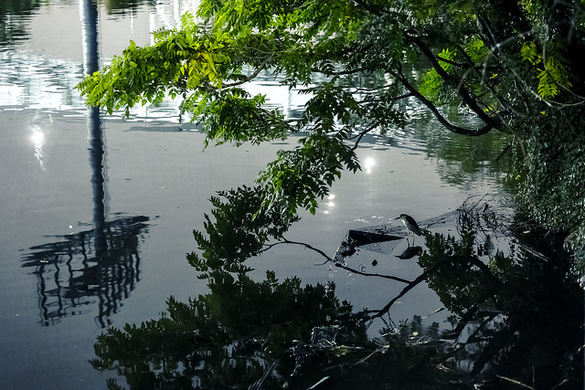
That’s apparently a Night Heron in the shot above, but since I always get the name of a bird wrong when I try to say what kind of bird a bird is – so, it’s a three eyed lobe tickler.
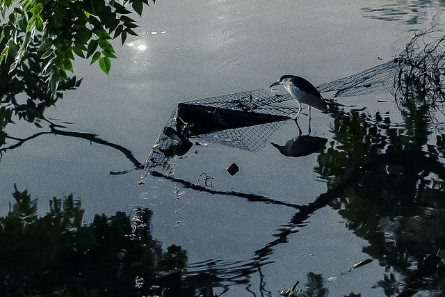
– photo by Mitch Waxman
If you shine a light into the waters here at night, the surface starts boiling as the little nocturnal fishies in the water column fall into panic mode. They’re what that descendant of the dinosaurs pictured above was hunting in the darkness.
I’m currently looking for a job in Pennsylvania. Worst comes to worst, I’ll drive for Lyft or Uber until I get something solid. There’s always managing a Denny’s or something. I plan on staying away from anything political or nonprofit in nature. I just want to go to work, and then take pictures and explore the area the rest of the time while I’m figuring out my next incarnation.
– photo by Mitch Waxman
We are all different people at different times of our lives. I used to be a comic book artist and writer who worked on it obsessively all night, while maintaining a day job persona on Madison Avenue as a production artist and photo retoucher. The latter job title caused me to have to learn about photography in order to interact with the photographers whose work I was editing and processing. That got me started taking my own shots, which is what led me down the path to who I am currently. Life is what happens to you while you’re making other plans, as the saying goes.
More tomorrow – at this – your Newtown Pentacle.
“follow” me on Twitter- @newtownpentacle
Buy a book!
“In the Shadows at Newtown Creek,” an 88 page softcover 8.5×11 magazine format photo book by Mitch Waxman, is now on sale at blurb.com for $30.


