Posts Tagged ‘sunnyside’
careful be
Randomly wandering around Sunnyside, in today’s post.

– photo by Mitch Waxman
Last week was one of those where my calendar was absolutely packed with “have to’s” and one found himself constantly scuttling from place to place. Given that a significant chunk of my “have to’s” involved Newtown Creek and that I live in Astoria, that meant that the way home inevitably meant transiting through the Sunnyside and Sunnyside Gardens sections of Queens.
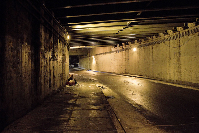
I’m led to believe that the cabling rig pictured above is the property of either Verizon or Spectrum, and one or the other is installing upgraded data cabling for high speed internet service. As a note, the Community Board people in Sunnyside insisted – many years ago – that these wired connections be installed in the neighborhood in a subterranean manner, which is why you don’t see the ugly and “willie nillie” tangle of airborne data and phone wires witnessed in other parts of Queens in Sunnyside.

– photo by Mitch Waxman
The NYC EDC team who are working on the ill conceived Sunnyside Yards Deck have adjured repeatedly that the revised planning for their Death Star will require the deck to be no more than three stories above current street grade, contradicting the feasibility report they created a few years ago. In fact, they’ve said they’re “throwing the feasibility study out” and we should just ignore it.
Ok, but that’s two million smackers of tax payer money you’re throwing out, and let’s do a bit of imagining based on what you’re seeing in the shot above. This section would be relatively unchanged on the east side of 43rd street, where the LIRR is transiting above those one story garages. Figure that the train represents a second story, and that the signal boards above the tracks are roughly the third story. That’s the height of the deck? Only three stories? What about the fifteen to thirty story tall luxury apartment houses on top of the thing of the sort you see in the distance?

– photo by Mitch Waxman
Patrick “Battle Axe” Gleason, the last mayor of Long Island City, left us warnings back in 1898 to not trust the Manhattan people’s intentions for Queens. He predicted that they would empty their island of the stinking factories and workhouses, and turn Queens into a charnel house of rendering plants, industrial chimneys, and gas refineries. That’s what started happening in the early 20th century. Ever since, whenever they get a bright idea over at City Hall, where they want to try it out is in Queens.
Stand up, speak out. Just say no.
“follow” me on Twitter- @newtownpentacle
Buy a book!
“In the Shadows at Newtown Creek,” an 88 page softcover 8.5×11 magazine format photo book by Mitch Waxman, is now on sale at blurb.com for $30.
Events!
Slideshow and book signing, April 23rd, 6-8 p.m.
Join Newtown Creek Alliance at 520 Kingsland Avenue in Greenpoint, Brooklyn for a slideshow, talk, and book signing and see what the incredible landscape of Newtown Creek looks like when the sun goes down with Mitch Waxman. The event is free, but space is limited. Please RSVP here. Light refreshments served.
The Third Annual, All Day, 100% Toxic, Newtown Creekathon. April 28th.
The Creekathon will start at Hunter’s Point South in LIC, and end at the Kingsland Wildflowers rooftop in Greenpoint. It will swing through the neighborhoods of LIC, Blissville, Maspeth, Ridgewood, East Williamsburg, Bushwick, and Greenpoint, visiting the numerous bridges that traverse the Creek. While we encourage folks to join us for the full adventure, attendees are welcome to join and depart as they wish. A full route map and logistics are forthcoming.This is an all day event. Your guides on this 12+ mile trek will be Mitch Waxman and Will Elkins of the Newtown Creek Alliance, and some of their amazing friends will likely show up along the way.
endlessly coruscating
Florida sounds good today, huh?

– photo by Mitch Waxman
A bit behind schedule again, and a highly frustrated and annoyed but still humble narrator has a single image on offer today. It’s a bit of a life metaphor, no?
“follow” me on Twitter- @newtownpentacle
gathered here
Mitch Waxman, working for YOU!

– photo by Mitch Waxman
The pathway which will allow access to the bike and pedestrian lane of the new Kosciuszcko Bridge is pictured above, a terrifying “last mile” section which is owned by the City. This is the approach at “Queens Midtown Expressway” or “Borden Avenue” (depending on whose map it is) which you get to via a southward journey along 43rd street in Sunnyside. It’s also the onramp for the BQE, and there’s nothing separating you from traffic other than a three inch curb. If you’re wondering, this is actually a fairly well used foot path between industrial Maspeth and South Sunnyside – so it’s not just me.
Why do I go this particular way? I’ll show you at the end of the post.

– photo by Mitch Waxman
Inviting, ain’t it?
A humble narrator is ringing the alarm bells here for a fairly simple reason, the Kosciuszcko Bridge construction project is meant to be opening the second and final half of the project up to traffic (of all kinds) by the end of the summer, at the latest. The City, which is supposed to have been redesigning this section of things (they own it), hasn’t been shown to have started any risible progress yet. Supposedly NYC DOT has a design, but where is it? Shovels in the ground, boys?
I’d be happy with a bunch of jersey barriers, truth be told.

– photo by Mitch Waxman
For years, literally years, I’ve been keeping an eye on this one.
I cannot tell you how many times in Western Queens that I’ve had the sudden realization that the sidewalk I was scuttling on led onto a highway. One time, after leaving St. Michael’s cemetery, the section of Astoria Blvd. I was walking along suddenly became the shoulder lane of the Grand Central Parkway as the sidewalk just ended.
– photo by Mitch Waxman
This path leads to a pedestrian bridge, one that the K Bridge project has recently constructed as a replacement for a far older but similar lane. Friends who grew up on the southern flank of Sunnyside tell me that this path was well familiar to them growing up, and that the road and sidewalk conditions found in the shot above date back to their earliest recollection.

– photo by Mitch Waxman
Just last week, I was walking through here and spotted the condition above. Hadn’t been through in about a month, so it’s possible this collapsed in sewer grate had been lying in wait for an errant tire to enter it for weeks.
Here’s the “working for you part.”

– photo by Mitch Waxman
First things first, you document it. That’s me and the camera in the shadow on the left. Second, you report it.
Now, here’s the thing… I often have trouble making 311 or 911 operators understand that Queens has hyphenated addresses. Also, it took several paragraphs of text and a few photos to describe the location and condition of this place to you, my quite savvy and well traveled Lords and Ladies of the Pentacle. Additionally, this was a dangerous situation and I feared somebody could be seriously hurt if their tire entered the hole.
Prior experience with road condition and damaged sewer hatch reporting (yep, lots and lots of prior experience) has taught me that it can take weeks for the City to dispatch somebody to do repairs. They’ll send the cops out to throw down a traffic cone, but otherwise – weeks. I’m “Mitch Waxman” however, so a quick scan of the contact list on my phone allowed me to contact the K Bridge team’s Community Liason’s office, who in turn alerted the NYC DEP, whose sewer it is. DEP dispatched an emergency squad within the hour and they had the thing all fixed and repaired by the next morning. On the repair front, I let my pals at Jimmy Van Bramer’s office know about all the goings on and how great I thought it was how the K Bridge team and DEP handled the situation. That was also in the name of “reporting it” since JVB’s office keeps a list of complaints and problems in his District and since this one wouldn’t come to them via 311 or 911, there you are.
Nobody gets hurt. Street boo boo all better now.

– photo by Mitch Waxman
On the other side of the “last mile” path, there is a permanently installed concrete separation between you and the onramp of the BQE. Where it slopes down and ends is the demarcation point of NYC and NYS’s property lines, or so I’m told. Want to guess why they’re there?
Yeah, that was me, suggesting it to the Engineering Team at K Bridge sometime back in 2012 or 2013.

– photo by Mitch Waxman
My pal “Special” Ed once described his ideal job title as “freelance unsolicited criticism,” which would take the form of waking into a bank and decrying the arrangement of the padded ropes leading to the tellers, whereupon he would then hand them a bill for his services. I don’t charge, but I fear that I’m living out Ed’s dream. Ed used to live downstairs from me in an apartment building on Manhattan’s Upper West Side, one which was packed with high school and college friends. We lived a life disturbingly reminiscent of “Seinfeld,” I’m afraid. Ed had nothing in his refrigerator save for a single glass of water and a spoon, and stored his clothing in the kitchen cabinets. I miss Ed.
Pictured above is the K Bridge from that pedestrian ramp dealie which carries you over the onramps to it from the LIE onto Laurel Hill Blvd. at the border of Maspeth and Blissville, and between the Kosciuszcko Bridge and First Calvary Cemetery.

– photo by Mitch Waxman
This is why I go this particular way. The view.
Just imagine what treasures await, when the ped and bike path is open. That’s presuming you don’t get squished by traffic on your way here, and end up in there.
“follow” me on Twitter- @newtownpentacle
sounds beneath
Ok, I haven’t done this sort of post for awhile, so away we go.

– photo by Mitch Waxman
Ask anyone who knows me in real life, and they’ll tell you that the following post is just like hanging out with old Mitch, and that it’s absolutely exhausting listening to the constant drone of me talking about Queens… That’s the Q60 rolling down Queens Blvd. on a recent rainy night.
Queens Blvd. is 7.5 miles long, starts at Queens Plaza nearby the Queensboro Bridge, and was created by merging two older roadways – Thomson Avenue and Hoffman Avenue – in the early 20th century shortly after NYC consolidation. In the 1920’s and again in the 1930’s the boulevard was widened and by the 1940’s there was serious talk of turning into it an arterial highway by – guess who… Robert Moses… but that obviously never ended up happening.
The IRT Flushing Line subway stops on Queens Blvd. opened in 1917. A trolley line (owned by the Manhattan and Queens Traction Company) that used to run off the Queensboro bridge and up Queens Blvd. since 1913 was made redundant by the elevated train service, but the streetcar staggered along for a bit. It took until 1937 for that trolley to go the way of all things, whereupon a private bus company – called the Green Bus Company – recreated the trolley’s “Queens Boulevard” route in 1943 using automotive buses. MTA took over the route in 2006, renaming it as the Q60 bus line. Like the old trolley and Green Bus, the Q60 service starts over in Manhattan on Second Avenue and then crosses over Queensboro into LIC, with its terminal stops occurring all the way out in Jamaica, Queens.

– photo by Mitch Waxman
Same rainy night, but a different byway – this time it’s Greenpoint Avenue in Sunnyside.
Diagonally situated against the street grid of most of the communities in Queens which it runs through, both Roosevelt and Greenpoint Avenues were created out a colonial era pathway that ultimately connected the waterfront communities of Greenpoint (East River) in Brooklyn with Flushing (Flushing Bay and Long Island Sound), using a centuried crossing at the Newtown Creek. Prior to Neziah Bliss building the first real bridge carrying Greenpoint Avenue over Newtown Creek in 1850 (the Blissville Bridge), you’d pay for a toll crossing on a flat bottom barge pulled across the waterway by donkey or mule powered ropes. In modern times, you just use the 1987 vintage Greenpoint Avenue Bridge and cross for free. Modernity defines the Roosevelt Avenue leg of this main drag, which travels though Sunnyside, Woodside, Jackson Heights, Corona, Willets Point, and ultimately Flushing as the “7 train corridor.”

– photo by Mitch Waxman
Same night, but many many hours later.
I’m always shooting, even when – as in the case of the shot above – I’m wasted drunk. I had attended a friend’s birthday party and overdid it with my consumption of gin martinis. The shot above, and a couple of others which I frankly don’t remember taking, jogged my memory the next morning of how and when I ended up back at HQ in Astoria. It was still raining when I left the party in the wee hours, and still raining when I woke up.
NYC receives an average precipitation of just over 45 inches of water per square acre (as in a 45″ tall flood of water which is one acre long on each of its 4 sides) – and despite my perceptions – 2018 was a fairly normal year for rain with some 46.78 inches of precipitant having been observed by those who record such matters. 2017 was a record breaker, which saw some 60.78 inches of precipitant falling on NYC. I say precipitant, as a significant amount of that water takes the form of snow. 2019 is shaping up as a record breaker as well, so far in January we’ve received a whopping 3.54 inches of rain. That’s apparently nearly 1/13th of all of last year just in the first three weeks of January, but I’m notoriously a mathematical moron, so if that arithmetic seems wrong you’re probably right.
More tomorrow.
“follow” me on Twitter- @newtownpentacle
correlate every
Artsy fartsy on Roosevelt Avenue.

– photo by Mitch Waxman
Funnily enough, I was actually talking on a conference call about MTA with a couple of colleagues while shooting the shots in today’s post. Additionally, I was freezing my yum yums off, but what does a little existential discomfort matter when one is pursuing the muse? I had scuttled along this pathway on Roosevelt Avenue sometime in the last couple of weeks and decided there and then that I needed to come back with the intention of capturing the artificial light playing along the steel of the IRT Flushing or 7 Line elevated subway tracks above. These shots are from where and when I did so.
Last Monday and Woodside, which sounds sort of anticlimactic, I guess.

– photo by Mitch Waxman
As mentioned yesterday, during the day, the steel structure casts harsh shadows that are framed by extremely bright shafts of sunlight which reduces photo exposure options significantly. At night, however, traffic and street lights – even light spilling out of apartment windows – creates a random and often quite colorful luminance. Throw in passing auto traffic and illuminated shop signs? Yup, interesting place to do some long exposures.

– photo by Mitch Waxman
Roosevelt Avenue, however, isn’t exactly a backwater. It’s densely travelled by vehicles of all kinds and there’s lots of pedestrians as well. Luckily, the steel girders supporting the overhead trackage provide lots of places for you to set up and compose a tripod shot. Unfortunately, these girders seem to be favorite spots for illegal dumping or vomiting and are very popular with the canine population of Woodside. C’est La Vie, ay?

– photo by Mitch Waxman
The path I decided on walking was, by necessity of climatological conditions, short by my standard. A quick subway ride on the M train from Astoria to the Roosevelt Avenue stop carried me to Jackson Heights, whereupon a southeasterly posture was assumed by turning onto Roosevelt and walking up the hill towards Queens Blvd. After finishing up my self appointed task, one walked down the hill at 48th street and back to HQ in Astoria.
Yes, I was tempted to cut things short and hail that cab in pursuance of warming up my yum yums.

– photo by Mitch Waxman
The conference call I was on, as mentioned, revolved around the MTA and various issues surrounding it in Queens. Given the dearth of subway lines serving 75% of the Borough, and the fact that most Queensican commuters have to rely on Buses, I volunteered to begin using the bus system more and more to “get smart” about it. Back when I was full time advertising guy Mitch, one of the agencies I worked for was Ogilvy & Mather, founded in part by a fellow named David Ogilvy. Ogilvy was one of the first scientific marketers back in the “mad men” era, and wrote several books about his experiences and realizations. One of his bits of advice involved signing up for or using your customer’s products, to learn what the experience is of the said customer you’re trying to sell something to.
I’m not trying to sell you bus rides, of course, but within a year I’ll be able to speak a lot more intelligently than I can now (I literally live over a Subway line, so I’m going to have to go far afield of “my way” on this one) about what’s good or bad about Bus service in – at least – Western and Northern Queens.

– photo by Mitch Waxman
Baby, it was cold outside. Luckily, I arrived at my turnaround point at Queens Blvd., packed up the tripod and wide angle lens, refitted the camera to handheld settings and affixed a “bright” night lens. As it turns out, my yum yums survived the cold and are in fine fettle.
Next week – something completely different at this, your Newtown Pentacle.
“follow” me on Twitter- @newtownpentacle


