Archive for the ‘kosciuszko bridge’ Category
resonant profanity
It’s National Ceviche Day, in these United States.

– photo by Mitch Waxman
“I’m late, I’m late, For a very important date. No time to say “Hello, Goodbye”. I’m late, I’m late, I’m late” is what was going through a humble narrator’s brain box last Saturday morning. Often is Lewis Carroll psychically conjured on my way to Newtown Creek, a place which is the very definition of “through the looking glass” for one such as myself.
Accordingly, a vehicular coach was summoned via the LYFT application found on my pocket telecommunications device, which automotively conveyed one to the poison cauldron of the Newtown Creek in Greenpoint. The driver, following the directions offered by a computer program on his own pocket telecommunications terminal, used the Brooklyn Queens Expressway for the trip. For once, rolling the dice on the BQE paid off and it was a quick journey between “Point A” in Astoria and “Point B” in Brooklyn.

– photo by Mitch Waxman
We crossed the lugubrious Newtown Creek on the sparkling new 2017 model Kosciuszcko Bridge, with the 1939 version just to the west. As one such as myself cannot turn down an opportunity to record and catalog any and all visual experiences encountered in the City of Greater New York, the camera was being waved around in the back seat as the driver performed his particular function in the front.

– photo by Mitch Waxman
The NYS DOT is currently working on the dismantling of the 1939 version, which is at an early stage. Newtown Creek Alliance has recently prepared and propagated a post describing what we know about the various stages, scheduling, and status of the demolition project for the so called “K Bridge,” and it can be accessed here.

– photo by Mitch Waxman
You may recall that I was up here for opening day of the new bridge back in April, but that was on foot. Dedicated pedestrian that I am, it’s an odd thing to actually be riding in an “auto-mobile,” but since I had experienced a fairly late night the evening before – one had risen later than planned and there was no way that I was going to get to Brooklyn from Astoria on time via perambulatory means.
I’m actually obsessed with being “on time” and am particularly keen on “being early” for events and meetings. It’s kind of a “thing” with me. My parents always insisted that you arrive early to appointments, as that’s at least one thing that the people you’re going to see can’t hold against you. Mom always said “you can’t do anything about being ugly, stupid, ungrateful, and unlikeable but at least you can be early.” I’m all ‘effed up.

– photo by Mitch Waxman
This wasn’t a tour, per se, as in one I was conducting of the area which I’ve long referred to as “DUKBO” or Down Under the Kosciuszcko Bridge Onramp.” Instead, the NYS DOT is in the early stages of planning two parks – one in Queens and one here in Brooklyn. They called together members of the K Bridge Stakeholders Advisory Committee (I’m on that one) and the Brooklyn Parks group “Open Space Alliance,” or OSA, to discuss the space and begin the process of planning.
I showed up wearing my Newtown Creek Alliance hat, but since we were going to enter the job site, it was soon replaced by a hard hat that said “Skanska.”
– photo by Mitch Waxman
My LYFT driver was instructed by both myself and the computer program on his pocket computer terminal to exit the BQE at the Meeker avenue stop, which was terribly exciting for one such as myself as I’m a “creek geek.”
Kept on thinking about that white rabbit, me. It was nearly the time for the meetup with DOT and OSA, and I’d still have to walk a block or two to the location.

– photo by Mitch Waxman
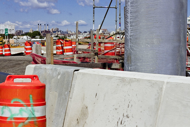
That’s the east side of Meeker Avenue pictured above, with its newly constructed on-ramps and approach roadways feeding traffic from Brooklyn into Queens. It’s been so chaotic in this area for the last few years, what with the construction and all, that it was quite a relief to see a bit of calm inserted back into DUKBO.

– photo by Mitch Waxman
Saying that, there was still quite a hullabaloo going on in DUKBO.
The demolition of the 1939 bridge will be the supreme focus of all the concerned parties for the next several months, but for right now the teams of contractors and union hard hats are making busy with repaving local roads and improving the subterranean infrastructure (sewers, drains etc.) that serve the new bridge. I know the folks who live in the house that that backhoe is working in front of, who are… shall we just say… anxious for the project to conclude.
Tomorrow, I’ll show you what I saw whilst wearing the hard hat in DUKBO.
Upcoming Tours and events
Newtown Creek, Greenpoint to Hunters Point, walking tour with NYCH2O – June 29th, 7-9 p.m..
Experience and learn the history of the western side of Newtown Creek, as well as the East River Parks Hunters Point with NCA Historian Mitch Waxman – details here.
“follow” me on Twitter- @newtownpentacle
odd purchases
It’s National Martini Day, in these United States.

– photo by Mitch Waxman
One of the things that we, as in the environmental and activist community along Newtown Creek, have been asking officialdom about for years is about why there is zero signage advising the citizenry about not fishing or crabbing in the Newtown Creek. I know this might strike you as odd, but folks actually do fish and crab hereabouts. Observationally, these are people who were born overseas, so the signage issue becomes a bit complicated given the legendary “diversity” of Western Queens and North Brooklyn. The Albany people have always questioned as to why you’d need signage, as it’s illegal to fish without a license, and every NYS licensee has been advised about the environmental conditions encountered on the inland waterways of NYC – which is one of the most “Albany people” things I’ve ever heard.
Luckily, the Feds at EPA realized what we’ve been asking for is necessary and have begun the process of creating advisory signage, and the PRP (Potentially Resonsible Parties) consortium which styles itself as the “Newtown Creek Group” volunteered to manufacture the placards, which EPA would in turn design and install. The signage is pretty close to its final design iteration, and the latest version looks like this. As to where the signs should be placed? Who has carefully documented every little pocket and corner of the streets surrounding the Creek? Who can tell you where people commonly fish? That’s a Newtown Creek Alliance job, anyone can tell you that.
Let’s face it, who ya gonna call?

– photo by Mitch Waxman
Accordingly, one found himself in Greenpoint recently at nine in the morning as the EPA team assembled. Civilians cannot ride in Government vehicles (which is an odd rule, as we technically own them) so the third party contractor who will do the actual installation of the things did the driving. We hit every little corner of the Newtown Creek where people can find access to the water, even the hidden spots where the “utes” of Greenpernt like to experiment with cannibinoids.
It was actually quite a beautiful morning, and the light was fantastic, so while the Feds got busy with the tape measures and GPS’d the various locations we visited, I waved the camera around a bit.

– photo by Mitch Waxman
We did encounter an “enforcement situation” in Brooklyn alongside the Metropolitan Avenue Bridge. There’s a protocol for “who’s responsible for what” along the Newtown Creek. Short version is this – EPA is in charge of Superfund, which is specifically related to the sediments under the water. New or ongoing pollution entering the water is the provence of the NYS Department of Environmental Conservation.
The NYC DEP is responsible for absolutely nothing anywhere or anytime, it’s not their fault at all, and they have no idea why they were named as a PRP in the first place as it’s all Exxon or National Grid’s fault.
The fellow from EPA I was on the bridge with confirmed my belief that “I should call this in” and the NYS DEC Spill Response hotline was called. If you spot oil slicks, plumes of floatable contaminants, or as in the case of the shot above – hundreds of gallons of milky white mystery juice exiting one of DEP’s open sewers – the protocol is to first photograph it, as documentation, and then to call 1 (800) 457-7362 to let DEC know about the situation so they can investigate.

– photo by Mitch Waxman
We were, as mentioned above, visiting every conceivable spot that the citizenry could find their way to the water.
That included “off limits” locations like the Montrose Avenue Rail Bridge over the English Kills tributary. As you can see from all the interesting graffiti on the bridge, which carries lead tracks of the Bushwick Branch LIRR, trespassing is pretty common back here. This is the reason that EPA asked Newtown Creek Alliance to send somebody along with them, as there’s the “official story” and a “real story” found along the water.

– photo by Mitch Waxman
This family of Canada Geese were encountered at the Maspeth Avenue Plank Road, and were being predated by a feral cat who was anxious for breakfast. Momma and Poppa Goose were just out of frame to the left, so the cat made a brilliant decision and continued on into the brush to look for some easier prey. We encountered a couple of broods of Geese over the course of the morning. Geese can be ornery, as a note, and will smack you up if they’re annoyed.
One of these illegal alien avian bullies, at Maspeth Creek, actually hissed at us as we neared, and stuck its tongue out at me.

– photo by Mitch Waxman
The reasoning behind the signage is based around science rather than good humored politics, incidentally. When you’re chatting with environmental officials, they don’t refer to oysters or mussels as shellfish, rather they call them “bioaccumulators.” Animals that are high up in the food chain have internal organs – livers in particular – and muscular tissues which have amassed dangerous levels of whatever pollutant is found in the sediments of the waterway, which they’ve attained by consuming all the prey critters who are below them in the food chain hierarchy. In the case of crabs, in particular, you can encounter a fantastic amount of chemical concentrates due to their particular niche and occupations.
Newtown Creek is – of course – a Federal Superfund site. The sediment beds hereabout are a goulash of petroleum and petroleum byproducts, organocopper compounds, volatile organic compounds, PCB’s, coal tar, sewage, and everything else that has ever been dumped or spilled into the water. The sediment is referred to as “black mayonnaise” and it’s where the crabs live. It’s also where most of the invertebrates that form the bottom of the food chain for the fish population live. Itty bitty critters eat the decaying organics of the black mayonnaise, and slightly less itty bitty critters eat handfuls of the little guys, and the larger critters eat hundreds of them – you get the idea.
You don’t want to eat fish or crabs that you catch in the Newtown Creek. Really.
Upcoming Tours and events
Newtown Creek, Greenpoint to Hunters Point, walking tour with NYCH2O – June 29th, 7-9 p.m..
Experience and learn the history of the western side of Newtown Creek, as well as the East River Parks Hunters Point with NCA Historian Mitch Waxman – details here.
“follow” me on Twitter- @newtownpentacle
angry pustule
It’s National Macaroon Day, in these United States.

– photo by Mitch Waxman
Everybody hates a tourist, they say. Me? I love ’em, especially when I’m the guide and the tour has come to my beloved Newtown Creek. 3.8 miles long, Newtown Creek is a tributary of NYC’s East River which defines around 3 miles of the currently undefended border of the boroughs of Brooklyn and Queens. Newtown Creek has multiple tributaries of its own – Dutch Kills, Unnamed Canal, Whale Creek, Maspeth Creek, the East Branch, and English Kills. It’s largely surrounded by an industrial zone which was once home to petroleum refineries and manufactured gas plants, which has left behind an unwholesome environmental legacy in the ground and water which earned the Newtown Creek a place on the Environmental Protection Agency’s “Superfund” list.
There are multiple bridges crossing the Newtown Creek. Starting from the west – you’ve got the Pulaski Bridge; at Dutch Kills you’ve got the DB Cabin and Cabin M rail bridges as well as the Borden Avenue Bridge, LIE truss bridge, and Hunters Point Avenue Bridge. Back on the main waterway, there’s the Greenpoint Avenue Bridge. At the East Branch there’s the Grand Street Bridge, and at English Kills there’s the Metropolitan Avenue Bridge and the Montrose Avenue rail bridge. Pictured above are the 1939 and 2017 model Koscisuzcko bridges.

– photo by Mitch Waxman
Early 21st century industry on the Newtown Creek is typified by the waste handling trade, and whether it’s the recycling yards or the “putrescent waste” handlers, there are dozens of waste transfer stations found along the bulkheads. There are still petroleum and gas businesses found along the water, but the name of the game these days is distribution rather than manufacture. Newtown Creek is one of the favored release points for NYC’s combined sewer system, and about 1.4 billion gallons of untreated sewage finds its way here annually. The TV and film industry, or “Hollywood,” has recently been acquiring huge parcels along the waterfront. At the mouth of the Newtown Creek, near its intersection with the East River, enormous housing and real estate projects are underway which will bring a large residential population to its shores.
The hard bottom of Newtown Creek is about 25-40 feet below the surface, depending on where you are. The “soft bottom” of Newtown Creek is roughly 15-20 feet down – a bed of toxic sediment composed of industrial waste (petroleum and byproducts, coal tar, raw sewage – everything that has ever fallen or been released into the water) which is referred to as “Black Mayonnaise.” The removal of this black mayonnaise and the restoration of normal environmental conditions in the water is the stated mission of the Federal Environmental Protection Agency’s Superfund team.

– photo by Mitch Waxman
Endemic environmental pollution exists in the upland properties surrounding the Newtown Creek. The “Greenpoint Oil Spill” is the second largest oil spill in American history, after the Deepwater Horizon Spill in the Gulf of Mexico. There’s other pockets of oil on the Queens side in Blissville. On both the Brooklyn and Queens sides, plumes of chemicals and solvents move about in subterranean mud with the tides. Thousands of heavy trucks ply the streets surrounding the Newtown Creek daily. The unending miles of concrete, and nearly complete lack of vegetation, causes the summer temperatures to rise between ten and fifteen degrees higher in the industrial zones than in the surrounding neighborhoods in accordance with the “Maspeth Heat Island Effect.” The air is filled with particulate materials delivered by automotive exhaust from the Brooklyn Queens Expressway, Long Island Expressway, and Queens Midtown Tunnel.
Welcome to the Newtown Creek.
Upcoming Tours and events
Newtown Creek Alliance and Riverkeeper Visioning, June 3rd, 1-4 p.m..
Imagine the future of Newtown Creek with Riverkeeper and NCA at the Kingsland Wildfowers Green Roof (520 Kingsland Avenue in Greenpoint) – details here.
Newtown Creek Alliance History lecture with NCA historian Mitch Waxman, June 3rd, 5:00- 7:30 p.m.
An free hour long lecture and slideshow about Newtown Creek’s incredible history at the gorgeous Kingsland Wildfowers Green Roof (520 Kingsland Avenue in Greenpoint) followed by a walk around the roof and a Q&A – details here.
Green Drinks Queens LIC, June 5th, 6:00- 9:00 p.m.
Come celebrate UN World Environment Day with Green Drinks: Queens on the LIC Waterfront! This year’s theme is “Connecting People With Nature.” – details here.
“follow” me on Twitter- @newtownpentacle
wide remark
It’s National Cheese Souflee Day, in these United States.

– photo by Mitch Waxman
So far, I’ve never tired of seeing the old Koscisuzcko Bridge from the roadway of the new one, but then again its only been around three weeks that the thing has been open. One is curious as to the reactions all of y’all have had at the sight of the new span, how it’s been working out for you so far, all that sort of thing. I’m on the Stakeholders Advisory Committee, so if there’s something specific or pithy you’d want me to bring to officialdom, let me know and I’ll pass it on to the powers that be.
Today’s first two shots were captured from behind the windshield of a car, in case you’re wondering. What I was doing in an automobile, of all things, is something which I’ll tell you about in a future post.

– photo by Mitch Waxman
The driver of the car I was in is one of my neighbors from back here in Astoria, if you’re curious, but I had engaged his services in the context of his being a professional and TLC licensed driver. Again, I’ll tell you why I needed a ride at a later date. Our path didn’t just include a crossing of the Koscisuzcko Bridge, but also involved a trip into the City as well. That’s the Roosevelt Island Tram hurtling over the Queensboro Bridge, pictured above. Very exciting.

– photo by Mitch Waxman
A couple of weeks ago, I conducted a Newtown Creek tour for a group of European college students, and my pals at Sims Metal Management were gracious enough to allow the group to visit the Newtown Creek Pier facility maintained by the recycling company. Sims has a contract with DSNY to handle the “MGP” or “metal, plastic, glass” recyclable trash we put out on the curb, and they were engaged in the process of collecting it from the white packer trucks maintained by the agency for the task. The stuff ultimately gets barged out to another Sims facility, where it’s sorted.
Upcoming Tours and events
Newtown Creek Alliance Boat tour, May 21st.
Visit the Newtown Creek on a two hour boat tour with NCA historian Mitch Waxman and NCA Project Manager Will Elkins, made possible with a grant from the Hudson River Foundation – details and tix here.
“follow” me on Twitter- @newtownpentacle
spending hours
It’s National Chocolate Truffle Day, in these United States.

– photo by Mitch Waxman
So; yesterday I showed you what the public opening ceremonials of the new Koscisuzcko Bridge looked like, and detailed a bunch of the stuff I saw. For the last couple of weeks, I’ve been alluding to an experience I had which was under an NDA – or Non Disclosure Agreement – which I couldn’t talk about or show photos of. I’ve been given the official release on that now that the bridge is open, so here’s what I got to see on April 17th of 2017, which is the day that the Stakeholders Advisory Committee of the Koscisuzcko Bridge replacement project met up with some elected officials in Maspeth and the NYS DOT gave us an opportunity to walk upon and visit the new bridge.
Hey, I’ve always dreamt of standing in the middle of the Brooklyn Queens Expressway, haven’t you?

– photo by Mitch Waxman
We climbed a temporary staircase on the Queens side of the job site. That’s where the DOT folks are headquartered, and we – Stakeholders Advisory Committee and Elected officials – donned orange safety vests and hard hats, followed our hosts through the site, and climbed the stairs between the two bridges.
Documenting this project has been a long standing project of mine – this 2012 post tells you everything you could want to know about Robert Moses, Fiorella LaGuardia, and the origins of the 1939 model Kosciuszko Bridge. Just before construction started, I swept through both the Brooklyn and Queens sides of Newtown Creek in the area I call “DUKBO” – Down Under the Kosciuszko Bridge Onramp. Here’s a 2014 post, and another, showing what things used to look like on the Brooklyn side, and one dating back to 2010, and from 2012 discussing the Queens side – this. Construction started, and this 2014 post offers a look at things. There’s shots from the water of Newtown Creek, in this June 2015 post, and in this September 2015 post, which shows the bridge support towers rising. Additionally, this post from March of 2016 detailed the action on the Queens side. Most recently, here’s one from May of 2016, and one from June of the same year. Here’s one from August of 2016, the December 2016 one, and finally . Here’s another from March of 2017 which discusses the demolition of the 1939 bridge.

– photo by Mitch Waxman
Up top, there were still people working, and from the appearance of the bridge – putting the finishing touches to the actual roadway, and adding a bit of spit and polish on the span to get it ready for its opening day on the 27th.

– photo by Mitch Waxman
Borough President of Brooklyn Eric Adams and Congresswoman Carolyn Maloney were along for the walk. (The Congresswoman did, in fact, have the hard hat on, but quickly took it off for this shot.)

– photo by Mitch Waxman
The fact of the image embargo weighed heavily on me, cannot tell you much I wanted to shout from the rooftops that I had gotten to visit the bridge and walk a part of its length, but you “gotta do what you gotta do.” As mentioned, there was a bit of road top conditioning going on, mainly on the Brooklyn side, and we couldn’t approach that zone for safety reasons.
The hard hat guys are big on safety.

– photo by Mitch Waxman
The view from the 1939 model Koscisuzcko Bridge has always been breathtaking, but was hidden by stout steel trusses and other structural elements. The second half of the project, due in 2020, will have a pedestrian and bicycle lane on the extreme western side which I anticipate as being a primal spot for photographers.
Imagine the sight of a thunderstorm, building over Manhattan, with the incredible Newtown Creek forming the foreground from this vantage point… the mind boggles.

– photo by Mitch Waxman
As opined above, there was still a bit of work going on at the Brooklyn side of the span. The off ramp at Meeker Avenue is still being finalized (last I heard) as of this writing, but that situation very well might have been resolved by now.
I can say that the morning after the bridge opened on April 27, there was still a lane of traffic passing over the old bridge, no doubt to service traffic to the LIE and or Meeker Avenue (that’s a guess though).

– photo by Mitch Waxman
We were allowed to wander around a bit, within a certain area, and soon my colleague from Newtown Creek Alliance Will Elkins and I were pointing cameras at the creek and creeklands in every possible direction. For me, it was a somewhat unique opportunity to actually compose shots and think about what I was shooting from up on the Koscisuzcko Bridge for once, rather than the “spray and pray” methodology of shooting which I normally do when passing over it in an automobile.
“Spray and Pray” is when you pre focus your lens, stick the camera out the window, and then hold down the shutter button while traveling at 30 mph, or in the case of the 1939 Kos – 5-12 mph.

– photo by Mitch Waxman
Thankfully, the image embargo and NDA is now “kaput,” so I can tell you that I got to visit and walk on the Koscisuzcko Bridge prior to its opening. Borough President Adams was apparently not under an NDA or image embargo, and shared the following picture with his legions of admirers on Twitter the day of. I hope his office doesn’t mind me reposting it here, but by gum I’m actually in the shot for once!

Upcoming Tours and events
First Calvary Cemetery walking tour, May 6th.
With Atlas Obscura’s Obscura Day 2017, Calvary Cemetery Walking Tour – details and tix here.
MAS Janeswalk free walking tour, May 7th.
Visit the new Newtown Creek Alliance/Broadway Stages green roof, and the NCA North Henry Street Project – details and tix here.
“follow” me on Twitter- @newtownpentacle


