Archive for the ‘newtown creek’ Category
proper edge
Monday

– photo by Mitch Waxman
October 27th found a humble narrator driving back from an assignation in Brooklyn’s Greenpoint section. As part of the big move to Pittsburgh, one decided to inventory literally every possession and scrap of paper which has accumulated into HQ over the years and decide whether or not I wanted to move it 400 miles west with me or not. This process revealed a staggering amount of electronics waste – cables, old computers which I’d been keeping for parts, gizmos and gadgets. Lots of stuff made of metal also didn’t make the cut. Thereby, several carloads of gear were transported to one of the local scrapyards for recycling or whatever. There’s also a lot of paper which went to a different recycling company found along Newtown Creek.
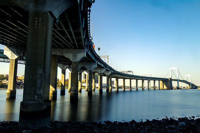
On my way back to Astoria from one of these junk yards one recent afternoon, one decided to try and grab a few last shots of places familiar and loved. The first two are from “DUPBO” or “Down Under the Pulaski Bridge Onramp.”

– photo by Mitch Waxman
Said onramp is pictured above. I get asked all the time about the off ramp to nowhere on the Pulaski, which I’m told was originally meant to connect to the Long Island Expressway. Apparently they ran out of money to complete that, in the late 1950’s when this bridge was erected.
Wish I could have lingered, but there’s been so much to do.

– photo by Mitch Waxman
On my way back to Astoria, I did find a minute or two while waiting at traffic lights to stick the camera up through the car’s moon roof.
Depicted above, the Queensboro Bridge and the nearby TerraCotta House, as seen from Vernon Boulevard.
More tomorrow.
“follow” me on Twitter- @newtownpentacle
Buy a book!
“In the Shadows at Newtown Creek,” an 88 page softcover 8.5×11 magazine format photo book by Mitch Waxman, is now on sale at blurb.com for $30.
bodily dislodgement
Friday
– photo by Mitch Waxman
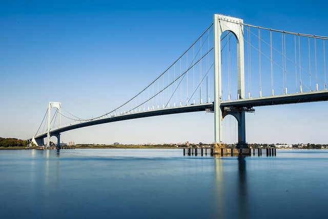
October 21st, and I was continuing my exploration of a few spots in College Point and Whitestone which seemed promising. These were located during a session I spent with Google Maps’ street view feature. The 1961 Throgs Neck Bridge is what it depicts. The Google map said I was in a dog park, but it was actually just a parking lot alongside a parkway.
The hour was growing a bit late, and plans to meet Our Lady of the Pentacle back in Astoria were in the offing, so I packed up my troubles in the old kit bag. Yes, I did, indeed, “smile, smile, smile.”
For those of you under the age of 1,000, that’s a jokey reference to this song.
– photo by Mitch Waxman
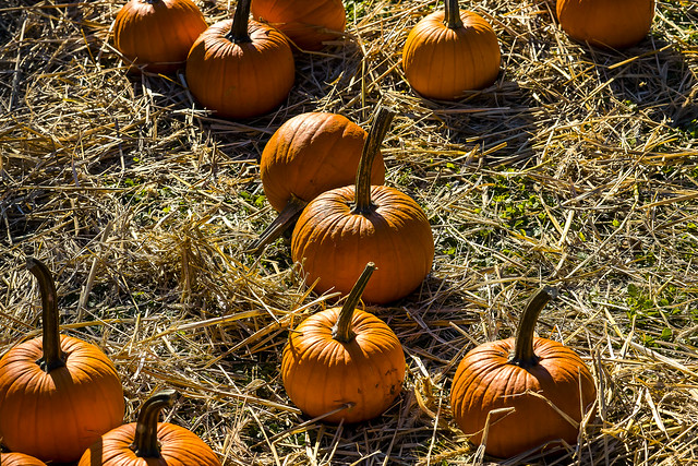
October 22nd saw me in Flushing, at the Queens Botanical Garden.
There were pumpkins.

– photo by Mitch Waxman
October 25th and I was scheduled to spend a day with one of my closest friends driving around Southern Brooklyn, but it was very foggy when I left the house about 8:30 a.m. My ultimate meetup destination was in Park Slope, and there’s an obvious way to get there by car from Astoria, one which unfortunately involves sitting in a lot of Manhattan bound traffic on a certain expressway that connects Brooklyn and Queens.
I decided to go there via the less obvious but more interesting route, by driving to Ridgewood and then hanging a right and then a left or two in Bushwick and then proceeding through that central part of Brooklyn which nobody ever talks about these days. Along my way to the first right in Ridgewood, I crossed Newtown Creek and couldn’t resist a shot or two of the Grand Street Bridge all cloaked up in mist.

– photo by Mitch Waxman
The new car has a moon roof. I don’t know what the actual difference between a sun roof and a moon roof is, but there you are. As I was driving along, whenever I got stuck at a light, I’d shove the camera up through the moon roof and turn the camera’s LED screen to a convenient angle so I could compose and record a quick shot.
That’s Brooklyn’s Grand Army Plaza, all fogged up.

– photo by Mitch Waxman
I did the same thing with the camera and moon roof on my way home. The fog had cleared by the afternoon, and the burning thermonuclear eye of God itself had burst into view. I was driving down Flatbush Avenue, this time headed in the direction of the aforementioned expressway betwixt Brooklyn and Queens.
I’ve been doing this sort of shot a bunch the last couple of weeks, as I’ve been driving a lot since receiving the car. It’s an interesting perspective for me, since the position of the lens to the car’s roof as it stands relative to the ground – if it were “eye level” – would indicate that I’m about six inches taller than I actually am.

– photo by Mitch Waxman
An errand got me off the expressway and into the Woodside and Jackson Heights zone, where I had to weave an automotive path through the various “improvements” to traffic flow offered by the City in recent years. While driving down Roosevelt Avenue, a splotch of pigeon scat landed on the hood of my car, and I decided that it would be good idea to close the moon roof.
Hey, they say that’s lucky, having a pigeon poop on you.
“follow” me on Twitter- @newtownpentacle
Buy a book!
“In the Shadows at Newtown Creek,” an 88 page softcover 8.5×11 magazine format photo book by Mitch Waxman, is now on sale at blurb.com for $30.
thumping rattle
Thursday
– photo by Mitch Waxman
October 20th and a humble narrator had just received the most critical bit of equipment needed to enable his “escape from New York.” A car.
All of these years in Queens, I’ve been a dedicated pedestrian and married to mass transit. I’ve always opined that having a car in Astoria is more of a curse than a boon. It was actually cheaper for me to use ride shares or cabs when I needed a ride than it was to own one.
I’m moving to America, and quite literally to “Mr. Roger’s Neighborhood,” where you cannot exist on the continent without a vehicle so I had to drop the hammer. Placed the order in July, and got a fresh from the factory new car in late October.
– photo by Mitch Waxman
Since becoming hyper mobile and independent of the geographic restrictions which are governed by how far my feet can scuttle, as well as the physical constraints of how long I can carry my photo kit, one has been ranging all over the city. Saying that, what is being missed out on now are the little things that you can’t see when driving along as you’re moving too fast.
After getting my driver’s license reinstated earlier this year, I rented a few different vehicles from Avis and Hertz, looking for a good fit for Our Lady of the Pentacle and myself. The Toyota RAV4 Hybrids rose to the top of my list, and we ordered one from one of the new car dealerships on Northern Boulevard. My accountant opined that even if I bought the thing in Alaska, NYS would still bill me for sales tax since my legal address would still here at the time of purchase, so I bit the bullet. Hopefully, this will be my last really large contribution to the black hole that Albany throws our earnings into to finance its dysfunction.
One of the bits of advice I offer is “if you’re thinking about buying a car, rent the model for a week first, and see if you like it.”
– photo by Mitch Waxman
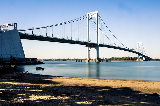
October 21st saw me taking advantage of this new mobility to get a few shots from an area that has always been a little too far off the grid for me to walk around, the coast lines of College Point and Whitestone.
That’s the Bronx Whitestone Bridge pictured above and below.

– photo by Mitch Waxman
Funnily enough, I’ve got more shots of this bridge from the Bronx side than I do the Queens one, due to there being a ferry stop on the Soundview NYC Ferry line in the former location.
I tooled around the area, exploiting several points of view which I had previously scouted out on Google maps. The Google Maps app is a great tool as far as finding potential points of view in areas which are either tangentially known or are complete mysteries. I never would have thought to visit the “Whitestone Bridge Observatory” otherwise, or even suspected such a roundabout street end existed.
– photo by Mitch Waxman
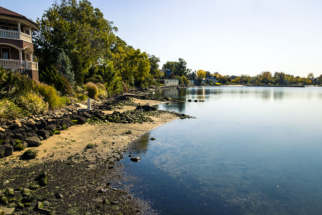
Whitestone seems to be a super wealthy community, with expansive homes that border on “mansion” nestled right up against the water. It looks more like a suburb than it does NYC. You don’t see piles of cast off garbage or debased humans lying in the street, for instance.
I had several photo set ups planned for the day, and since I was in a car, didn’t mind carrying all of the heavy kit which would normally create a limit on how far and wide I could range.
– photo by Mitch Waxman
There aren’t too many Sandy beaches on the East River. I think it’s about 6 or 7, that I know about at least. That’s one of them, above, at Francis Lewis Park. Nice spot.
One kept on heading eastwards, right up and sometimes over the City/Nassau County line.
More on that tomorrow at your – now – hard driving Newtown Pentacle.
“follow” me on Twitter- @newtownpentacle
Buy a book!
“In the Shadows at Newtown Creek,” an 88 page softcover 8.5×11 magazine format photo book by Mitch Waxman, is now on sale at blurb.com for $30.
noxious heap
Tuesday
– photo by Mitch Waxman
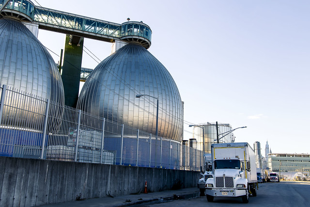
Continuing with the sights witnessed along a longish scuttle on October 8th, a humble narrator found himself crossing the Greenpoint Avenue Bridge and heading towards Brooklyn’s Greenpoint section.
That’s my beloved Newtown Creek in the shot above. About 1.3 miles back from the East River.
– photo by Mitch Waxman
Kingsland Avenue is in the process of being redesigned in response to the opening of Phase 3 of the Newtown Creek Nature Walk at the sewer plant, which has brought lots and lots of pedestrian and bike traffic to the former entirely industrial street. As always seems to be the case these days, NYC DOT’s traffic engineers has managed to imagine up the worst possible design, and implemented it in a piecemeal and inconsistently thought out fashion.
Somebody else’s problem now. I’m done fighting City Hall.
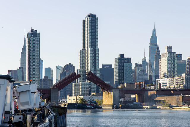
– photo by Mitch Waxman
At the Nature Walk, which hugs the water facing side of the Sewer Plant, the Pulaski Bridge opening for a passing tug was observed.
Somebody recognized me, and I was having a conversation with them while climbing on a fence. They were clearly afraid that I was going to fall in the water while doing so, but there you are.
– photo by Mitch Waxman
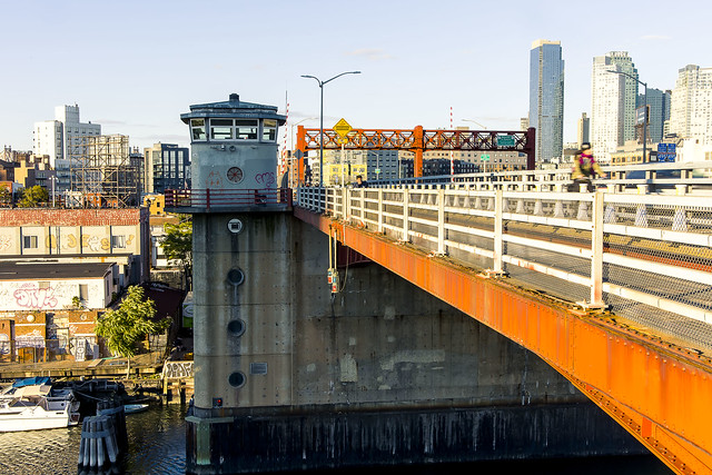
The next section of my walk involved attaining the Pulaski Bridge’s pedestrian path. Which carried me back out of Brooklyn and into Queens’ Long Island City section.
One briefly considered hopping on the subway, but it was a beautiful day and I just kept on scuttling.
– photo by Mitch Waxman
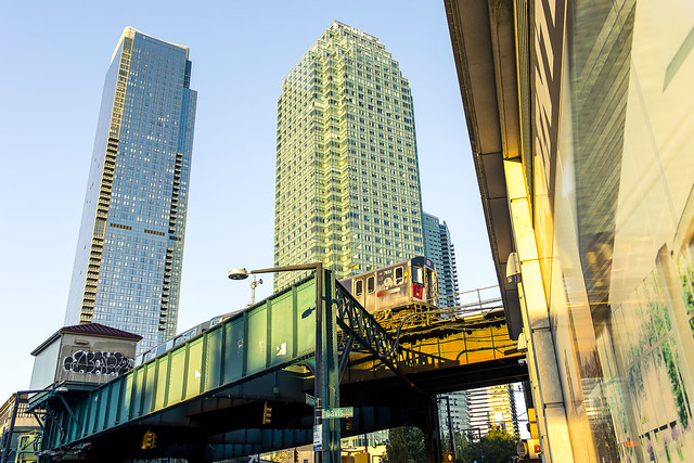
One headed eastwards on Jackson Avenue, heading towards Astoria.
“Every time might be the last time.”

– photo by Mitch Waxman
Queens Plaza has become absolutely unrecognizable at this point. The few remaining industrial buildings and warehouses which survived the reconstruction of the area have finally been consumed by the real estate frenzy.
Tomorrow – something a bit different, at this – your Newtown Pentacle.
“follow” me on Twitter- @newtownpentacle
Buy a book!
“In the Shadows at Newtown Creek,” an 88 page softcover 8.5×11 magazine format photo book by Mitch Waxman, is now on sale at blurb.com for $30.
slate tombstone
Monday

– photo by Mitch Waxman
October 8th was one of the days in Long Island City that passerby might have noticed a pile of black sackcloth being carried along by the wind. Closer inspection would have revealed a humble narrator clothed in his street cassock, a filthy black raincoat flapping about in the poison breeze. One was enjoying an afternoon constitutional, and occasionally startling the elderly and their dogs if they gazed upon my countenance while passing by. A face for radio, that’s me.
One was feeling particularly invigorated, and it was a beautiful day for a stroll over to a hopelessly polluted industrial zone.

– photo by Mitch Waxman
Somebody left their shop door open, and I cracked out an exposure or two of the scene within while shambling past. Neat!
In accordance with recent policy shifts here at HQ in Astoria, one had timed the walk for the late afternoon. This was around 5 p.m., give or take. In October, the burning thermonuclear eye of god itself lobs about in the sky at fortuitous angularities relative to the street grid of New York City. Not so much in January, so take advantage when you can.

– photo by Mitch Waxman
One of the torments which my friends endure revolves around me having led them through over hill and dale and onto hell’s favorite streets, baking in the sun the whole way, whereupon I present them with a description of our destination as being “only 2-3 miles more to go” followed by “but, it’s all down hill from here.” To wit: the shot above. Several of you reading this just groaned.
What you’re actually looking at above is the hydrological reservoir and surrounding sloped basin of the Dutch Kills tributary of Newtown Creek. The flat lowlands around the waterway were wetlands, or “waste meadows” as they called them in the old days. Behind me, and further up the hill from where I was standing, is Greenpoint Avenue. Greenpoint Avenue connects with, and used to incorporate Roosevelt Avenue, which went all the way to Flushing back in the days of the decadent Dutch in the form of a turnpike. Greenpoint Avenue was set up as a high ground ridge road which connected two isolated waterfront colonies separated by bogs, swamps, and grass land.

– photo by Mitch Waxman
1940 is when the monstrosity pictured above, which largely follows Borden Avenue’s far more ancient path, was opened for traffic. Formerly, the horse or oxen drawn traffic followed Borden or Hunters Point Avenue on its path to the East River, where ferry or boat transport would complete the journey of passengers or cargo to Manhattan from Queens. Back then, there were shops and restaurants and inns along the route. Houses too, a few blocks back.
When the City bound traffic disappeared onto the Long Island Expressway and into the similarly aged Queens Midtown Tunnel, it blighted the area, and an already onerous catalog of industries in this area got worse in terms of character and pollution.

– photo by Mitch Waxman
When you’re on the south side of the Long Island Expressway, you’ve entered Blissville. That’s the name of the neighborhood. Really.
This neighborhood, and many of its residents, have a special place in my heart. I like having beers at Bantry Bay on Greenpoint Avenue, and I can point you at a very comfortable socialist bench nearby Review Avenue (it was donated to the Blissville Community by the campaign of Jonathan Bailey, who ran as a Democratic Socialist for City Council in the last cycle, so “socialist bench.”)
I am unaware of any public furniture donations to Blissville from the Republican Candidate for the seat, Marvin Jeffcoat.

– photo by Mitch Waxman
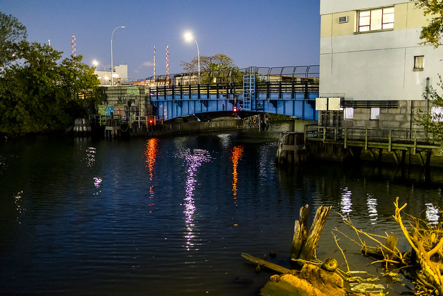
One such as myself is probably the only person in Brooklyn or Queens happy to see the Greenpoint Avenue Bridge opening at 5:30 p.m. on a weekday, but there you are. I enjoyed the show, and waited patiently, unlike everybody else, for the thing to resume “bridging” after it finished “drawbridging.”
More tomorrow.
“follow” me on Twitter- @newtownpentacle
Buy a book!
“In the Shadows at Newtown Creek,” an 88 page softcover 8.5×11 magazine format photo book by Mitch Waxman, is now on sale at blurb.com for $30.


