Archive for the ‘Photowalks’ Category
odd pantaloons
It’s National Fried Chicken Day, in these United States.

– photo by Mitch Waxman
Pondering just what the hell I’m doing with my life is something that happens everytime I cross the Pulaski Bridge, for some reason. As a matter of fact, existential pondering on that subject is a mental activity reserved specifically for crossings of the Pulaski Bridge, and a point is made of not wasting time on such matters elsewhere. I have other locations around Newtown Creek, all of which are assigned to different sets of worries, such as pooping my pants whilst conducting a tour and figuring out how to deal with the public shame and embarrassment (I worry about that at the Metropolitan Avenue Bridge) – but that’s another story.
I’m all ‘effed up.
Anywho, that’s the Mary H. Tug entering Newtown Creek while towing a fuel barge.

– photo by Mitch Waxman
Mary H. is a regular on the Newtown Creek, working for the Bayside Fuel people whose facility is coincidentally found alongside the Metropolitan Avenue Bridge, over on the East Williamsburg side of the world. Technically speaking, Bayside Fuel is on the English Kills tributary and if memory serves – they’re 3.1 miles back from the East River.
Personally, I’ve always thought it pretty cool that tugboats service an industrial dock some 3 and change miles deep into Brooklyn, but that’s me.

– photo by Mitch Waxman
A bunch of the photographers I know have been doing the aerial drone thing of late, so this view of a tug has become rather commonplace in recent years, but I still prefer doing the old fashioned way – finding a high vantage and waiting for it to come to me. I worry about losing my technical edge when I’m over on the Hunters Point Avenue Bridge, if you’re curious. You don’t want to know what I worry about on the Borden Avenue Bridge… brrrr.
Upcoming Tours and events
13 Steps Around Dutch Kills Walking Tour, with Newtown Creek Alliance – July 15th, 10 a.m. – 1 p.m..
The “then and now” of Newtown Creek’s Dutch Kills tributary in LIC, once known as the “workshop of the United States.”with NCA Historian Mitch Waxman – details here.
“follow” me on Twitter- @newtownpentacle
cylcopean blocks
It’s National Spareribs Day, in these United States.

– photo by Mitch Waxman
Not just having the titular cake, nor the eating of it too, ever seems to satiate the lustful aspirations of the Real Estate Industrial Complex here in Long Island City. Population loading – despite intensifying the looming infrastructure crisis surrounding transit, electrical, and water systems – just continues. The backdrop in the shot above represents a not insignificant number of the approximately 13,000 new apartments added to LIC in the last decade. NYC City Planning is about to unveil a new rezoning plan called the “LIC Core” which will change current regulations and make it legally possible for about another 20,000 apartments to be built. Hospital beds? Not so much.
LIC Core, btw, brings the eastward march of these glass shrouded monstrosities to just within throwing distance of Newtown Pentacle HQ. Couple that with the monstrous Sunnyside Yards development proposal, which would bring half the population of Boulder, Colorado into the mix? As a note, while capturing the shot above, my back was turned to the former Paragon Oil building on 49th avenue and 21st street – once known as the Subway Building and or Queens Borough Hall.
Bugs Bunny, who is another Brooklyn kid, said it best. Batman says it well too.

– photo by Mitch Waxman
Whose fault is all of this runaway development – devoid of some overarching governance plan that demands some municipal payback from these Manhattan based developers that sow and reap hereabouts?
NYC’s real estate economy is not exactly set in the 1970’s anymore, as far as there being a excess of undeveloped land which the City had to beg developers to do something with, offering sweetheart deals with reduced taxes and lots changing hands for a dollar. Why does the Real Estate Industrial Complex still get to operate in the manner that they did during the Koch administration? Why can’t we get a Subway station or a few hospital beds out of them? Who is responsible?
The Mayor, City Planning, Councilmember, or the NYC Economic Development Corporation? The Governor, or the Assembly member, or the State Senator? What about the Congressional Representatives, or the Senators? What about the Borough Presidents? Is it all of them, or is the horrible truth actually that there’s nobody steering the wheel at all?

– photo by Mitch Waxman
On a related note, I’ve been reading up a bit on the Borough Presidents of Queens recently. Interesting group, and reminsescent of early Norman history.
1) First up was the City Consolidation era BP Frederick Bowley, from 1898-91.
2) “Curly Joe” Cassidy was BP from 1902-05, and the sewer situation on the Queens side of Newtown Creek is pretty much his fault. Cassidy was accused of 47 different counts of financial corruption during his terms, 24 of which were proven but he was never brought to trial. In 1912, however, he did a year in Sing Sing prison for trying to sell a seat on the NY Supreme Court.
3) Joseph Bermel ran as reformer against the corruption of Curly Joe’s administration, and was in office from 1906-1908. He effectively resigned as BP by skipping out of the country – on an ocean liner to Rome – during the lunch break on a day in 1908 that he was testifying in court – at his own corruption trial. BP Bermel’s final statement to tthe press was “I have nothing to say except to leave good luck for my friends and enemies alike.” He died in 1921 in Czechoslovakia.
4) Lawrence Gresser was Borough President of Queens from 1908-11, and was removed from office by the Governor of New York State for abusing the BP office’s power, and for being incompetent.
5) Maurice E. Connolly was BP from 1911-28, and is my 2nd favorite political character in Queens history, after BattleAx Gleason. Connolly resigned in 1928, then brought to trial for a sewer construction graft scandal. He was fined, convicted, and did a one year stretch in prison.
6) Bernard M. Patten stepped into the office for seven months in 1928, filling in for Connolly in the same way that David Patterson filled in for Elliot Spitzer as Governor a few years back. This sort of thing is common in the history of the Broough President’s office in Queens.
7) George U. Harvey was the first Republican Borough President, serving from 1929-41. Harvey was deeply involved with a series of Robert Moses’s projects, but the 1939 Worlds Fair is the one most closely associated with him.
8) James A. Burke put the Borough Presidency back in the hands of the Democrats, and he served from 1942-49 when he resigned the office.
9) Maurice A. FitzGerald was Borough President of Queens from 1950-51, and died of a heart attack while on vacation.
10) Joseph F. Mafera served out the remaining four months of FitzGerald’s term in 1951.
11) James A. Lundy was the last Republican Party Borough President, from 1952-57. He was an energy industry captain, and had a long public career ahead of him after leaving office.
12) James J. Crisona was BP in 1958, a members of the Democrat Party which has claimed the office since. Crisona was a real climber, having previously been elected to the NYS Assembly and Senate, he resigned as Borough President in 1958 and assumed a seat on the NY Supreme Court.
13) John Thomas (Pat) Clancy stepped into the office from 1959-62, resigning to become a Queens County Surrogate Judge.
14) Mario J. Cariello was Borough President from 1963-8, was a former State Assemblyman, and also resigned to take a position on the NYS Supreme Court.
15) Sidney Leviss was BP from 1969-71, before resigning and following his forebears to the NYS Supreme Court.
16) Donald Manes was BP from 1971-86. In 1986 he was under investigation for various charges when he first attempted to commit suicide in his car. He succeeded in killing himself a few months later, after stabbing himself in the heart with a kitchen knife. As a note, during Manes’s term, a City Charter revision occurred which neutered the power and influence of the Borough Presidents in favor of a “strong Mayor.”
17) Claire Shulman took over the office, and served from 1986-2002. The first female BP title goes to her.
18) Helen M. Marshall came next, and was in office from 2002-13.
19) Melinda Katz was voted into office in 2014.
“follow” me on Twitter- @newtownpentacle
distant relations
It’s National Barbecue Day, in these United States.

– photo by Mitch Waxman
Have a happy 4th of July, lords and ladies, celebrating the original Brexit.
“follow” me on Twitter- @newtownpentacle
unseen eyes
It’s National Eat Beans Day, in these United States.

– photo by Mitch Waxman
For those of you who received a post update last night from Newtown Pentacle, oops. Guess I have to pull back the curtain a bit to explain, but suffice to say that I’m working off an iPad and I fat finger published a template document rather than hit “save draft.” It’s happened before. Reason for the template? Lots easier to format remotely on the iPad, which is pretty decent for writing, but absolute shit for writing HTML instructions as it keeps on trying to spellcheck everything. Like I mentioned above, “oops.”
At any rate, that’s a mysterious jack of hearts I found laying on the street near my house one afternoon, all by itself. As to the disposition of the rest of the deck, who can say? It did make me think of that great Bob Dylan song, though.

– photo by Mitch Waxman
One has been observing a different perambulatory schedule of late. It has been increasingly difficult over the last few months to set aside the time for a day or half day long walking excursions, which has meant that one is not getting as much exercise as is salubrious. My remedy for this has been to scuttle my feet a bit faster than I would on a long trek – say, Red Hook to Astoria, or Astoria to Flushing – and ensure that I make it out for at least an hour and change a day, but by staying in the “neighborhood” I’m saving some time.
Generally – this sort of “quicker” trek will be something like a walk from Steinway Street to the East River and back, or from Astoria’s Broadway over to Queens Plaza and back via Sunnyside’s Queens Blvd. and over one of the truss bridge roads spanning the Sunnyside Yards. Since I know where all the holes in the fences are anyway, I’m often chasing a shot of the LIRR or Amtrak as they move through the Harold Interlocking, so at least I’m doing something useful beyond getting some exercise. And, yeah, before you ask, I can walk pretty fast when I want to if I’m working above the railroad.

– photo by Mitch Waxman
One recent afternoon, while on one of my “quickies,” a gentleman’s clothing emporium on Steinway Street had positioned some of their wares outside to lure in potential customers. Of the two display items, I actually find the one on the right the most distasteful. The floral number on the left might come in handy if I ever had to judge a child’s beauty contest or appear in a Bollywood dance scene, but… just ain’t my style, yo.
Dean Martin could pull that one off, however, but… Dino, right?
“follow” me on Twitter- @newtownpentacle
sterner things
It’s National Bomb Pop Day, in these United States.

– photo by Mitch Waxman
As described in yesterday’s post, a hurried flight from “Point A” in Astoria to “Point B” in Brooklyn’s Greenpoint section was enacted last Saturday, in order to arrive on time for a walk through and discussion of the NYC DOT’s Kosciuszcko Bridge project’s commitment to create new parkland in the post facto footprint of their construction zone. Invitees were community members, folks from Open Space Alliance, NYC Parks Department, and a few local busybodies such as myself.
That’s Robert Adams, of the New York State Department of Transportation, chief engineer and showrunner for the K Bridge replacement project.

– photo by Mitch Waxman
I’ve stated many times that the community communications side of this project has been extraordinary. I’ve also reported to a number of people that Mr. Adams, in particular, has been remarkably transparent and amiable to receiving input from those who surround the perimeter of his project. Gold standard, in my experience, as far as handling the impact of a large scale public works projects in the crowded urban industrial setting of Newtown Creek in North Brooklyn and Western Queens. Kudos.

– photo by Mitch Waxman
As has become familiar – when visiting the K Bridge job site – our little group donned “Personal Protective Equipment,” which included safety glasses, gloves, orange vests, and hard hats. That paved sidewalk, on the left of the shot above adjoining the retaining wall for the Brooklyn Queens Expressway’s Meeker Avenue onramp, is “used to be Cherry Street.” The street we were walking down, in a northerly direction heading towards Scott Avenue, is nouveau Cherry Street.
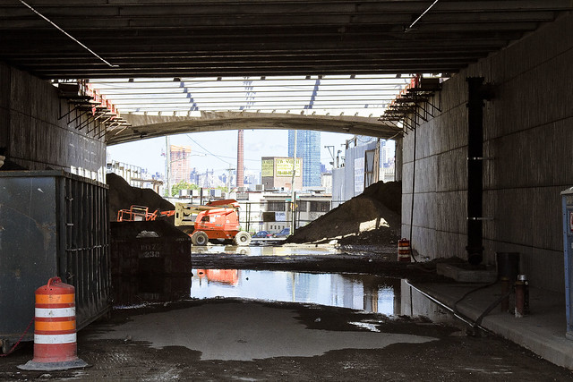
– photo by Mitch Waxman
That’s the new overpass at Varick Avenue, looking westwards towards the East River.
Documenting this project has been a long standing project of mine – this 2012 post tells you everything you could want to know about Robert Moses, Fiorella LaGuardia, and the origins of the 1939 model Kosciuszko Bridge. Just before construction started, I swept through both the Brooklyn and Queens sides of Newtown Creek in the area I call “DUKBO” – Down Under the Kosciuszko Bridge Onramp. Here’s a 2014 post, and another, showing what things used to look like on the Brooklyn side, and one dating back to 2010, and from 2012 discussing the Queens side – this. Construction started, and this 2014 post offers a look at things. There’s shots from the water of Newtown Creek, in this June 2015 post, and in this September 2015 post, which shows the bridge support towers rising. Additionally, this post from March of 2016 detailed the action on the Queens side. Most recently, here’s one from May of 2016, and one from June of the same year. Here’s one from August of 2016, the December 2016 one, one from March of 2017 which discusses the demolition of the 1939 bridge.
Most recently – a post showing what I saw during a pre opening walk through in early April of 2017, and the fanfare surrounding the opening of half of the new bridge in April of 2017.

– photo by Mitch Waxman
Just shy of Gardner Avenue, currently a closed off section of the construction site, Mr. Adams began to discuss the perimeter of the new park. It will quite literally be in DUKBO, Down Under the Kosciuszcko Bridge Onramp. The site will occupy a mostly paved area largely shadowed by the two new bridges. Our group discussed the possibility of shade tolerant plants, and or harvesting “gray water” from the highways to feed into planting beds.
The problem with that, as stated by somebody from Parks Dept. was this – shade tolerant plants are seldom salt resistant and that even without harvesting runoff from the BQE’s drains, there’s going to be a considerable amount of road salting during the winter months both above and below the parcel.

– photo by Mitch Waxman
The demolition of the old bridge is going to be occurring shortly, which will play out in two stages. First is the removal of the central truss section, then the “energetic demolition” of the approaches. If the schedule holds true, the second half of the new K Bridge will open in 2020 standing in the footprint of the old one.
That’s when the parks business will begin in earnest. There’s a section on the Maspeth side, on 43rd street, in Queens. Another section is this parcel in Brooklyn, and the old Sgt. Dougherty park on Meeker avenue at Chery Street is going to be redesigned and rebuilt.

– photo by Mitch Waxman
One of the interjections a humble narrator offered, as one who knows this zone intimately enough to refer to it affectionately as the “Poison Cauldron of the Newtown Creek,” involved the intended pathways which people from the surrounding neighborhoods would use to get here. The surrounding areas to the east and south are insanely dangerous, traffic wise, with gargantuan trucks whizzing about and all sorts of blue collar people doing blue collar things. Warehouses, waste transfer stations, truck and bus mechanics… not to mention all of the autos at Meeker Avenue angrily straining to get into the approach lanes for the BQE.
In short, way finding and traffic control.

– photo by Mitch Waxman
About those waste transfer stations… one of the things that makes this particular “cauldron” so “poison” is the tonnage of putrescent – or black bag – garbage transported here daily. This section of DUKBO is covered in quite toxic dust. Harvesting a booger from your nasal cavity after a walk through this section will reveal many things to you about the quality of air and suspended particulates. There’s also the smell.
DUKBO stinks of decay, rot, and hot garbage. On humid days, you will notice swirls of diesel exhaust along with shiny specks of dust hanging in the ether, as illuminated by an odd shaft of light. In short – dust and odor control are essential.
The choice of this area is an extremely challenging one for a park, but given the paucity of parkland in North Brooklyn – beggars can’t be choosers and you have to work with what you’ve been given.

– photo by Mitch Waxman
As far as the construction progress side of things, as mentioned, DOT and their contractor’s efforts are now being focused on the removal of the 1939 era Kosciuszcko Bridge. Up top, traffic has long been rerouted onto the easterly half of the new span, and torch bearing demolitionists have been cutting up small sections of the old bridge. The former walkway and the side railing has been cut up and will be sent off for recycling.

– photo by Mitch Waxman
Above Newtown Creek, but below the BQE, crews are assembling the “strand jacks” which will lower the central truss down to a waiting barge. The steel of the central truss is also meant to be recycled, and will be making a final journey to New Jersey escorted by tugs sometime during the coming month.

– photo by Mitch Waxman
This is the view from Scott Avenue, and the new park will continue down to the bulkheads and will overlook the water, I’m told. There has been some discussion of waterfront access here, as in a place where you’d be able to put a boat in the water, but one hasn’t been a part of that conversation.

– photo by Mitch Waxman
Walking back, as we crossed Gardiner Avenue, I handed off my “PPE” to Mr. Adams and bid the group adieux rather than go all the way back to Meeker and Varick Avenues where we had met up.
I headed down instead to the site of the first Meeker Avenue, or Penny Bridge. Once upon a time there was a swing bridge on Newtown Creek which connected Brooklyn’s Meeker Avenue with Queens’ Review Avenue (and the Penny Bridge LIRR stop). Penny Bridge was demolished in 1939 when the new Meeker Avenue Bridge opened (renamed as Kosciuszcko in 1940) but the masonry on both sides of Newtown Creek are still present.
It was a neat idea, I thought, visiting all three Meeker Avenue Bridges in the same day.
History nerd here, what can I tell ‘ya?

– photo by Mitch Waxman
While I was at Penny Bridge, my zoom lens was dialed to its extant focal length and I zeroed in on the Queens side’s strand jacks being erected. Hey, I may be a history nerd, but I know for a fact that several of you out there are engineering nerds.
Upcoming Tours and events
Newtown Creek, Greenpoint to Hunters Point, walking tour with NYCH2O – June 29th, 7-9 p.m..
Experience and learn the history of the western side of Newtown Creek, as well as the East River Parks Hunters Point with NCA Historian Mitch Waxman – details here.
“follow” me on Twitter- @newtownpentacle


