Archive for the ‘Construction’ Category
increasingly rigid
It’s National Date-Nut Bread Day, in these United States.
– photo by Mitch Waxman
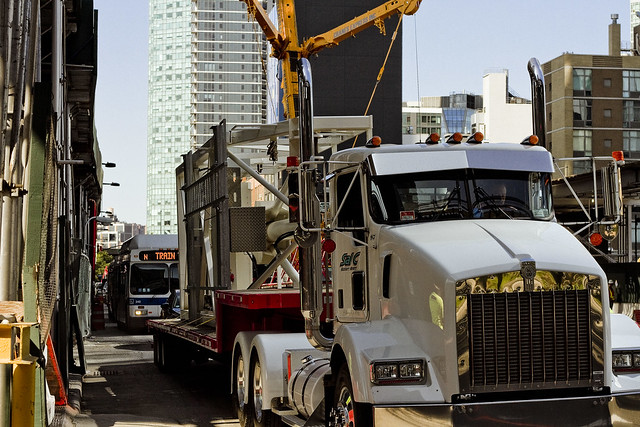
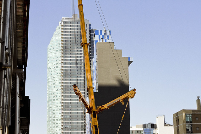
Hunters Point is a section of Long Island City. Most modern people refer to it “as” Long Island City, but LIC – as in the “independent municipality of” – includes the neighborhoods of Astoria, Sunnyside, Blissville, Ravenswood, Dutch Kills, and Hunters Point as well. Hunters Point is pretty much defined as the zone sitting between Skillman Avenue to the east, the East River to the west, Queens Plaza to the north, and Newtown Creek to the south. The independent municipality of LIC’s old borders ran eastwards to what’s now the Kosciuszcko Bridge and Woodside Avenue to the east, Bowery Bay on the north, Newtown Creek on the south, and by the East River to the west.
The Dutch arrived in this peninsular area, sparsely populated by bands of the Lenape, back in the 1640’s. The first European land holder was a Dutch Priest named Dominie Everardus Bogardus, and back then LIC was referred to as “Dominie’s Hoek.” Bogardus, whom the historical record is not kind to, died in a shipwreck in 1647. Hunters Point, as defined above, came into the possession of a Dutch Sea Captain named Peter Praa, and the land stayed in his family until just before the American Revolution. At that time, the deed was in the hands of a Praa descendent named Anna Hunter. That’s why it’s called Hunters Point.

– photo by Mitch Waxman
Anna Hunter had three sons, and in the name of family unity and amity, her will stipulated that the land be sold off to avoid them fighting over the inheritance. By the time of the Civil War, the land had been divided into lots and sold off to a number of different concerns. The village, or town, of Hunters Point was a part of a county municipal organization called “Newtown” whose borders stretched all the way into modern day Nassau County. Newtown was a relict of the Dutch civilization’s “Nieuwtown,” whose function and borders were continued by the British and later the American governments long after the Dutch. The British first called it “Nieuwe Stad,” and at the time of the Revolution it was “Newtown.”
In the early 19th century, NYC was a ship building colossus. Manhattan shoreline properties along the East River were dearly held, and massively expensive to acquire. Ship yards, carpentry shops, iron foundries, coal yards, and rope factories were moving their operations over to Williamsburg and Greenpoint in Brooklyn and moving steadily north.
Industrial piers began to appear along the busy East River in Hunters Point, and along Newtown Creek. In 1848, the Roman Catholic Church bought the Alsop farm in Blissville in pursuance of creating Calvary Cemetery. Vernon Avenue was created and paved, and a plank road was built connecting to agricultural Blissville. The plank road was named for its destination, at the Borden Dairy Farms in Maspeth, and it was erected out of the swampy lowlands adjoining the Newtown Creek in 1868.
In the 1860’s, railroad tracks were connected to the east river by a company that would soon call itself the Long Island Railroad. Industrialization got its footing in LIC, due to easy access to the railroad AND to the water. Speculators began buying up dismal tidal swamps, filling them in with garbage, dead animals, human waste, and other fill materials. The Borden Plank road was paved and became Borden Avenue.
In 1870, a group of ambitious and notorious politicians, railroad operatives, and robber barons were successful in their bid to secede from agricultural Newtown and the independent municipality of Long Island City was formed.
The first land grab in what we call Queens got underway.
– photo by Mitch Waxman
Over twenty nine years of glorious misrule and an infamously corrupt political environment, LIC grew into the workshop of America. Enormous factories opened, and the waterfront in Hunters Point became a maritime industrial center, with nearly all of the freight traffic carried by the Long Island Railroad moving through it. Sugar factories, steel mills, oil refineries, chemical plants, fat renderers, pickle factories, fertilizer mills, manure yards, dead animal wharves – you name it – it was here. The City of Greater New York consolidated itself in 1898, incorporating LIC into its now familiar five boroughs, all under the guidance of the notorious Tammany Hall leader Richard Croker. Manhattan began to convert its industrial shorelines over to residential districts, and started to export all of its dirty industries to its new holdings in Brooklyn, and to the newly named Queens.
Manhattan began a process which modernity would describe as gentrification, displacing the working class poor and encouraging them to move to newly constructed row housing in the “outer boroughs.” The row housing was constructed by political insiders like Cord Meyer. Mr. Meyer and his fellow real estate speculators like Michael Degnon had inside information from the politicians of Tammany Hall about where the roads and subways would be created and they began to buy up agricultural properties all over the former Newtown. Entire neighborhoods were created, seemingly overnight. Call it Elmhurst? That’s Cord Meyer Sr. you’re echoing.
In 1909, the Queensboro Bridge was opened for business. Hell Gate Bridge opened in 1917. The Sunnyside Yards opened in 1919, made possible by the Pennsylvania Railroad company, which also created the East River tunnels that LIRR and Amtrak use to this day. The subways made gradual appearances in the first, second, and third decades of the twentieth century. Notably, what we call the 7 line – which already had three stops connecting Hunters Point to Manhattan as of 1915 – opened the Corona extension in April of 1917.
The second land grab in Queens got underway.

– photo by Mitch Waxman
Manhattan’s infamous tenement slums began to empty, and the working class hordes of immigrants began to populate into the new residential neighborhoods in Brooklyn, Queens, and the Bronx. Hunters Point had a relatively small residential population, which was centered not in the industrial zone but rather in the neighborhoods surrounding it. Sunnyside Gardens was created as an early example of “affordable housing” and as a planned community in the late 1920’s, in response to the multi story apartment houses which began to rise in Dutch Kills and Astoria along the new subway lines. At the same time, Robert Moses had appeared on the scene, along with his Triborough Bridge project.
Mighty Triborough opened in 1936, and the highways that feed into it like the Grand Central Parkway soon followed. The age of the automobile arrived in Queens, which allowed for heavy residential construction in previously rural areas. Forest Hills and Rego Park, Bayside and Douglaston, even Jamaica were now connected to Manhattan. For those who supported Mr. Moses, the routes and off ramps of the new high speed roads were revealed. In 1940, the Long Island Expressway and Queens Midtown Tunnel appeared in Hunters Point, which effectively blighted and cut the ancient community in half.
The third land grab in Queens got underway.
– photo by Mitch Waxman
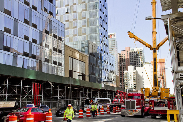
After the Second World War, things began to change in Hunters Point. New York City began a process of de industrialization that wouldn’t become truly apparent until the middle 1960’s. Heavy industry began migrating to the American south and west, where industrial campuses of collossal size could be constructed. The political establishment of NYC, still married to the industrial labor unions, realized that they had to do something to try and protect their base. In 1961, The Department of City planning (which was controlled by Robert Moses) issued a decree that Hunters Point was now an “M1” zone – the land was reserved exclusively for heavy manufacturing use only.
For the homeowners and residential community in Hunters Point (and in Dutch Kills as well), what that meant was that no bank would advance them credit for a mortgage, or loan them money for renovation projects on existing residential properties. The fly in the ointment this time around, however, was that because of a general decline of manufacturing activity in the entire Northeastern United States the industrial base was seeking to vacate New York City. By the 1970’s, you couldn’t give the land away in Hunters Point. The residential community dwindled, but narrow strips of habitation persisted. The political establishment was heavily involved in “urban renewal” projects, and floods of federal money enabled developers like the Tishmans, Trumps, and Lefraks to build massive commercial and housing projects in Manhattan, Brooklyn, and Queens. This is when the big landlords and the politicians first really got to know each other, and the current alliance between big real estate and the political establishment of Manhattan was cemented.
It’s also when, in an attempt to revive a moribund local economy, the City began giving away land to developers. This process really kicked into gear in the 1980’s, under Mayor Koch.
– photo by Mitch Waxman
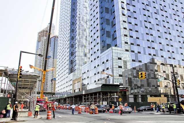
In 1981, NYC City Planning rechristened Hunters Point as a “mixed use district.” The first large scale development that occurred after this was the Citigroup tower, which opened in 1993, a 53 story structure which was built on land formerly occupied by a hospital. In 1995, 2001, and again in 2004, City Planning opened up zoning restrictions on height in LIC – particularly along the Hunters Point waterfront. As restrictions were loosened, and residential corridors were created, there was some construction activity but it was a lot of smoke with very little flame. The New York Times and other cheerleaders for the real estate interests began to refer to Hunters Point as “LIC” and started calling it “the next big thing.” (City planning is currently working on further loosenings of zoning in Hunters Point, and preparing the “LIC Core” rezoning which will make it possible to build high density residential towers as far east as Steinway Street, along Northern Blvd.) The currently underway Hunters Point South development is billed as the largest “affordable” housing project in the United States, but it’s not affordable by many of the current residents of LIC.
The so called “Brooklyn miracle” happened instead. From the post industrial waterfront of Williamsburg all the way south to what is now referred to as “DUMBO,” high density towers rose and created the new “Gold Coast” of Long Island. In the last decade, financial speculators and globalist investors have driven the price of Brooklyn real estate so high that financiers have begun to focus in on Hunters Point and Astoria instead, looking for a “good buy.”
The fourth land grab in Queens is underway, as you read this.
– photo by Mitch Waxman
All of this development has avoided upgrading the municipal infrastructure which the new population would require – cops, fire department, sewerage, hospitals, schools. If you’re walking through one of the glorious new waterfront parks in Hunters Point, and you suddenly grab at your chest, where the FDNY ambulance will take you is either Bellevue Hospital in Manhattan, the Mount Sinai hospital on Crescent street in Astoria, or out to Elmhurst hospital. FDNY’s fire fighting apparatus in western Queens was designed for industrial fires, and the 108th precinct is housed in a tiny 19th century building which still has horse stables. The sewer plant servicing this gargantuan residential population was opened by Fiorella LaGuardia in 1936. Our transit needs far outweigh current capability. There are not enough school desks. Don’t get me started on the environmental legacy of all that industry which used to be here. The buildings being erected in the photos in today’s posts are on the site of a former chemical factory in Queens Plaza, for instance.
Simply put, “gentrification” is nothing new in Western Queens and it’s been going on since at least the Civil War. The “G bomb” has already been dropped, and it has gone off. A looming infrastructure crisis is just beginning.
Upcoming Tours and events
Calvary Cemetery Walking Tour, with Atlas Obscura – Saturday, September 9th, 11 a.m. – 1 p.m.
Explore NYC history, hidden inside sculptural monuments and mafioso grave sites, as you take in iconic city views on this walking tour, with Newtown Creek Alliance Historian Mitch Waxman – details here.
“follow” me on Twitter- @newtownpentacle
buzzing polyhedron
It’s National Vanilla Custard Day, in these United States.
– photo by Mitch Waxman
One insists on a couple of cups of coffee in the morning, accompanied by a bit of quiet time to read the papers. I’m not one of the artisanal coffee people, as a note, as I favor the supermarket brand Folgers. I’ll actually sacrifice an hour of sleep and wake up at 4:30 in the morning to get my morning coffee time in on days when I have to leave the house early to catch a boat or something. Once upon a time, when I was a full time advertising fellow, you’d see me riding the train in the morning with one of those travel mug things, but in recent years I’ve realized that doing that sort of thing is just servicing the need for morning caffeine rather than servicing the need for some “me” and composing my thoughts time.
This whole morning coffee ritual is critical to my day long happiness, and something I enjoy. Now, it’s up to the Internet commentariat to tell me that I’m deluding myself, and being some kind of asshole, because that’s the world in which we now live. Mind your own business, and don’t tell me what to think or do. Look in a mirror instead, and work yourself over instead. I don’t have time, nor do I want, to argue semantics. My day is busy enough by the time I finish that coffee.

– photo by Mitch Waxman
When I’ve finished my coffee, I usually get down to business. There’s always shots to develop, calls to make, posts to write, schedules to keep, checks and payments from clients I need to chase down. There’s “deliverables” which I need to get out to those clients, attention to pay to the dog, trouble I need to start involving the Newtown Creek or any of the hundreds of little existential things I care about here in Queens. I’m also sort of obligated to do the social media thing a few times a day, promoting this or that event or trying to call attention to some of those aforementioned “Queens things” I care about.
Occasionally, over the course of the day, I’ll check in on the various video games I have in my iPad and play a round or two for diversion (at the moment, that means “Boom Beach” and “Star Wars Commander”).

– photo by Mitch Waxman
Sometimes I’ll knock off in the late afternoon and head over to the local pub for a pint or two of beer and chat with the neighbors to find out what they’re thinking and what they care about, and then head home to get dinner ready. Post meal, I’ll hang out with Our Lady of the Pentacle for a bit, and then I try to stick to a schedule of reading some dry text related to the history of NYC for a couple of hours. By this point, I’m dying for another cup of coffee, but resist the urge since it means that I’ll be up all night while buzzing on caffeine. I’ll usually hit the work again before drifting off to bed since – as mentioned – there’s always more of it to do.
That’s a day in the life, for a humble narrator. What’s your life like? What do you do? Who do you spend your time with? Where do you go? Why do you go there?
Upcoming Tours and events
DUPBO Newtown Creek Walking Tour, with NYCH20 – Thursday August 24th, 7 p.m. – 9 p.m.
Explore Greenpoint and Hunters Point, with NCA Historian Mitch Waxman – details here.
America’s Workshop Newtown Creek Walking Tour, with Atlas Obscura – Saturday August 26th, 11 a.m. – 2 p.m.
Explore the Dutch Kills tributary of Newtown Creek in Long Island City, with NCA Historian Mitch Waxman – details here.
“follow” me on Twitter- @newtownpentacle
heavy rumblings
It’s National Panini Day, in these United States.

– photo by Mitch Waxman
On this day, in 3,114 B.C.E., the Mayans began their “long count” calendar. Today’s also the day, in 480 B.C.E., that Leonidas and his 300 Spartans finally succumbed at Greece’s Thermopylae to the human wave attacks of the Persian armies of Xerxes. In 1929, Babe Ruth became the first baseball player to achieve 500 career home runs, and in 1972 the United States exited its last combat units from Viet Nam. Today is the day that industrialist Andrew Carnegie died in 1919, the painter Jackson Pollock also kicked the bucket in 1956, and we also lost comedian Robin Williams on this day in 2014. In 1992, the Mall of America opened for business, and in 1965 the Watts riots kicked into gear in Los Angeles.
Me? I don’t have too much to do today, but it’s going to be a fairly busy weekend.

– photo by Mitch Waxman
I’m planning on checking out the “Queens Anti-Gentrification” march on Saturday afternoon in LIC. What I’ve read about, and offered by, this group doesn’t exactly jibe with reality as I know it, but I figure if somebody is willing to stick their neck out and offer their views and opinions in public you owe it to them to at least listen to what they have to say. So far, I haven’t been a fan of their tactics either, but there you are. After that, I’m hopping on a ferry to Pier 11 in Manhattan, where I’ll be boarding a boat with the Working Harbor Committee. I’ll be sharing the microphone with Andrew Gustafson of Turnstile Tours and we will be talking about the Brooklyn Waterfront’s (Newtown Creek to Sunset Park) “Past, Present, and Future.”

– photo by Mitch Waxman
I’ll be up early on Sunday to conduct the “Poison Cauldron of the Newtown Creek” walking tour for Newtown Creek Alliance. This is one of my favorite excursions to conduct, and it tells the story of the oil and energy industries in North Brooklyn from the 1850’s all the way to the present. It also moves through one of the most god awful areas NYC has ever created, so how’s that for a selling point?
Upcoming Tours and events
Brooklyn Waterfront Boat Tour, with Working Harbor Committee – Saturday August 12th, 6 p.m. – 8 p.m.
Explore the coastline of Brooklyn from Newtown Creek to Sunset Park, with NCA Historian Mitch Waxman, Andrew Gustafson of Turnstile Tours, and Gordon Cooper of Working Harbor Committee on the narrating about Brooklyn’s industrial past and rapidly changing present. – details here.
The Poison Cauldron of the Newtown Creek Walking Tour, with Newtown Creek Alliance – Sunday August 13th, 11 a.m. – 1:30 p.m.
Explore the hellish waste transfer and petroleum districts of North Brooklyn on this daring walk towards the doomed Kosciuszko Bridge, with NCA Historian Mitch Waxman – details here.
Two Newtown Creek Boat Tours, with Newtown Creek Alliance and Open House NY – Wednesday August 16th, 5 p.m. and 7 p.m.
The neighborhoods surrounding Newtown Creek are home to the densest collection of these garbage facilities anywhere in the city and collectively, the waste transfer stations around and along Newtown Creek handle almost 40% of the waste that moves through New York. Join Newtown Creek Alliance’s Mitch Waxman and Willis Elkins to learn about the ongoing efforts to address the environmental burden that this “clustering” has caused. – details here.
DUPBO Newtown Creek Walking Tour, with NYCH20 – Thursday August 24th, 7 p.m. – 9 p.m.
Explore Greenpoint and Hunters Point, with NCA Historian Mitch Waxman – details here.
“follow” me on Twitter- @newtownpentacle
outspread under
It’s National Watermelon day, in these United States

– photo by Mitch Waxman
A sense of place is one of the things that I always keep in mind when I’m out shooting around Newtown Creek. Without a glimmer of the skyline, in particular a recognizable silhouette like the Empire State Building, it’s impossible to say if you’re looking at NYC or just some post industrial landscape anywhere in the great American rust belt.
Saying all that, you’ve got to be careful about how much of the frame is filled by iconic architecture like Empire State as the people who own the building zealously defend a theoretical copyright on images in which it appears. If the shot above was to appear in an advertisement, for instance, a fee would need to be negotiated with the building’s management for usage of its image. The Empire State Building is like Brad Pitt or Beyoncé.

– photo by Mitch Waxman
One has been thinking about the ownership of reproduction rights over something that you can’t help but have occupy a certain proportion of shots captured whilst out in public. Back when I was a full time advertising retoucher, one of the most ridiculous assignments I received was to remove any and all identifiable “brands” from a series of stock photos. These photos were going to published in a direct mail offering for a large credit card company serviced by the agency, and the client didn’t want to negotiate with the various brand owners for usage. Therefore, one spent a week or so retouching every logo and identifiable brand image out of shots of Times Square, the Ginza strip, and Picadilly Circus.
The results were bizarre, and looked like something from the second act of a zombie movie, but the client was happy and I got paid… so… victory. I guess.

– photo by Mitch Waxman
Personally, since I’ve stepped behind the camera over the last decade or so, a point is made to frame my shots in such a manner as to necessitate as little retouching out of logos and brand marks as possible. As I always say to the creative types – check with the retoucher before the shoot if you want to save yourself a bunch of money.
Upcoming Tours and events
We’re cancelling Saturday the 5th’s Insalubrious Valley tour due to a forecast of scattered thunderstorms with lightning expected.
The Insalubrious Valley of the Newtown Creek Walking Tour, with Newtown Creek Alliance – Saturday August 5th, 11 a.m. – 1;30 p.m.
Century old movable bridges, the remains of a 19th century highway between Brooklyn and Queens, and explore two of the lesser known tributaries of the troubled Newtown Creek watershed. For the vulgarly curious, Conrad Wissell’s Dead Animal and Night Soil wharf will be seen and described, with NCA Historian Mitch Waxman – details here.
Brooklyn Waterfront Boat Tour, with Working Harbor Committee – Saturday August 12th, 6 p.m. – 8 p.m.
Explore the coastline of Brooklyn from Newtown Creek to Sunset Park, with NCA Historian Mitch Waxman, Andrew Gustafson of Turnstile Tours, and Gordon Cooper of Working Harbor Committee on the narrating about Brooklyn’s industrial past and rapidly changing present. – details here.
The Poison Cauldron of the Newtown Creek Walking Tour, with Newtown Creek Alliance – Sunday August 13th, 11 a.m. – 1:30 p.m.
Explore the hellish waste transfer and petroleum districts of North Brooklyn on this daring walk towards the doomed Kosciuszko Bridge, with NCA Historian Mitch Waxman – details here.
Two Newtown Creek Boat Tours, with Newtown Creek Alliance and Open House NY – Wednesday August 16th, 5 p.m. and 7 p.m.
The neighborhoods surrounding Newtown Creek are home to the densest collection of these garbage facilities anywhere in the city and collectively, the waste transfer stations around and along Newtown Creek handle almost 40% of the waste that moves through New York. Join Newtown Creek Alliance’s Mitch Waxman and Willis Elkins to learn about the ongoing efforts to address the environmental burden that this “clustering” has caused. – details here.
DUPBO Newtown Creek Walking Tour, with NYCH20 – Thursday August 24th, 7 p.m. – 9 p.m.
Explore Greenpoint and Hunters Point, with NCA Historian Mitch Waxman – details here.
“follow” me on Twitter- @newtownpentacle
sterner things
It’s National Bomb Pop Day, in these United States.

– photo by Mitch Waxman
As described in yesterday’s post, a hurried flight from “Point A” in Astoria to “Point B” in Brooklyn’s Greenpoint section was enacted last Saturday, in order to arrive on time for a walk through and discussion of the NYC DOT’s Kosciuszcko Bridge project’s commitment to create new parkland in the post facto footprint of their construction zone. Invitees were community members, folks from Open Space Alliance, NYC Parks Department, and a few local busybodies such as myself.
That’s Robert Adams, of the New York State Department of Transportation, chief engineer and showrunner for the K Bridge replacement project.

– photo by Mitch Waxman
I’ve stated many times that the community communications side of this project has been extraordinary. I’ve also reported to a number of people that Mr. Adams, in particular, has been remarkably transparent and amiable to receiving input from those who surround the perimeter of his project. Gold standard, in my experience, as far as handling the impact of a large scale public works projects in the crowded urban industrial setting of Newtown Creek in North Brooklyn and Western Queens. Kudos.

– photo by Mitch Waxman
As has become familiar – when visiting the K Bridge job site – our little group donned “Personal Protective Equipment,” which included safety glasses, gloves, orange vests, and hard hats. That paved sidewalk, on the left of the shot above adjoining the retaining wall for the Brooklyn Queens Expressway’s Meeker Avenue onramp, is “used to be Cherry Street.” The street we were walking down, in a northerly direction heading towards Scott Avenue, is nouveau Cherry Street.
– photo by Mitch Waxman
That’s the new overpass at Varick Avenue, looking westwards towards the East River.
Documenting this project has been a long standing project of mine – this 2012 post tells you everything you could want to know about Robert Moses, Fiorella LaGuardia, and the origins of the 1939 model Kosciuszko Bridge. Just before construction started, I swept through both the Brooklyn and Queens sides of Newtown Creek in the area I call “DUKBO” – Down Under the Kosciuszko Bridge Onramp. Here’s a 2014 post, and another, showing what things used to look like on the Brooklyn side, and one dating back to 2010, and from 2012 discussing the Queens side – this. Construction started, and this 2014 post offers a look at things. There’s shots from the water of Newtown Creek, in this June 2015 post, and in this September 2015 post, which shows the bridge support towers rising. Additionally, this post from March of 2016 detailed the action on the Queens side. Most recently, here’s one from May of 2016, and one from June of the same year. Here’s one from August of 2016, the December 2016 one, one from March of 2017 which discusses the demolition of the 1939 bridge.
Most recently – a post showing what I saw during a pre opening walk through in early April of 2017, and the fanfare surrounding the opening of half of the new bridge in April of 2017.

– photo by Mitch Waxman
Just shy of Gardner Avenue, currently a closed off section of the construction site, Mr. Adams began to discuss the perimeter of the new park. It will quite literally be in DUKBO, Down Under the Kosciuszcko Bridge Onramp. The site will occupy a mostly paved area largely shadowed by the two new bridges. Our group discussed the possibility of shade tolerant plants, and or harvesting “gray water” from the highways to feed into planting beds.
The problem with that, as stated by somebody from Parks Dept. was this – shade tolerant plants are seldom salt resistant and that even without harvesting runoff from the BQE’s drains, there’s going to be a considerable amount of road salting during the winter months both above and below the parcel.

– photo by Mitch Waxman
The demolition of the old bridge is going to be occurring shortly, which will play out in two stages. First is the removal of the central truss section, then the “energetic demolition” of the approaches. If the schedule holds true, the second half of the new K Bridge will open in 2020 standing in the footprint of the old one.
That’s when the parks business will begin in earnest. There’s a section on the Maspeth side, on 43rd street, in Queens. Another section is this parcel in Brooklyn, and the old Sgt. Dougherty park on Meeker avenue at Chery Street is going to be redesigned and rebuilt.

– photo by Mitch Waxman
One of the interjections a humble narrator offered, as one who knows this zone intimately enough to refer to it affectionately as the “Poison Cauldron of the Newtown Creek,” involved the intended pathways which people from the surrounding neighborhoods would use to get here. The surrounding areas to the east and south are insanely dangerous, traffic wise, with gargantuan trucks whizzing about and all sorts of blue collar people doing blue collar things. Warehouses, waste transfer stations, truck and bus mechanics… not to mention all of the autos at Meeker Avenue angrily straining to get into the approach lanes for the BQE.
In short, way finding and traffic control.

– photo by Mitch Waxman
About those waste transfer stations… one of the things that makes this particular “cauldron” so “poison” is the tonnage of putrescent – or black bag – garbage transported here daily. This section of DUKBO is covered in quite toxic dust. Harvesting a booger from your nasal cavity after a walk through this section will reveal many things to you about the quality of air and suspended particulates. There’s also the smell.
DUKBO stinks of decay, rot, and hot garbage. On humid days, you will notice swirls of diesel exhaust along with shiny specks of dust hanging in the ether, as illuminated by an odd shaft of light. In short – dust and odor control are essential.
The choice of this area is an extremely challenging one for a park, but given the paucity of parkland in North Brooklyn – beggars can’t be choosers and you have to work with what you’ve been given.

– photo by Mitch Waxman
As far as the construction progress side of things, as mentioned, DOT and their contractor’s efforts are now being focused on the removal of the 1939 era Kosciuszcko Bridge. Up top, traffic has long been rerouted onto the easterly half of the new span, and torch bearing demolitionists have been cutting up small sections of the old bridge. The former walkway and the side railing has been cut up and will be sent off for recycling.

– photo by Mitch Waxman
Above Newtown Creek, but below the BQE, crews are assembling the “strand jacks” which will lower the central truss down to a waiting barge. The steel of the central truss is also meant to be recycled, and will be making a final journey to New Jersey escorted by tugs sometime during the coming month.

– photo by Mitch Waxman
This is the view from Scott Avenue, and the new park will continue down to the bulkheads and will overlook the water, I’m told. There has been some discussion of waterfront access here, as in a place where you’d be able to put a boat in the water, but one hasn’t been a part of that conversation.

– photo by Mitch Waxman
Walking back, as we crossed Gardiner Avenue, I handed off my “PPE” to Mr. Adams and bid the group adieux rather than go all the way back to Meeker and Varick Avenues where we had met up.
I headed down instead to the site of the first Meeker Avenue, or Penny Bridge. Once upon a time there was a swing bridge on Newtown Creek which connected Brooklyn’s Meeker Avenue with Queens’ Review Avenue (and the Penny Bridge LIRR stop). Penny Bridge was demolished in 1939 when the new Meeker Avenue Bridge opened (renamed as Kosciuszcko in 1940) but the masonry on both sides of Newtown Creek are still present.
It was a neat idea, I thought, visiting all three Meeker Avenue Bridges in the same day.
History nerd here, what can I tell ‘ya?

– photo by Mitch Waxman
While I was at Penny Bridge, my zoom lens was dialed to its extant focal length and I zeroed in on the Queens side’s strand jacks being erected. Hey, I may be a history nerd, but I know for a fact that several of you out there are engineering nerds.
Upcoming Tours and events
Newtown Creek, Greenpoint to Hunters Point, walking tour with NYCH2O – June 29th, 7-9 p.m..
Experience and learn the history of the western side of Newtown Creek, as well as the East River Parks Hunters Point with NCA Historian Mitch Waxman – details here.
“follow” me on Twitter- @newtownpentacle


