Posts Tagged ‘Hunters Point’
elaborately fashioned

– photo by Mitch Waxman
While moving through DUPBO (Down Under the Pulaski Bridge Onramp) the other day, a passing train forced me to halt my ceaseless marching momentarily. Suffering from a malfunction, my headphones were not working, and the ultimate horror of being alone with my thoughts occurred. A brief interlude with your humble narrator has been described as exhausting, and that’s when the interviewee is feeling generous or is governed by polite behavioral norms. Long exposures to my uniquely abhorrent personality have been known to induce madness, encourage alcoholism, and destroy all hope for peace. An expectation of normalcy is usually abandoned by those unable to escape my presence shortly after first contact.

– photo by Mitch Waxman
My family describes me as best taken in small doses, and does their best to disavow, deny, and distance themselves. Imagine what it must be like, between my ears, as one cannot escape from oneself. With the headphones roaring their cacophony, it is often possible for me to drown my endless narrative of self referential critique and worry, but without them the omnipresence of paranoid wonderings is impossible to evade. What you read in this blog is what I’m like all the time.

– photo by Mitch Waxman
Poverty stricken of late, my plan to get every last millimeter of sole from my last pair of hiking boots backfired, causing an injury of some kind to my left foot. Not severe, discomfort is barely noticeable until several miles into a walk, but after a while it becomes uncomfortable. While standing in DUPBO, one wondered if it might be something truly horrible and I began to ponder if it might be foot cancer. This led me to begin thinking about whether or not there was any such thing as “foot cancer” (there is), which led me to begin wondering about all the other aches and pains which I experience and attempted to ascribe a hypochondriacal “worst case” scenario to each.

– photo by Mitch Waxman
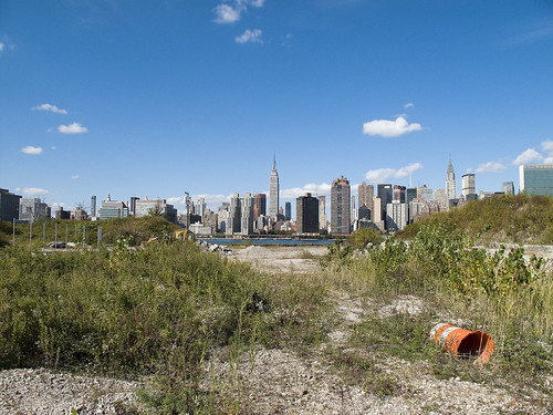
Constant thought is given to being struck by a truck, or car, or train of course. I also worry about things falling off of buildings- did you know that bricks sometimes just come loose and fall? Falling air conditioners, electrified utility lines, even sinkholes could randomly cross my path. There are feral dogs, packs of rats, hordes of flesh eating centipedes, and aggressive seagulls… One could fall in the creek head first and get stuck in the mud, be drawn into a wood chipper, or end up stuffing a fifty gallon drum after taking a photo of something I shouldn’t have. It is not fun thinking these thoughts, and impossible for me to turn them off. Over the years, I’ve seen a lot of things happen in New York City, things which are admittedly “statistically unlikely” but happened nevertheless- decapitation, bloodcicles, and pineapple with ham on pizza. Oddly enough, I seldom worry about being struck by lightning- go figure.

– photo by Mitch Waxman
This is, of course, why I keep my headphones buried firmly in my ears and the volume turned way up, on these long walks around Queens and the Newtown Creek. It’s also why, as soon as budget allowed, a new pair of shoes were purchased, because you cannot run away from imagined dangers when your left foot hurts. The repair to the headphones has been accomplished as well, and as this shadow of what looks like a man strides forth, he no longer is forced to listen to a fear crazed maniac within his head. Still worried about foot cancer though… So many things can happen to you…
little memories

– photo by Mitch Waxman
What you’re looking at used to be one of the centers of the world, the Long Island Railroad terminus at 2nd street and Borden Avenue. The original version of the place was built in 1861 and provided egress to Manhattan via an enormous ferry terminal which shuttled commuters back and forth across the East River. This was (and is) the literal “End of the Line”.

– photo by Mitch Waxman
The station was electrified (WRONG, Sharp Eyed Reader “Kevin” points out that these are diesel trains) along with the rest of the LIRR western spurs, when the tunnels to Manhattan were opened in the early 20th century. The tunnels allowed direct transport to Penn Station, eliminating those delays associated with weather which plagued the ferry service.
Today, excess capacity during the slack time between rush hours can be found idling on the tracks on any given day.

– photo by Mitch Waxman
Several versions of the station have been installed here- for instance, a calamitous fire in 1902 destroyed the wooden buildings and train sheds which distinguished the place in the late 19th century. A trip to the acknowledged masters on the subject- the website arrts-arrchives.com is recommended for the curious.
enchanting metamorphoses

– photo by Mitch Waxman
Recent announcements have heralded the formal beginnings of the process which will transmogrify the ancient Hunters Point section of Long Island City irrevocably. The support of overt interests of the Manhattan political elite have been made in public, and the financial and real estate folks are in line behind the project.
Behold, the future home of an estimated 11,000 people, imagine Tower Town.
from nyc.gov
More than 5,000 new apartments are anticipated to be constructed in the primary neighborhood character study area by 2017, including completion of the residential development at Queens West and many other mid-size residential buildings throughout the immediate area. Almost 11,000 new residents are expected in the primary study area as a result of this new construction activity.
As the primary study area (and the secondary study area, discussed below) becomes more densely developed, traffic and pedestrian volumes will increase noticeably from the current levels. Intersections throughout the area will be more congested in the morning, midday, and evening peak hours. The intersections that currently experience some congestion on Vernon Boulevard will be noticeably more congested, with some levels of service D and even LOS F, indicating high to unacceptable delays. In addition, other intersections along Vernon Boulevard in the primary study area will also have moderate to high congestion in the peak hours. On the east-west avenues in the area near the project sites (i.e., 48th, 49th, 50th, and 51st Avenues) traffic volumes are expected to increase slightly.
Pedestrian volumes will also increase in the future without the proposed actions, but sidewalks, corners, and crosswalks will generally continue to operate at acceptable levels. The crosswalk across Vernon Boulevard on the north side of 50th Avenue will, however, become noticeably congested during the morning peak hour, as people cross to enter the subway station there. This crosswalk will operate at LOS E, as will the subway stair closest to the corner (Stair S8). Buses serving the primary study area will also be noticeably more crowded.

– photo by Mitch Waxman
Direct sightlines of the heroic Manhattan skyline will be offered by these new high rise buildings, and soar over the starry old coastline that has known only industrial usage since the first Europeans arrived on the archipelago we know as New York. Its value for industry has long been exhausted, and today it is a brutal waste of land.
also from nyc.gov
The proposed actions would almost double the study area’s population. However, the proposed actions’ mix of affordable and market-rate housing could serve to relieve rather than increase residential market pressure in the study area. Additionally, given the very strong trend already in place in the neighborhood, the new population at Sites A and B would not be expected to introduce or accelerate a trend toward increased market rents in the study area that might cause significant indirect residential displacement. The redevelopment of Site B would introduce new residential uses to the Long Island City industrial area south of Borden Avenue. It is possible that the introduction of this residential use could lead to some limited indirect business displacement because of increased rent pressures. However, the potential for indirect displacement resulting from increased rent pressure is limited, and would not result in significant adverse indirect displacement impacts.

– photo by Mitch Waxman
The new development, a planned community with parks and schools, will extend far from the river- nearly all the way to the Pulaski Bridge with a basketball court and green space sited for the location of the old Vernon Avenue Bridge. The shining city of Queens, and a monument to a revolutionary and aggressive group of city planners, the story of Tower Town has begun.
also from nyc.gov
The Hunter’s Point South Rezoning and Related Actions would allow Site A and Site B to be redeveloped with largely residential buildings with building components ranging in height from
40 to 400 feet. Ground floors would include local retail, lobby, and community facility uses. On Site A, a network of new streets, sidewalks, and bikeways would be developed, creating seven new city blocks from the single 30-acre parcel it is today. Center Boulevard would be continued southward onto Site A and would connect to the rest of the street network. On Site B, it is anticipated that a new publicly accessible private road and open space would roughly bisect the site. The new residential buildings would vary in height, with bases ranging in height from 40 to 70 feet and high rise elements ranging in height from 250 to 400 feet. Nine towers would be developed on Site A, and four towers would be developed on Site B. Ground floors would be occupied by local retail and other commercial uses and community facility uses. A new public school would serve the residents of the buildings and the surrounding neighborhood and create a varied and active streetscape.
In addition, a new public waterfront park would be developed along the East River and Newtown Creek frontages of Site A and a shore public walkway would be developed along the Newtown Creek frontage of Site B. An additional linear public park would also be developed on the south side of 55th Avenue between Center Boulevard and 2nd Street, and a similar public open space would be developed on the south side of the publicly accessible private road on Parcel B, creating a wide boulevard on that street. The new waterfront parks and open spaces on Sites A and B along the East River and Newtown Creek waterfronts would provide greatly increased public access to waterfront views. Wide views of the waterfront and Manhattan would be available from locations throughout the park.
Overall, the proposed actions would change the character of Sites A and B from a commercial and industrial neighborhood to a residential neighborhood. This new residential neighborhood would incorporate retail and park uses that would attract visitors. On both Site A and Site B, pedestrian activity and vehicular activity would increase substantially over existing conditions.
– photo by Mitch Waxman
Tower Town is impossible to argue against, this real estate- former home to rail and ferry docks, and 19th century barge based casinos, and printing plants, and refineries, and power plants- is a blight on the city, and an uncomfortable reminder of that earlier time when brick strewn lots were not remarkable but common.
An economic boom in construction and real estate sales will come, when it is built. A new tax base of luxury and glamour will come to western Queens, and a wildfire of enhanced valuation will spur growth throughout surrounding riverine communities- further enhancing the economy and strengthening their own tax base- Dutch Kills first, then Astoria, and Greenpoint.
Tower Town at Hunters Point South, Atlantic Yards in Brooklyn, Flushing Commons, Willets Point, the Kosciuszko Bridge replacement.
All at once.
from “Air Quality In Queens County” at synapse-energy.com
In the interest of protecting the environment and public health of Northwest Queens, the Natural Resource Defense Council (NRDC) and the Citizens Helping Organize for a Klean Environment (CHOKE) participated in the New York State Article X permitting process for several new power plants proposed in Northwest Queens. One of their objectives was to have a study conducted to analyze the contributors to air pollution in Northwest Queens and to identify possible strategies for improving air quality and reducing risks to public health. As part of the Article X permitting process for its 250 MW Ravenswood Combined Cycle project, KeySpan committed to funding such a study as a community benefit. CHOKE and NRDC contracted with Synapse to conduct this study. The conclusions and recommendations are those of the authors but do not necessarily reflect the position of KeySpan.
One of the reasons that Queens County was chosen for this study is that it is home to many sources of air pollution. In the northwest corner of the county there currently are four large power plants, which together house 46 electric generating units. The county also contains an extensive transportation network that includes the Long Island Expressway, the Brooklyn Queens Expressway, the Grand Central Parkway, two highway bridges, a tunnel to Manhattan, and two airports, along with over 400 miles of arterial and local roads. Queens also has several large industries, and some 2.2 million residents, leading to significant economic activity which contributes to air quality problems.

– photo by Mitch Waxman
A small and insignificant scuttling thing who some might describe as a man, your humble narrator has spent a good deal of time wandering about the lonely industrial frontages of Hunters Point and expended some effort into learning its past. My opinion of this project is meaningless, it is a gathering thunderhead, and Manhattan is coming to Queens. There is just one thing that has been glossed over in mainstream reports about this place…
…this waterfront property…
from a Newtown Pentacle post of 6/7/2009
In 1697, a Dutch sea captain named Peter Praa bought the Bogardus properties and set up farming. He died in 1740, and the land was left to his granddaughter Anne Bennet. Her son, Jacob Diks, inherited next and he passed the land to his daughter- Anna Hunter. In 1817, Hunter, who had three sons, left the land to her children under the proviso that it be sold and the moneys divided evenly between them. This is why the “Mispat” became known as “Hunter’s Point”.

– photo by Mitch Waxman
For the water that promoters of this plan mention is the East River, not the water that has defined it throughout all recorded time.
from a Newtown Pentacle post of 2/28/10:
3.8 miles long, its mouth is directly opposite the Bellevue Psychiatric Hospital in Manhattan, and defines the currently undefended border between North Brooklyn and Western Queens. Estimates state that some 14 million gallons of combined sewage, storm runoff, and industrial waste provide the only flow of water into the Creek. It’s waters are opaque, and in the height of summer turn an unnatural shade of green.
The soft bottom of the waterway is 15-20 feet below the surface of the water, and the hard bottom is occluded by a gelatinous sediment known as “Black Mayonnaise”. Composed of petroleum residues, coal tar, PCB’s, and human excrement- it lies 15 feet thick on the bed. The oxygen content of the water drops precipitously as soon as one leaves the East River. The first of the drawbridges which cross it- known as the Pulaski Bridge, is the borderline beyond which immersion in this water is worthy of full HAZMAT gear and first responders institute biological decontamination procedures for anyone who finds themselves in it.
As I’ve mentioned in the past… the chemicals Putrescine (an organic chemical compound NH2(CH2)4NH2 (1,4-diaminobutane or butanediamine) and Cadaverine (a toxic diamine with the formula NH2(CH2)5NH2)which are produced by the rotting and putrefaction of animal flesh are abundantly found in the Newtown Creek under industrial aliases like Acrylonitrile and are prominent members on the EPA’s list of Volatile Organic Compounds– or VOC’s..
Who can guess, what it is, that may be buried down there?

– photo by Mitch Waxman
Tower Town, you see, will be built along the Creek as well…
…the Newtown Creek…
from epa.gov
“Newtown Creek is one of the most grossly-contaminated waterways in the country,” said Acting Regional Administrator George Pavlou. “By listing the creek, EPA can focus on doing the extensive sampling needed to figure out the best way to address the contamination and see the work through.”
EPA responded to requests by members of Congress to evaluate specific sites along the creek by publishing a September 2007 report that contained a review of past work and recommendations regarding future work at Newtown Creek. The state of New York referred the site to EPA due to the complex nature of the contamination along the creek.
Newtown Creek is part of the core area of the New York-New Jersey Harbor Estuary, which has been designated by EPA as an “estuary of national significance.” Despite the ongoing pollution problems, some residents currently use the creek for recreational purposes such as kayaking, while others catch fish for consumption out of it. Various sediment and surface water samples have been taken along the creek and reveal the presence of pesticides, metals, PCBs, and volatile organic compounds (VOCs), which are potentially harmful contaminants that can easily evaporate into the air.
In the mid -1800s, the area adjacent to the 3.8-mile Newtown Creek was one of the busiest hubs of industrial activity in New York City. More than 50 industrial facilities were located along its banks, including oil refineries, petrochemical plants, fertilizer and glue factories, sawmills, and lumber and coal yards. The creek was crowded with commercial vessels, including large boats bringing in raw materials and fuel and taking out oil, chemicals and metals. In addition to the industrial pollution that resulted from all of this activity, the city began dumping raw sewage directly into the water in 1856. During World War II, the creek was one of the busiest ports in the nation. Some factories and facilities still operate along it, and various adjacent contaminated sites have contributed to its contamination. Today, as a result of its industrial history, including countless spills, Newtown Creek is badly polluted.
In the cold waste 3
This is the 163rd posting of the Newtown Pentacle, last one of 2009, and just about 6 months into this little project. Halfway through writing this, I had to evacuate the building due to a fire in another apartment. NYFD was prompt and performed their work in the normal fashion. Thanks Guys, and Happy New Year… now on with the dirge, apostasy, and dire prophecies…

Gondor, or Manhattan- from recently completed sections of Gantry Plaza State Park – photo by Mitch Waxman
The new East River Parks are magnificent and welcome additions to the waterfront, a tony garland showcasing the shining shield wall of Manhattan, and a value adding loss leader for landlords to dazzle the prospective Tower People with. Queensbridge Park was similarly awe inspiring upon its completion in the 3rd incarnation of Ravenswood, until things went horribly wrong in the Housing Complex it was designed to serve and the vain optimists in City government lost interest in funding it.
Today, its bulkheads are collapsing into the river and the muddy ball fields and patchy lawns are shoddy at best. Perhaps the experiences of the Tower People will be different as the calendar pages roll by, here in the Newtown Pentacle.

From the Wheelspur Yard road crossing beneath the Pulaski Bridge – photo by Mitch Waxman
The story of Long Island City, as one proceeds south, is told in steel and concrete. Leave the modern world, which is possible in Long Island CIty, and see the apotheosis of victorian aspirations. The industrial past of the 19th century, whose cracked pavement and toxic inheritances define the modern era, can be accessed merely by crossing the street. By 2020, the Manhattan Skyline will be hidden behind even more Tower Condos, and Hunters Point will accommodate some 5,000 new housing units. Hotels and Parks are also planned.
All the while, the City is closing Queens Fire Houses and Hospitals.

LIE from the Pulaski Bridge – photo by Mitch Waxman
Surmount the Pulaski Bridge, but do not touch it with your bare skin. From here, the early and mid 20th century is visible. Witness a steel highway- Robert Moses’s LIE soaring over “the empty corridor“. It once carried the terrified middle class away from a troubled mid and late 20th century New York, in the manner of some open artery, creating the vast populations of suburban Long Island. It also blighted and depopulated western Queens, turning the valuable industrial land it shadowed into empty warehouses and abandoned brick lots. For the last half of the 20th century, Long Island City and the surrounding communities became ethnic ghettos and crime infested wards of municipal indifference. In this mid century midden, the rats ruled, and rat kings ruled over all.

Open air warehouse at Newtown Creek – photo by Mitch Waxman
And then there is the Creek. The Newtown Creek. I have a lot of purple prose fun with the Newtown Creek- these quotes are culled from various postings-
“I’d rather drink a glass of that queerly coloured effluviam which flows lugubriously through a crucible of dictatorial capitalism called the Newtown Creek.”
“just a little bit of the chemical recipe that produces an anaerobic broth like that found in the Newtown Creek”
“VOC’s are amongst the primary pollutants fouling the waters of a nearby cautionary tale called the Newtown Creek.”
“and indeed- swirling within a nearby cataract of tears called the Newtown Creek”
“which I attribute to the possibly mutagenic qualities of the chemical pollution of that nearby extinction of hope called the Newtown Creek.”
“languidly across that gelatinous slick of black water- called the Newtown Creek- triggered its horns”
“The secular spectacular merely whets the appetite of your humble narrator for the open skies and sacred vantages found along those unhallowed backwaters of an urban catastrophe called the Newtown Creek.”
“The motive engines of the Pulaski began grinding in those deep pilings sunken on both sides of that vexing mystery called the Newtown Creek”
” is powered, fed, and flushed by that which may be found around a shimmering ribbon of abnormality called the Newtown Creek.”
“flabby jowled, staring eyed, scaly group which had been tormenting me- and whose apparent leader was a young girl carrying a curiously polydactyl cat whose aspect “I did not like”- were running off in the direction of that stygian cataract called the Newtown Creek”
There is actually nothing funny about the Creek, its a sobering subject, but I do my best to keep things light. One of the maddening facts though, is that the open air warehouse observed above, is designated to become a City Park as the Hunters Point South phase of the Queenswest development gets rolling in 2010.

Still Waters Run Deep – photo by Mitch Waxman
The EPA comment period on the issue of “superfunding the creek” has just ended, and as expected, the Oligarchs of Manhattan have rendered their opinion that the Creek should remain under their jurisdiction.
Did you think, honestly, that City Hall is going to cede control over a 4 x1 mile strip of Brooklyn and Queens to Washington without a fight?
That’s what Superfund means, the feds TAKE OVER, for as long as it will take to clean up the mess. They will fine whoever they want to for whatever they want to, issue orders that MUST be followed by commoner and king alike, and will not take “NO” or “That isn’t possible in this climate” as an answer. In the case of the Newtown Creek, the estimates for completion of project (at the medium estimate) are 30-45 years (45 years ago in 1963, John Kennedy had just been assassinated in November and LBJ was president). A river of federal money will flush out the Newtown Creek, but the tide is going to hit the masters across the river in Manhattan.
Our fellow citizens in the Western States have been chaffing under the authority of the EPA for a long time, which has created an electoral preference for smaller and less intrusive government policy amongst the citizenry. A lack of “institutional memory”, a disturbing modern trend easily blamed on a 4th estate owned and operated by real estate interests, is a smoking volcano.

Your Humble Narrator – photo by Mitch Waxman
It is the end of a year of change- but all years are “years of change”. New York, and the United States on the whole, continue their trend toward apathy and quasi-fascism.
- The rich are always right- for by virtue of their fortunes they are proven so
- Our enemies are all around us- and we must consider which rights to trade away in the name of security
- Endless is war, with new fronts opening in Northern Africa and the Far East as we speak (did you notice how fast the story of “the underwear bomber” came together?)
- The burdens of the social contract suddenly seem to be too much to bear as the Baby Boomer population begins to retire.
Ceasar is just a few years away now, and will choose to reveal him or her self shortly- and offer clarity and purpose to the masses- who will love their Ceasar, along with the bread and circuses.
And all the poisons in the mud will leach out.


