Posts Tagged ‘Sunnyside Yard’
Queens Plaza to Sunnyside Yards & LGA
Friday
– photo by Mitch Waxman
There was zero chance that I’d be waiting for an eastbound 7 train at Queensboro Plaza and not get the shot above. It’s a classic.
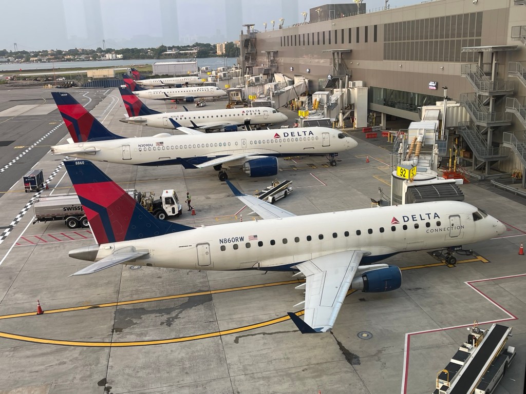
I was on my way to Sunnyside for one last visit before heading back to Pittsburgh via LaGuardia. 40th/Lowery stop was my destination.
– photo by Mitch Waxman
There was also very little chance that I wouldn’t click the shutter for that view above, either. It was positively sultry out, but there you go.
Momentary or even days long discomfort is just something you have to deal with when traveling. Toughen up, I always say. Then I’m told that ‘you’re a monster’ by some Millennial worm, and that one should embrace personal failings and or weaknesses and incorporate them as the core of my identity.
I offer the band Black Flag’s ‘Rise Above’ for an alternative philosophy.
– photo by Mitch Waxman
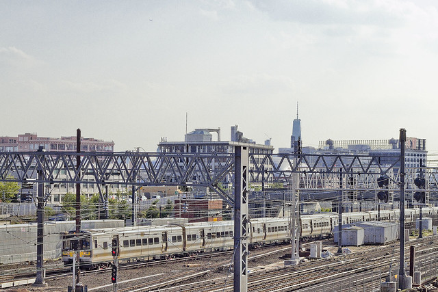
After my convivial coffee with an old friend in Sunnsyide, it was back to scuttling for me. I decided to head towards Astoria, and along the way stopped off at ‘Hole Reliable’ at Sunnyside Yards. This is an aperture in the plate steel fencing of the rail yard which I exploited for years and years.
It’s likely a surveyor’s hole, but it’s big enough to fit a camera lens through, and overlooks the Harold Interlocking – which are the busiest rail tracks in the United States… so…
Mainly LIRR and Amtrak, but New Jersey Transit is spotted here every now and then as well.
– photo by Mitch Waxman
MTA finally finished one of their projects here, a holding yard and new siding for the Long Island Railroad. They were working on this for decades, it feels like. Part of the East Side access project, I think.
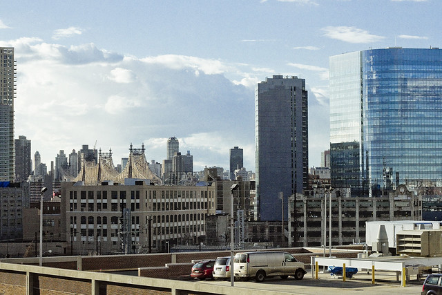
I headed over to Astoria, and despite swearing up and down I wasn’t going to go to my old bar on Broadway and 42nd, there I was drinking a Guinness and talking shit with random guys at the bar. I only knew a couple of the guys there, but it was early and I had a plane to catch.
– photo by Mitch Waxman
A cab carried my carcass over to LaGuardia, and by this point – the ankle was pissed off. A slight limp had crawled back in.
I got through security, and that’s when I found out about the delayed flight. At least it was air conditioned, though. I plugged in my phone, kicked off my shoes, and settled into ‘waiting’ mode.
– photo by Mitch Waxman
This shot was captured using my phone, which is why it looks a bit different than the others. My flight eventually boarded, about four hours late, and I was back in Pittsburgh around one in the morning. Had to wait a good amount of time before a cab was available, and walked in the door at HQ in Dormont around 2:30 in the morning.
Back next week.
“follow” me on Twitter- @newtownpentacle
Buy a book!
“In the Shadows at Newtown Creek,” an 88 page softcover 8.5×11 magazine format photo book by Mitch Waxman, is now on sale at blurb.com for $30.
public building
Sunnyside Yard, in today’s post.
– photo by Mitch Waxman
Everybody always asks me how I get these shots, or about certain qualities in them. Simple answer is that I’m always experimenting with the camera, and when I come up with some protocol for “how to get this or that” my next move is usually to reverse it and see what happens.
How do you get to Carnegie Hall? Practice, my friend, practice.
The setting: Recently, an evening meeting carried one up the hill from the elluvial flatlands of Southern Astoria to the heights of the ridge which Sunnyside was built into. Between these two neighborhoods, there’s a former tidal swamp into which the Sunnyside Yard was embedded back in the first decade of the 20th century. Once the largest rail coach yard on earth, the Yard still hosts the busiest rail junction found on the continent, the so called Harold Interlocking. The busy part is due to the frequent passage of Long Island Railroad commuter rail trains, which share the switches and rails with Amtrak.

– photo by Mitch Waxman
The conditions: Sunset to the west, which I was going to be shooting right into. The weather was humid, and a bit misty. The point of view is surrounded by steel plated chain link fencing whose purpose is to deny observation of vulnerable infrastructure (I’m told that this fencing was installed during the first decade of the Terror Wars). One such as myself has a vast catalog of fence holes and gaps which are dearly held, and since my meeting in Sunnyside would carry one past an entire series of these occluded viewpoints, a point was made to pocket one of my lenses small enough to fit into while leaving HQ. I also brought some chewing gum, but that’s not important.
My “good lenses,” which are used in particularly high rotation, have a circumference too large for these cracks in the walls around the Sunnyside Yard – so a “decent” lens which has a decidedly smaller diameter was employed.

– photo by Mitch Waxman
The “decent lens” mentioned is the so called “nifty fifty” offered by Canon. It’s far and away my most inexpensive tool, and allows wide open apertures which would make it handy for night time shots but for its persnickety focusing mechanics. The term for what it does, autofocus wise, is called “hunting.” What that means is that it noisily rolls through the range of focus and never quite settles itself into a lock. My usual habit with this sort of thing is to use autofocus to “get it close” and then switch the thing over to manual focus for final adjustment.
The optic formula of the lens also renders things a bit less “contrasty” than I’d like, but you can’t really complain about camera equipment which retails for around a hundred bucks – especially when it fits through fence holes.

– photo by Mitch Waxman
The methodology: For those of you not in the know, as to how cameras and lenses work – a “bright lens” will allow you to operate it at wide apertures (f1.8 in the instance of the nifty fifty). Wide apertures create a tremendous “depth of field” effect, which means that the area which is in focus will appear sharply delineated and everything else will be blurred. Higher aperture settings – the “f-stops” as it were – will create a hyperfocal range in which everything in frame will be sharply defined. The lower the “f-stop” the more light enters the camera, and the higher ones allow less light to get to the sensor. You balance the shot using shutter speed and ISO settings. Night shots and interior spaces require you to use the lens “wide open,” with slow shutter speeds, and higher ISO settings – all of which introduce certain quality issues to the captured image.
The shots in today’s post were consciously captured with the desire to have “everything” in focus, with a minimum of motion blur as well, and to record a full range of color and tone. Difficult to do with the sun behind the scene, and in a setting where everything is made of contrasting reflective surfaces.
My formula was to actually reverse my night shooting protocol on 2/3rds of the exposure triangle, using a very narrow f-stop and fairly fast shutter speed, but with a high ISO setting for tone and color sensitivity (f10, 1/1250th of a second, ISO 800). Sometimes, particularly during the summer, the problem isn’t that there enough light – there’s actually too much of it and some methodology needs to be employed to control it. Experimentation and failure often emanate from screwing around with your normal shooting habits, but sometimes it pays to mix things up a bit.
“follow” me on Twitter- @newtownpentacle
Upcoming Tours –
July 12th, 2015
Glittering Realms Walking Tour
with Newtown Creek Alliance, click here for details and tickets.
psychologically sensitive
Another darkling image in today’s post.

– photo by Mitch Waxman
As mentioned yesterday, an attempt to catch up on my many deadlines is under way, hence a single shot with little commentary is offered.
Upcoming Tours
Saturday- September 28, 2013
Newtown Creek Boat Tour with the Working Harbor Committee- tickets on sale now.
Saturday – October 19, 2013
The Insalubrious Valley of the Newtown Creek with Atlas Obscura- tickets on sale soon.
Sunday- October 20th, 2013
The Poison Cauldron of the Newtown Creek with Brooklyn Brainery- tickets on sale now
“follow” me on Twitter- @newtownpentacle
higher order
“follow” me on Twitter at @newtownpentacle

– photo by Mitch Waxman
Happy Monday Newtowniverians, and a healthy one is wished for all the Brooklynites and Queensicans out there.
Today’s post displays a couple of interesting shots I managed to grab before a meeting held at LaGuardia Community College for the Newtown Creek CAG.
This CAG is a sort of advisory/community group which has formed up around the edges of the EPA Superfund project. The CAG is a requirement for EPA, and they periodically convene a meeting to inform us about their activities and overall status of the process.
from epa.gov
A Superfund Community Advisory Group (CAG) is made up of members of the community and is designed to serve as the focal point for the exchange of information among the local community and EPA, the State regulatory agency, and other pertinent Federal agencies involved in cleanup of the Superfund site.

– photo by Mitch Waxman
In this meeting, during which a presentation from the NYC DEP was offered describing a forthcoming dredging project on Newtown Creek, discussion of various issues surrounding the Superfund project between Federal officials and community representatives was offered. Everyone else in the room was a lettered professional or community leader or of high professional caliber, representing every conceivable office, power, and potentate involved in the Newtown Creek story.
Then there’s me, who kept on having his attention drift over to the Sunnyside Yard and the fantastic views of it at rush hour which I wasn’t photographing.
from newtowncreekcag.wordpress.com
Newtown Creek CAG membership is structured on a rolling basis. The Superfund process on Newtown Creek will take many years, and interested stakeholders are encouraged to become CAG members as they learn of and want to fully participate in the process.
The CAG is designed to serve as an ongoing vehicle for information-sharing, discussion, and, where possible, consensus-building regarding decision-making related to the Newtown Creek Superfund Site. Its members represent a diverse cross-section of key stakeholder interests, including affected property owners, concerned residents, local governments, community groups, environmental groups, health experts, the business community, and others as appropriate. Requirements and responsibilities for CAG members are described in the CAG’s Operating Procedures, posted in the Resources tab.
– photo by Mitch Waxman
An odd duck, even after all these years, it is so strange to think that someone like me is even allowed in the building let alone invited to participate and offer both questions for correct answering and contribute direct observations of obscure places being discussed. The folks at EPA have shared some of their early findings, which have greatly excited the scientific minded and fired the imaginations of those who imagine a “greener” city. Check out the CAG site for details.
“out of your depth”- meaning: in water that is so deep that it goes over your head when you are standing: I’m not a strong swimmer so I prefer not to go out of my depth.
nature and position

– photo by Mitch Waxman
Shenanigans continue on the weekends, here in the heart of the perennial “next big thing” known to most as Long island City. When the “next big thing” term originally applied, in 1909, it actually was true and a vast industrial city sprang forth from amongst scattered mills and swamps overlaid with rail tracks. That whole thing lasted around twenty or thirty years, whereupon the neighborhood began a long and slow decline. In the late 1980’s, LIC became the “next soho” and then in the late 90’s the “next DUMBO”, and of late the “next Williamsburg”. Problem is that these days, it’s just kind of difficult to get around the place without a car, which is ironic, as this is where all the trains are headed.
from mta.info
Work Completed
Court Sq Station was closed for ten weeks between January and April. During the time the station was closed, we replaced the Manhattan-bound and Flushing-bound platforms and windscreens (platform walls), installed ADA accessible boarding areas, tactile warning strips, and signage. In addition, new track and platform to mezzanine stairways were installed and the station’s mezzanine and columns on station platforms were painted.
At Hunters Point Av, during an 11-month construction project we installed new column and wall tiles, a floor in the mezzanine, new railings and stainless steel handrails and light fixtures above stairs. In addition, we refurbished the street and platform stairs, painted the mezzanine, platform and track ceilings and repaired structural steel above the platforms and tracks. Also, water leaks were sealed and the public address system was modified.
A six-month station improvement project at Vernon Blvd-Jackson Av resulted in repairing/replacing station column and wall tiles; repairing platform surfaces and platform edge concrete; and repairing and painting platform and track ceilings. Station lighting and platform drainage was upgraded, and tactile ADA (Americans with Disabilities Act) warning strips and new rubbing boards (edge of platform) were installed.

– photo by Mitch Waxman
They just love to mess around with us on the weekends, don’t they? Turn off entire subway lines while running the buses on weekend schedules. Just a few weeks ago, signal problems on the R and N tracks also shut down the G, F, and E- all this on the same day that 7 service was closed for maintenance. This put western Queens in quite a pickle, except for those who ride bicycles or drive cars.
from wikipedia
Long Island City is served by the elevated BMT Astoria Line (N Q trains) and IRT Flushing Line (7 ; trains) of the New York City Subway. It is also served by the underground IND 63rd Street Line (F train), IND Queens Boulevard Line (E F M R trains) and IND Crosstown Line (G train). The Long Island City and Hunterspoint Avenue stations of the Long Island Rail Road are here, and a commuter ferry service operated by NY Waterway at the East River Wharf. Cars enter by way of the Queensboro Bridge, the Queens Midtown Tunnel and the Pulaski Bridge. The Roosevelt Island Bridge also connects Long Island City to Roosevelt Island. Queens Boulevard, Northern Boulevard (New York 25A) and the Long Island Expressway all pass through the area.

– photo by Mitch Waxman
The “next big thing”, you have to understand, is the concentrating point of transportation infrastructure on western Long Island. The Long Island Expressway terminates at the Midtown Tunnel, and the various rail tunnels peppered about this ancient city are the choke point for subway, LIRR, and Amtrak service into and out of Manhattan. Losing any one piece of the system is massively disruptive, especially when it becomes a multi month affair as it was in the first quarter of 2012. Luckily, we are about to enjoy another protracted period of transit outages in 2013, and your humble narrator has grown quite used to walking.
from wikipedia
The Steinway Tunnel carries the 7 ; trains of the New York City Subway under the East River between 42nd Street in Manhattan and 51st Avenue in Long Island City, Queens, in New York City. It was originally designed and built as an interurban trolley tunnel (hence the narrow loading gauge and height), with stations near the 7 ; trains’ current Hunters Point Avenue and Grand Central stations. It is named for William Steinway, who was a major promoter of its construction, although he died in 1896 before it was completed.
Also- Upcoming Newtown Creek tours and events:
for more information on the October 27th Newtown Creek Boat Tour, click here

for more information on the November 9th Newtown Creek Magic Lantern Show, click here

for an expanded description of the November 11th Newtown Creek tour, please click here


