Archive for the ‘English Kills’ Category
fulgent images

– photo by Mitch Waxman
This is not the world you know, this 3.8 mile long cataract of water which forms the currently undefended border of Brooklyn and Queens, whose mouth is found directly opposite the Bellevue Psychiatric Hospital in Manhattan. The very air you breathe is a poisonous fume, and beneath the languid ripples of its mirrored surface hide a morass of centuries old poisons which have been allowed to agglutinate and congeal in fuligin depths. This is where the industrial revolution actually happened, around the canalized bulkheads of the infamous Newtown Creek.

– photo by Mitch Waxman
Great fortunes have arisen here- the Pratts, and Rockefellers, even Peter Cooper- all grew fat at this banquet table. Five great cities arose around the Creek- Williamsburg, Long Island City, Greenpoint, Bushwick, and New York- and by 1900 a thriving maritime industry saw more cargo cross this tiny waterway than could be found on the entire Mississippi river. The vast populations of those five cities found employment here, in titan rail yards and factory mills whose smokestacks blotted out the light cascading down from the burning thermonuclear eye of god itself. This is where the bill came due in the early 20th century, as you cannot have a “Manhattan” without causing a “Newtown Creek”.

– photo by Mitch Waxman
Thought irredeemable, this place became a dumping ground, with raw sewage and every imaginable kind of filth allowed to pool and mingle with the water. By the end of the 20th century, it was a literal backwater and forgotten by all but those cursed to live nearby. Petroleum swirls about beneath the ground, mingling with the esoteric byproducts of early chemical factories and one and a half centuries of breakneck industrial growth. The top soil is impregnated by heavy metals, asbestos, and tons of soot deposited daily by automotive exhaust. Along the rotting bulkheads, sediment mounds of sewage rise from the water, and from forgotten pipelines unknown chemical combinations drip and drool. Who can guess, all there is, that might be buried down there?

– photo by Mitch Waxman
Hope rises, however, at the start of the Superfund era. Federal authorities have begun the laborious process of analyzing and categorizing those sediments which lie fifteen to twenty feet thick on the bottom of the waterway, colloquially referred to as “Black Mayonnaise”. The Superfund legislation which governs their actions has compelled them to remove and remediate these sediments, and deliver Newtown Creek to the future in a healthier condition. Community groups, industrial stakeholders, and officials from both the State and City have begun the task of planning the Newtown Creek of future times. This is the literal backbone and center of New York City.
inaccessible locality

– photo by Mitch Waxman
It would be nice to own a piece of Newtown Creek real estate, don’t you think? I know this sounds like an odd dream of mine, but I’d really love to buy some waterfront parcel were I financially capable. The whole lot would be fairly feral after a short time, of course, except for the teams of archaeologists I’d invite to dig there for treasure. Captain Kidd is supposed to have buried a chest of pirate booty somewhere on the Brooklyn side, don’t you know?
The creek is the receptacle for all the refuse from the sewers, factories, and slaughter-houses of the east of Brooklyn; constant deposits are therefore forming in it, especially at the upper end, from these causes and from the caving in of the unprotected banks, which consist of marsh mud. To remedy this difficulty, annual dredging will be needed until the banks are protected by bulkheads throughout their whole length. The commerce of the creek is so large that this improvement should be pushed at least 3 mile.s up from the mouth as soon as possible, so that vessels drawing 20 to 23 feet may pass in and out of the creek with full cargoes at or near low water.

– photo by Mitch Waxman
Wouldn’t live there, of course, but there would be a public dock. Assuming that a multi million dollar property like this was within my reach, I’d probably have enough left over for one of those flat bottom boats with the big propellor on the back that they use in the swamps of Florida and Louisiana to hunt gators. Of course, I can’t afford the nice zoom lens that I covet, and that’s just a couple thousand, so I can just forget about owning a valuable industrial bulkhead. The last people who let this land go cheap were the aboriginal Lenape, and they were largely wiped out by Smallpox by the 1680’s.
from “Queens Borough, New York City, 1910-1920; the borough of homes and industry, a descriptive and illustrated book setting forth its wonderful growth and development in commerce, industry and homes during the past ten years … a prediction of even greater growth during the next ten years … and a statement of its many advantages, attractions and possibilities as a section wherein to live, to work and to succeed” at Archive.org
Some further idea of the immense commerce of this waterway can be obtained from the figures compiled by the Department of Plant and Structures of New York City, which show that during the year 1918, 59,389 boats passed through the Vernon Avenue Bridge, 56,735 passed through the Greenpoint Avenue Bridge, 27,000 through the Meeker Street Bridge and 5,007 through the Grand Street Bridge.
Steamers schooners and unrigged vessels are the principal freight carriers. Their drafts range from 5^ to 20 feet; 2 to 19 feet; 2 to 18 feet respectively. Some steamers of still larger draft lighter in their cargoes.
Among the larger plants on the Queens shore of Newtown Creek are the National Sugar Refining Company, Nichols Copper Company, National Enameling and Stamping Company, General Chemical Company, Standard Oil Refineries. American Agricultural Chemical Company, and the Wrigley Chewing Gum Company.

– photo by Mitch Waxman
It’s a stupid aspiration, and even dumber to think that I’d just let scholars “have at the place”. What could possibly be learned by turning over a few shovels of dirt in this place, where the only tale to tell is about a certain oil spill or endemic pollution? What else has ever happened here?
from junipercivic.com
On September 15, 1776, General Lord Howe decided to attack Manhattan Island. He ordered three Ships of War to sail up the North River and get the American’s attention while he launched his entire First Division in flatboats against Kips Bay. The flatboats were embarked from the head of Newtown Creek as General Lord Howe and General Warren watched from the Sackett-Clinton House (later Gov. DeWitt Clinton’s mansion) in Maspeth. The Americans on Manhattan Island under General George Washington made their retreat to Harlem and escaped the British attack.

– photo by Mitch Waxman
Can you imagine how cool it would be to restore just a single section of the Newtown Creek to its natural state? To see the salt marsh grasses rippling in the wind, and stout trees sprouting, beneath the golden rays of the burning thermonuclear eye of god itself? What could possibly go wrong with that?
from 1901’s “Forest and stream” Volume 57- By William A. Bruette, courtesy google books
Mosquitoes Galore
Lieutenant Schwatka’s experience with mosquitoes reminds me. Years ago I crossed the Newtown salt meadows on a horse car. It was from a point where Williamsburg left off and Newtown then called Maspeth began. Both are now included in Greater New York. The sun had set and in the twilight from the surface of the meadows could be seen innumerable coils of smoke each one as clearly defined and separate as if emanating from the dying embers of a redman’s camp fire.
First would the dark mass of smoke leave the ground in a slender spiral thread to broaden out as it ascended keeping up the spiral twining of the cloud.
This phenomenon could be seen upon the entire stretch of meadow ahead of us. It was a curious and interesting sight to watch those thousands of small camp fires giving forth their spiral canopies of smoke.
The air had been still and quiet and the smoke ascended slowly and gracefully from the grass. Suddenly a gust of wind passed over the meadows blowing toward us and instantly the spiral harmony of the situation was changed into a grayish atmosphere and as it reached the open car in which I sat a realization that we were looking at spiral clouds of mosquitoes arising from the grass instead of smoke was forcibly thrust upon myself and the well filled car of passengers.
The woodwork of the car the inside of the roof the backs of the seats the hats and clothing of the passengers instantly assumed a dark gray color. The horses were covered from head to foot and became almost unmanageable The car became as some one once remarked all bustle and confusion.
While the passengers with handkerchiefs whipped the mosquitoes from their necks and faces the driver urged the frantic horses to their utmost speed and after a race of about ten minutes we emerged from the meadows and spent the remainder of the trip gradually getting rid of the mosquitoes that were traveling in our car.
I know nothing about Alaska mosquitoes but if they are as thick every summer’s day in Alaska as they were that particular evening twenty years agp on the Newtown Creek meadows then I wonder how grizzly bears moose or any other furred animals can live in Alaska and thrive
-Charles Cristadoro
Project Firebox 39

– photo by Mitch Waxman
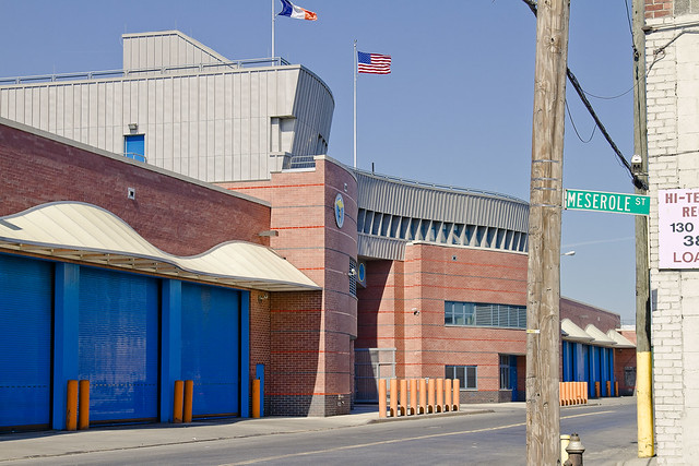
Buried to its waist in modernity, this scarred sentinel against the flames of dissolution adorns the driveway of the gargantuan waste transfer station on Varick Avenue in Brooklyn which is maintained by the Waste Management folks.
skillfully wafted
– photo by Mitch Waxman
As mentioned in the Newtown Pentacle posting “Approaching Locomotive“, a recent opportunity to visit the gargantuan Waste Management facility on Varick Street in Brooklyn (whose back yard abuts the English Kills tributary of the fabled Newtown Creek) materialized. your humble narrator has long desired to witness the place, so I jumped at the chance.
As a note- I’m a member of Newtown Creek Alliance, and so is one of the subjects of this posting. Said admission is offered in the name of avoiding charges of bias, nepotism, or cronyism.
from wikipedia
Waste Management, Inc. (NYSE: WM) is a waste management, comprehensive waste, and environmental services company in North America. Founded in 1894, the company is headquartered the First City Tower in Houston, Texas.
The company’s network includes 367 collection operations, 355 transfer stations, 273 active landfill disposal sites, 16 waste-to-energy plants, 134 recycling plants, 111 beneficial-use landfill gas projects and six independent power production plants. Waste Management offers environmental services to nearly 20 million residential, industrial, municipal and commercial customers in the United States, Canada, and Puerto Rico. With 21,000 collection and transfer vehicles, the company has the largest trucking fleet in the waste industry. Together with its competitor Republic Services, Inc, the two handle more than half of all garbage collection in the United States.

– photo by Mitch Waxman
Accompanying a class of high school students from “The Green School” on Graham Avenue in Williamsburg, we arrived at the Titan depot early in the afternoon. Early for the diurnal, of course, but late in the day for the Waste Management folks who get more accomplished before sunrise than most do by sunset.
The Green School is a 9th-12th grade learning community that develops science, math, literacy, and social studies skills in the context of New York City’s many environments. Through rigorous interdisciplinary curricula and hands-on experiential projects, students will engage with their environment, participate meaningfully in community life, and prepare for their futures.
While focusing on “green” careers, the school’s primary theme is sustainability, a concept and a practice that incorporates and recognizes the interconnectedness of the environment, the economy, society, and culture and promotes practices with the future in mind. The curricula focus on giving students scientific, historical, and contextual knowledge to make meaningful connections between their lives and the broader world, and the math and literacy skills they need to participate in that world. Students are able to demonstrate mastery of academic work in portfolios, examinations, and reflections by applying it to the world around them, explaining the geometry in the arc of an elevated train, deducing air quality using the scientific method, or designing and carrying out learning experiences for local elementary students. Students participate in community service projects, internships and apprenticeships, and do independent projects based on their interests each year.
The mission of The Green School lends itself to create a school environment open to the diverse needs of ELL, special education, gifted and struggling students. The Green School is committed to provide all students an education and the required skills that are transferable from the classroom to their collegiate and/or professional pursuits.

– photo by Mitch Waxman
The two fellows at either end of the shot above are Newtown Creek Alliance’s Michael Heimbinder and Marc Ottaviani, 11th grade English Language Arts teacher. Michael, in addition to his NCA work, is involved in several other projects- one of which is habitatmap.org.
from habitatmap.org
Michael Heimbinder, Founder & Executive Director
Michael Heimbinder is a writer, researcher, community organizer and information designer. Over the years he has collaborated with a wide range of environmental and human rights organizations including the Newtown Creek Alliance, the United Nations Equator Initiative, the Ghana Wildlife Society and Food First. He is also a Fellow at the Oakland Institute and a technical advisor to the Organization of Waterfront Neighborhoods where he consults on solid waste management issues in New York City. Michael is a graduate of Colorado College and received his M.A. in International Affairs from the New School for Social Research.

– photo by Mitch Waxman
The program which the kids are taking part in, funded by the NYCEF fund of the Hudson River Conservancy, is built around the habitatmap concept, and is described thusly:
“School to develop and teach a ten week course that instructs 11th grade students on maps-based research methods focusing on two facilities adjacent to Newtown Creek: the Newtown Creek Wastewater Treatment Plant and Waste Management’s Varick Avenue Transfer Station. The selected facilities are the starting point from which the students are examining water and waste systems by geographically tracing the material flows and institutional networks that connect these facilities to the larger world. The students’ findings will be documented using HabitatMap’s community mapping platform and integrated into a maps-based research methods toolkit. The toolkit will be used by high schools, both in New York and nationally, to conduct investigations of water and waste systems in their own communities using examples from Newtown Creek.
By developing coursework that combines technology, classroom learning, and field research the curriculum is specifically designed to meet the Green School’s mission, which aims to prepare students for their future studies and employment “through rigorous interdisciplinary curricula and hands-on experiential projects that encourage students to engage with their environment and participate meaningfully in community life.”
also from habitatmap.org
Mission
HabitatMap is a non-profit environmental health justice organization whose goal is to raise awareness about the impact the environment has on human health. Our online mapping and social networking platform is designed to maximize the impact of community voices on city planning and strengthen ties between organizations and activists working to build greener, greater cities. Utilizing our shared advocacy platform participants can:
- Alert the public to environmental health hazards
- Hold polluters accountable for their environmental impacts
- Highlight urban infrastructures that promote healthy living
- Identify future opportunities for sustainable urban development
- Promote policies that enhance equitable access to urban resources

– photo by Mitch Waxman
As such class trips have begun since the dawn of time, we were brought to a room where one of the Waste Management superintendents and staff described the process, and procedural habits, of the transfer station. A transfer station, for those of you unused to such terminology, is a concentrating point for the garbage collected by the DSNY and others for sorting and containerizing. The white collection trucks carry their cargo here, where it is loaded onto train cars for eventual disposition into (usually out of state) landfills.
from wikipedia
A transfer station is a building or processing site for the temporary deposition of waste. Transfer stations are often used as places where local waste collection vehicles will deposit their waste cargo prior to loading into larger vehicles. These larger vehicles will transport the waste to the end point of disposal in an incinerator, landfill, or hazardous waste facility, or for recycling
In the future, transfer stations could be equipped with material recovery facilities and with localized mechanical biological treatment systems to remove recyclable items from the waste stream.

– photo by Mitch Waxman
When the DSNY trucks arrive at the facility, they are weighed on enormous vehicle scales like the ones in the shot above. When exiting the facility, they are weighed a second time, and the differential is recorded as the tonnage of waste which was delivered. My understanding is that in the contract Waste Management enjoys with the City of New York, the fees paid for the handling of this putrescent lahar are assessed on a “per ton” basis.
from gothamgazette.com
Other parts of the city’s solid waste plan have moved forward. Twenty-year contracts have been either negotiated or are in effect with Waste Management of New York to export trash from Brooklyn, the Bronx and Queens. The sanitation department is currently negotiating with the Port Authority of New York and New Jersey for a long-term contract to take the vast majority of Manhattan’s refuse to a waste-to-energy plant in New Jersey.
At the time of the solid waste management plan’s approval, the administration argued long-term contracts would save the city money, and it would get the city’s trash off of dirty diesel trucks. Almost 90 percent of city trash, the mayor promised, would be sent by rail or barge instead.
According to the Department of Sanitation, the cost of exporting the city’s trash has increased per ton from $61.30 in 2000 to $92.80 in 2010 — a 20 percent increase over the rate of inflation. As of April, 33 percent of the city’s trash has been unloaded from trucks and put on rail cars — an increase from 14 percent in 2006, according to the solid waste plan.
None of the city’s waste is currently exported by barge, according to the Department of Sanitation, because those transfer stations have not been completed.

– photo by Mitch Waxman
We were informed that our arrival in the afternoon was fortuitous as Waste Management’s schedule is precisely administered to conclude sorting and containerization by a certain time of day which allows them purchase to clean and disinfect their mill. The representatives explained that they are regularly visited by inspection officers and are contractually obligated to several “best practice” regulations.
from habitatmap.org
In 2006 Waste Management NY 215 Varick handled 652,706 tons of material; this sum represents 5.3% of all waste exported through transfer stations in New York City.

– photo by Mitch Waxman
Late in the night and early morning, fleets of collection trucks arrive here, are weighed, and “tip” or discharge their cargo. Enormous machinery, clawed derricks and jotun sized earth moving equipment, flies into action. This can be an enormously dangerous place to work, were routine safety procedures not strictly observed. Even so, extreme caution was urged as we moved into the relatively empty transfer station.
from nyc.gov
Each week, in Fiscal Year 2010, the Department assigned approximately 4,941 trucks to collect 49,922 tons of curbside residential refuse and scheduled 460 E- Z Pack and Roll-on/Roll-off containerized trucks to collect an additional 8,000 tons. The amount of refuse generated by the 8.2 million residents of New York City is subject to seasonal variations. Each month, the Department allocates weekly truck and tonnage targets to each of its 59 districts to better manage our productivity. These targets are closely monitored to ensure that productivity improvement goals are met. District Superintendents constantly evaluate routes and tonnage in their districts to achieve these targets.

– photo by Mitch Waxman
The extant mound of trash in these shots was huge, but as mentioned by the Waste Management people, represented only a small fraction of what they handle daily. In fact, they were quite nearly finished processing the daily waste of most of Brooklyn when we arrived. They also explained that the relative lack of odor was due to state of the art equipment maintained at the site which accomplished odor control and elimination via technological means.

– photo by Mitch Waxman
For scale, this stitched panorama image is included. That’s Mr. Heimbinder in the foreground, and he’s around six feet tall. The trash pile was roughly thirty to forty feet high, and covered a fairly large parcel of floorspace. Any estimate I could offer would be wrong, as your humble narrator is notorious for overestimation of such matters. Somewhere between a regulation basketball court and a regulation football field would be my best guess.

– photo by Mitch Waxman
The Waste Management crew were waiting for us to exit the facility before they got back to work, and as schedules must be maintained- we were escorted along. Like a lot of the people you meet in the garbage industry, they were really nice and seemingly “regular joes” who took their jobs seriously. A few of the Waste Management and DSNY personnel who were on site also talked to the kids, assuring them that these were “good jobs” with great pay and a full package of benefits.

– photo by Mitch Waxman
Your humble narrator knows quite a few people employed in this industry, at both public agencies and private carting firms. None of them regret their choices, career wise, but for the early start time which is common at such jobs. Most of the folks I know who are engaged in this trade leave home before the sun comes up, arriving at work by 5 A.M. or thereabouts. Often, a change of clothes is kept in the trunk, as their work clothes can become quite soiled as the day goes on. After a shower, you’d never know what they do for a living.
approaching locomotive

– photo by Mitch Waxman
On Morgan Avenue in the ancient section of industrial Brooklyn, not far from the legendary heart of darkness which is the English Kills tributary of the Newtown Creek, there may be observed a rail crossing. Part of the so called LIRR Bushwick Branch, recent opportunities have allowed me to fill in a missing piece of the great puzzle.
from wikipedia
The Bushwick Branch, also called the Bushwick Lead Track, is a freight railroad branch that runs from Bushwick, Brooklyn, to Fresh Pond Junction in Queens, New York, where it connects with the Montauk Branch of the Long Island Rail Road. It is owned by the LIRR but operated under lease by the New York and Atlantic Railway, which took over LIRR freight operations in May 1997.

– photo by Mitch Waxman
By no means should it be inferred that any special knowledge of the history of street grade rail in Brooklyn is possessed by your humble narrator, as this is still a subject under study around Newtown Pentacle HQ. If you were to look left (or south west) while on Morgan Avenue and traveling northward, this is what you’d see, way back here in the Cripplebush.
from wikipedia
East Williamsburg is a name for the area in the northwestern portion of the borough of Brooklyn in New York City, United States, which lies between Williamsburg, Greenpoint, and Bushwick. Much of this area has been and still is referred to as either Bushwick, Williamsburg, or Greenpoint with the term East Williamsburg falling out of use until the 1990s. East Williamsburg consists roughly of what was the 3rd District of the Village of Williamsburg and what is now called the East Williamsburg In-Place Industrial Park (EWIPIP), bounded by the neighborhoods of Northside and Southside Williamsburg to the west, Greenpoint to the north, Bushwick to the south and southeast, and both Maspeth and Ridgewood in Queens to the east.
Although the City of New York recognizes East Williamsburg as a neighborhood, there are no official boundaries to East Williamsburg since the City only officially delineates Community Districts and Boroughs, not neighborhoods.

– photo by Mitch Waxman
Looking right, or north east, you’ll see what appears to be a locomotive right of way that terminates at a distant green wall. The Bushwick line has been explored by many others who are braver of heart than I, including Diego Cupolo and Forgotten-NY’s own Kevin Walsh. There’s a missing piece in their accounts (which to be fair, has been off limits to inspection by passerby for some time), however, which recent serendipity allows me to bring to you.
This is, after all, part of Newtown Creek.
from The Eastern District of Brooklyn By Eugene L. Armbruster, via google books
BEYOND THE NEWTOWN CREEK
In the olden times the lands on both sides of Newtown Creek were most intimately connected. County lines were unknown, the creeks were dividing lines between the several plantations, for the reason that lands near a creek were taken up in preference to others, and the creeks were used in place of roads to transport the produce of the farms to the river, and thus it was made possible to reach the fort on Manhattan Island.
The territory along the Newtown Creek, as far as “Old Calvary Cemetery” and along the East River to a point about where the river is now crossed by the Queensboro bridge and following the line of the bridge past the plaza, was known as Dutch Kills. On the other side of Old Calvary was a settlement of men from New England and, therefore, named English Kills. The Dutch Kills and the English Kills, as well as the rest of the out-plantations along the East River, were settlements politically independent of each other and subject only to the Director-General and Council at Manhattan Island, but became some time later parts of the town of Newtown.

– photo by Mitch Waxman
An obsession of mine, let’s just name it a calling, is to photograph every possible corner of the Newtown Creek watershed.
Challenging, most of the shoreline is under lock and key, and many parts of it are under strict supervision by security personnel and police authorities. The spot these shots were gathered from is even hazy ground, and although I never stepped on the tracks and stayed to the extreme sides of the pathway, I was probably violating a “no trespassing” rule which I wear on my sleeve.
The presence of graffiti and a largish homeless camp I know to exist back here made me feel that any rule against taking a look around is lightly enforced by the gendarme and the proverbial dice would be thrown.
Speaking of dice, a locally famous accident occurred on the Bushwick line back in 2004.
from ntsb.gov
LIRR 160 traveled about 1.2 miles on the Bushwick Branch, passing over seven passive highway/railroad grade crossings. The event recorder indicated that the locomotive traveled the total distance of about 11,692 feet (2.2 miles) in 16 minutes 9 seconds and reached a maximum speed of about 31 mph.
During the runaway, LIRR 160 struck an automobile at one grade crossing and pushed it several hundred feet. The two occupants of this vehicle sustained serious injuries and required hospitalization. At another grade crossing, the locomotive struck two more automobiles, resulting in serious injuries to their drivers, who also required hospitalization. Two trucks were parked along the tracks near another grade crossing. The locomotive struck the trucks and pushed them about 800 feet westward beyond the crossing before it stopped. One of the trucks was carrying welding supplies, including acetylene and oxygen cylinders; the cylinders were damaged during the accident and caused a fire. The trucks were unoccupied; however, employees of the trucks’ owner had to jump away from the track to avoid injury.
As LIRR 160 collided with the automobiles and trucks, the struck vehicles were propelled in different directions and struck other vehicles. As a result, the accident damaged five other vehicles and a backhoe.

– photo by Mitch Waxman
Speaking of graffiti, these puzzling bits of signage were observed on a well painted wall. Like the “God’s Gift to Pain” graffiti at the end of English Kills, however, they filled me with some nameless dread.
from wikipedia
The first recorded use of the A in a circle by anarchists was by the Federal Council of Spain of the International Workers Association. This was set up by Giuseppe Fanelli in 1868. It predates its adoption by anarchists as it was used as a symbol by others. According to George Woodcock, this symbol was not used by classical anarchists. In a series of photos of the Spanish Civil War taken by Gerda Taro a small A in a circle is visibly chalked on the helmet of a militiaman. There is no notation of the affiliation of the militiaman, but one can presume he is an Anarchist. The first documented use was by a small French group, Jeunesse Libertaire (“Libertarian Youth”) in 1964. Circolo Sacco e Vanzetti, youth group from Milan, adopted it and in 1968 it became popular throughout Italy. From there it spread rapidly around the world.

– photo by Mitch Waxman
The icon in the tree part of this illustration is meant to be an “anarchy” symbol, but to me it looked like some multi lobed eye, if you know what I mean. Weird things go on around here, and this is no safe place, even while the radiant attentions of the burning thermonuclear eye of god itself are shining down upon the poison shores of English Kills.
from wikipedia
The “three-lobed burning eye” is one of many manifestations of Nyarlathotep, a messenger of the Outer Gods, from fiction penned by H. P. Lovecraft. This particular manifestation is a huge bat-winged creature, with a burning tri-lobed eye. In Lovecraft’s story “Haunter of the Dark,” the character Robert Blake discovers a Shining Trapezohedron in a church steeple in Providence, RI, a place of worship for the Church of Starry Wisdom cult. Narrowly escaping an unseen horror released by the Trapezohedron, Blake realizes the horror can only travel in the dark. When a storm and power blackout envelop the city, he scribbles down his findings, concluding the story with his terrified record of what he can only glimpse of the approaching beast. “I see it– coming here– hell-wind– titan-blur– black wings– Yog-Sothoth save me– the three-lobed burning eye…”

– photo by Mitch Waxman
Speaking of English Kills, this is the rail bridge which the tracks of the Bushwick Branch utilize to cross over it. In the background of the shot is one of the largest CSO outfalls in New York City and behind that is an access a ride parking depot and Johnson Avenue.
This is what it looks like from the water, incidentally, and long have I desired to see the New York and Atlantic crossing it from this perspective.
from habitatmap.org
- Combined Sewer Outfall – Newtown Creek 015
- Address Johnson Ave., Brooklyn, NY
- Neighborhood Newtown Creek
- Owner/Occupant NYC DEP
- Location Details Combined Sewer Overflow Outfall NC-015:
- discharges 344.4M gallons per year into English Kills
- Tier 2 outfall
- Ranked 20 out of over 400 in terms of volume
- located at Johnson Ave

– photo by Mitch Waxman
The bridge, which I’ve always heard referred to as “The Montrose Avenue Rail Bridge” is found some 3.8 miles from the East River, and regains land on the eastern shore of English Kills. Notice the green gate visible in the shot above.
from bushwickbiennial.com
James Riker’s 1706 “Bushwicklands” were separated from the original het dorp site by the estuary wetlands that would evolve from a creek into fetid industrial transportation canals (from the Dutch kil, trans. “body of water”). As the old farms were surveyed and sold as city-block lots, area borderlands became an underbelly serving the 19th century constructions of the “English Kills Canals,” the “Town of Bushwick” to the south, and the westerly “Village of Williamsburgh.” Becoming an offal zone for breweries, slaughterhouses, & chemical manufacturing, glass, rope & bag factories, and coal, oil, & stone distribution: the flatland meadows and canal basins provided business opportunities for waves of 19th century Central European immigrants that was near, but away from, metropolitan domestic life down Bushwick Ave.

– photo by Mitch Waxman
Here is that same gate, from the perspective of the trackway. The property behind that gate is the Waste Management Varick Avenue site, which is pretty much off limits. The fabled garbage train begins its journey to the continent here, as the Varick Avenue facility handles much of the putrescent waste produced in Brooklyn.
from wikipedia
Waste Management, Inc. (NYSE: WM) is a waste management, comprehensive waste, and environmental services company in North America. The company is headquartered in Suite 4000 at the First City Tower in Downtown Houston, Texas, in the United States.
The company’s network includes 367 collection operations, 355 transfer stations, 273 active landfill disposal sites, 16 waste-to-energy plants, 134 recycling plants, 111 beneficial-use landfill gas projects and 6 independent power production plants. Waste Management offers environmental services to nearly 20 million residential, industrial, municipal and commercial customers in the United States, Canada, and Puerto Rico. With 21,000 collection and transfer vehicles, the company has the largest trucking fleet in the waste industry. Together with its competitor Republic Services, Inc, the two handle more than half of all garbage collection in the United States.

– photo by Mitch Waxman
Speaking of Waste Management, the serendipity mentioned above involved your humble narrator joining with a group of students on a tour of the facility, and this is what the rail bridge looks like from the other side of the gate.
Welcome to the unknown country.
from dot.ny.gov
Waste Management has a substantial waste transfer operation located on English Kills upstream from the Metropolitan Avenue Bridge, incorporating all of the east side of the English Kills from Ten Eyck Street to the LIRR bridge near the head of the creek, an area of 24.7 acres. Currently, Waste Management uses the site to transfer commercial and residential refuse to trucks and rail for transport to landfills in New Jersey, as well as to store and maintain their trucks.

– photo by Mitch Waxman
Another posting coming in the near future will discuss the interior workings of this place, but for now, here’s where the Bushwick branch tracks continue on their course. This is where the folks at Waste Management containerize and load up the “garbage train”.
from nytimes.com
For decades, as trash has made its way from transfer stations in Brooklyn to out-of-state landfills, it has been shuttled through the borough’s streets on ground-rattling, smoke-belching tractor trailers.
The result: irritated neighbors and polluted air.
On Wednesday, Mayor Michael R. Bloomberg unveiled a plan to replace those trucks with trains. The city will now transport tons of garbage out of Brooklyn via railroad, which will take thousands of trucks off the street.
Speaking at a trash transfer station in North Brooklyn — with a trash-filled train behind him — Mr. Bloomberg said that the change would eliminate about 13,000 truck trips a year, helping the city meet ambitious goals for cutting carbon emissions.

– photo by Mitch Waxman
The tracks continue northeast across the property, and towards Varick Avenue. They cross Varick at Grade, and continue on their winding course toward the Fresh Pond depot, crossing Flushing Avenue in Maspeth and meeting connections toward Long Island City not far from Rust Street. This Rust Street connection offers access to the tracks which follow Newtown Creek through West Maspeth, Berlin, Blissville, and terminate ultimately at Hunters Point. Once, they carried cargo all the way to the East River, where Gantry Docks loaded them onto float barges for delivery in Manhattan and beyond.
from prnewswire.com
While many people balk at taking out the trash, it’s a job that the New York & Atlantic Railway does gladly — hauling 1.7 million pounds of residential and municipal waste each day, destined to Dixie in sealed containers riding aboard extra-long flat cars.
Monday through Saturday, a NY&A train crew goes over to the Varick Avenue transfer station in East Williamsburg, Brooklyn, where they couple up with 10-to-12 89-ft. flat cars loaded with up to 48 22-ft. long containers. Each has been stuffed with 18 tons of refuse, collected from homes and businesses in North Brooklyn.
The Varick Avenue facility was redesigned recently to accommodate rail shipments. It is owned and operated by Waste Management Inc. — one of the nation’s leading transporters and processors of municipal waste. NY&A began test movements in late January and handled its first regular shipment on February 16, 2009.

– photo by Mitch Waxman
This is the view from inside the gates on the Varick side of the Waste Management property…

– photo by Mitch Waxman
And this is the reversed POV, shot through a gap in the fence on the sidewalk.

– photo by Mitch Waxman
The line continues on the other side of Varick, in the distance, you can see the Scott Avenue Footbridge.
This “trainsarefun.com” page offers detailed schematics and historic shots of the Bushwick line, which are certainly worth a moment of your time.


