Archive for the ‘New York Harbor’ Category
primitive ruins
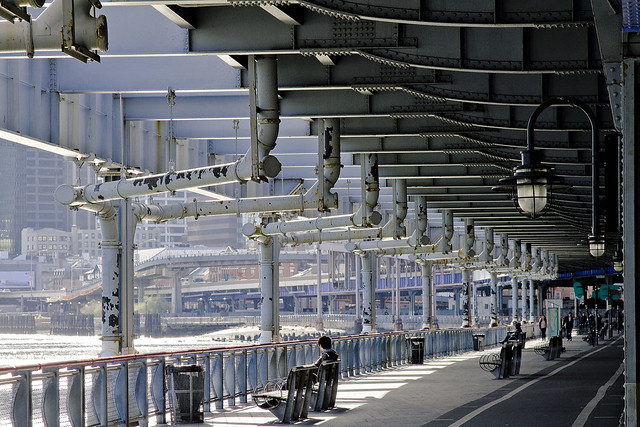
– photo by Mitch Waxman
Recent business brought me to Manhattan, and an opportunity to walk along the East River while moving downtown presented itself. A spectacular promenade has recently emerged along the coast of the Shining City, much of which is unfortunately cement. Shiny and new, the sections above Corlears Hook made me a little nervous, as if one had wandered into an architect’s drawing populated by spandex wearing fitness models riding bicycles and running determinedly. Downtown, between East River Bridge Two and One (Manhattan and Brooklyn) this waterfront parkland was just grungy and old enough to feel lived in, by ordinary folk.

– photo by Mitch Waxman
It is difficult to complain about these open air trottoirs, which allow the citizenry a chance to gaze at the splendors of the harbor, especially given what these areas were like a mere 20-30 years ago. Trash strewn and off limits, New York had left its waterfront to rot away. The great shame of it all, and this is where the kvetching and Monday morning quarterbacking comes in, is that the infrastructure of docks and wharfs which literally made New York great is gone- never to return. Once something becomes a park, it is virtually impossible for it to return to other usage. No ship will be arriving here ever again.

– photo by Mitch Waxman
It’s the way of things, of course, and long ago was it decided that maritime interests were unimportant to Manhattan. So few are the docks on the island nowadays that it is scantly possible to find a berth. Word has it that the various waterfront vision plans include the usage of “temporary” or “floating” docks at some point in the future, but the days when a ship could unexpectedly arrive in the City- laden with some mysterious cargo from the south seas- seem to be over.
middle stature

– photo by Mitch Waxman
It’s Maritime Sunday once again at this, your Newtown Pentacle, and today the focus is on Thornton Towing’s 1600 HP and 1958 vintage “Thornton Bros.” tugboat. Call sign WDD6171, Thornton Bros. is some 25m x 8m in size and has been clocked going as fast as 8 knots.
from wikipedia
Merchant and naval vessels are assigned call signs by their national licensing authorities. In the case of states such as Liberia or Panama, which are flags of convenience for ship registration, call signs for larger vessels consist of the national prefix plus three letters (for example, 3LXY, and sometimes followed by a number, i.e. 3Lxy2). United States merchant vessels are given call signs beginning with the letters “W” or “K” while US naval ships are assigned callsigns beginning with “N”. Originally both ships and broadcast stations were given call signs in this series consisting of three or four letters, but as demand for both marine radio and broadcast call signs grew, gradually American-flagged vessels were given longer call signs with mixed letters and numbers.

– photo by Mitch Waxman
From what I’ve been able to determine, the actual Thornton Brothers are local boys, although I’ve never met them. The tug Thornton Bros., however, seems to spend a lot of time transporting bulk metals around the harbor. These are the same sort of barges which one often observes at SimsMetal at Newtown Creek, so one might presume that they are part of the “recycling industrial complex”.
from marinesteel.com
Thornton Towing & Transportation is owned by Gerard and Richard Thornton, and Ed Carr; all of whom have spent their entire professional careers working on and around the waters of New York Harbor.

– photo by Mitch Waxman
Originally launched as the John E. Matton, the tug has had a long career and undergone more than one change of ownership. As is maritime custom, each owner has leased the boat with a unique sobriquet, which is detailed by the always reliable folks at tugboatinformation.com in the link below.
Built in 1958, by Matton Shipyard of Cohoes, New York (hull #325) as the John E. Matton.
The Morania Oil Tanker corporation chartered the vessel and eventually purchased her, where she was renamed as the Morania No. 12 .
When Morania phased out their canal fleet and the Morania No. 12 was acquired by Reinauer Transportation of Staten Island, New York where she was renamed as the Cissi Reinauer .

– photo by Mitch Waxman
John Matton was a shipbuilder upstate, located in Cohoes NY. A largely forgotten industrial center, Cohoes was also a center of brick manufacturing and to this day- one can discern thousands of red bricks scattered along the Hudson River shoreline.
The tale begins in 1899. An enterprising boat builder by the name of John E. Matton opened a boat building and repair facility along the enlarged, mule-drawn Champlain Canal about three miles north of the Waterford side-cut. At the time, the ill-fated “$9 million improvement” of New York’s canals was on life support but still limping along against the backdrop of corruption and scandal in Albany. John E. Matton had no reason to expect that he would not be able to work out of his present location for years and years to come.
Just four years later, however, after Theodore Roosevelt had appointed a new commission to chart a future for New York’s canals, the Barge Canal Act was passed by the State Legislature and approved by New York voters. What would this mean for John E. Matton? That his facility would be utterly useless in a matter of years when the new Barge Canal was completed.
garret studio

– photo by Mitch Waxman
There’s a whole lot of dredging going on.
It seems that the Harbor of NY itself is desirous of silting up, which would destroy its value as a commercial port. What the Harbor is actually doing is attempting to revert to the shallow estuary it once was, following the methodologies set down by nature, but this would impede navigation and be catastrophic for both the economic and urban activities of man.
When the terrorist is nature incarnate- the Marines, Army, or Air Force can’t help you at all. Forget about Homeland Security, for any problem that involves a whole lot of dredging you send in the United States Army Corps of Engineers!
from nan.usace.army.mil
New York Harbor encompasses approximately two-dozen separately authorized and maintained Federal navigation channels. These projects, whose authorized depths vary from 8 feet to 50 feet, along with the privately operated berthing areas, generate approximately 1 to 2 million cubic yards of sedimentary material annually from maintenance dredging alone. Further, several of these channels are either under construction or in plans for deepening in the upcoming years to accommodate larger vessels calling at the port. The construction of these deeper channels will also generate substantial amounts of dredged material. The DMMP process seeks to identify and implement options to manage the material generated from both the federal and non-federal maintenance and deepening of the Port through the year 2065.

– photo by Mitch Waxman
The USACE has over the course of time reshaped the course of mighty rivers, eradicated tall mountains, and they’ve even bent the Helegaat to its will. The USACE has powers and abilities far beyond those of ordinary men, which they employ in a neverending battle for the American Way. In the case of the modern dredging observed around the Kill Van Kull and Port Newark, the Corps are ensuring that the soft bottom of the waterway will be deep enough to allow an enormous class of cargo ship called “Panamax” to safely navigate the port.
This involves the movement and dispersal of a whole lot of dredging spoils.
from nytimes.com
For more than a decade, workers using giant digging machines have scooped up enormous mounds of rock, clay, sand and silt from the waters around New York to deepen the shipping channels to accommodate giant cargo vessels that will navigate the widened Panama Canal starting in the middle of the decade.
The dredging has produced millions of cubic yards of muck.

– photo by Mitch Waxman
There’s a few different machines which are involved in this sort of thing, and not just the claw bucket derricks which are filling barges in these shots. Lots of private contractors actually do the work, with a few key players getting the lion’s share.
Some effort has been made to find shots of these various devices- photos which a humble narrator clearly remembers shooting- but they are currently lost amongst the nearly 20,000 shots which I’ve obtained and uploaded for usage at Newtown Pentacle in the last few years.
As far as my hard drives go, there’s a whole lot of dredging that needs to be done.
from epa.gov
The Administrator of the EPA and the Secretaries of the Army and of Transportation agreed to close the Mud Dump Site for disposal of dredged material in their 1996 Three Party Letter. This was in response to surveys that had shown that contaminants in the dredged material caused sediment toxicity and bioaccumulation effects in estuarine organisms. For example, worm tissue at the disposal site was found to accumulate dioxins, and both dioxin and polychlorinated biphenyl (PCB) contamination was found in lobsters. Individual elements of the aforementioned data do not prove that sediments within the HARS are imminent hazards to the New York Bight Apex ecosystem, living resources or human health. However, the collective evidence presents cause for concern, and justifies the finding that a need for remediation exists, that the site is Impact Category I (see, 40 CFR 228.10), and that the site should be managed to reduce impacts to acceptable levels.

– photo by Mitch Waxman
There’s little controversy around the idea that the government needs to keep these channels open, and lots of acrimony about what to do with the often toxic materials which are brought up to the surface. According to most sources, the sediment which rests on the floor of the harbor contains a cocktail of industrial leave behinds. Concerns are also voiced about sediments which reenters the water column and proceeds to swirl and shoal in new places.
Which brings us back to “What do you do with a whole lot of dredging spoils?”.
from nan.usace.army.mil
To accommodate the increasing need for the disposal of the assorted material, The Office of Supervisor of New York Harbor was established by an act of Congress in 1888. The Harbor Supervisor, acting through the Office of the Chief of Engineers (of the U.S. Army Corps of Engineers), was responsible for the designation of specific disposal sites and for ensuring that ocean disposal would not be detrimental to navigation or pollute adjacent beaches (Williams and Duane, 1974).
Materials including garbage, city refuse, cellar dirt (natural rock and soil excavated during building construction), floatable materials, and sediments derived from dredging during the maintenance, deepening and construction of new channels in New York Harbor, were dumped at specific locations in the New York Bight Apex. Records indicate that approximately six locations were selected to receive this wide range of materials. As the material accumulated at these locations, the sites were relocated farther seaward where increased water depths alleviated concerns of potential navigation threats posed by accumulation of materials.
Hydrographic data spanning the period from 1845 to 1934 revealed that mounds of material were being formed in the general area of the submerged Hudson Shelf Valley (Christiaensen Basin), the Ambrose Light Station (Diamond Hill), and the Scotland Light Buoy. By 1914, shoaling at one of the sites reserved for dredged material and cellar dirt became a critical factor in the decision of the Supervisor of New York Harbor to separate the site usages and thus segregate the material being disposed at each site.

– photo by Mitch Waxman
Were there just some seemingly limitless abyss, an infinity of dark and cold which might just swallow up the sins of the world. Indigo, this ideal dump would boast colossal pressure and unimaginable cold whose combination might vouchsafe whatever poisons you might secret away against future discovery. Some sunken Grand Canyon, which might be neither too far, nor too close.
This would be a great place, a historic one, to dispose of a whole lot of dredging spoils.
from wikipedia
The Hudson Canyon is a submarine canyon that begins from the shallow outlet of the estuary at the mouth of the Hudson River. It extends out over 400 nmi (740 km) seaward across the continental shelf finally connecting to the deep ocean basin at a depth of 3 to 4 km below sea level. It begins as a natural channel of several kilometers width, starting as a 20-40 m depression at Hudson Channel southward from Ambrose Light, then carving through a deep notch of about 1 km depth in the shelf break, and running down the continental rise. Tidally associated flows of about 30 cm/s (1 km/h) up and down the deeper parts of the canyon have been recorded. As silt, sand and mud are carried down the Hudson River, they flow into the canyon and out into the deep sea.
The Hudson Canyon proper is located about 100 miles (160 km) east of the mouth of the Hudson River off the New Jersey coast. Its walls rise three-quarters of a mile from the canyon floor making it comparable to the Grand Canyon, whose cliffs are over a mile deep and 270 miles (430 km) long. It is the largest known ocean canyon off the East Coast of the United States, and one of the largest submarine canyons in the world. The canyon is located near the 100 meter isobath on the continental shelf and is 2,200 m (7,217 ft) deep at the base of the continental slope. Over an 80 km (50 mi) distance, the average slope of the canyon floor is 1.5°. At this point the canyon is as much as 12 km (7.5 mi) wide (from east rim to west rim) and as much as 1,100 m (3,609 ft) deep from canyon rim to canyon floor across the continental slope. The floor of the canyon is less than 0.5 km (1,640 ft) wide across the upper part of the slope and broadens to about 0.9 km (~3,000 feet) at the base of the slope.

– photo by Mitch Waxman
The deeps have been explored a bit, but not enough, by the federal agency NOAA. They report that the canyon is littered with sunken sailing ships, indian canoes, even ocean going diesel freighters of relatively recent vintage. Can you imagine, all there is, that might be down there?
from pubs.usgs.gov
The 150-km-long Hudson Shelf Valley, the largest physiographic feature on the mid-Atlantic continental shelf, bisects the New York Bight region. The Valley is the submerged seaward extension of the ancestral Hudson River drainage system that, unlike other valleys on the Atlantic shelf, has not been filled with sediment. A survey of the topography and backscatter intensity of the valley has been carried out using a Simrad Subsea EM 1000 multibeam sea floor mapping system. The valley head is located in a broad shallow basin and extends offshore 5-40 m below the shelf surface to a seaward terminus at a shelf-edge delta. The valley can be divided into upper, middle, lower and outer sections based on the topography, surficial sediments, and drainage pattern. The middle valley is characterized by 5 local topographic lows along the valley axis that have relief of 3-11 m below the valley floor. The northwestern portion of the study area has been affected by disposal of dredged and other materials since the late 1800’s. Part of this area has been designated as the Historic Area Remediation Site (HARS). The sea floor of the HARS is being remediated by placing at least a one-meter cap of clean dredged material on top of the existing surface sediments that exhibit varying degrees of degradation. A large field of sand waves is located in the lower valley in 70-80 m water depth that cover an area approximately 30 km long and 4 km wide. This sand wave field is hypothesized to be part of a flood deposit that formed as a result of the break-out of glacial lakes in upstate New York approximately 13,500 years BP. In the eastern-most part of the survey area in water depths greater than about 110 m, the sea floor is marked by long narrow northeast-southwest-trending grooves that are interpreted to be iceberg scour marks.
ALSO:
March 5th, as in Monday night:
Riverkeeper and NCA ask: How’s the Water? How’s Newtown Creek?
Join Riverkeeper and the Newtown Creek Alliance for a presentation on water quality in the Hudson River Estuary and its tributaries, focusing on the waters around Manhattan Island and in Brooklyn’s Gowanus Canal and Newtown Creek.
March 5, 2012, 7:30PM to 9:30PM
Brooklyn Brewery, 79 North 11th Street, NY map
and March 6th, as in Tuesday

wild dances

– photo by Mitch Waxman
It’s Maritime Sunday again, here at your Newtown Pentacle, a weekly post which focuses in on and examines some aspect of NY Harbor- or the Sixth Borough as our friends from Tugster call it.
As many of you know, your humble narrator is quite the enthusiast for such matters, and serves as a Steering Committee member for the Working Harbor Committee. This role and set of interests often puts me in a position to witness and photograph interesting circumstance around the harbor, which these “Maritime Sunday” postings endeavor to share.
Today’s spotlight is cast upon the Moran Towing Tug “Kimberly Turecamo”.

– photo by Mitch Waxman
There are quite a few tugs with the surname Turecamo that are operated by Moran Towing, the result of a merger between two towing companies in the age of corporate expansion and conglomeration. The founder of Turecamo Coastal was born on an island in the Tyrrhenian Sea called Isola Lipari, part of the Aeolian Archipelago that straddles the distance between Mount Vesuvius and Mount Etna in fabled Italy. Lipari has a long and sordid history, a story which stretches back in time to the Estruscans, Greeks, and the Romans. The Island was once conquered by Arab Pirates, after all.
This of course, has nothing to do with the Tugboat Kimberly Turecamo, its just nice to know where certain folks hail from. The guy from Cake Boss on the TLC Channel, and Natalie Imbruglia- their dads come from Isola Lipari as well.
Turecamo Coastal and Harbor Towing Corporation was foundeded by Bartholdi Turecamo, who immigrated from Isola Lipari, a small island between the northern coast of Sicily and the southern tip of Italy. As an immigrant Turecamo found work in road construction around New York.

– photo by Mitch Waxman
Kimberly Turecamo, the tug, is from Louisiana. She also was one of the ships which assisted in the evacuation of lower Manhattan on September 11, 2001. One of the great stories from that day, it’s only the persistent modesty of those sailors who managed to move more than a quarter million people out of harms way that prevents this story from pervading the popular imagination.
Sailors are a different breed, and immodest only amongst themselves.
from morantug.com
It is reported that as many as 300,000 people were evacuated from lower Manhattan during an eight hour period following the attacks. When the evacuation first began, Moran had 11 tugs on the scene, each taking as many as 100 people to designated sites around the port, and to New Jersey. “After the initial surge of evacuation, we went down to about five boats on the scene, still working around the clock, and after four or five days we still had two boats working there at the end,” said Keyes. “As soon as the people were taken off, the boats were used for moving emergency crews, equipment and supplies.”
Moran tugs logged a total of 256 hours during the operation, according to Keyes. The tug Turecamo Boys was on the scene longest, with 84 hours logged, followed by Marie J. Turecamo with 51 hours and Margaret Moran with 49 hours. Other tugs involved with the evacuation were Nancy Moran, Brendan Turecamo, Kathleen Turecamo, Diana Moran, Kimberly Turecamo, Miriam Moran, Turecamo Girls and Catherine Turecamo.

– photo by Mitch Waxman
The iconic white “M” on their black stacks, coupled with the scarlet hull and white detailing, make Moran tugs the easiest craft to spot in NY Harbor. As mentioned in the past, there is just something iconic about them, and if you were to ask someone to describe a tugboat blindly- they would probably craft an image of something not unlike the Kimberly Turecamo.
Built in 1980, by McDermott Shipyard of Morgan City, Louisiana (hull #255) as the Rebecca P.
The tug was later acquired by Turecamo Maritime where she was renamed as the Kimberly Turecamo .
In 1998, Turecamo Maritime was acquired by the Moran Towing Corporation where the tug retained her name.

– photo by Mitch Waxman
Kimberly Turecamo is at work in the shot above, guiding a fuel tanker through the narrow Kill Van Kull waterway. The Kill Van Kull at it’s narrowest point, between New Jersey and Staten Island, is a scant thousand feet wide and might boast a depth of merely 40-45 feet above the soft bottom. The cargo ships which come here in pursuit of trade are ocean going vessels whose titan engines would provide a lack of subtlety in handing such conditions.
The Kill Van Kull is a tidal straight, incidentally.
from morantug.com
Moran commenced operations in 1860 when founder Michael Moran opened a towing brokerage, Moran Towing and Transportation Company, in New York Harbor. The company was transformed from a brokerage into an owner-operator of tugboats in 1863, when it purchased a one-half interest in the tugboat Ida Miller for $2,700.
At the time, the Harbor was alive with ships – many of them still sail-powered – and Moran’s enterprise soon grew into a fleet of tugboats. It was Michael Moran himself who painted the first white “M” on a Moran tugboat stack, reportedly around 1880.

– photo by Mitch Waxman
An interesting bit of trivia about the harbor of New York is that its natural depth is a mere 17 feet, but was deepened by the actions of dredging to 24 feet before the end of the 19th century. The large ships of modernity utilize shipping channels which are deeper than the surrounding area, in particular the Ambrose Channel- a 1914 construct.
Ambrose leads the way in from a spectacular natural formation, a depression on the continental shelf called the New York Bight.
The Bight is clove by the terrifying depths of the Hudson Canyon.
from wikipedia
The western edge of Newark Bay was originally shallow tidal wetlands covering approximately 12 square miles (31 km2). In 1910s the City of Newark began excavating an angled shipping channel in the northeastern quadrant of the wetland which formed the basis of Port Newark. Work on the channel and terminal facilities on its north side accelerated during World War I, when the federal government took control of Port Newark. During the war there were close to 25,000 troops stationed at the Newark Bay Shipyard.
unfortunate lunatic

– photo by Mitch Waxman
Selected for your perusal today are scenes from the hoary desolation of Brooklyn’s Bushwick Inlet.
This little bay, where the USS Monitor was launched some 150 years ago, was the river outlet for Continental Iron Works. In addition to the Monitor, countless steam boats, and the manufacture of all manner of cast iron building supplies- the caissons for the Brooklyn Bridge were assembled and launched here.
The Brooklyn street grid indicates Calyer and Clay streets as being the nearest geographic indicators, but there’s something else missing.

– photo by Mitch Waxman
Bushwick Creek once flowed into and mingled with the East River at this spot after finishing its journey from upland. The city of Williamsburg listed this body of water as its border with the town of Greenpoint, which itself was defined and named for a promontory bluff overgrown with hemlock that existed between the Newtown and Bushwick Creeks.
The hemlock was what originally attracted shipwrights here, as the straight growing evergreens produced wood that had several uses onboard ships.

– photo by Mitch Waxman
The inlet is owned by Motiva Enterprises, a company with several locations in the area which employs itself as a fuel distributor. Accordingly, access to the area is severely limited due to security and safety issues. These shots were acquired during the Greenpoint Monitor Museum‘s recent parade event. The northern side of the site is in a state of disuse and relict decay, while the southern houses several enormous fuel tanks.
There is some buzz that the Museum is attempting to site themselves here, a welcome addition, IMHO.

– photo by Mitch Waxman
Scatterings of artifacts, a brick marked “Manhattan Fire Brick Co.”, or a rust stained concrete foundation peek out of the mud here and there. The very surface you stand on is crumbling, and at waters edge all sorts of uncommented masonry sits in a tumbledown arrangement as the languid waters of the East River nibble away at the shoreline.
The muddy soil is a greasy particulate, more sticky sand than dirt, oddly irridescent and stained with “the colour” which distinguishes the nearby Newtown Creek.

– photo by Mitch Waxman
Across the river in Manhattan, which today hosts the Stuyvesant Town housing development and a power plant, there were shipyards. Novelty Iron Works as well as hundreds of smaller shops were spread out between 14th street and Corlears Hook (just below the modern day Williamsburg Bridge). In the late 19th century, Stuyvesant Town’s site was occupied by shanty tenements and the enormous “works” of the gas system which lit Manhattan streets and homes- I’ve seen references to it as the “gas light district”.
As one got closer to 23rd street, stone masons and other artisan businesses began to appear.

– photo by Mitch Waxman
When a large business concern like Continental Iron Works or Novelty sited somewhere, it created a halo of smaller businesses springing up around it. Coopers to make barrels, carpenters to supply barrel wood, blacksmiths to make carpentry tools. Rope makers, lunch wagons, carting companies- all surrounded these large plants. Greenpoint was no different, with enormous numbers of storefront and stable based craftsmen supplying everything from pencils to livestock to the larger concerns.
Additionally, ferries and streetcar lines were required to transport workers and raw materials from place to place.

– photo by Mitch Waxman
Disuse, changing economies, and the unusual indifference which the 20th century displayed toward the waterfront of New York City have left this historic patch of land a wasteland. Indigenous species or a mollusca invader from foreign shores, all have claimed a rightful place here, planting strong roots which slither into and spread apart the forgotten brick foundations of long ago and way back when.
Who can guess, all there is, that might be buried down there?

– photo by Mitch Waxman
Here in the foundry of the American Industrial Revolution, all we manufacture these days are Red Velvet Cupcakes and other items of fashionable taste.
Stronger men, born in an age of sail, forged a world of steel and iron in this place. A vibrating hum of industry lit the smoky sky with coal fired avarice, forging the great fortunes of some and the prosperity of most. Where are these titans today, with their great and satanic mills, and what happened to “Coketown“?
Also:

Your humble narrator will be narrating humbly on Friday, February 24th at 7:30 P.M. for the “Ridgewood Democratic Club, 60-70 Putnam Avenue, Ridgewood, NY 11385” as the “Newtown Creek Magic Lantern Show” is presented to their esteemed group. The club hosts a public meeting, with guests and neighbors welcome, and say that refreshments will be served.
The “Magic Lantern Show” is actually a slideshow, packed with informative text and graphics, wherein we approach and explore the entire Newtown Creek. Every tributary, bridge, and significant spot are examined and illustrated with photography. This virtual tour will be augmented by personal observation and recollection by yours truly, with a question and answer period following.
For those of you who might have seen it last year, the presentation has been streamlined, augmented with new views, and updated with some of the emerging stories about Newtown Creek which have been exclusively reported on at this- your Newtown Pentacle.
For more information, please contact me here.


