Archive for the ‘New York Harbor’ Category
magnitude of
Arthur Kill with the USACE, in todays post.

– photo by Mitch Waxman
As described yesterday, I was invited to join with about a hundred other water facing activists and government officials aboard the MCV Hayward for the United States Army Corps of Engineers annual inspection of NY Harbor. This time around, the USACE wanted to discuss their projects and initiatives playing out on Staten Island and at the Port facilities in Newark Bay. After navigating beneath the Verrazano Bridge, the Hayward entered the Arthur Kill – a roughly ten mile long tidal strait which forms Staten Island’s border with New Jersey.
That’s the NJ side tower of the Outerbridge Crossing pictured above, a 1928 suspension cantilever bridge (thx Dan S) operated by the Port Authority. It connects NY route 440 with NJ route 440, offers a 143 foot clearance over the water, and with its approaches the Outerbridge Crossing is just over three miles long. It’s named for “Gene” Eugenius Outerbridge, who was the first chairman of the Port Authority of New York and New Jersey.

– photo by Mitch Waxman
For somebody with my interests, Arthur Kill is a wonderland of maritime industrial splendors. Given that it’s fairly difficult to get here by boat, given the distance and time/fuel equation, it’s a rare treat for me to be waving the camera around while moving north along it. Also compounding the treat aspect is the time of year (early autumn light in NY Harbor is at the perfect relative angle) and of course there was also the company. While I was shooting this, I was joking around with members of the EPA team from the Newtown Creek Superfund, who are normally quite staid and maintain a “professional” demeanor in our usual encounters. I also got to hang out with the Deputy Commissioner of the DEP, a few people I know from the City Planning arm of NYC Government, and a gaggle of Graduate students and their Professors who are studying various aspects of the harbor. Good times.

– photo by Mitch Waxman
To my eye, that’s a former coaling station on the New Jersey side of Arthur Kill. I could be wrong, but I don’t want to inquire too deeply as it’s important to me that there’s still things out there in the Harbor that I don’t know everything about. The New Jersey side of Arthur Kill is often called “the Chemical Coast,” due to a rail line just upland called the “Conrail Chemical Coast Line” which is part of the PANYNJ expressrail system at Port Elizabeth Newark.
The Chemical Coast moniker first appeared in the late 19th century, when the colorants and dyes industry began to base themselves in this section of New Jersey. These industrialists took advantage of the abundance of manufactured gas byproducts being produced around NY Harbor. The red in the American flag, and the blue, are after products of gas manufacturing. Those businesses got forced out when Standard Oil took over the NJ side coastline, and the Standard Oil Company of New Jersey was established. SOCONJ eventually changed its name to ESSO and later to EXXON.

– photo by Mitch Waxman
There are numerous tributaries and secondary waterways feeding into Arthur Kill – on the New Jersey side you’ve got the Elizabeth, Rahway, Passaic, and Hackensack Rivers (I met citizen activist counterparts for Newtown Creek Alliance from each onboard) as well as the Morse’s and Piles Creek. On Staten Island, you’ve got Lemon, Old Place, Sawmill, and Bridge creeks. Also on Staten Island, you’ve got the infamous Fresh Kills.
That’s the Dann Towing tug Ruby M navigating past the largest man made object on the planet, which is in Staten Island and which the Fresh Kill still flows through. Draining most of the western half of the island, Fresh Kill was designated as NYC’s primary garbage dump and landfill by Robert Moses back in 1947. Between 1948 and 2001, 20 barges a day of garbage – some 650 tons per day – was layered into the pile at the Fresh Kills landfill. NYC Parks took it over in 2006, and converted the now covered mound into a park. Fresh Kills instantly increased NYC parkland by one third.

– photo by Mitch Waxman
One of the future projects which USACE discussed onboard was doing something about the old Witte Ship’s graveyard just north of Fresh Kills. A maritime scrap yard established in 1930, which is a shadow of its former self, the Witte graveyard is nowadays owned by the DonJon towing company. The Army Corps folks discussed their concerns about slicks of unknown composition they’ve observed coming from the wrecks, and the nuances of what would essentially be an excavation job to clean up and remediate the area.
Cotter Dams were mentioned, as well as an extremely large number of dollars.

– photo by Mitch Waxman
Moving northwards along Arthur Kill, we slotted into the channel under the brand new and recently opened Goethals Bridge replacement. The original Goethals was built at the same time as Outerbridge Crossing, 1928. Named for the first supervising engineer of the Port Authority – Gen. George Washington Goethals (who also happened to be the construction supervisor of the Panama Canal) – the original bridge offered two lanes in each direction. The new model sports three traffic lanes, is meant to have a pedestrian and bicycle lane, and the engineers built the thing with the capability of eventually carrying a mass transit light rail line, should the need arise sometime in the next century.
More tomorrow.
“follow” me on Twitter- @newtownpentacle
Buy a book!
“In the Shadows at Newtown Creek,” an 88 page softcover 8.5×11 magazine format photo book by Mitch Waxman, is now on sale at blurb.com for $30.
corresponding sign
Cool stuff I get to do, in today’s post.

– photo by Mitch Waxman
As far as the fellow pictured above, I’d normally reference Captain America, but in the case of Thomas Asbery it’s Colonel America. Col. Asbery is the commandant of West Point and heads up the United States Army Corps of Engineers in the NYC region. He’s an immensely nice and friendly guy, and last Wednesday was the second time that I got invited out on his boat with a bunch of other activists, officials, and water facing people to do a harbor inspection. Last year, we went out to Jamaica Bay so that the Colonel and his staff could show off some of the shoreline resiliency projects they were working on. This year, we headed off in a different direction – for a circumnavigation of Staten Island.
A number of post Hurricane Sandy USACE shoreline projects which have been planned in the interim are about to start playing out in Richmond County, and which are designed to protect upland neighborhoods and businesses from future storms, and also to prepare NYC – proactively – for rising sea levels in the 21st century. Whatever your politics are on the subject of climate change are is immaterial to the engineers and soldiers of the USACE – they have a job to do and that’s protecting the citizenry.

– photo by Mitch Waxman
About a hundred of us gathered on the west side of lower Manhattan, a couple of blocks away from the World Trade Center site. We boarded the vessel pictured above, the DCV Hayward. A drift collection vessel, Hayward is one of several boats operated by the USACE that performs maintenance functions in NY Harbor. You can read a bit more about her mission and function here.
If you didn’t click through, Hayward and it’s crew remove flotsam and jetsam and any other navigational hazards which might interfere with maritime traffic from the water. Hence the big crane.

– photo by Mitch Waxman
Hayward first navigated eastwards and then moved in a southern direction along the coast of Brooklyn for a bit, then began the southwest journey towards Staten Island. Along the way, Col. Asbery and his staff told the assembled guests about various efforts they were involved in executing, and we were treated to the usual variety show that NY Harbor offers.
It was medium early in the morning – or late afternoon by military or maritime standard – we left the dock at 9 a.m. There were articulated tug and barge combos everywhere, as well as standard harbor tugs performing various duties.

– photo by Mitch Waxman
That’s the tug Shawn Miller, towing a flat top barge that had two semi tractor trailer trucks on it, as well as a statue of a horse festooned with “Longines” logos. Doesn’t matter if the tug is pulling, pushing, or tied up “on the hip,” it’s called towing.
Tug companies in NY Harbor generally name their boats after family members. The tug pictured above is owned by a family owned company. Obviously, the family surname is Miller.

– photo by Mitch Waxman
Hayward navigated into the section of the Narrows between Brooklyn’s Bay Ridge and Staten Island. Gerritsen Bay is the official nomenclature for this section of the water, and our course carried us directly under the Verrazano Narrows Bridge. Notice the low lying shoreline above?
The section of Staten Island between the Bridge and the Arthur Kill were amongst the most heavily flooded sections of the City during Sandy, back in 2012, and the USACE has designed a plan to keep that from happening again. The beaches along Father Cappodano Blvd. on this coast are going to completely redone, we were told, with a sloping sandy berm and a Rockaway Beach style boardwalk designed to structurally support it. Most of the drowning deaths associated with the storm occurred in the neighborhoods (Arrochar, South Beach, Ocean Breeze, Midland Beach, and New Dorp Beach) found along this shoreline.

– photo by Mitch Waxman
Photographically speaking the shoreline mentioned above is fairly “meh,” as it’s a residential and wooded area. A humble narrator began to perk up when the Hayward entered the maritime channel on the western shoreline of Staten Island known simply as the Arthur Kill. That’s the Port Authority’s Outerbridge Crossing bridge pictured above.
More tomorrow, at this – your Newtown Pentacle.
“follow” me on Twitter- @newtownpentacle
Buy a book!
“In the Shadows at Newtown Creek,” an 88 page softcover 8.5×11 magazine format photo book by Mitch Waxman, is now on sale at blurb.com for $30.
general noisesomeness
Things I’ve seen, in today’s post.

– photo by Mitch Waxman
Sunday last, the estimable Working Harbor Committee (which I’m proud to be a part of) produced the 2019 Great North River Tugboat Race over on the Hudson River. One had to show up medium early in Manhattan for this one, but a good time was had by all and it was a fairly nice day – weather wise. WHC will be publishing official race results and describing who won what trophy as soon as everyone recovers from the effort.

– photo by Mitch Waxman
My pal Val drove into the City for the event, and then gave me a lift home afterwards. While crossing the East River on the Queensboro Bridge, the camera was brandished – as is my habit – and the shot above was collected. Funnily, it reminds me of the opening video scrawl from the ’80s sitcom Taxi.

– photo by Mitch Waxman
First Calvary Cemetery in the Blissville section of Long Island City just before sunset offers long shadows for the itinerant photographer to record, and luckily I was there at a particularly picturesque moment.
Back next week, with more sights.
“follow” me on Twitter- @newtownpentacle
Buy a book!
“In the Shadows at Newtown Creek,” an 88 page softcover 8.5×11 magazine format photo book by Mitch Waxman, is now on sale at blurb.com for $30.
vast trepidation
I’ve been colder, I tell ya.
– photo by Mitch Waxman
A quick post today, with a few shots from the East River. Apparently, we’ve got a few tix still available for tonight’s “Infrastructure Creek” walking tour, so if you fancy a shvitz – come with. Links available below.

– photo by Mitch Waxman
My dog Zuzu doesn’t want to leave the air conditioning, so I might have to just hold her over the toilet and squeeze her midsection in order to get her to blow off ballast. She’s a cold weather dog, and whereas I like it warm, today is just ridiculous.
Looking forward to seeing the electrical transformers start exploding this weekend?

– photo by Mitch Waxman
That’s the USACE Hayward pictured above, passing under the Manhattan Bridge. It’s job is to keep the harbor clear of flotsam and jetsam. What’s the difference? Flotsam is stuff that naturally falls into the water, like trees and such. Jetsam is something that anthropogenic in origin, as in some bloke tossing crap into the water.
“follow” me on Twitter- @newtownpentacle
Upcoming Tours and Events
RESCHEDULED FROM LAST WEEK DUE TO WEATHER
Wednesday, July 17, 7 p.m. – 8:30 p.m.
“Infrastructure Creek” Walking Tour w Newtown Creek Alliance
If you want infrastructure, then meet NCA historian Mitch Waxman at the corner of Greenpoint Avenue and Kingsland Avenue in Brooklyn, and in just one a half miles he’ll show you the largest and newest of NYC’s 14 sewer plants, six bridges, a Superfund site, three rail yards with trains moving at street grade (which we will probably encounter at a crossing), a highway that carries 32 million vehicle trips a year 106 feet over water. The highway feeds into the Queens Midtown Tunnel, and we’ll end it all at the LIC ferry landing where folks are welcome to grab a drink and enjoy watching the sunset at the East River, as it lowers behind the midtown Manhattan skyline.
Click here for ticketing and more information.
Thursday, July 25, 6:30 p.m. – 8:30 p.m.
Greenpoint Walking Tour w NYCH20
Explore Greenpoint’s post industrial landscape and waterfront with Newtown Creek Alliance historian Mitch Waxman.
Click here for ticketing and more information.
Buy a book!
“In the Shadows at Newtown Creek,” an 88 page softcover 8.5×11 magazine format photo book by Mitch Waxman, is now on sale at blurb.com for $30.
loosely paved
Tower Town, and wandering through it.

– photo by Mitch Waxman
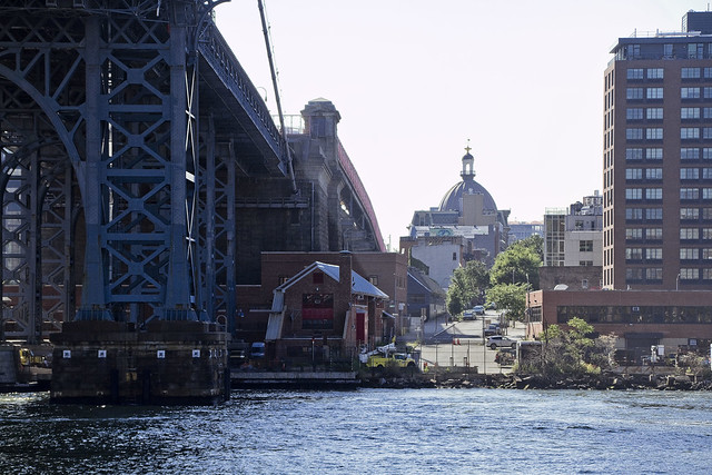
A visceral need to “do my thing” will sometimes drive one out in search of interesting things to point the camera at. More often than not, I’ll find myself in Long Island City. Given the less than enjoyable climate offered in the last month or two, this activity has been curtailed, so whenever the universe is cooperative I’m out for a scuttle. After a rather busy recent day, I hopped on the train and took it to the Court Square stop to save myself some sweaty walking, emerging from the underground at the foot of the Sapphire Megalith. A short scuttle was engaged upon, and soon I was down at the East River waterfront.
Have to say, I’m really missing the old days when LIC was a desolate and unpopulated wasteland at night.

– photo by Mitch Waxman
At Hunters Point South Park, these two old utility poles are embedded in the shoreline. Decorative, they have the look and feel of former railroad signal poles, but I can’t say for certain if that’s what they actually are or not.
I got “fancy” with this one, setting up the tripod and using an ND filter in pursuance of a long exposure. That’s why the water has that weird misty look. The lavender cast isn’t from the filter, instead this shot was actually from the end of my walk in LIC, about an hour after the first and second were shot. Sunset does lovely things, colorimetric wise, to the East River.

– photo by Mitch Waxman
Not sure where I’m going next, but LIC is always my “go to” when I’m looking for someplace that offers long horizons and interesting views. The H shaped thing blocking the Empire State Building is called the Copper Building, and you can see one of the hideous Hudson Yards buildings ruining ESB’s silhouette just behind it.
Doesn’t Hudson Yards look just like space borne debris that rained down and embedded itself on the west side of 34th street?
“follow” me on Twitter- @newtownpentacle
Upcoming Tours and Events
Saturday, July 13, 10 a.m. – 12 p.m.
“Exploring the East River, From General Slocum Disaster
to Abandoned Islands” Boat Tour w NY Adventure Club
Onboard a Soundview route NYC Ferry – Join New York Adventure Club for a two-part aquatic adventure as we explore the General Slocum disaster, and historic sights and stories along the East River, all by NYC Ferry.
Click here for ticketing and more information.
Buy a book!
“In the Shadows at Newtown Creek,” an 88 page softcover 8.5×11 magazine format photo book by Mitch Waxman, is now on sale at blurb.com for $30.


