Archive for the ‘Staten Island’ Category
primal farmyard
Today is the day, in 1909, that Geronimo died. His real name was Goyaałé.

– photo by Mitch Waxman
Owing to other obligations and piss poor weather conditions for the last couple of weeks, one hasn’t got anything new to show you for this week. Accordingly, it has been decided to instead present a few archive shots of the various branches of NYC government which make life liveable for us here in “Home Sweet Hell.”
Today, the focus is on the NYC DOT – the bewildering New York City Department of Transportation, whom, as you might discern from some of their assets pictured above, are showoffs.

– photo by Mitch Waxman
NYC DOT handles and oversees NYC’s streets, highways, 788 roadway and pedestrian bridges (both major and minor, and with 25 of them moveable), and sidewalks. DOT also does street signs, traffic signals, street lights, street resurfacing, pothole repair, parking meters, and manages municipal parking. They’re also in charge of bike lanes, regulate private bus services, and spend about $700 million bucks a year doing all this – last time I checked.
They also run that big orange boat you see in the shot above. Money well spent, no?

– photo by Mitch Waxman
Of course, there’s a lot of purely mundane stuff they do. With the help of a couple of large contractors, notably Weisbach, DOT oversees the care and maintenance of those fancy new parking meter kiosks, street lights, and road paving. They also work with and augment the DSNY during snow events with plows and road salt.
“follow” me on Twitter- @newtownpentacle
bearded colleague
Kitteh, in today’s post.
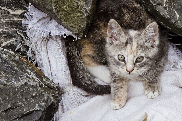
– photo by Mitch Waxman
I’m taking a short break this week, and offering single images of the Internet’s favorite critter. These are all ferals, encountered in the nooks and crannies of NYC which I wander through. Have a great Thanksgiving.
“follow” me on Twitter- @newtownpentacle
intact copy
A short aside on the Arthur Kill, and a look at the Goethals Bridge project.

– photo by Mitch Waxman
For the last few days, I’ve been describing a day trip to South East Brooklyn, which we’ll return to later on, but for today’s post I want to show you what’s going on at the veritable edge of NYC on the western end of… Staten Island… at the Arthur Kill waterway. That’s the Goethals Bridge construction project you’re looking at, which is another one of the three mega projects involving bridges going on in NYC at the moment.
I was actually “at work” when these shots were captured, conducting a corporate boat excursion for a group that wanted to “see something different” than what you normally get on a harbor cruise. They were all eating lunch on another deck as we passed by the Goethals so I grabbed my camera and got busy.

– photo by Mitch Waxman
I’m nowhere near as familiar with Goethals as I am with the Kosciuszcko Bridge over my beloved Newtown Creek, of course, but I can tell you that the span overflying the water is 672 feet long. With its approaches, which connect Elizabeth, New Jersey (and the NJ Turnpike) to… Staten Island… the structure is actually some 7,109 feet long. It’s 62 feet wide, 135 feet over the Arthur Kill, and carries about 80,000 vehicles a day.
Goethals opened in June of 1928, and along with the nearby Outerbridge Crossing, was the inaugural project for a newly created organization known to modernity as the Port Authority of New and New Jersey.

– photo by Mitch Waxman
Like several of the depression era bridges in NYC, Goethals has been deemed as being insufficient for the amount of traffic it carries, and it has developed some structural issues over the last century. Port Authority is building a replacement bridge, which will be a cable stay type span. It’s going to be wider, have modern traffic lanes, and incorporate both bicycle and pedestrian access into its design. It’s also meant to be a “smart bridge” which will utilize active sensor technologies to monitor traffic and structural integrity.
The PANYNJ has also left room in their designs for future modifications to the span like adding a rapid transit line. The blue bridge you see just north east of the Goethals is a railroad lift bridge which connects New Jersey’s CSX rail lines to the New York Container Terminal port facility on the… Staten Island… side. It’s called the “Arthur Kill Vertical Lift Railroad Bridge,” for the curious.
The part of… Staten Island… where all this is happening is called “Howland Hook.”

– photo by Mitch Waxman
That’s the Elizabeth, New Jersey side, where the Goethals connects to New Jersey’s “Chemical Coast.” It’s called that for the enormous presence of the petroleum industry in Elizabeth. This area was formerly the property of the Standard Oil Company of New Jersey.
SOCONJ retained the corporate branding of the Standard Oil trust after the Sherman anti trust act was invoked by President Teddy Roosevelt back in 1911. That branding was “S.O.,” which over the course of the 20th century first became “ESSO” and then later became “EXXON.”

– photo by Mitch Waxman
The new Goethals Bridge is meant to be ready for use in 2018, at which point the PANYNJ will begin the demolition project to get rid of the original. The 1928 steel truss cantilever bridge was designed by a fellow named John Alexander Low Waddell, who also designed the nearby Outerbridge Crossing. As a note, Outerbridge Crossing is not called that due to it being the furthest out bridge, as colloquially believed. It’s named for a a guy named Eugenius Harvey Outerbridge, and I’m friends with his grandson Tom.
The Goethals Bridge(s) is named for General George Washington Goethals, superviser of construction for the Panama Canal, and first consulting engineer of the Port Authority of New and New Jersey.
The PANYNJ has a neat website set up for the project which includes live construction webcams, check it out here.
Upcoming Events and Tours
Saturday, July 23, 11:00 a.m. – 1:00 p.m. –
Calvary Cemetery Walking tour,
with Brooklyn Brainery. Click here for more details.
Tuesday, July 26, 6:30 p.m. – 8:30 p.m. –
Glittering Realms Walking tour,
with NYC H2O. Click here for more details.
Wednesday, July 27, 1st trip – 4:50 p.m. 2nd trip – 6:50 p.m. –
2 Newtown Creek Boat Tours,
with Open House NY. Click here for more details.
Saturday, July 30, 11:00 a.m. – 1:00 p.m. –
DUPBO Walking Tour,
with Atlas Obscura. Click here for more details.
Sunday, August 21, 11:00 a.m. – 1:00 p.m. –
Poison Cauldron Walking Tour,
with Atlas Obscura. Click here for more details.
“follow” me on Twitter- @newtownpentacle
presiding demon
Bringing the thunder…

– photo by Mitch Waxman
As mentioned, tomorrow night I’m going to be co-narrating the Working Harbor Committee Newark Bay tour with my pal Gordon Cooper. Now, Newark Bay is WHC’s signature tour, and the people who have handled the narration in the past – WHC’s Capt. John Doswell, Ed Kelly of the Maritime Association, Lucy Ambrosino of Port Authority – lets just say that they’ve set a pretty high standard for this narration on this particular caper.
Tugboat Alley and the 3rd largest Port in the United States is quite a subject to write a tour of.

– photo by Mitch Waxman
Saying that, I’ve been on this particular tour literally dozens of times and have always paid close attention. I’ve also got a whole bunch of historical information which hasn’t been offered in the past, and I’m hoping to add something to the narrative if such a thing is possible. The good news is that the weather promises to be on my side tomorrow, and a beautiful NYC summer day and evening is forecast.
This should be glorious, and for my part – I’m planning on being in rare form tomorrow night.

– photo by Mitch Waxman
Port Elizabeth Newark is gob smacking in its scale, history, importance to our regional economy, and in its ongoing maritime operations. Our boat will be leaving from Pier 11 in Lower Manahattan, crossing the anchorage channel, transversing the Kill Van Kull, and then visiting the literal prototype for all modern container terminals. We will be proceeding north into Newark Bay – the confluence of the Hackensack and Passaic rivers – and then exiting back through the Kill Van Kull and heading over to the Statue of Liberty for sunset.
Hey, what better place are you going to get your selfie than at the Statue of Liberty?

– photo by Mitch Waxman
The trip will be two hours long, and I’m truly excited to invite you lords and ladies to come along. Ticketing link is below – come with? If you do, bring your cameras, as the Workign Harbor Committe’s Port Elizabeth Newark tour is a not to be missed and quite spectacular experience.
Upcoming Events and Tours
Thursday, June 30, 6:00 p.m. – 8:00 p.m. –
Port Elizabeth Newark Boat Tour,
with Working Harbor Committee. Click here for more details.
“follow” me on Twitter- @newtownpentacle
gateway temple
Bayonne Bridge progress, in today’s post.

– photo by Mitch Waxman
The Bayonne Bridge spans the Kill Van Kull waterway, connecting Staten Island with Bayonne, New Jersey. The fourth largest steel arch bridge upon the earth, it was designed by Othmar Amman.
Bayonne Bridge’s origins were commemorated in this 2010 post. The Bayonne Bridge, and the Frederick E Bouchard tug, were discussed in this 2012 post. Also back in 2012, I walked over the original Bayonne Bridge for the last time. In August of last year, I gathered the shots featured in this 2015 post.

– photo by Mitch Waxman
A new class of cargo ships, the Panamax, will soon become standard for global trade. These gargantua have necessitated the widening of the Panama Canal, and will be too large to fit under the Bayonne Bridge in its original configuration at high tide. Given that Port Elizabeth Newark is found just beyond the Bayonne Bridge, the Port Authority of New York and New Jersey has been forced to take steps.
Very expensive steps.

– photo by Mitch Waxman
A seperate project is underway to increase the draught of NY Harbor’s Ambrose Channel and Kill Van Kull to fifty feet instead of forty via dredging, but the roadway of the Bayonne Bridge is being replaced by a new one which will be high enough to accommodate the new class of cargo ships.

– photo by Mitch Waxman
In the shot above, you can see the project is well underway. The shots in today’s post were captured from the waters of the Kill Van Kull in May of 2016, btw. The new roadway is quite a bit higher than the original, and the older one is slated to be demolished.

– photo by Mitch Waxman
Unlike the Kosciuszko Bridge at Newtown Creek (which is being fully replaced), the project engineers have decided to retain the original steel arch structure and approaches to the span. Also, unlike the Kosciuszko project, I have no special access or knowledge of the project beyond some water access.
I can tell you that certain harbor and shipping industry magnates I know favored demolishing the span entirely, reasoning that another class of mega cargo ships is inevitable, and that access to Newark Bay is paramount for the economy of the Northeastern United States. Right now, Port Elizabeth Newark is the second largest port facility in the USA’s part of North America. Bayonne Bridge provides a critical vehicular path to Staten Island and Brooklyn via the Verrazano Bridge for the trade items which arrive there.

– photo by Mitch Waxman
From a purely esthetic point of view, the composition and positioning of the new roadway is pretty “fugly.” Amman is turning in his grave, I’m sure.
Upcoming Events and Tours
Saturday, June 4, 11:00 a.m. -1:30 p.m. –
DUPBO: Down Under the Pulaski Bridge Onramp,
with Brooklyn Brainery. Click here for more details.
“follow” me on Twitter- @newtownpentacle


