Archive for the ‘Tower Town’ Category
May 21st

– photo by Mitch Waxman
The show must go on, as they say, yet your humble narrator is of heavy heart in announcing the Newtown Creek tour of May 21st, 2011- which is offered for your consideration by the Working Harbor Committee.
It is not the task of course, which tempers the normal ebullience experienced when an opportunity to share the wonders of the Newtown Creek with a group of enthusiasts from the comfort and safety of a modern vessel like the MV American Princess (which is outfitted with all the amenities one would expect to find during a harbor trip in a tourist Mecca such as New York City), crosses my path.
It is not that unnatural and uncontrollable timorousness which plagues me when I am asked to speak before “this group of pale enthusiasts” or “that gang of antiquarians”. Revealing and sharing the history of this amazing place is one the things I revel in, and brings me close to understanding what joy must be like.
from workingharbor.com
Visit Beautiful Newtown Creek Saturday, May 21, 2011
On MV American Princess, Boat departs from Pier 17, South Street Seaport, Manhattan NYC, 10am – 1pm
Souvenir Tour Brochure with historical information and vintage maps. Narration by experienced historical and environmental guest speakers. Complimentary soft drinks will be served. Come aboard for an intense Newtown Creek exploration! Our comfortable charter boat will travel the length of Newtown Creek. The tour will pause at many interesting locations for narration and discussion. Guest narrators will cover historical, environmental, and conservation issues. Large comfortable vessel with indoor & outdoor seating. Cruise runs rain or shine. Price: $60
To purchase tickets click here
or contact Tour Chairman Mitch Waxman: waxmanstudio(AT)gmail.com

– photo by Mitch Waxman
This is where the Industrial Revolution happened, and this trip will transverse and offer certain observations about the Newtown Creek’s present form and usage, and reveal a potentially bright future which this neglected ribbon of water- which provides the currently undefended border of Brooklyn and Queens- were it to be revitalized and renewed, might offer the future.
After boarding at South Street seaport, Working Harbor’s maritime experts will discuss the waterfront of Brooklyn as we pass beneath the Brooklyn Bridge and Manhattan Bridge, and finally passing under the Willamsburg Bridge. Our vessel will smoothly move past the neighborhoods of Dumbo, Williamsburg, and Greenpoint in Brooklyn, and offer spectacular views of Manhattan. This entire trip will be a photographer’s delight, incidentally, offering spectacular and unreal urban panoramas.

– photo by Mitch Waxman
At Long Island City, your humble narrator will presume to expose you to a short history of the Newtown Creek, and offer an identity to some of the enigmatic structures arrayed around the troubled industrial waterway.
Luckily for all concerned, there are other speakers who will relieve the crowd from my droning prattle, maritime experts and environmentalists included. Around Newtown Creek Alliance headquarters, there is some buzz amongst the staff about which one of the heavyweight orators will be onboard.
Soft drinks, one to a customer, will be complimentary as well.

– photo by Mitch Waxman
The American Princess will proceed past the titan Newtown Creek Waste Water Treatment Plant, the malign Dutch Kills, the cyclopean SimsMetal dock, the brutal symmetry of the Greenpoint Avenue Bridge, through the agglutinated heart of the Greenpoint Oil Spill, past the severed Penny Bridge at Meeker Avenue, and beyond the emerald devastations of Calvary Cemetery.
Then, we’re going to take a moment to remember our fallen friend… for just a moment.
I’m hesitant to mention this… as this is not what this trip is meant to be about, this is not a memorial event… but Bernie Ente is and will be so profoundly missed by many of us who will be conducting this tour, of which he is the originator and founder of… it would be in bad taste if a moment of silence to remember him, in this place which he expended so much of his attentions revealing and teaching and guiding about, were not offered. More on this in a later posting, but as the initial line says “the show must go on”, and that is exactly what Bernie would have us do.

– photo by Mitch Waxman
The course will continue, past the middle point of the Newtown Creek, and will plunge past the Maspeth Plank road, past the Phelps Dodge site and the Kosciusko Bridge. At the branching of the Newtown Creek which exists at the confluence of the East Branch and English Kills, we will witness the remains of the Maspeth Plank Road and approach the wicked end of the navigable section of the Newtown Creek itself and approach one the hydra like tributaries which spread languishing tendrils of rotting bulkheads and unused yet prime industrial waterfront locations all across Brooklyn and Queens.
This is not the world you know.

– photo by Mitch Waxman
Witness the startling elegance of the Grand Street Bridge, a century old swing bridge connecting Brooklyn and Queens, which signals the entrance to English Kills has been reached. Industrial heartland, this is a grossly contaminated section of the waterway which has- of course- been designated as a Federal Superfund site. Seeing the Newtown Creek in this state, this bizarre half life which is neither tick nor tock- industrial nor residential, is a fairly short term proposition.
Vast changes are coming which will literally alter the very landscape.

– photo by Mitch Waxman
The Kosciusko Bridge replacement, and the enormous new populations and residential conversion in progress and expected in Hunters Point South and Greenpoint, and the EPA conducting the initial stages of Superfund remediation (which will involve dredging and vast public works projects conducted by hundreds of contractors) will all be happening in roughly the same timeframe. Ten years from now, it will hard to recognize the place, and twenty more will render it a stranger to those who know it today.
In the English Kills, you will become transfixed by a waterfront frozen in some other century, and witness the extant vitality of those economies of heavy industry which build, and drain, and recycle, and dispose of. You don’t get Manhattan without a Newtown Creek, after all.

– photo by Mitch Waxman
We will proceed into the depths of English Kills near the Third Ward in East Williamsburg, Brooklyn. Our journey will cross the navigable sections of the Newtown Creek and begin it’s return journey to the Shining City of Manhattan and the South Street Seaport, leaving Greenpoint and Long Island City behind.
The plan for the return narration includes a full description and explanation of the Superfund situation by representatives of the Newtown Creek Alliance, and a return to Manhattan’s South Street Seaport. Personally, I’ll be at the bow during this part of the trip, as the photographic possibilities of moving languidly along the Creek with the sun behind us and illuminating both the creek lands and the Shining City as we smoothly speed across the East River beyond will be awe inspiring.
You haven’t experienced the Newtown Creek until you’ve sailed down it, and such a trip will disabuse you of viewing it with anything but wonder afterward. Simply, what is offered is a new perspective on the City of New York, one that less than 10% of New Yorkers have ever even heard of.

– photo by Mitch Waxman
Once again…
from workingharbor.com
Visit Beautiful Newtown Creek Saturday, May 21, 2011
On MV American Princess, Boat departs from Pier 17, South Street Seaport, Manhattan NYC, 10am – 1pm
Souvenir Tour Brochure with historical information and vintage maps. Narration by experienced historical and environmental guest speakers. Complimentary soft drinks will be served. Come aboard for an intense Newtown Creek exploration! Our comfortable charter boat will travel the length of Newtown Creek. The tour will pause at many interesting locations for narration and discussion. Guest narrators will cover historical, environmental, and conservation issues. Large comfortable vessel with indoor & outdoor seating. Cruise runs rain or shine. Price: $60
To purchase tickets click here
or contact Tour Chairman Mitch Waxman: waxmanstudio(AT)gmail.com
sleep filmed eyes

– photo by Mitch Waxman
Altered by timidity and terror, your humble narrator continued down Borden Avenue, and crossing beneath the fecund Pulaski Bridge this totemic awaited. At first, it seemed to be material proof of certain theories and cognitive dissonances, confirmation of deep voids beneath the modern plate of cement which typifies area streets.
Who, after all, can guess what may be buried down there?

– photo by Mitch Waxman
Amongst the many things whose worried considerations are enjoyed by one such as myself is the sure knowledge that modern New York City, particularly older sections like Hunters Point in Queens or the business district in Manhattan, is the icing of a very deep layer cake. Foundations of ancient structures, with industrial pipelines, sewer connections, and still extant subterranean warehouse vaults are intricately woven into the ground.

– photo by Mitch Waxman
Often, in areas around the malediction known as the Newtown Creek in particular, the expediency required of rapid capital driven entrepreneurial growth has demanded that a property lot be cleared without any clear record left behind of what once occupied the space. This patch of the Creek was raised from the swampy morass which was its natural form sometime in 1861, for instance. The first buildings in Hunters Point were constructed near here, and Borden Avenue itself (although known as first “Ferry Road” and later as “Blissville Road”) was christened only in 1869.
Hunters Point is named for the family of Captain George Hunter, although it has also been called Mespit, Nechtanc’s Hook, Curles Hook, Dominie’s Hook, and Bennet’s Hook before it became referred to by its modern nomenclature.

– photo by Mitch Waxman
Ambitious to the point of hubris, the transformation of Hunters Point from “an industrial center which had fallen on hard times” (mainly due to meddling with its zoning by real estate interests and long retired city planners in 1960) to a neighborhood is beginning. Like it or hate it, it’s happening- and “Hunters Point South” is shaking free of the twin shackles of an economic downturn and municipal bureaucracy. The behemoth project promises to reveal much that is hidden in the ground, whether it be those venomous environmental inheritances- contamination from some long ago refinery or chemical plant- or the archaeological remains of the early colonial or aboriginal inhabitants.
In the midst of all the historical reminisce, a rustle from behind me forced remembrance of why I had come here…

– photo by Mitch Waxman
Spectral, a companion had latched onto me earlier in the day. It was that day when I finally located the grave of Calvary Cemetery’s first interment (Esther Ennis, 1848), stepped in a dead rabbit, picked up a paranormal companion on my long walk, found myself in a state of “stupendous ruin“, and soon realized that my perceptions had grown “bafflingly homogeneous“. According to occult specialists and paranormal experts, eldritch entities are somehow connected to and can access the ambient electromagnetic spectrum as evidenced by cold spots in haunted houses and the rapid draining of camera batteries in similar locations. (I can report that my Canon battery functions normally within area cemeteries, however)
Long Island City… LIC is all about power and always has been.

– photo by Mitch Waxman
In 1881, when the goody two shoe reformers in Manhattan outlawed gambling and bookmaking, the “operation” moved to Hunters Point. In 1890, things were going so well that the Queens County Bank was built on 2nd street. It wasn’t until the 20th century that the “800 pound gorilla” built its powerhouse, and it would be another 20 years until the tunnels to Manhattan were finished which allowed the new subway system to cross under the river via the miracle of electrical motility.
Under the ground here, raw electrical power exists in cascades…

– photo by Mitch Waxman
My shadowy passenger, whose identity I suspected but cannot prove, seemed to shudder at the thought of crossing the river of electrical cables which underlie this section of the waterfront. Emboldened by its trepidation, I set off down 2nd street, and headed for Tower Town where no shadow can be found. Atavist fear and horror struck panics aside, your humble narrator is no stranger to the mythologies and common tropes of the occult…
Haunt my house? I’ll fill the carpet steamer with holy water…
Progress
– photos by Mitch Waxman
The growth of the Tishman Speyer Gotham Center building in the new Queens Plaza, from every corner of the Newtown Pentacle.
Superfund me

– photo by Mitch Waxman
LO, BEHOLD, and TREMBLE… for the Newtown Pentacle is back in session…
Over several of the last few years, agents and officials of the Federal Government have conducted a strange and secretive investigation into certain conditions within and around the ancient New York waterway called the Newtown Creek.
The public first learned of it in 2009, when a vast series of public meetings and pronouncements were offered by agents of the Environmental Protection Agency which confirmed and introduced the news that the ancient corridor of industry and forbidden history called the Newtown Creek was being considered for inclusion on the Federal Superfund list.
This listing would bestow extraordinary powers over the waterway, and ultimate authority, to the Federal Government. Effectively, the 3.8 mile long border of Brooklyn and Queens with its enormous number of crumbling bulkheads, worm eaten piers, and supposedly empty warehouses are now the responsibility of the G-Men. Uninquiring souls let the occurrence pass as one of the major developments in a spasmodic war on environmental pollution and the toxic legacy of the industrial revolution.
from epa.gov
Release date: 09/27/2010
Contact Information: John Senn (212) 637-3667, senn.john@epa.gov
(New York, N.Y.) The U.S. Environmental Protection Agency (EPA) today added Newtown Creek in New York City to its Superfund National Priorities List of the country’s most hazardous waste sites. The final listing will allow EPA to conduct a comprehensive evaluation of the creek to determine what remedial actions need to be implemented. Various sediment and surface water samples have been taken along the creek. Potentially harmful contaminants such as pesticides, metals and polychlorinated biphenyls (PCBs) have been detected in Newtown Creek along with volatile organic compounds (VOCs). VOCs are potentially harmful contaminants that can easily evaporate into the air.
“The toxic pollution in Newtown Creek is more than a century in the making. EPA is placing Newtown Creek on the Superfund list to ensure the creek receives a thorough cleanup,” said EPA Regional Administrator Judith Enck. “Newtown Creek is a key urban waterway, which provides recreational and economic resources to many communities. Throughout the investigation and cleanup, we will work closely with the communities along the creek to achieve a revitalization of this heavily-contaminated urban waterway.”
EPA proposed Newtown Creek be added to the Superfund NPL list in September 2009. EPA received and considered public comments on its proposal before making its final decision.

– photo by Mitch Waxman
On Monday the 27th of September in this year of 2010, the EPA announced the Superfund listing of Newtown Creek would be moving forward.
Interesting coincidences abound for this date:
The first Ford Model T rolled off the assembly line in 1908 in Detroit, Einstein had his E=MC2 formula published for the first time in 1905, Crete fell to the Turks in 1669, and the Jesuits were granted a Papal charter in 1540. The Warren Commission released its report on the assassination of President John F. Kennedy in 1964, the Ottoman Siege of Vienna began in 1529, the Taliban captured Kabul in 1996, and Thomas Nast was born in 1840.
It is also 110 years and 19 days after this report appeared in the NY Times, and some 122 years and 11 days since this report appeared in the same publication.
also from epa.gov
EPA had previously responded to requests by members of Congress to evaluate specific sites along Newtown Creek by publishing a September 2007 report that contained a review of past and ongoing work being conducted to address the Greenpoint oil spill as well as recommendations regarding future work to assist with the spill response. The state of New York referred the site to EPA due to the complex nature of the contamination in the creek. EPA’s Superfund study and cleanup are expected to focus on the sediments in the creek and on identifying and addressing sources of pollution that continue to contribute to the contamination.
Newtown Creek is part of the core area of the New York-New Jersey Harbor Estuary, which has been designated by EPA as an “estuary of national significance.” Despite the ongoing pollution problems, some residents currently use the creek for recreational purposes such as kayaking, while others eat the fish they catch from the creek.

– photo by Mitch Waxman
According to statements rendered by Government representatives, the actual work on the remediation project is not scheduled to begin in earnest for several months (if not years), as a period of further study and evaluation of the endemic situation before the final formulation of their plans to ferret out and eradicate all that there is which may be buried down there.
The government plans on removing hundreds of metric tons of the sediment which lines the bottom of the Newtown Creek. Privileged to have been included on the conference call during which EPA announced their decision to the third estate, your humble narrator queried EPA personnel as to the methodology of its removal (terrestrial industries versus maritime) and whether they had determined a probable destination for the contaminant laced material they intend to dredge out.
Both questions seemed to have been unexpected, and they reported that answers will be readily uncovered when the final action plan is unveiled sometime in the near future.
additionally, from epa.gov
In the mid -1800s, the area adjacent to the 3.8-mile Newtown Creek was one of the busiest hubs of industrial activity in New York City. More than 50 industrial facilities were located along its banks, including oil refineries, petrochemical plants, fertilizer and glue factories, sawmills, and lumber and coal yards. The creek was crowded with commercial vessels, including large boats bringing in raw materials and fuel and taking out oil, chemicals and metals. In addition to the industrial pollution that resulted from all of this activity, the city began dumping raw sewage directly into the water in 1856. During World War II, the creek was one of the busiest ports in the nation. Some factories and facilities still operate along it, and various adjacent contaminated sites have contributed to its contamination. Today, as a result of its industrial history, including countless spills, Newtown Creek is badly polluted.
In the early 1990s, New York State declared that Newtown Creek was not meeting water quality standards under the Clean Water Act. Since then, a number of government-sponsored cleanups of the creek have taken place. The New York City Department of Environmental Protection has sampled sediment and surface water at a number of locations along the creek since 1980. In early 2009, EPA sampled the sediment throughout the length of Newtown Creek and its tributaries. EPA will review existing information about Newtown Creek to develop a plan for further investigation.

– photo by Mitch Waxman
The professional press also on the call seemed more interested in the Gowanus Canal, how the Mayor felt about the announcement, and grew fixated on the cost of the cleanup effort. EPA clearly spelt out that its budgeting process has barely begun, and they can neither supply a final cost estimate or time table at this early date. This is actually the logical course, as the secrets of the Newtown Creek must- as always- bubble up and reveal themselves to those who stare deeply into its occluded depths.
And, in their own time, all the poisons in the mud will leach out.
and also, from epa.gov
EPA conducted an Expanded Site Investigation (ESI) of Newtown Creek in 2009 as part of the Hazard Ranking System scoring process for NPL listing under Superfund. Based on the ESI, which was focused on Newtown Creek itself and not its tributaries, EPA concluded that metals, volatile organic compounds, and semi-volatile organic compounds (including polycyclic aromatic hydrocarbons and polychlorinated biphenyls) were present in Creek sediments at elevated concentrations. The variety and distribution of the detected contaminants suggests that they originated from a variety of sources. Previous environmental investigations of Newtown Creek, or specific portions of the Creek, also disclosed that sediments in Newtown Creek are contaminated by a wide variety of hazardous substances. Environmental investigations of upland parcels adjacent to or nearby the Creek have disclosed contamination of those parcels by hazardous substances similar to hazardous substances found in sediments in Newtown Creek.
enchanting metamorphoses

– photo by Mitch Waxman
Recent announcements have heralded the formal beginnings of the process which will transmogrify the ancient Hunters Point section of Long Island City irrevocably. The support of overt interests of the Manhattan political elite have been made in public, and the financial and real estate folks are in line behind the project.
Behold, the future home of an estimated 11,000 people, imagine Tower Town.
from nyc.gov
More than 5,000 new apartments are anticipated to be constructed in the primary neighborhood character study area by 2017, including completion of the residential development at Queens West and many other mid-size residential buildings throughout the immediate area. Almost 11,000 new residents are expected in the primary study area as a result of this new construction activity.
As the primary study area (and the secondary study area, discussed below) becomes more densely developed, traffic and pedestrian volumes will increase noticeably from the current levels. Intersections throughout the area will be more congested in the morning, midday, and evening peak hours. The intersections that currently experience some congestion on Vernon Boulevard will be noticeably more congested, with some levels of service D and even LOS F, indicating high to unacceptable delays. In addition, other intersections along Vernon Boulevard in the primary study area will also have moderate to high congestion in the peak hours. On the east-west avenues in the area near the project sites (i.e., 48th, 49th, 50th, and 51st Avenues) traffic volumes are expected to increase slightly.
Pedestrian volumes will also increase in the future without the proposed actions, but sidewalks, corners, and crosswalks will generally continue to operate at acceptable levels. The crosswalk across Vernon Boulevard on the north side of 50th Avenue will, however, become noticeably congested during the morning peak hour, as people cross to enter the subway station there. This crosswalk will operate at LOS E, as will the subway stair closest to the corner (Stair S8). Buses serving the primary study area will also be noticeably more crowded.

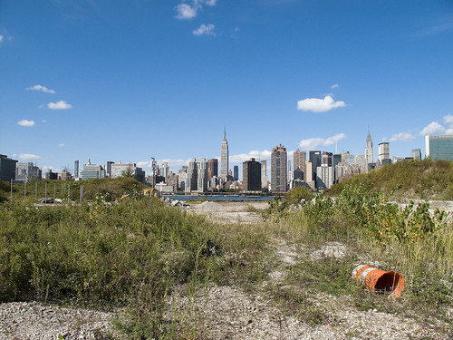
– photo by Mitch Waxman
Direct sightlines of the heroic Manhattan skyline will be offered by these new high rise buildings, and soar over the starry old coastline that has known only industrial usage since the first Europeans arrived on the archipelago we know as New York. Its value for industry has long been exhausted, and today it is a brutal waste of land.
also from nyc.gov
The proposed actions would almost double the study area’s population. However, the proposed actions’ mix of affordable and market-rate housing could serve to relieve rather than increase residential market pressure in the study area. Additionally, given the very strong trend already in place in the neighborhood, the new population at Sites A and B would not be expected to introduce or accelerate a trend toward increased market rents in the study area that might cause significant indirect residential displacement. The redevelopment of Site B would introduce new residential uses to the Long Island City industrial area south of Borden Avenue. It is possible that the introduction of this residential use could lead to some limited indirect business displacement because of increased rent pressures. However, the potential for indirect displacement resulting from increased rent pressure is limited, and would not result in significant adverse indirect displacement impacts.

– photo by Mitch Waxman
The new development, a planned community with parks and schools, will extend far from the river- nearly all the way to the Pulaski Bridge with a basketball court and green space sited for the location of the old Vernon Avenue Bridge. The shining city of Queens, and a monument to a revolutionary and aggressive group of city planners, the story of Tower Town has begun.
also from nyc.gov
The Hunter’s Point South Rezoning and Related Actions would allow Site A and Site B to be redeveloped with largely residential buildings with building components ranging in height from
40 to 400 feet. Ground floors would include local retail, lobby, and community facility uses. On Site A, a network of new streets, sidewalks, and bikeways would be developed, creating seven new city blocks from the single 30-acre parcel it is today. Center Boulevard would be continued southward onto Site A and would connect to the rest of the street network. On Site B, it is anticipated that a new publicly accessible private road and open space would roughly bisect the site. The new residential buildings would vary in height, with bases ranging in height from 40 to 70 feet and high rise elements ranging in height from 250 to 400 feet. Nine towers would be developed on Site A, and four towers would be developed on Site B. Ground floors would be occupied by local retail and other commercial uses and community facility uses. A new public school would serve the residents of the buildings and the surrounding neighborhood and create a varied and active streetscape.
In addition, a new public waterfront park would be developed along the East River and Newtown Creek frontages of Site A and a shore public walkway would be developed along the Newtown Creek frontage of Site B. An additional linear public park would also be developed on the south side of 55th Avenue between Center Boulevard and 2nd Street, and a similar public open space would be developed on the south side of the publicly accessible private road on Parcel B, creating a wide boulevard on that street. The new waterfront parks and open spaces on Sites A and B along the East River and Newtown Creek waterfronts would provide greatly increased public access to waterfront views. Wide views of the waterfront and Manhattan would be available from locations throughout the park.
Overall, the proposed actions would change the character of Sites A and B from a commercial and industrial neighborhood to a residential neighborhood. This new residential neighborhood would incorporate retail and park uses that would attract visitors. On both Site A and Site B, pedestrian activity and vehicular activity would increase substantially over existing conditions.
– photo by Mitch Waxman
Tower Town is impossible to argue against, this real estate- former home to rail and ferry docks, and 19th century barge based casinos, and printing plants, and refineries, and power plants- is a blight on the city, and an uncomfortable reminder of that earlier time when brick strewn lots were not remarkable but common.
An economic boom in construction and real estate sales will come, when it is built. A new tax base of luxury and glamour will come to western Queens, and a wildfire of enhanced valuation will spur growth throughout surrounding riverine communities- further enhancing the economy and strengthening their own tax base- Dutch Kills first, then Astoria, and Greenpoint.
Tower Town at Hunters Point South, Atlantic Yards in Brooklyn, Flushing Commons, Willets Point, the Kosciuszko Bridge replacement.
All at once.
from “Air Quality In Queens County” at synapse-energy.com
In the interest of protecting the environment and public health of Northwest Queens, the Natural Resource Defense Council (NRDC) and the Citizens Helping Organize for a Klean Environment (CHOKE) participated in the New York State Article X permitting process for several new power plants proposed in Northwest Queens. One of their objectives was to have a study conducted to analyze the contributors to air pollution in Northwest Queens and to identify possible strategies for improving air quality and reducing risks to public health. As part of the Article X permitting process for its 250 MW Ravenswood Combined Cycle project, KeySpan committed to funding such a study as a community benefit. CHOKE and NRDC contracted with Synapse to conduct this study. The conclusions and recommendations are those of the authors but do not necessarily reflect the position of KeySpan.
One of the reasons that Queens County was chosen for this study is that it is home to many sources of air pollution. In the northwest corner of the county there currently are four large power plants, which together house 46 electric generating units. The county also contains an extensive transportation network that includes the Long Island Expressway, the Brooklyn Queens Expressway, the Grand Central Parkway, two highway bridges, a tunnel to Manhattan, and two airports, along with over 400 miles of arterial and local roads. Queens also has several large industries, and some 2.2 million residents, leading to significant economic activity which contributes to air quality problems.

– photo by Mitch Waxman
A small and insignificant scuttling thing who some might describe as a man, your humble narrator has spent a good deal of time wandering about the lonely industrial frontages of Hunters Point and expended some effort into learning its past. My opinion of this project is meaningless, it is a gathering thunderhead, and Manhattan is coming to Queens. There is just one thing that has been glossed over in mainstream reports about this place…
…this waterfront property…
from a Newtown Pentacle post of 6/7/2009
In 1697, a Dutch sea captain named Peter Praa bought the Bogardus properties and set up farming. He died in 1740, and the land was left to his granddaughter Anne Bennet. Her son, Jacob Diks, inherited next and he passed the land to his daughter- Anna Hunter. In 1817, Hunter, who had three sons, left the land to her children under the proviso that it be sold and the moneys divided evenly between them. This is why the “Mispat” became known as “Hunter’s Point”.

– photo by Mitch Waxman
For the water that promoters of this plan mention is the East River, not the water that has defined it throughout all recorded time.
from a Newtown Pentacle post of 2/28/10:
3.8 miles long, its mouth is directly opposite the Bellevue Psychiatric Hospital in Manhattan, and defines the currently undefended border between North Brooklyn and Western Queens. Estimates state that some 14 million gallons of combined sewage, storm runoff, and industrial waste provide the only flow of water into the Creek. It’s waters are opaque, and in the height of summer turn an unnatural shade of green.
The soft bottom of the waterway is 15-20 feet below the surface of the water, and the hard bottom is occluded by a gelatinous sediment known as “Black Mayonnaise”. Composed of petroleum residues, coal tar, PCB’s, and human excrement- it lies 15 feet thick on the bed. The oxygen content of the water drops precipitously as soon as one leaves the East River. The first of the drawbridges which cross it- known as the Pulaski Bridge, is the borderline beyond which immersion in this water is worthy of full HAZMAT gear and first responders institute biological decontamination procedures for anyone who finds themselves in it.
As I’ve mentioned in the past… the chemicals Putrescine (an organic chemical compound NH2(CH2)4NH2 (1,4-diaminobutane or butanediamine) and Cadaverine (a toxic diamine with the formula NH2(CH2)5NH2)which are produced by the rotting and putrefaction of animal flesh are abundantly found in the Newtown Creek under industrial aliases like Acrylonitrile and are prominent members on the EPA’s list of Volatile Organic Compounds– or VOC’s..
Who can guess, what it is, that may be buried down there?

– photo by Mitch Waxman
Tower Town, you see, will be built along the Creek as well…
…the Newtown Creek…
from epa.gov
“Newtown Creek is one of the most grossly-contaminated waterways in the country,” said Acting Regional Administrator George Pavlou. “By listing the creek, EPA can focus on doing the extensive sampling needed to figure out the best way to address the contamination and see the work through.”
EPA responded to requests by members of Congress to evaluate specific sites along the creek by publishing a September 2007 report that contained a review of past work and recommendations regarding future work at Newtown Creek. The state of New York referred the site to EPA due to the complex nature of the contamination along the creek.
Newtown Creek is part of the core area of the New York-New Jersey Harbor Estuary, which has been designated by EPA as an “estuary of national significance.” Despite the ongoing pollution problems, some residents currently use the creek for recreational purposes such as kayaking, while others catch fish for consumption out of it. Various sediment and surface water samples have been taken along the creek and reveal the presence of pesticides, metals, PCBs, and volatile organic compounds (VOCs), which are potentially harmful contaminants that can easily evaporate into the air.
In the mid -1800s, the area adjacent to the 3.8-mile Newtown Creek was one of the busiest hubs of industrial activity in New York City. More than 50 industrial facilities were located along its banks, including oil refineries, petrochemical plants, fertilizer and glue factories, sawmills, and lumber and coal yards. The creek was crowded with commercial vessels, including large boats bringing in raw materials and fuel and taking out oil, chemicals and metals. In addition to the industrial pollution that resulted from all of this activity, the city began dumping raw sewage directly into the water in 1856. During World War II, the creek was one of the busiest ports in the nation. Some factories and facilities still operate along it, and various adjacent contaminated sites have contributed to its contamination. Today, as a result of its industrial history, including countless spills, Newtown Creek is badly polluted.


