Posts Tagged ‘photowalk’
puerile symbolism

– photo by Mitch Waxman
It’s difficult for me to not interpret what I found on my camera card for this leg of my “Grand Walk”, a panic induced fugue through starry pathways which carried me from St. Patrick’s Old Cathedral in Manhattan back to Astoria, as not being influenced by street car lines which haven’t existed since the early 20th century. These streets are relict, not that important anymore, and have served Brooklynites simply as short cuts to the bridge for quite some time. The BQE served to silence and humiliate Williamsburg mid century and nearly destroyed the place.
from the Brooklyn daily eagle almanac, courtesy google books

– photo by Mitch Waxman
By diverting traffic around Williamsburg, just as the Long Island Expressway does in the “Empty Corridor” of Long Island City, the local streets are starved of the economic benefits they once enjoyed from the Manhattan bound traffic. When still a child, the family would pack into the Plymouth periodically and head to north Brooklyn for so called “Italian cookies”. The trip was justified by the existence of relict bakeries in the area which hadn’t changed their menus in decades as no new customers were appearing.
The entire coast line of Long Island that faces the East River spent most of the 20th century asphyxiating in this manner and one man in particular is responsible for it.
from wikipedia
Robert Moses’s power increased after World War II, when, after the retirement of LaGuardia, a series of politically weak mayors consented to almost all of Moses’s proposals.Named city “construction coordinator”, in 1946, by Mayor William O’Dwyer, Moses also became the official representative of New York City in Washington, D.C. Moses was also now given powers over public housing that had eluded him under LaGuardia. Moses’s power grew even more when O’Dwyer was forced to resign in disgrace and was succeeded by Vincent R. Impellitteri, who was more than content to allow Moses to exercise control over infrastructure projects from behind the scenes.
One of Moses’s first steps after Impellitteri took office was killing the development of a city-wide Comprehensive Zoning Plan, underway since 1938, that would have restrained his nearly uninhibited power to build within the city, and removing the existing Zoning Commissioner from power. Impellitteri enabled Moses in other ways, too. Moses was now the sole person authorized to negotiate in Washington for New York City projects. He could now remake New York for the automobile. By 1959, Moses had built 28,000 apartment units on hundreds of acres. In clearing the land for high-rises in accordance with the tower in a park scheme, which at that time was seen as innovative and beneficial, he sometimes destroyed almost as many housing units as he built.
From the 1930s to the 1960s, Robert Moses was responsible for the construction of the Throgs Neck, the Bronx-Whitestone, the Henry Hudson, and the Verrazano Narrows bridges. His other projects included the Brooklyn-Queens Expressway, the Staten Island Expressway, the Cross-Bronx Expressway, the Belt Parkway, the Laurelton Parkway, and many more. Federal interest had shifted from parkway to freeway systems, and the new roads mostly conformed to the new vision, lacking the landscaping or the commercial traffic restrictions of the pre-war ones. He was the mover behind Shea Stadium and Lincoln Center, and contributed to the United Nations headquarters.

– photo by Mitch Waxman
As is the case in cities across the world, when the rents went down, crime went up. In modernity, while New York City was experiencing a serious decline in crime statistics – Nassau County and Newark experienced an explosion of illicit activity. This is a largely uncommented phenomena, of course, as the lowering of crime in NYC is largely attributed to the NYPD rather than a socioeconomic migration of problematic populations from one part of the megalopolis to another. The same is true of the “gentrified” sections of Brooklyn and Queens, when crime dropped in Long Island City- it rose in Jamaica.
Why? The rent is cheaper in Jamaica than it is in Tower Town.
from wikipedia
New York became the most populous urbanized area in the world in early 1920s, overtaking London, and the metropolitan area surpassed the 10 million mark in early 1930s, becoming the first megacity in human history. The difficult years of the Great Depression saw the election of reformer Fiorello LaGuardia as mayor and the fall of Tammany Hall after eighty years of political dominance.
Returning World War II veterans created a postwar economic boom and the development of large housing tracts in eastern Queens. New York emerged from the war unscathed as the leading city of the world, with Wall Street leading America’s place as the world’s dominant economic power. The United Nations Headquarters (completed in 1950) emphasized New York’s political influence, and the rise of abstract expressionism in the city precipitated New York’s displacement of Paris as the center of the art world.
In the 1960s, New York City began to suffer from economic problems and rising crime rates. While a resurgence in the financial industry greatly improved the city’s economic health in the 1980s, New York’s crime rate continued a steep uphill climb through the decade and into the beginning of the 1990s.[83] By the 1990s, crime rates started to drop dramatically due to increased police presence and gentrification, and many American transplants and waves of new immigrants arrived from Asia and Latin America. Important new sectors, such as Silicon Alley, emerged in the city’s economy and New York’s population reached an all-time high in the 2000 census.

– photo by Mitch Waxman
What fascinates, however, are the lost connections between the ancient villages and once upon a time cities of this original gold coast found along the River of Sound. Manhattan avenue, looking off in the direction of Greenpoint is pictured above. The street car lines which shuttled shoppers and commuters from the Grand Street Ferry back to Newtown Creek’s greatest city ran along here, and would have turned off Grand north toward Greenpoint and Long Island City via the Vernon Avenue Bridge.

– photo by Mitch Waxman
Another line would break off at Bushwick Avenue, carrying passengers south and east. Ultimately, a rider could travel all the way to Canarsie from here. Mention must be made that I’m no expert on the topic of street car lines in Brooklyn, and that the subject has only recently gained any paramount in my researches on the history and underlying structure of this- your Newtown Pentacle.
Which brings me to something I get asked a lot these days- what exactly do you mean by “Newtown Pentacle”?

– photo by Mitch Waxman
The European mind of the 17th, 18th, and early 19th century delighted in geometry and esoteric symbolism. Famously, Christopher Wren laid London’s churches and palaces out in a colossal pentagram when rebuilding from the Great Fire of London in 1666. Certainly, defensive fortifications and strategic thinking in these ages followed certain long standing geometries- stars and pentagrams especially. Washington D.C. Fulfills some freemasonic ideal of urban planning, with White House and Capitol Building occupying particular location and relationship to obelisk and parade grounds. Western Queens and North Brooklyn are no exception to this rule.
from wikipedia
Little also is known of Wren’s schooling. The story that he was at Westminster School from 1641 to 1646 is unsubstantiated. Parentalia, the biography compiled by his son, a third Christopher, places him there “for some short time” before going to Oxford (in 1650). Some of his youthful exercises preserved or recorded (though few are datable) showed that he received a thorough grounding in Latin; he also learned to draw. According to Parentalia, he was “initiated” in the principles of mathematics by Dr William Holder, who married Wren’s elder sister Susan (or Susanna) in 1643. During this time period, Wren manifested an interest in the design and construction of mechanical instruments. It was probably through Holder that Wren met Sir Charles Scarburgh whom Wren assisted in his anatomical studies.
On 25 June 1650, Wren entered Wadham College, Oxford where he studied Latin and the works of Aristotle. It is anachronistic to imagine that he received scientific training in the modern sense. However, Wren became closely associated with John Wilkins, who served as warden in Wadham. Wilkins was a member of a group of distinguished scholars. This group, whose activities led to the formation of the Royal Society, consisted of a number of distinguished mathematicians, original and sometimes brilliant practical workers and experimental philosophers. This connection probably influenced Wren’s studies of science and mathematics at college. He graduated B.A. in 1651, and three years later received M.A.

– photo by Mitch Waxman
Start a line at the Williamsburg Bridge, or let’s just call it the Wallabout. Trace it to Broadway’s intersection with Jamaica Avenue, and follow the Interboro (Jackie Robinson Parkway) to the remains of Flushing Creek at the Grand Central. Follow Grand Central north, past Strong’s Causeway, to the extant of historic Newtown in Elmhurst at “North Beach” which is modern day LaGuardia airport. Trace the line west along the original coastline of Queens to Hells Gate, and then south back to the Wallabout. This area encapsulates the entire colonial network of roads and villages which grew up isolated from the rest of the island by the Cripplebush of Brooklyn and other natural obstacles like the Flushing River, Newtown and Sunswick and Wallabout Creeks, and which developed into three of the four great municipalities of Long Island’s western coast- Greenpoint, Long Island City, and Williamsburg.
The 4th was the actual city of Brooklyn, of course, but that’s another story.
Pictured above is Morgan Avenue, where another street car would break from the Grand Street line to carry workers to the mills and factories of English Kills in the 3rd ward of Williamsburg, known to modernity as East Williamsburg. God’s gift to pain is found in this direction, and this image signals that my unremembered and unconscious walk had carried me to the Creeklands.

– photo by Mitch Waxman
The colour is noticed here, the iridescent sheen which is neither black nor white nor describable by use of any wholesome Pantone swatch. The prismatic coating which adorns every rusted fencepost and worm eaten piece of wood and the sinister faces of oddly hostile children is like nothing of this earth, rather it is like something from beyond- like a colour from space. A manifestation of dissolution and decay, this colour signals that the Newtown Creek flows lugubriously nearby.

– photo by Mitch Waxman
In this place, where Grand Street meets Metropolitan, another rail car would slip off the main line and head toward Ridgewood, while the Grand Street line would continue toward Maspeth and eventually the center of Newtown itself- crossing the creek via the Meeker Avenue, or Penny, bridge for the electric cars and Grand Street Bridge for the horse drawn.
In this place, what looks like sand is powdered automotive glass, that which appears to wholesome soil is congealed soot and ash, and the very air you breathe is a poisonous fume. Unknown aerosols drift from open sewer and automotive tailpipe mixing freely in a petrochemical haze as the burning thermonuclear eye of god itself stares down on the concrete desolation. Its emanations causes these humors and industrial liquors to combine chemically in unknown and unstudied ways- depositing more of the colour as they precipitate onto every available surface.

– photo by Mitch Waxman
It wasn’t until I saw these images on my camera card that realization set in as to where my panic induced perambulation was headed, and that I hadn’t been following trolley routes or anything normal like that. There was only one place I could be going along this route, one that millions had followed in the 19th century, a journey that started at St. Patrick’s Old Cathedral on the Lower East Side of Manhattan, crossed the River, and continued up Grand Street to it’s final destination in Queens.
For now, though, I seem to have wandered into DUMABO.
from nyc.gov
Metropolitan Avenue Bridge Over English Kills
Metropolitan Avenue is a two-way local City street in Kings and Queens Counties. The number of lanes varies from two to four along the entire length of Metropolitan Avenue, which runs east-west and extends from River Street in the Southside section of Brooklyn to Jamaica Avenue in Queens. The bridge, the only one over English Kills, carries both Metropolitan Avenue and Grand Street. The bridge is situated between Vandervoort and Varick Avenues in the East Williamsburg section of Brooklyn. The Metropolitan Avenue Bridge is a double leaf bascule bridge with a span of 33.8 m. The general appearance of the bridge has been significantly changed since it was opened in 1931. The bridge provides a channel with a horizontal clearance of 26.2 m and a vertical clearance, in the closed position, of 3.0 m at MHW and 4.6 m at MLW. The bridge structure carries a four-lane two-way vehicular roadway with sidewalks on either side. The roadway width is 16.2 m and the sidewalks are 1.8 m. There are no height restrictions on the bridge.
After the City acquired Metropolitan Avenue from the Williamsburg and Jamaica Turnpike Road Company in 1872, the existing bridge was replaced by a swing bridge, which was also used by the Broadway Ferry and Metropolitan Avenue Railroad Company. Growth in the area made the bridge inadequate by the early 20th century. The current bridge was built in 1931. Modifications since then have included upgrading the mechanical and electrical systems and the replacement of deck, bridge rail, and fenders. The stringers were replaced and new stiffeners added in 1992.
old gardens

– photo by Mitch Waxman
Williamsburg is iconic “Brooklyn”, but it was very much its own city until relatively late in the game. Technically, the city of Brooklyn ended at the Wallabout Creek, and that’s where the upstart city of Williamsburg began. Williamsburg had earlier broken away from the larger municipality of Bushwick which it had been a part of during the colonial era, when it was known as “The Strand”. During the terror induced walk which carried me from Manhattan back to Astoria in a somnambulist haze, Williamsburg was a magnetic pole which attracted a humble narrator, at least according to the images I found on my camera card.
Such folly amuses that thing which cannot exist in the Sapphire megalith of Queens, which neither thinks nor breathes but instead hungers.

– photo by Mitch Waxman
A wasteland of nettles and thorns called the “cripplebush“, and both the Bushwick and Wallabout Creeks served to isolate the Strand from its neighbors in olden times. Accordingly the coastal town looked to New York, as Manhattan was called, for a trading partner. Williamsburg had natural advantages in the age of mercantile trade, deep water docks and such, and grew rapaciously.
At one time, this little city represented 10% of the wealth present in the entire United States.

– photo by Mitch Waxman
When the Bridge came, Williamsburg had already been absorbed by the City of Brooklyn, and even the City of Brooklyn itself has been “consolidated” within the City of Greater New York (which began the period of Manhattancentric development and urban planning), but even then it didn’t quite fit into the “borough of churches and houses”. Williamsburg’s population were former Lower East Siders, born and bred in the mean streets of industrial Manhattan- unlike the baronial farmers of Flatbush or the staid German brewers of Bushwick.
Tenements went up, and great factory and mill complexes arose. Legendary fortunes were achieved, whether in the sugar business or petroleum or in garment manufacturing. The head count in Williamsburg kept on rising.

– photo by Mitch Waxman
The first half of the 20th century saw Williamsburg become a smoking industrial center, with confluences of rail and harbor traffic which made it a difficult place to live. Again, the experiences of my own family are mentioned, who left the area for the southern and eastern districts of Brooklyn during the Great Depression. Owing to it’s heritage on Manhattan’s Delancey Street, the character of the neighborhood retained the familiar ethnic makeup of a few Germans, many Jews, and Italians.
A unique urban patois emerged in the locally accented form of english, the sound of which is best described as “Bugs Bunny has a Williamsburg accent”.

– photo by Mitch Waxman
Grand street is named to match its counterpart on the New York side, and although its head is known as Borinquen Place in modernity, once this was the site of what we might describe as an intermodal transportation facility.
Robert Fulton’s Grand street ferry, a steam service, shuttled Brooklynites and Manhattanites back and forth across the East River. On the Williamsburg side, horse and electric streetcars waited to move passengers inland (the Q59 bus replicates one of these routes today). From here, you could reach Jamaica or Newtown if you needed to. If one desires to go to either location from this point today, you’re best served by heading back into Manhattan and routing from there.

– photo by Mitch Waxman
Williamsburg always had a certain Jewish character to it, especially after the Bridge opened and the so called “Jewtown” or “Ghetto” of the Lower East Side began to deflate. The Hasidic population arrived mid century, when the neighborhood entered a period of hard times. Additionally, a new population of Caribbean islanders who had arrived contemporaneously in New York with the Hasidim (who favored cheap rent and pre war apartments to house enormous families)– the Puerto Ricans- began to leave the lower east side and cross into infinite Brooklyn.
Ethnic neighborhoods tended to move together- as a loose group, in my observation, during the late 20th century. My own family, with our Italian and Irish counterparts from the “old neighborhood”, continued moving eastward- my parents settled in Flatlands, and many members of the clan went first to Nassau and then Suffolk counties on Long Island.

– photo by Mitch Waxman
In my panic induced stupor, I seem to have focused in on an amazing artifact at 455 Grand Street. Notice that the lock is in the center of the carved wood of the door? Unless this is a modern imposture, it would indicate that the wood in this door was harvested no less than century ago. The google tells me that the modern occupation of it’s surrounding structure houses a recording studio, and it’s historical occupants had some sort of plumbing problem in 1908.
Can anyone fill a humble narrator in on this plank of centuried goodness?
mottled blossoms

– photo by Mitch Waxman
Continuing the “Grand walk” whose beginnings on the Lower East side of Manhattan at St. Patrick’s Old Cathedral were discussed in two prior postings… And as a note, the external shots of the Williamsburg Bridge were photographed on a separate occasion from the afore described narcoleptic perambulation and are included for the sake of “establishing shots”.
I quite obviously didn’t find myself bodily whirling around the Bridge, in the manner of a superhero.
from wikipedia
This bridge and the Manhattan Bridge are the only suspension bridges in New York City that still carry both automobile and rail traffic. In addition to this two-track rail line, connecting the New York City Subway’s BMT Nassau Street Line and BMT Jamaica Line, there were once two sets of trolley tracks.
The Brooklyn landing is between Grand Street and Broadway, which both had ferries at the time. The five ferry routes operated from these landings withered and went out of business by 1908.
The bridge has been under reconstruction since the 1980s, largely to repair damage caused by decades of deferred maintenance. The bridge was completely shut down to motor vehicle traffic and subway trains on April 12, 1988 after inspectors discovered severe corrosion in a floor beam. The cast iron stairway on the Manhattan side, and the steep ramp from Driggs Avenue on the Williamsburg side to the footwalks, were replaced to allow handicapped access in the 1990s.

– photo by Mitch Waxman
Oh- would that I had born capable of such superhuman feats- stronger, more robust of mind and spirit, and not incarnated as the least of men. Were it not my lot to disappoint, discourage, and disabuse myself of opportunities to please others. When I stare in the mirror, an assassin of joy gazes back. I’m all ‘effed up.
Unfortunately, when “one of my states” comes upon me, any notion or pretense I might have of manhood goes out the window and a screeching ape like coward inhabits my mind. Full conviction is evinced that were I magically transported back to the New York City which saw this bridge go up in 1903, I would be consumed by its inmates within minutes.
from nyc.gov
The Williamsburg Bridge has served New York for over 100 years, but in 1988, age, weather, traffic volume increases and deferred maintenance finally caught up with the Bridge and it had to be temporarily closed. At that time, a technical advisory committee formed to decide the fate of the Williamsburg Bridge proposed three options:
- Permanently close the bridge, which would shift traffic through local communities to one of the other already congested East River crossings.
- Build a new bridge, which require locating bridge approaches, possibly through the acquisition of stores and residences. Plus, the existing bridge would still require repairs while the new bridge was being built.
- Repair the existing bridge
Of those three options, the one with the least impact on drivers and local communities was the third. And in 1988, the decision was made to repair the Williamsburg Bridge while keeping it open. The Williamsburg Bridge Reconstruction Project is one of the most ambitious projects undertaken by the New York City Department of Transportation-Division of Bridges.

– photo by Mitch Waxman
The tales of the “Fin de siècle” “Lower East Side” and it’s counterpart communities in Brooklyn, as transmitted by doting grandparents who sought to conceal the darker side of things from their fat American born families, are lost to time.
The New York City of the late 19th and early 20th century was peopled by a specie of predators according to published anecdote and municipal statistic alike, a population hardened and formed by harsh experience and ill fortune. They didn’t emigrate to the United States, they escaped to America.
Routine physical hardship, sickness, and unfairness were their lot upon arriving, and the gentle mannerisms so common to the 21st century were a luxury few could afford.
from Handbook of cost data for contractors and engineers By Halbert Powers Gillette, 1910, courtesy google books
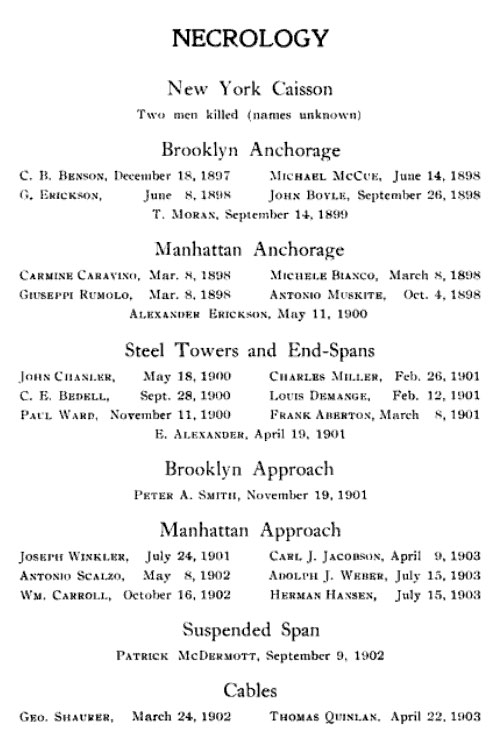
The work here described consisted of sinking two large caissons. 63 x 79 ft. In size on the Brooklyn side of the Williamsburg Bridge to bed rock. In one case 86 ft. and in the other 110 ft below mean high water, filling same with concrete and building masonry piers upon this foundation inside of coffer dams up to elevation plus 23 ft. above M. H. W. All work was done by contract during the years 1897 to 1899.
The caissons were constructed of yellow pine timber at the site of the work, launched, floated Into place and sunk to the river bottom, which was about 55 ft. below M. H. W., by filling them with concrete.
Compressed air was then turned on, and the caissons were sunk to bed rock. The material encountered, consisting of river mud, sand, clay and rock, was excavated either by means of Moran patent material locks or by wet blow out; finally the working chamber was filled with concrete. While the caissons were being sunk, the coffer dams, which were attached to the caissons, were added in order to keep their tops above water, and inside of these coffer dams the masonry piers were built. During the sinking process the masonry was built only In sufficient quantity to give the weight necessary for sinking the caissons. After the caissons were sealed and the air taken off. the shafting and piping were removed, the spaces occupied by them filled with concrete, and the pier carried up to Its final elevation. The coffer dams were then removed.

– photo by Mitch Waxman
The working people, whether they came from Sicilian village or the Jewish Shtetl, understood that America was a choice they made which would have to be lived with. There was no going back, at a time when the new political and economic theory called Capitalism could be best described as “predatory”.
The mills and factories were hellish, but reliably put bills to rest and provided a meager but steady series of meals for their families. The poorest of the poor were in Manhattan, a smoky warren of tenements and factories entirely ringed by the busiest waterfront on Earth. When and if savings were available, the aspiration of every tenement family was to move away and go live in the country- which was Brooklyn or Queens back then.
from Architecture: Volumes 7-8 – Page 104, 1903, courtesy google books
The Mayor appointed a Board of expert Bridge Engineers to examine the new plans, and their approval, together with that of the Municipal Art Commission, having been obtained, the city has accomplished something of which tew municipalities can boast.
Considering the Williamsburg Bridge first, its comparison with the old Brooklvn Bridge suffices to show how7 inartistic and reallv uglv it is, and how graceful and beautiful the older bridge appears. It is interesting to note that professional opinion has severely criticised the appearance of the Williamsburg Bridge, and that the city was willing to, and did, appropriate money to beautify this bridge.
Now, this sort of architectural padding or embellishment is the popular idea of an architect’s function in beautifying an engineering structure. “The bridge is built, happens to be ugly, employ an architect, and add some fancy features.” Or, the engineer makes the design, hands it to the architect to add a lantern or two, makes it fancy, and the artistic conscience of the interested community is at rest. The Williamsburg Bridge can never be made to look well, no matter how much it is padded; its angular lines may possiblv be softened, but that is about all that can be done.

– photo by Mitch Waxman
Remember, the America which so many members of the body politic wistfully pine for was a divided society.
What has always struck your humble narrator comically, however, is that the division was not so simple as we believe in our comfortable and streamlined modernity. Efforts of mid 20th century educators, social reformers, and political factions defined the notion of an America divide that was simply “black or white”.
The reality was that it was the Protestant gentry (of strict Anglo Saxon, or Germanic descent with a pre Civil War arrival date) and everybody else. Even the French were seen as sub human, and you can just forget about what was said about the Irish, Italians, and Jews. In my readings, Eugenics comes up a lot, and those Protestant mission houses in the “Five Points” and “Jewtown” weren’t exactly benign entities- rather they were colonialist appendages of the upper class hoping to create better servants from the lesser breeds.
from Mayor Low’s administration in New York By City Club of New York, 1903, courtesy google books
The general plan of the bridge was adjopted by the East River bridge commission on August 19th, 1896, and filed in the department of public works of each of the two cities. In May, 1897, an amended plan was adopted and filed. The first actual work on the bridge was begun on the Manhattan tower foundation on October 28th, 1896.
The tower foundations on both sides of the river rest on solid rock. The north pier on the Manhattan side sinks to a depth of 56 feet below high water and the south pier 66 feet below high water. On the Brooklyn side the north pier extends to a maximum depth of about 101 feet below high water and the south pier to a maximum depth of about 90 feet below high water. The Manhattan anchorage rests on 3,500 piles driven through clay to a bed of sand overlying the rock. The Brooklyn anchorage rests on natural sand.

– photo by Mitch Waxman
What is interesting to me (and as a son of Brooklyn- beautiful) is the way in which the imperious bourgeois (called the Knickerbocracy at the time) ending up being supplanted in power and position by these lesser breeds.
A combination of luck, hard work, and business acumen resulted in vast fortunes agglutinating amongst the immigrant hordes. The reactionary “establishment” responded with tightened immigration laws, progressive movements whose goal was “slum clearance”, and in the case of the Five Points itself- physical eradication of the neighborhood. The Public Schools were not established out of municipal altruism, rather they were a reaction to the Roman Catholic church offering free education (what would someday be the Parochial Schools) to all who wished to attend, regardless of affiliation.
Contemporary opinion rendered this as a “Papish attempt to inculcate, infiltrate, and infect the Republic with the poisons of Europe”.
also from from Mayor Low’s administration in New York By City Club of New York, 1903, courtesy google books
Transportation on the Williamsburg bridge, especially the movement of trolley cars, will not have to contend with some of the obstacles that now conspire to impede traffic on the Brooklyn bridge. The roadways for vehicles on the Williamsburg bridge will be entirely separated from the railway tracks, both trolley and elevated. This will allow the trolley cars ample space, unobstructed by vehicular traffic. The terminals will also have adequate facilities for the trolley and elevated tracks and passengers, thus avoiding the congestion now witnessed at the Brooklyn bridge terminals.

– photo by Mitch Waxman
By the period which saw the East River bridges rise, the Dutch were largely gone save for a few hold outs from ancient times. The vast majority of their population was either bred out into English lines, or had gone into the west and north. New York was firmly in the hands of the Irish empowered Tammany Hall, and the landlords of the City had realized that they could earn more by illegally subdividing existing housing stock into smaller units called “tenements”.
Manhattan was dangerously overcrowded, and everybody agreed that someone should do something about it.
from The Williamsburg Bridge: an account of the ceremonies attending the formal opening of the structure, December the nineteenth, MDCCCCIII : together with an illustrated historical and descriptive sketch of the enterprise, courtesy google books
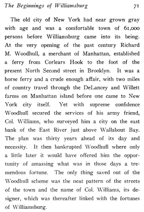

– photo by Mitch Waxman
The Brooklyn Bridge, first of the East River bridges, had proven to be a great generator of wealth on both sides of the river despite it’s outlandish cost and efforts. Modern documents emanating from municipal sources and persoanlly witnessed have referred to the modern day “Williamsburg Bridge Financial Corridor”, an attempt to explain the rejuvenation of the neighborhood from the Bowery to East River along Delancey Street as a direct consequence of the new affluence that current day Williamsburg has come to represent due to its darling status for the Real Estate industry.
In a sense, it was the original “Brooklyn Bridge Financial Corridor” which ultimately put an end to the slums of lower Manhattan, and allowed it’s occupants a chance to escape into Brooklyn. Queens came later, of course.
also from The Williamsburg Bridge: an account of the ceremonies attending the formal opening of the structure, December the nineteenth, MDCCCCIII : together with an illustrated historical and descriptive sketch of the enterprise, courtesy google books
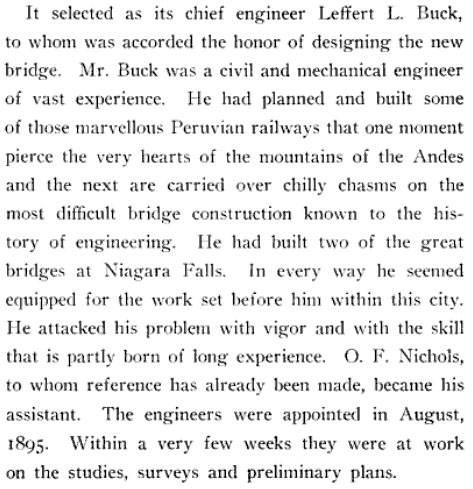

– photo by Mitch Waxman
Prior to the Williamsburg Bridge, there were two scheduled ferries one might utilize to transit from Manhattan to Williamsburg.
One was Robert Fulton’s “Grand Street Ferry”, which crossed between the Brooklyn and Manhattan roads of the same name, and a Houston street ferry made the trip albeit less frequently and with a smaller capacity of passengers. Additionally, hundreds of smaller vessels made the trip carrying some passengers, but mainly shuttling manufactured cargo or agricultural product between the coasts. An unpredictable eddy of currents and inclement weather often stranded passengers on one or the other sides of the river, sometimes for a day or more.
also from The Williamsburg Bridge: an account of the ceremonies attending the formal opening of the structure, December the nineteenth, MDCCCCIII : together with an illustrated historical and descriptive sketch of the enterprise, courtesy google books
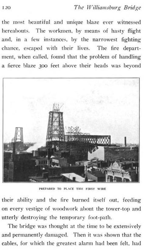

– photo by Mitch Waxman
After the 2nd East River Bridge was completed, Brooklyn’s population began to grow exponentially. Always the junior member of the two great cities on the harbor, it nevertheless absorbed millions while Manhattan began to transform- transmogrify in fact- into the Shining City we know today. Blocks of tenements were cleared away, deep pilings sunk, and the office towers began to rise and scrape the sky. The 3rd and 4th bridges were already underway and discussion of crossing the Narrows was beginning.
Bridge Commissioner Lindenthal commented on the age he lived in as being unique, knowing that the resources to conceptualize and build projects of this size only come along once or twice in the history of any city, and described himself as living in “The Age of Iron”.
also from The Williamsburg Bridge: an account of the ceremonies attending the formal opening of the structure, December the nineteenth, MDCCCCIII : together with an illustrated historical and descriptive sketch of the enterprise, courtesy google books

– photo by Mitch Waxman
As mentioned at the beginning of this post, your humble narrator is composed of lesser stuff than most and certainly does not exhibit any of the qualities of iron besides corrosion. While examining the contents of my camera card, which bore hundreds of shots I did not remember taking, my hands began to shake as I saw this familiar scene…
…I had entered the truest place, and the ultimate reality…
…that pole of consciousness and latent possibility which all other locations are mere reflections of…
…the one place where “do or die” actually means something…
from wikipedia
Williamsburg is a neighborhood in the New York City borough of Brooklyn, bordering Greenpoint to the north, Bedford-Stuyvesant to the south, Bushwick to the east and the East River to the west. The neighborhood is part of Brooklyn Community Board 1. The neighborhood is served by the NYPD’s 90th Precinct. In the City Council the western and southern part of the neighborhood is represented by the 33rd District; and the eastern part of the neighborhood is represented by the 34th District.
Many ethnic groups have enclaves within Williamsburg, including Hasidic Jews, Italians, Puerto Ricans, and Dominicans. It is also an influential hub for indie rock, hipster culture, and the local art community, all of which are associated with one of its main thoroughfares, Bedford Avenue. The neighborhood is being redefined by a growing population and the rapid development of housing and retail space.

– photo by Mitch Waxman
…I had come to Infinite Brooklyn…
also from wikipedia
In 1638 the Dutch West India Company first purchased the area’s land from the local Native Americans. In 1661, the company chartered the Town of Boswijck, including land that would later become Williamsburg. After the English takeover of New Netherland in 1664, the town’s name was anglicized to Bushwick. During colonial times, villagers called the area “Bushwick Shore.” This name lasted for about 140 years. Bushwick Shore was cut off from the other villages in Bushwick by Bushwick Creek to the north and by Cripplebush, a region of thick, boggy shrub land which extended from Wallabout Creek to Newtown Creek, to the south and east. Bushwick residents called Bushwick Shore “the Strand.” Farmers and gardeners from the other Bushwick villages sent their goods to Bushwick Shore to be ferried across the East River to New York City for sale via a market at present day Grand Street. Bushwick Shore’s favorable location close to New York City led to the creation of several farming developments. In 1802, real estate speculator Richard M. Woodhull acquired 13 acres (53,000 m²) near what would become Metropolitan Avenue, then North 2nd Street. He had Colonel Jonathan Williams, a U.S. Engineer, survey the property, and named it Williamsburgh (with an h at the end) in his honor. Originally a 13-acre (53,000 m2) development within Bushwick Shore, Williamsburg rapidly expanded during the first half of the nineteenth century and eventually seceded from Bushwick and formed its own independent city.
grotesquely gnarled

– photo by Mitch Waxman
As described in a prior posting– certain anonymous parties had contacted me about- and a meeting at St. Patrick’s Old Cathedral in Manhattan was arranged- to discuss and finally gain possession of information which would lead to a certain location in First Calvary Cemetery which has denied all attempts at discovery.
Arriving at the venerable church early, however, the individual with whom this appointment was arranged arrived with confederates of a seeming rough character, and the notion that I had stumbled into some sort of conspiratorial snare of malign intent terrified me. Your humble narrator fell into “one of my states”, and the scene was fled in a stuporous panic.
Several hours later, when able to recompose myself, it was discovered that the memory card of my camera was nearly full, and this is the second of a series of postings attempting to reconcile the hundreds of photos I found with my episode of “missing time”.
from wikipedia
Missing time is a proposed phenomenon reported by some people in connection with close encounters with UFOs and abduction phenomena. The term missing time refers to a gap in conscious memory relating to a specific period in time. The gap can last from several minutes to several days in length. The memory of what happened during the missing time reported is often recovered through hypnosis or during dreams.

– photo by Mitch Waxman
Based on the series of photos, it is presumed that my route took me down Mulberry on a southern declination, before turning east on Kenmare and ultimately to Delancey. The warren of streets which defy and predate the Manhattan grid, which is two centuries old this year– I would add- have been massively altered from their historic patterns by the attentions of urban planners and DOT engineers since the time of the Bloody Sixth Ward.
Partially, this was to accommodate the “automobile city” of the early 20th century, but no small effort was spared to eliminate the alleyways and so called “courts” which denied easy policing and access by fire and sanitation inspectors in this region of the Shining City.
It was in these courts and alleys that the street gangs of the 19th century were allowed to fester and swell, an offensive and dangerous situation to the progressives and reformers of the post civil war era “City Beautiful”.
from wikipedia
The City Beautiful Movement was a reform philosophy concerning North American architecture and urban planning that flourished during the 1890s and 1900s with the intent of using beautification and monumental grandeur in cities. The philosophy, which was originally associated mainly with Chicago, Detroit, and Washington, D.C. allegedly promoted beauty not for its own sake, but rather to create moral and civic virtue among urban populations. Advocates of the philosophy believed that such beautification could thus promote a harmonious social order that would increase the quality of life.

– photo by Mitch Waxman
My trusty camera seems to have been pointed in the direction of the 2nd of the three East River Bridges to have been erected, which we know as the Williamsburg. 100 years ago, I might have boarded a street car or horse drawn wagon to carry me over the span and boarded it at Bowery and Delancey. Were I cognizant of my surroundings, rather than stumbling in a panic, I might have caught an electric light rail- which is referred to as a “subway”- but instead and inexorably I marched forward into “Jewtown”.
from HOW THE OTHER HALF LIVES By JACOB A. RIIS, courtesy google books
THE tenements grow taller, and the gaps in their ranks close up rapidly as we cross the Bowery and, leaving Chinatown and the Italians behind, invade the Hebrew quarter. Baxter Street, with its interminable rows of old clothes shops and its brigades of pullers-in—nicknamed “the Bay ” in honor, perhaps, of the tars who lay to there after a cruise to stock up their togs, or maybe after the “schooners” of beer plentifully bespoke in that latitude— Bayard Street, with its synagogues and its crowds, gave us a foretaste of it. No need of asking here where we are. The jargon of the street, the signs of the sidewalk, the manner and dress of the people, their unmistakable physiognomy, betray their race at every step. Men with queer skull-caps, venerable beard, and the outlandish long-skirted kaftan of the Russian Jew, elbow the ugliest and the handsomest women in the land. The contrast is startling. The old women are hags; the young, houris. Wives and mothers at sixteen, at thirty they are old. So thoroughly has the chosen people crowded out the Gentiles in the Tenth Ward that, when the great Jewish holidays come around every year, the public schools in the district have practically to close up.

– photo by Mitch Waxman
The politics of modern city dwellers prefers not to attach ethnic sobriquets to neighborhoods where any single population crowds out other mention anymore, but in the 19th century no such prohibition applies. Early subway maps refer to this section of Delancey east of the Bowery as “the Ghetto” for instance. Such description signifies the magnetic appeal of the tenement neighborhood to the vast Yiddish speaking populations which made good their escape from the “the Pale” in the 19th century.
These largely weren’t the Orthodox Jews of today, of course, as the Hasidic and Lubavitcher sects – typified by an outdated style of dress and clannish separation from their surrounding environs – are a fairly modern path which only began to gather real steam in the 19th century (just like most fundamentalist religions) and in the 20th century these groups still represent only a tiny fraction of the larger ethnic population.
Instead the majority were religious but secular peasants from the countryside, suddenly finding themselves in New York City living next door to a sophisticated citizen from the Austro Hungarian- or Russian- or Ottoman- empires. It was these transplanted urbanites who founded the Forverts and other Yiddish language newspapers.
from wikipedia
The Forward (Yiddish: פֿאָרווערטס; Forverts), commonly known as The Jewish Daily Forward, is a Jewish-American newspaper published in New York City. The publication began in 1897 as a Yiddish-language daily issued by dissidents from the Socialist Labor Party of Daniel DeLeon. As a privately-owned publication loosely affiliated with the Socialist Party of America, Forverts achieved massive circulation and considerable political influence during the first three decades of the 20th Century. The publication still exists as a weekly news magazine in parallel Yiddish (Yiddish Forward) and English editions (The Jewish Daily Forward).

– photo by Mitch Waxman
The synagogues of Eastern and Southern Europe which have survived into modernity have all the appearances of a fortified house or town, and go to some lengths to blend into the surrounding communities. In the United States, however, the desire to show off and build a palace to the almighty was not limited to the Catholics or Episcopalians. Such aspirations were present amongst the Jews as well.
On the corner of Delancey and Forsyth one may find the former “Forsyth Street Synagogue, Poel Zedek Anshei Illia (Doers of Good, People of Illia)“. In modernity, it serves as a place of worship for the Seventh Day Adventists, which grew out of the millennialist Millerites in the years following the “Great Disappointment” 1844.
from wikipedia
October 22, 1844, that day of great hope and promise, ended like any other day to the disappointment of the Millerites. Both Millerite leaders and followers were left generally bewildered and disillusioned. Responses varied: some Millerites continued to look daily for Christ’s return, others predicted different dates—among them April, July, and October 1845. Some theorized that the world had entered the seventh millennium, the “Great Sabbath”, and that, therefore, the saved should not work. Others acted as children, basing their belief on Jesus’ words in Mark 10:15, “Truly, I say to you, whoever does not receive the kingdom of God like a child shall not enter it.” O. J. D. Pickands used Revelation 14:14-16 to teach that Christ was now sitting on a white cloud, and must be prayed down. Probably the majority however, simply gave up their beliefs and attempted to rebuild their lives. Some members rejoined their previous denominations while a substantial number became Quakers.

– photo by Mitch Waxman
An unknown structure to me, online accounts describe it as having passed from Hebraic hands during the long 20th century decline of the neighborhood and speak of its resurrection when it began to serve as a church to some of modern Christianity’s more charismatic adherents. It is odd to see the Mogen David bisected by the rood outside of the esoteric or gnostic traditions.
Delancey street, I would mention, always figured prominently in the adages and folkloric warnings that my grandmother would hand out when I was a young but already humble narrator. A product of the Pale herself, she found work in America in that jewish garment trade which once flourished here, and even into extreme old age she practiced her craft. She always referred to Delancey and the environs as a home to midwives and fortune tellers (kabbalists) and shmata men.
When queries as to how lucrative the shmata (rag) trade was, and who could possibly need enough rags to keep a merchant employed full time- her response was “vat doz yu tink yu viped yur arse mit? Dere vas no terlet papah beck den”.
from wikipedia
Adventism is a Christian movement which began in the 19th century, in the context of the Second Great Awakening revival in the United States. The name refers to belief in the imminent Second Coming (or “Second Advent”) of Jesus Christ. It was started by William Miller, whose followers became known as Millerites. Today, the largest church within the movement is the Seventh-day Adventist Church.
The Adventist family of churches are regarded today as conservative Protestants. While they hold much in common, their theology differs on whether the intermediate state is unconscious sleep or consciousness, whether the ultimate punishment of the wicked is annihilation or eternal torment, the nature of immortality, whether or not the wicked are resurrected, and whether the sanctuary of Daniel 8 refers to the one in heaven or on earth. The movement has encouraged the examination of the New Testament, leading them to observe the Sabbath.

– photo by Mitch Waxman
Uncertainty exists in my mind as to whether or not my trance induced scuttling and the photographic record thereof bears any kind of narrative thread or not. It would seem that my subject matter and focal point of view remained steady with normal pursuits, chasing esoteric and disabused touchstones of the oft occluded past, and noticing the small details hidden amongst the centuries old tapestry.
One wonders if I might have wandered into this storefront psychic and what Gypsy legend would have been offered. Perhaps I did, but in my trance state, who can venture as to what might have occurred in the moments between photos?
from wikipedia
Romani mythology is the myth, folklore, religion, traditions, and legends of the Romani people (also known as Gypsies). The Romanies are a nomadic culture which originated in India during the Middle Ages. They migrated widely, particularly to Europe. Some legends (particularly from non-Romani peoples) say that certain Romanies are said to have passive psychic powers such as, empathy, precognition, retrocognition, or psychometry. Other legends include the ability to levitate, travel through astral projection by way of meditation, invoke curses or blessings, conjure/channel spirits, and skill with illusion-casting.
Burial: Romanies pushed steel or iron needles into the body’s heart and put pieces of steel in the mouth, over the eyes, ears, and between the fingers. Hawthorn was placed on the legs, or driven through the legs. They would also drive stakes, pour boiling water on the grave, and behead or burn the body. All this preparation was to ward off vampires.
Afterlife: Romanies had a concept of Good and Evil forces. Dead relatives were looked after loyally. The soul enters a world like the world of the living, except that death does not exist. The soul lingers near the body and sometimes wants to live again.

– photo by Mitch Waxman
The River of Sound awaited, and a vast steel span was to be crossed.
Tomorrow is Williamsburg, where Brooklyn’s Grand Street will be attained and the puzzling series of shots found on my camera card will be further explored at this… Your Newtown Pentacle.
from medical-dictionary.thefreedictionary.com
compulsive walking
affected animals walk oblivious to their surroundings. They appear to be blind, walk into objects, headpress against them and stay in this position for long periods, are oblivious to danger and may die of misadventure. They may attempt to climb a wall and fall over backwards. Common causes are hepatic encephalopathy and increased intracranial pressure.
unending steps

– photo by Mitch Waxman
By email, I was contacted by a personage who claimed that the long desired location of a certain interment at First Calvary Cemetery in Queens- the burial site of “he who must not be named“- was in his possession. Further, it was asserted that while anonymity and certain other odd conditions were required, the occluded information so long sought would be mine for the taking.
A meeting was hastily arranged at St. Patrick’s Old Cathedral on Manhattan’s Mulberry street, and your humble narrator scuttled off to the Bloody Sixth Ward and the House of Dagger John.
What greeted me was not to my liking.
from saintpatrickscathedral.org
The recent elevation of New York as an Episcopal see with its own bishop inspired the increasing Catholic population to build the original Cathedral of New York under the name of Ireland’s patron saint, Saint Patrick. The site chosen belonged to the corporation of Saint Peter’s Church and was located on Mulberry Street in lower Manhattan. The cornerstone was laid in June 1809.

– photo by Mitch Waxman
As is habit and curse, an early arrival was attempted and achieved, and a hidden vantage point amongst the venerable pews was attained. The odd fellow who had contacted me described his aspect and appearance accurately, and recognition was instant when he strode confidently into the ancient church. He did not arrive alone, as he had implied in his missives, however.
The disturbing aspect of his companions, leathery creatures best described as men, and the hushed instructions he seemed to be offering them, brought me to a peak of nervous excitedness and a panic set in upon me. Stupidly, I had walked directly into a spiders web, lured in by forbidden fruit.
Had some sort of diabolical plot, hatched by those malign forces whose secretive occupations and desires and unguessed at existence has been inadvertently hinted at and offended by this- your Newtown Pentacle, been set in motion to snare and silence me?
from wikipedia
Until 1830, the Cathedral was the ending place of the annual St. Patrick’s Day parade. After that, it ended on Ann Street at the Church of the Transfiguration, whose pastor, Father Varela, was Cuban, but was a fervent nationalist and the chaplin of the Hibernian Universal Benevolent Society. Eventually, the parade moved uptown to pass in front of the new St. Patrick’s Cathedral.
In 1836, the cathedral was the subject of an attempted sack after tensions between Irish Catholics and anti-Catholic Know-Nothing nativists led to a number of riots and other physical confrontations. The situation worsened when a brain-injured young woman wrote a book telling her “true” story – a Protestant girl who converted to Catholicism, and was then forced by nuns to have sex with priests, with the resulting children being baptized then killed horribly. Despite the book being debunked by a mildly anti-Catholic magazine editor, nativist anger at the story resulted in a decision to attack the cathedral. Loopholes were cut in the church’s outer walls, which had just recently been built, and the building was defended from the rioters with muskets.

– photo by Mitch Waxman
As previously described, vast physical inadequacy and cowardice are my hallmarks. The least of all men, my only recourse is flight, and I seem to have descended into some sort of fugue state.
I remember leaving the sepulchral darkness and unnatural cool of the old Cathedral, but from the moment that the burning thermonuclear eye of god itself shone upon me, it’s a total blank.
My next conscious memory is that of having arrived back at HQ in Astoria some hours later with blistered feet and chafed thighs, and an odd crusty residue around my eyes reminiscent of the dehydrated tears which adorn the occulum of a recently awakened sleeper.
During this multi hour episode, I seem to have been taking hundreds of pictures as I scuttled instinctually and inexorably homeward.
I’ve pieced my somnambulist route together from the shots on my camera card and for some reason, seemed to be subconsciously following an ancient street car route, the one that went to Calvary via Williamsburg as I later scried.
In 1850 a line of two horse stages was running from Grand Street ferry past the Dutch Church on the Old Woodpoint Road out to Newtown. Grape arbors extended from Leonard Street to Humboldt Street.
Martin J. SUYDAM ran a stage from Peck Slip and Grand Street. Ferries through Grand Street and Metropolitan Avenue to Newtown.
The Grand Street and Newtown Railroad Co., was chartered in 1860. At the foot of the street was the office of the Houston Street Ferry Association and later of the Nassau Ferry Co. A long wooden stairway led from the ferry to the American Hotel, latter, #2 & 4, kept by Jackson HICKS.

– photo by Mitch Waxman
Some sort of odd symmetry presents itself, of course, in this dreamt of photowalk. The vast numbers who lie within the emerald devastations of Laurel Hill made the same journey themselves, although most did not take the Williamsburg Bridge- rather a connecting ferry and streetcar line which would have joined some forgotten 19th century Manhattan pierage (near its own Grand Street) with the gentry of Brooklyn. Don’t forget, in the 19th century, Manhattan was a pestilential hell hole of factories and open sewers populated by a starving horde of refugees- Brooklyn was in it’s own golden age.
The Bridge didn’t come along until 1883 after all, and First Calvary was nearly full by then.
I suppose there are and have been worse conditions of life, but if I stopped short of savage life I found it hard to imagine them. I did not exaggerate to myself the squalor that I saw, and I do not exaggerate it to the reader. As I have said, I was so far from sentimentalizing it that I almost immediately reconciled myself to it, as far as its victims were concerned. Still, it was squalor of a kind which, it seemed to me, it could not be possible to outrival anywhere in the life one commonly calls civilized. It is true that the Indians who formerly inhabited this island were no more comfortably lodged in their wigwams of bark and skins than these poor New-Yorkers in their tenements. But the wild men pay no rent, and if they are crowded together upon terms that equally forbid decency and comfort in their shelter, they have the freedom of the forest and the prairie about them; they have the illimitable sky and the whole light of day and the four winds to breathe when they issue into the open air. The New York tenement dwellers, even when they leave their lairs, are still pent in their high-walled streets and inhale a thousand stenches of their own and others’ making. The street, except in snow and rain, is always better than their horrible houses, and it is doubtless because they pass so much of their time in the street that the death rate is so low among them. Perhaps their domiciles can be best likened for darkness and discomfort to the dugouts or sod huts of the settlers on the great plains. But these are only temporary shelters, while the tenement dwellers have no hope of better housing; they have neither the prospect of a happier fortune through their own energy as the settlers have, nor any chance from the humane efforts and teachings of missionaries, like the savages. With the tenement dwellers it is from generation to generation, if not for the individual, then for the class, since no one expects that there will not always be tenement dwellers in New York as long as our present economical conditions endure.

– photo by Mitch Waxman
As evidenced in the shot above, I seem to have proceeded south along Mulberry Street, past the high walls of the Old Cathedral which were erected by Dagger John and the Hibernians to protect the sanctuary from the violent attentions of Nativist rioters during those starry years when this neighborhood was known as “the bloody sixth ward”.
from History of the Second company of the Seventh regiment By Emmons Clark, courtesy google books
The Sixth Ward was noted for its disorderly character, and the frequent skirmishes which took place within its borders, with the consequent black eyes and bloody noses, gave it the well-known sobriquet,—”the Bloody Sixth.” On the first day of the election, in the spring of 1834, it was said that the anti-bank, Democratic, and Irish citizens of the Sixth Ward, had blockaded the polls and prevented the Whigs from voting. On the second day, the Whigs from other districts rallied in large numbers to the Sixth Ward, resolved to break the blockade and give their friends an opportunity to cast their ballots. The result was a series of engagements, in which both parties maintained their positions in the field until the polls closed for the day. A ship, mounted on wheels and adorned with Whig banners, was drawn through the ward, and used to convey voters to the polls, and this insulting invasion of the Democratic stronghold increased the excitement.

– photo by Mitch Waxman
This grand walk carried me, in a seemingly dream like state, through the lower Manhattan neighborhoods known to Dagger John and his compatriots as either “Jewtown” or “the Ghetto”, over the Bridge, into Williamsburg, through Bushwick and then Maspeth in Brooklyn and Queens respectively, into Berlin and then Blissville in the Creeklands, and ultimately Calvary Cemetery itself. Over the next few days, and from the comfort and safety of a well fortified Newtown Pentacle HQ (which sports a cadre of Croatian Varangians dedicated to my health and well being, should these malign forces decide to visit… as well as other… more esoteric defenses) I’ll be presenting the fruits of this journey. As mentioned, I somehow kept shooting the whole way.
from wikipedia
Basil II’s distrust of the native Byzantine guardsmen, whose loyalties often shifted with fatal consequences, as well as the proven loyalty of the Varangians, led him to employ them as his personal bodyguards. This new force became known as the Varangian Guard (Greek: Τάγμα των Βαράγγων, Tágma tōn Varángōn). Over the years, new recruits from Sweden, Denmark, and Norway kept a predominantly Scandinavian cast to the organization until the late 11th century. So many Scandinavians left to enlist in the guard that a medieval Swedish law from Västergötland stated that no one could inherit while staying in “Greece”—the then Scandinavian term for the Byzantine Empire. In the eleventh century, there were also two other European courts that recruited Scandinavians: Kievan Rus’ c. 980–1060 and London 1018–1066 (the Þingalið). Steven Runciman, in The History of the Crusades, noted that by the time of the Emperor Alexios Komnenos, the Byzantine Varangian Guard was largely recruited from Anglo-Saxons and “others who had suffered at the hands of the Vikings and their cousins the Normans”. The Anglo-Saxons and other Germanic peoples shared with the Vikings a tradition of faithful (to death if necessary) oath-bound service, and after the Norman Conquest of England there were many fighting men who had lost their lands and former masters and looked for a living elsewhere.
Additionally, for those who might be interested in a FREE boat tour of Newtown Creek on City of Water Day – which is Saturday, July 16th- this web page bears monitoring.


