unvisited mountain
Tuesday
– photo by Mitch Waxman
One last batch of photos from my penultimate boat trip down Newtown Creek greets you in today’s post.
The very first time I came back here by boat was back in 2007 or 2008, and it was a tour led by my future friend Bernie Ente with Working Harbor Committee acting as the organizer. Bernie was one of the founders of Newtown Creek Alliance, a great photographer, and he left his family and this world while still far too young in 2011.

– photo by Mitch Waxman
Bernie and I had been working together for a while when he passed, doing boat and walking tours, and having adventures. My pal Mai Armstrong started hanging around with us, and we all worked on the NYC Bridge Centennial Commission with Barry and Judith Schneider, Gridlock Sam Shwartz, and the then NYC DOT Commissioner Jeanette Sadik-Khan on the City’s centennial celebrations for the Queensboro, Manhattan, Madison Avenue, and Hunters Point Avenue Bridges. Bernie almost missed the latter one, and he ended up checking himself into a hospital just a few days after it. He never checked out.
Bernie Ente introduced me to a circle of incredible people, all experts on one subject or another, and we collectively referred to ourselves as “Team Bernie” afterwards.
– photo by Mitch Waxman
There was John Doswell, and Meg Black. There was John Skelson and Rich Taylor, a guy named John who works for the city and I can’t say his last name out loud in public or he’ll get in trouble with his boss, the self proclaimed “Harbor Wenches,” and Captain Maggie and…
Over at Newtown Creek Alliance, which had recently become a “proper” non profit rather than a community group, there were Katie Schmidt and the new Executive Director Kate Zidar, and my pal Penny Lee from NY City Planning. At the time, I was still on speaking terms with the Greater Astoria and Newtown Historical Societies. Those two’s a tale, I tell’s ya.
The path of education that Bernie started me on was continued by all of these people. My pal Mai Armstrong was by my side through it all.
– photo by Mitch Waxman
Boat tours were always my favorite. I love telling the story of Newtown Creek and New York Harbor while bouncing along on the tide. I got to narrate on the Circle Line once with historian Dr. Kenneth Jackson (Encyclopedia of New York) onboard and at no point did he throw a chair at me or anything, so great success.
I’m quite reflective about all these people, many of whom have either retired to their dotage or passed on to their rewards.
– photo by Mitch Waxman
It won’t be too long now. I’ll be living somewhere else by Christmas.
I’ve spent my entire life in NYC. Grew up in Brooklyn, lived for a while in Manhattan, and I’ve been in Astoria for just under 20 years now. Newtown Creek has been at the center of my thoughts and actions for nearly 15 years. It’s time for the next generation to pick up their lance and tilt at the windmills along my beloved Creek.

– photo by Mitch Waxman
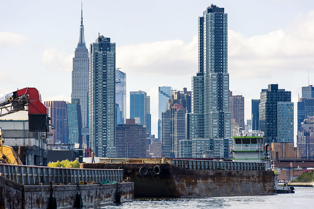
In a first for me, I actually had to sort of leap off the boat and catch a ladder affixed to the shoreline to get back on land in Greenpoint.
One soon found himself scuttling again, across the Pulaski Bridge. As always, the camera was being waved around at the various wonders of the currently undefended border of Brooklyn and Queens.
Tomorrow, more – more – MORE!
“follow” me on Twitter- @newtownpentacle
Buy a book!
“In the Shadows at Newtown Creek,” an 88 page softcover 8.5×11 magazine format photo book by Mitch Waxman, is now on sale at blurb.com for $30.
grassy cobbles
Monday

– photo by Mitch Waxman
Last week, one described the circumstances of a navigation of Newtown Creek on September 27th during which the photos in today’s, and prior postings, were captured. The small boat I was riding in had been navigated all the way back to the Metropolitan Avenue Bridge by it’s Captain – Carter Craft. There’s still a bit of navigable water beyond this span, a double bascule drawbridge owned and operated by the NYC DOT, but I seldom go back there in anything larger than a rowboat and I don’t do that often at all.
Down Under the Metropolitan Bridge Onramp or DUMABO, that’s how I “tag” anything which I’ve written about this bridge, or the area directly surrounding it in Brooklyn. The English Kills tributary of Newtown Creek is entirely contained within the political boundaries of the Borough of Brooklyn, in its East Williamsburgh section.

– photo by Mitch Waxman
English Kills is entirely hidden from view on the surrounding streets. A once natural waterway canalized by the various Corporate entities which once housed themselves here, and the United States Army Corps of Engineers. From the surrounding streets, you’d never know it was there if it wasn’t for the industrial noises and horrific smell. The odor is not unlike what you’d expect were you were to shit into a bucket of rubber cement thinner, and then set it out to sit in direct sunlight, while a running diesel engine out gassing exhaust. The sound is a “constant din” as in there’s no specific point source for it, rather there’s an atmosphere of noise echoing off the factory and warehouse walls.
The canalized shape of English Kills follows the jigsaws grid of the surrounding streets, which causes its waters to stagnate around the right angled turns. The presence of CSO’s – or Combined Sewer Outfalls – all along Newtown Creek means that the only fresh water entering English Kills comes from these upland drains. This flow is a mix of storm water, road runoff, and sewage. The latter is full of piss and poop, if you need me to point that out. The runoff and storm water washes through the neighborhoods first, carrying garbage and whatever might have dripped out of vehicles passing by on the roadways, and then into the stagnant water column of the tributary.
Because of the stagnation, a bed of sedimentation sits 15-20 feet thick under the surface of the water, sometimes poking out into the air at low tide. The sediments are referred to as “Black Mayonnaise.”

– photo by Mitch Waxman
Historic records suggest that the natural waterway that was once here, prior to colonization by the Dutch, was fed by upland streams and rock springs running down into the waterway’s basin from the highlands surrounding it, in modern day Maspeth, Ridgewood, and Bushwick. It’s the availability of that fresh water bubbling up from the rock springs that drew German beer breweries to establish themselves in these areas. The springs were capped, and the ground water claimed. That was the first industrial nail in the coffin of this part of the larger waterway. Contaminants and pollution from industrial plants literally miles away on the Creek would end up getting pushed back here and since there was nothing tidally pushing back, the bad stuff settled to the bottom. The Black Mayonnaise encountered “here” can be very different from conditions encountered “there,” despite the fact that it’s the same water body. Even on English Kills, the section you’re looking at in the shot above is entirely different from the hellscape found a half mile away in the zone around the apocalyptic Montrose Avenue Railroad Bridge nearby Newtown Creek’s terminus, at Bushwick’s Johnson Avenue.
Few of the modern businesses on English Kills use their maritime bulkheads, once amongst the most valuable in NY Harbor or even the world due to the nearby Evergreen Line Railroad tracks – which are today’s Long Island Railroad Bushwick Branch tracks.

– photo by Mitch Waxman
Open sewers dating back to the Civil War are seen here.
English Kills is the extermination of ration and hope, and a cautionary tale about municipal indifference. The NYC DEP, who operate those CSO drains mentioned above, found themselves under regulatory scrutiny by New York State a few years ago due to the low levels of oxygen present in these waters. The low oxygen situation is caused by sewage bacteria, which they allow into the Newtown Creek via the CSO’s. The answer DEP came up, since doing anything at all about the outflows themselves would be very expensive to the City, was to instead build an aeration system into the waterway. Giant bubble wands, reminiscent of a hobbyist aquarium’s setup, pump air into the water, which causes surface turbulence. These bubbles theoretically cause atmospheric oxygen to diffuse into the water.
The air flow also introduces mechanical energy into the bottom sediments and causes them to rise and coat the shorelines, where the so called black mayonnaise becomes exposed to the air.

– photo by Mitch Waxman
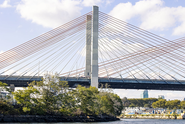
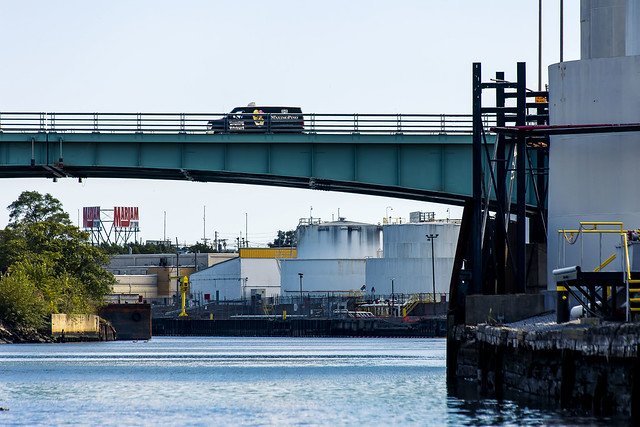
Grand Street Bridge, a swing bridge, is pictured above. The center of that bridge is where the currently undefended border of Brooklyn and Queens is found. If hostilities ever break out, this will be a flash point and no man’s land where campaigns of armed attrition will play out.
Our time on Newtown Creek was nearing an end and my pal Carter captained us back toward Greenpoint, and the Manhattan Avenue Street End where he picked us up earlier in the day. A humble narrator was on an emotional roller coaster, it should be admitted.
“Every time might be the last time.”

– photo by Mitch Waxman
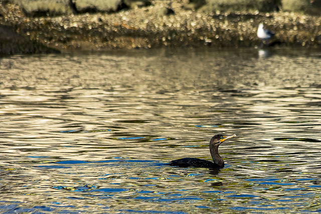
Along our journey back in the direction of the East River, nearly three miles back on the Maspeth side, we saw a guy fishing in Newtown Creek.
Tomorrow, more! And then even more! More all the time, now with extra more! Now – more than ever – more!
“follow” me on Twitter- @newtownpentacle
Buy a book!
“In the Shadows at Newtown Creek,” an 88 page softcover 8.5×11 magazine format photo book by Mitch Waxman, is now on sale at blurb.com for $30.
tenement blocks
Friday

– photo by Mitch Waxman
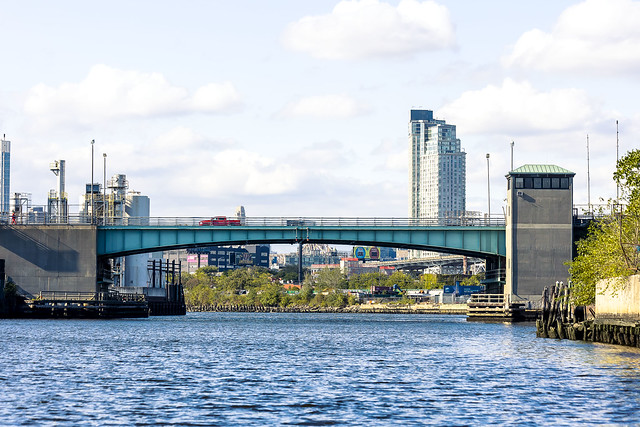
As described yesterday, on the 27th of September my friend Carter Craft offered to shuttle me around Newtown Creek onboard his boat. These photos are from that excursion, which is likely my penultimate trip on the Creek. That’s the Greenpoint Avenue Bridge pictured above, and the POV looks westwards along the creek towards LIC. This spot is 1.37 miles from the East River.
The NYC DOT, whose 1987 vintage double bascule drawbridge this is, also refers to the thing as the J.J. Byrne Memorial Bridge. A former saloon singer and later a Commissioner of Public Works for Brooklyn, Byrne became Borough President in 1925, succeeding the previous BP – Joseph A. Guider – who died while in office. As to why the rather unremarkable Byrne ended up in the top spot, look no further than his Brother in Law – John H. McCooey – the political boss of Brooklyn who was known as “their man in Brooklyn, Uncle John” to the Tammany Hall players over in Manhattan. Byrne would also die in office, and just to show you how long the lines of political patronage in NYC government are – Michael Bloomberg is the Mayor who presided over adding the “J.J. Byrne” moniker to the bridge.

– photo by Mitch Waxman
We continued eastwards along the Newtown Creek, past the spectacle of the Green Asphalt outfit filling a barge with their product. A single maritime barge carries the equivalent cargo of 38 heavy trucks. The only hope NYC has to survive the next century without filling every single street, all the time, with heavy trucking is maritime in nature. What have we done with our waterfronts, accordingly? Luxury apartment buildings and eradicating ship to shore infrastructure and industrial centers… but, alas… nothing matters and nobody cares.
Green Asphalt, and companies like it, sprung into existence after the 2010 Solid Waste Management Act was rammed into existence by the Bloomberg people. Prior, when a roadway was milled, the asphalt surfacing that was dug up out of the roadbed would be sent to landfills. Green Asphalt receives this material nowadays from the NYC DOT road crews and contractors who maintain our streets. It’s heated up using steam, and a bit of fresh material is introduced into the stuff, which is then sent back out to be reapplied to the roadbed.

– photo by Mitch Waxman
We floated past the Queens side site of the first large scale petroleum refinery in the United States – the remnants of the 1854 vintage “North American Kerosene Gas Light Company” of Abraham Gesner. Later acquired by Charles Pratt (Standard Oil Company of New York), Mobil Oil would inherit the site and operate an industrial lubricant manufacturing plant here until the second half of the 20th century.
One of the petroleum enforcement actions which ExxonMobil has had to oblige on Newtown Creek started one day in 2011 when I was tagging along on one of Riverkeeper’s patrols of Newtown Creek and when I noticed that oil was migrating out of the bulkheads in this area. That’s the day that the story of the “Blissville Seep” began. The Riverkeeper folks shortly got the “official” ball rolling with the regulatory agency – NYS Department of Environmental Conservation. ExxonMobil admitted a modern day culpability for the deeds of their long ago corporate brethren, and deployed their environmental contractors (under the supervision of NYS DEC) who are busily installing all sorts of equipment in these industrial quarters to handle the situation.
This POV is on the water side of Review Avenue, behind the line of factory and warehouse buildings – and the LIRR tracks – opposite First Calvary Cemetery.
Only oil spill I ever got to help discover, at least. This was also the beginning of my whole “Citizen Waxman” shtick.

– photo by Mitch Waxman
When the project to replace the Kosciuszcko Bridge suddenly received an Andy Cuomo sized shoe up its keister, I had already been cataloguing the DUKBO section of Newtown Creek for a few years. Anything collected or written about, in this area, received that particular tag. Just as this project was kicking into gear is when what I was doing on Newtown Creek got noticed by a whole big bunch of people, including The NY Times.
That’s when Citizen Waxman was invited to join the Kosciuszcko Bridge Stakeholders Advisory Committee, and that put me right in the center of the whole rebuilding and replacement project. All of a sudden, I was in the same room as Congressmen and City Council people regularly. That’s also right about when I started working for Atlas Obscura and others, doing Newtown Creek walking and vehicle tours nearly every weekend during the summer months for several years.

– photo by Mitch Waxman
For one of these tours, my buddy Joey and I transported a bunch of wooden palettes from his job site at a haulage company to a weed choked mud hole along the creek in Maspeth. We laid the palettes down on top of the Poison Ivy and dodged the clouds of flying insects which we’d disturbed. Formerly, you had to just bust your way through thorns and vines to get down to the water. I’ve always been big on safety for people that came on my walks, so Joey and I created a plank road of palettes at the Maspeth Avenue Plank Road site. Eventually, after talking about its potential endlessly, I managed to “put something on the map.” Today – people actually come here as a destination, and they hang out by the water. Artists, musicians.
To each and every one of my friends, whom I’ve convinced to do utterly illogical and over the top things with me over the years along the creek… thank you. This is why.
The Plank Road has since received historic signage, and Newtown Creek Alliance has undertaken a stewardship program at the place. The ground has received some landscaping as well. It’s a site which will also be preserved through the superfund process, which is another feather I can point to in my cap.

– photo by Mitch Waxman
My pal Carter turned the boat into English Kills, which is technically a tributary, but it seems like it’s just the bitter end of Newtown Creek.
This is one of the most environmentally damaged sections of the waterway, as a note. Also – “Kills” is ye olde Dutch for Creek. This spot is about 3 miles back from the East River, and it’s right at the turn out from the main channel. The Grand Street Bridge is nearby, and in accordance with my zone system acronyms – this area is tagged with DUGSBO, or Down Under the Grand Street Bridge Onramp.
More next week, at this – your Newtown Pentacle.
“follow” me on Twitter- @newtownpentacle
Buy a book!
“In the Shadows at Newtown Creek,” an 88 page softcover 8.5×11 magazine format photo book by Mitch Waxman, is now on sale at blurb.com for $30.
devilish anxiety
Thursday

– photo by Mitch Waxman
As described in yesterday’s post, on the 27th of September one was provided with a uniquely wonderful offer by my friend, Carter Craft. Carter owns a boat, and he offered to take me out for an afternoon’s navigation upon the absolutely lugubrious Newtown Creek.
We got lucky, with perfect autumn weather. That’s what the Pulaski Bridge looks like from below. Over the years, everything that’s I’ve written about that’s in the vicinity of this bridge, on either side of the creek – Brooklyn or Queens – has been tagged with the acronym DUPBO – short for “Down Under the Pulaski Bridge Onramp.”

– photo by Mitch Waxman
For the first 10 years or so of the time I’ve been hanging around Newtown Creek, boat excursions and tours were pretty frequent. With either Working Harbor Committee, or Newtown Creek Alliance or sometimes both – we’d hire out ferry boats to conduct public or private facing tours of the waterway. Working Harbor’s mission includes “educating the public about the harbor” and NCA’s is “reveal, restore, revitalize,” so bringing people here was a significant action for us. We’d also partner up with Open House NY and others to do boat tours.
When NYC Ferry came along about 8 years ago, they began hiring all the available ferry boats in NY Harbor to handle their success on the Rockaway line, and what that meant to us was that the only boats still available were luxurious party and dinner vessels, which were way out of the price range that any of the non profits could support. Ticket prices would have had to have been north of $100, just to cover costs of the boat itself.

– photo by Mitch Waxman
This hasn’t really been a terrible thing, necessarily, as my pal Will Elkins from NCA is a leading member of the North Brooklyn Boat Club and has been organizing paddling trips up the Creek for years. There’s a couple of giant row boats in their inventory, and plenty of kayaks. This provided for a more relaxed form of narration, and a slower pace.
Then COVID came along, and thereby it’s been nearly three years since I’ve been out on the waters of my beloved Newtown Creek. When my pal Carter Craft contacted me, and said “I can’t let Mitch Waxman leave New York without taking him out on Newtown Creek,” one jumped at the chance to do so.
– photo by Mitch Waxman
Every time might be the last time. In this case, it’s my penultimate trip on the Creek. If you’re along the waterway this Saturday afternoon and you see a historic Fireboat passing by, wave at me. I’ll be the one in the filthy black raincoat waving a camera around. That’ll be the last one.
As of Sunday, I’ll be closing the cover on this part of my life. I’ve decided to keep on publishing here for a bit, just to maintain my own sanity. Things are so hectic at the moment, as I prepare to move to another state, that I find myself having to check with my phone to see what day it is. Writing these posts is the singular “non chaotic” activity I’ve got at the moment, so…
– photo by Mitch Waxman
That’s the Greenpoint Avenue Bridge. Every post that’s been published here since 2009 involving this bridge or the terrain surrounding it has been tagged with “DUGABO” or Down Under the Greenpoint Avenue Bridge Onramp.
The logic behind the DUPBO or DUGABO or DUKBO thing has always been to break the creek up into regions. The waterway is 3.8 miles end to end, with a large tributary called Dutch Kills branching off of it, and the surrounding territory and street grid is so byzantine and obtuse that it made sense to create “zones” just to stay organized around the “landmark” bridges.

– photo by Mitch Waxman
That’s what it looks like under the Greenpoint Avenue Bridge. You’re looking towards the Queens side there, in LIC’s Blissville, where Railroad Avenue is found. We navigated on, which I’ll describe in subsequent postings.
More coming…
“follow” me on Twitter- @newtownpentacle
Buy a book!
“In the Shadows at Newtown Creek,” an 88 page softcover 8.5×11 magazine format photo book by Mitch Waxman, is now on sale at blurb.com for $30.
formal blessing
Wednesday

– photo by Mitch Waxman
“Every time might be the last time,” I keep saying. On the 27th of September, one was traveling during the late morning to Brooklyn’s Greenpoint section. Specifically, I was heading for the Manhattan Avenue street end. An appointment was involved, and to ensure my timeliness the Subway was invoked.
Moving through the transit portals I do, one inevitably found himself over at the MTA’s Court Square facility, and the G line subway.

– photo by Mitch Waxman
A brief ride, and then one found himself in Greenpoint itself. The MTA has recently installed an elevator system in this station.
Its signage caught my eye.
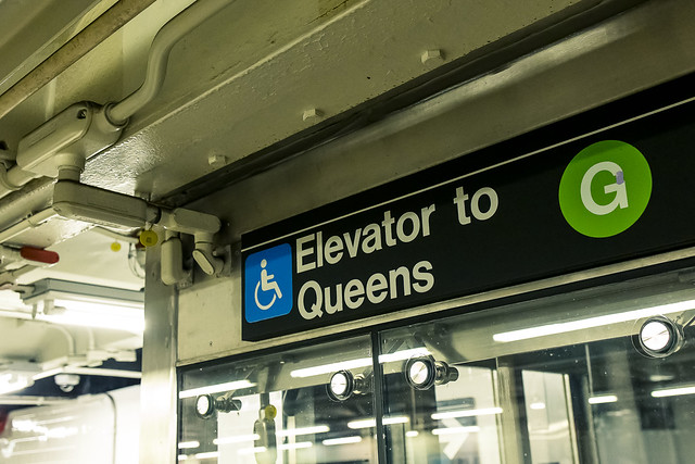
– photo by Mitch Waxman
That must be some elevator, thought I.
Since I like using things I’ve helped pay for, I hit the button and had a funny exchange about the improvement with another commuter, whose personal invective was framed by English spoken with a syrupy Polish accent. Ahh, Greenpoint, how I’ll miss the default state of sarcasm that you inspire, and that I always enjoy interacting with, in your residents.
– photo by Mitch Waxman
One scuttled down hill along Manhattan Avenue, towards the fabulous Newtown Creek.
“Every time might be the last time,” and this time around, I was meeting up with a friend that owns a boat. He offered to take me out for one last “from the water” photo session on my beloved Creek.

– photo by Mitch Waxman
While I was waiting for him to arrive, the tug Miss Madeline reappeared in front of the camera.
Just a few days ago, shots of the selfsame vessel attempting to conquer the laws of physics and mechanical engineering were offered here.
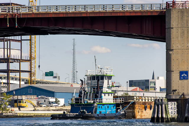
– photo by Mitch Waxman
Tomorrow – I’ll show you what I captured on this particular day.
Miss Madeline navigated under the Pulaski Bridge, as we soon would.
More tomorrow.
“follow” me on Twitter- @newtownpentacle
Buy a book!
“In the Shadows at Newtown Creek,” an 88 page softcover 8.5×11 magazine format photo book by Mitch Waxman, is now on sale at blurb.com for $30.


