Posts Tagged ‘newtown creek’
loosely knit
It’s National Piña Colada Day, in these United States.

– photo by Mitch Waxman
Given that the final weeks of the old Kosciuszcko Bridge spanning the fabled Newtown Creek are at last upon us, one has been determined to record a few portrait shots to commemorate its long tenancy over the waterway. To wit, last week, one determined that it was time to carry the tripod all the way to eastern Greenpoint and stand there in the dark while shooting the end of an era in this particular corridor of the “House of Moses.” The tripod was needed to allow for long exposure, hyperfocal aperture depth, and deep saturation. Where I was will be instantly recognizable to some Newtown Creek enthusiasts, but to most – not so much. It’s off the beaten path, off the pavement in fact, and my specific vantage was shielded from street lights, perfectly dark, and stunk to high heaven from a passing slick of sewage.
Ahh… my beloved Newtown Creek.
I’m pretty happy with what I got in the shot above, which is a 30 second exposure captured at about 9:10 p.m. As always, if you click the photo it will open up a new window to Flickr, where you can zoom in or whatever.

– photo by Mitch Waxman
While I was there – and as you’d imagine – one shot multiple variations of the first shot in today’s post using different exposure triangles, but it was randomly decided at the end of my little seission to pivot the tripod head about and get some shots of the surrounding creek as well. This is looking northward at the Queens side, and that black slab forming the background against the sky is the tree line of First Calvary Cemetery.
Documenting this project has been a long standing project of mine – this 2012 post tells you everything you could want to know about Robert Moses, Fiorella LaGuardia, and the origins of the 1939 model Kosciuszko Bridge. Just before construction started, I swept through both the Brooklyn and Queens sides of Newtown Creek in the area I call “DUKBO” – Down Under the Kosciuszko Bridge Onramp. Here’s a 2014 post, and another, showing what things used to look like on the Brooklyn side, and one dating back to 2010, and from 2012 discussing the Queens side – this. Construction started, and this 2014 post offers a look at things. There’s shots from the water of Newtown Creek, in this June 2015 post, and in this September 2015 post, which shows the bridge support towers rising. Additionally, this post from March of 2016 detailed the action on the Queens side. Most recently, here’s one from May of 2016, and one from June of the same year. Here’s one from August of 2016, the December 2016 one, one from March of 2017 which discusses the demolition of the 1939 bridge.
Most recently – a post showing what I saw during a pre opening walk through in early April of 2017, and the fanfare surrounding the opening of half of the new bridge in April of 2017, and a walk through of the Brooklyn side job site in June of 2017.

– photo by Mitch Waxman
Looking west along the Newtown Creek, towards the Shining City of Manhattan. The burning thermonuclear eye of God itself doesn’t dip behind the skyline until about 8:30 this time of year, and the shot was captured less than five minutes after the first shot in today’s post. That’s about when Indecided to break down the gear and head back to the rolling hills of Astoria, after having spent about an hour at my location.
As far as the burning question everybody’s been asking me – no, I don’t have any intel on when the old bridge is coming down or not. Newtown Creek Alliance has recently published this post, which discusses the issue in detail and tells you what to expect from the operation.
Upcoming Tours and events
13 Steps Around Dutch Kills Walking Tour, with Newtown Creek Alliance – July 15th, 10 a.m. – 1 p.m..
The “then and now” of Newtown Creek’s Dutch Kills tributary in LIC, once known as the “workshop of the United States.” with NCA Historian Mitch Waxman – details here.
The Poison Cauldron of the Newtown Creek Walking Tour, with Atlas Obscura – July 22nd, 11 a.m. – 2 p.m..
Explore the hellish waste transfer and petroleum districts of North Brooklyn on this daring walk towards the doomed Kosciuszko Bridge, with NCA Historian Mitch Waxman – details here.
“follow” me on Twitter- @newtownpentacle
odd pantaloons
It’s National Fried Chicken Day, in these United States.

– photo by Mitch Waxman
Pondering just what the hell I’m doing with my life is something that happens everytime I cross the Pulaski Bridge, for some reason. As a matter of fact, existential pondering on that subject is a mental activity reserved specifically for crossings of the Pulaski Bridge, and a point is made of not wasting time on such matters elsewhere. I have other locations around Newtown Creek, all of which are assigned to different sets of worries, such as pooping my pants whilst conducting a tour and figuring out how to deal with the public shame and embarrassment (I worry about that at the Metropolitan Avenue Bridge) – but that’s another story.
I’m all ‘effed up.
Anywho, that’s the Mary H. Tug entering Newtown Creek while towing a fuel barge.

– photo by Mitch Waxman
Mary H. is a regular on the Newtown Creek, working for the Bayside Fuel people whose facility is coincidentally found alongside the Metropolitan Avenue Bridge, over on the East Williamsburg side of the world. Technically speaking, Bayside Fuel is on the English Kills tributary and if memory serves – they’re 3.1 miles back from the East River.
Personally, I’ve always thought it pretty cool that tugboats service an industrial dock some 3 and change miles deep into Brooklyn, but that’s me.

– photo by Mitch Waxman
A bunch of the photographers I know have been doing the aerial drone thing of late, so this view of a tug has become rather commonplace in recent years, but I still prefer doing the old fashioned way – finding a high vantage and waiting for it to come to me. I worry about losing my technical edge when I’m over on the Hunters Point Avenue Bridge, if you’re curious. You don’t want to know what I worry about on the Borden Avenue Bridge… brrrr.
Upcoming Tours and events
13 Steps Around Dutch Kills Walking Tour, with Newtown Creek Alliance – July 15th, 10 a.m. – 1 p.m..
The “then and now” of Newtown Creek’s Dutch Kills tributary in LIC, once known as the “workshop of the United States.”with NCA Historian Mitch Waxman – details here.
“follow” me on Twitter- @newtownpentacle
cellular corruption
It’s National Mai Tai day, in these United States.

– photo by Mitch Waxman
Increasingly, one realizes the depths of his personal ignorance about common things. Whilst watching, lovingly, my little dog Zuzu sleeping the other night it occurred to me that I didn’t know very much about Dogs from a scientific point of view. This led me directly into a “Wikipedia rabbit hole” during which canid evolution and its various family trees were explored, and soon it was 3:30 in the morning. This is an occupational hazard for the curious.
The next morning, I continued my reading on the Canids of the Holocene era, which led me to the Oligocene and the root ancestry of the Carnivora mammals. Moving forward instead of back in time, I soon found myself reading about the Hyena family, which somehow led to me watching videos of wild animals fighting. It was decided to end my explorations after witnessing a battle between a Hippo and a Rhino. The Hippo won, which was sort of unexpected but there you go.
I was able to control myself and avoid searching for “Tiger versus Hippo” as it might shatter a preconception I have which states that nothing can beat a Tiger in claw on claw combat, with the notable exception of a Russian. Russians and Tigers are probably the toughest bastards on the planet in terms of pure survival skills, IMHO, and long have I argued for the preservation of both specie just in case we are ever invaded by an extraterrestrial civilization.

– photo by Mitch Waxman
It would be unexpected, I realize, for some space faring race of conquerors to suddenly find themselves beset by Russian Spetnatz troops riding militarized Siberian tigers. Supposition began to reign, and it occurred to me that the “tough guy” cultures of the Earth – all the tribes of man – would probably lend a unit of paired human and animal predators to the battle for earth. Maori riding rocket propelled tiger sharks in zero gravity, Inuit riding Polar Bears… the mind boggles when imagining units of French Dauphine commandos or Apache wolf riders. Vietnamese guerillas mounted on giant centipedes or Mekong Catfish, Polynesian Frogmen and their cephalopod partners, Bantu special forces with their Hippo armies – the mind boggles.
With the right inducement, we could probably create whole divisions of animalia who would require no human partner at all. It’s their planet too. Imagine units of angry Chimpanzees in space helmets suddenly introduced into the confines of a spacecraft. Chimps are ghastly and powerful warriors.
You don’t mess around with Chimps, as a note, as they’ll eat your face and twist off your junk just for shits and giggles.

– photo by Mitch Waxman
A little known fact about Western Queens is that when the Europeans arrived here, Maspeth in particular, but all of the East River coastline was infested with wolves. It was likely the so called “Red Wolf” which was well established on the eastern coast of North America. The Dutch, and later the English, offered bounties to the populace for wolf pelts in pursuance of exterminating the predators which poached from the European farmer’s livestock.
According to my readings, entered into after watching Zuzu the dog snoring away in a corner of the living room, modern day wolves and dogs are both descended from a common ancestor which was far larger and more vicious than anything walking the earth today – a critter adapted for taking down the megafauna of the Ice Age. Who knew?
Happy July 4th weekend, lords and ladies, back on Monday with something completely different at this – your Newtown Pentacle.
“follow” me on Twitter- @newtownpentacle
sterner things
It’s National Bomb Pop Day, in these United States.

– photo by Mitch Waxman
As described in yesterday’s post, a hurried flight from “Point A” in Astoria to “Point B” in Brooklyn’s Greenpoint section was enacted last Saturday, in order to arrive on time for a walk through and discussion of the NYC DOT’s Kosciuszcko Bridge project’s commitment to create new parkland in the post facto footprint of their construction zone. Invitees were community members, folks from Open Space Alliance, NYC Parks Department, and a few local busybodies such as myself.
That’s Robert Adams, of the New York State Department of Transportation, chief engineer and showrunner for the K Bridge replacement project.

– photo by Mitch Waxman
I’ve stated many times that the community communications side of this project has been extraordinary. I’ve also reported to a number of people that Mr. Adams, in particular, has been remarkably transparent and amiable to receiving input from those who surround the perimeter of his project. Gold standard, in my experience, as far as handling the impact of a large scale public works projects in the crowded urban industrial setting of Newtown Creek in North Brooklyn and Western Queens. Kudos.

– photo by Mitch Waxman
As has become familiar – when visiting the K Bridge job site – our little group donned “Personal Protective Equipment,” which included safety glasses, gloves, orange vests, and hard hats. That paved sidewalk, on the left of the shot above adjoining the retaining wall for the Brooklyn Queens Expressway’s Meeker Avenue onramp, is “used to be Cherry Street.” The street we were walking down, in a northerly direction heading towards Scott Avenue, is nouveau Cherry Street.
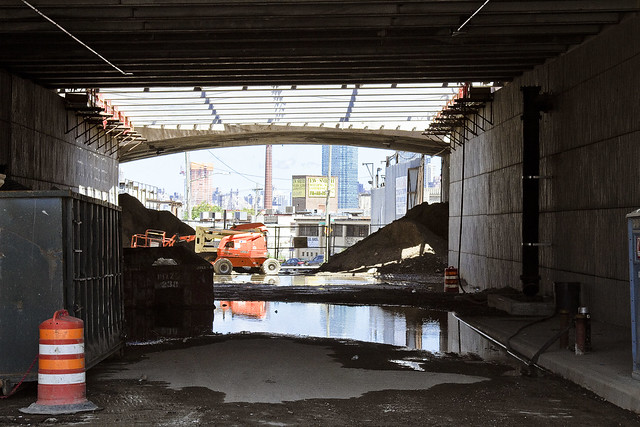
– photo by Mitch Waxman
That’s the new overpass at Varick Avenue, looking westwards towards the East River.
Documenting this project has been a long standing project of mine – this 2012 post tells you everything you could want to know about Robert Moses, Fiorella LaGuardia, and the origins of the 1939 model Kosciuszko Bridge. Just before construction started, I swept through both the Brooklyn and Queens sides of Newtown Creek in the area I call “DUKBO” – Down Under the Kosciuszko Bridge Onramp. Here’s a 2014 post, and another, showing what things used to look like on the Brooklyn side, and one dating back to 2010, and from 2012 discussing the Queens side – this. Construction started, and this 2014 post offers a look at things. There’s shots from the water of Newtown Creek, in this June 2015 post, and in this September 2015 post, which shows the bridge support towers rising. Additionally, this post from March of 2016 detailed the action on the Queens side. Most recently, here’s one from May of 2016, and one from June of the same year. Here’s one from August of 2016, the December 2016 one, one from March of 2017 which discusses the demolition of the 1939 bridge.
Most recently – a post showing what I saw during a pre opening walk through in early April of 2017, and the fanfare surrounding the opening of half of the new bridge in April of 2017.

– photo by Mitch Waxman
Just shy of Gardner Avenue, currently a closed off section of the construction site, Mr. Adams began to discuss the perimeter of the new park. It will quite literally be in DUKBO, Down Under the Kosciuszcko Bridge Onramp. The site will occupy a mostly paved area largely shadowed by the two new bridges. Our group discussed the possibility of shade tolerant plants, and or harvesting “gray water” from the highways to feed into planting beds.
The problem with that, as stated by somebody from Parks Dept. was this – shade tolerant plants are seldom salt resistant and that even without harvesting runoff from the BQE’s drains, there’s going to be a considerable amount of road salting during the winter months both above and below the parcel.

– photo by Mitch Waxman
The demolition of the old bridge is going to be occurring shortly, which will play out in two stages. First is the removal of the central truss section, then the “energetic demolition” of the approaches. If the schedule holds true, the second half of the new K Bridge will open in 2020 standing in the footprint of the old one.
That’s when the parks business will begin in earnest. There’s a section on the Maspeth side, on 43rd street, in Queens. Another section is this parcel in Brooklyn, and the old Sgt. Dougherty park on Meeker avenue at Chery Street is going to be redesigned and rebuilt.

– photo by Mitch Waxman
One of the interjections a humble narrator offered, as one who knows this zone intimately enough to refer to it affectionately as the “Poison Cauldron of the Newtown Creek,” involved the intended pathways which people from the surrounding neighborhoods would use to get here. The surrounding areas to the east and south are insanely dangerous, traffic wise, with gargantuan trucks whizzing about and all sorts of blue collar people doing blue collar things. Warehouses, waste transfer stations, truck and bus mechanics… not to mention all of the autos at Meeker Avenue angrily straining to get into the approach lanes for the BQE.
In short, way finding and traffic control.

– photo by Mitch Waxman
About those waste transfer stations… one of the things that makes this particular “cauldron” so “poison” is the tonnage of putrescent – or black bag – garbage transported here daily. This section of DUKBO is covered in quite toxic dust. Harvesting a booger from your nasal cavity after a walk through this section will reveal many things to you about the quality of air and suspended particulates. There’s also the smell.
DUKBO stinks of decay, rot, and hot garbage. On humid days, you will notice swirls of diesel exhaust along with shiny specks of dust hanging in the ether, as illuminated by an odd shaft of light. In short – dust and odor control are essential.
The choice of this area is an extremely challenging one for a park, but given the paucity of parkland in North Brooklyn – beggars can’t be choosers and you have to work with what you’ve been given.

– photo by Mitch Waxman
As far as the construction progress side of things, as mentioned, DOT and their contractor’s efforts are now being focused on the removal of the 1939 era Kosciuszcko Bridge. Up top, traffic has long been rerouted onto the easterly half of the new span, and torch bearing demolitionists have been cutting up small sections of the old bridge. The former walkway and the side railing has been cut up and will be sent off for recycling.

– photo by Mitch Waxman
Above Newtown Creek, but below the BQE, crews are assembling the “strand jacks” which will lower the central truss down to a waiting barge. The steel of the central truss is also meant to be recycled, and will be making a final journey to New Jersey escorted by tugs sometime during the coming month.

– photo by Mitch Waxman
This is the view from Scott Avenue, and the new park will continue down to the bulkheads and will overlook the water, I’m told. There has been some discussion of waterfront access here, as in a place where you’d be able to put a boat in the water, but one hasn’t been a part of that conversation.

– photo by Mitch Waxman
Walking back, as we crossed Gardiner Avenue, I handed off my “PPE” to Mr. Adams and bid the group adieux rather than go all the way back to Meeker and Varick Avenues where we had met up.
I headed down instead to the site of the first Meeker Avenue, or Penny Bridge. Once upon a time there was a swing bridge on Newtown Creek which connected Brooklyn’s Meeker Avenue with Queens’ Review Avenue (and the Penny Bridge LIRR stop). Penny Bridge was demolished in 1939 when the new Meeker Avenue Bridge opened (renamed as Kosciuszcko in 1940) but the masonry on both sides of Newtown Creek are still present.
It was a neat idea, I thought, visiting all three Meeker Avenue Bridges in the same day.
History nerd here, what can I tell ‘ya?

– photo by Mitch Waxman
While I was at Penny Bridge, my zoom lens was dialed to its extant focal length and I zeroed in on the Queens side’s strand jacks being erected. Hey, I may be a history nerd, but I know for a fact that several of you out there are engineering nerds.
Upcoming Tours and events
Newtown Creek, Greenpoint to Hunters Point, walking tour with NYCH2O – June 29th, 7-9 p.m..
Experience and learn the history of the western side of Newtown Creek, as well as the East River Parks Hunters Point with NCA Historian Mitch Waxman – details here.
“follow” me on Twitter- @newtownpentacle
odd purchases
It’s National Martini Day, in these United States.

– photo by Mitch Waxman
One of the things that we, as in the environmental and activist community along Newtown Creek, have been asking officialdom about for years is about why there is zero signage advising the citizenry about not fishing or crabbing in the Newtown Creek. I know this might strike you as odd, but folks actually do fish and crab hereabouts. Observationally, these are people who were born overseas, so the signage issue becomes a bit complicated given the legendary “diversity” of Western Queens and North Brooklyn. The Albany people have always questioned as to why you’d need signage, as it’s illegal to fish without a license, and every NYS licensee has been advised about the environmental conditions encountered on the inland waterways of NYC – which is one of the most “Albany people” things I’ve ever heard.
Luckily, the Feds at EPA realized what we’ve been asking for is necessary and have begun the process of creating advisory signage, and the PRP (Potentially Resonsible Parties) consortium which styles itself as the “Newtown Creek Group” volunteered to manufacture the placards, which EPA would in turn design and install. The signage is pretty close to its final design iteration, and the latest version looks like this. As to where the signs should be placed? Who has carefully documented every little pocket and corner of the streets surrounding the Creek? Who can tell you where people commonly fish? That’s a Newtown Creek Alliance job, anyone can tell you that.
Let’s face it, who ya gonna call?

– photo by Mitch Waxman
Accordingly, one found himself in Greenpoint recently at nine in the morning as the EPA team assembled. Civilians cannot ride in Government vehicles (which is an odd rule, as we technically own them) so the third party contractor who will do the actual installation of the things did the driving. We hit every little corner of the Newtown Creek where people can find access to the water, even the hidden spots where the “utes” of Greenpernt like to experiment with cannibinoids.
It was actually quite a beautiful morning, and the light was fantastic, so while the Feds got busy with the tape measures and GPS’d the various locations we visited, I waved the camera around a bit.

– photo by Mitch Waxman
We did encounter an “enforcement situation” in Brooklyn alongside the Metropolitan Avenue Bridge. There’s a protocol for “who’s responsible for what” along the Newtown Creek. Short version is this – EPA is in charge of Superfund, which is specifically related to the sediments under the water. New or ongoing pollution entering the water is the provence of the NYS Department of Environmental Conservation.
The NYC DEP is responsible for absolutely nothing anywhere or anytime, it’s not their fault at all, and they have no idea why they were named as a PRP in the first place as it’s all Exxon or National Grid’s fault.
The fellow from EPA I was on the bridge with confirmed my belief that “I should call this in” and the NYS DEC Spill Response hotline was called. If you spot oil slicks, plumes of floatable contaminants, or as in the case of the shot above – hundreds of gallons of milky white mystery juice exiting one of DEP’s open sewers – the protocol is to first photograph it, as documentation, and then to call 1 (800) 457-7362 to let DEC know about the situation so they can investigate.

– photo by Mitch Waxman
We were, as mentioned above, visiting every conceivable spot that the citizenry could find their way to the water.
That included “off limits” locations like the Montrose Avenue Rail Bridge over the English Kills tributary. As you can see from all the interesting graffiti on the bridge, which carries lead tracks of the Bushwick Branch LIRR, trespassing is pretty common back here. This is the reason that EPA asked Newtown Creek Alliance to send somebody along with them, as there’s the “official story” and a “real story” found along the water.

– photo by Mitch Waxman
This family of Canada Geese were encountered at the Maspeth Avenue Plank Road, and were being predated by a feral cat who was anxious for breakfast. Momma and Poppa Goose were just out of frame to the left, so the cat made a brilliant decision and continued on into the brush to look for some easier prey. We encountered a couple of broods of Geese over the course of the morning. Geese can be ornery, as a note, and will smack you up if they’re annoyed.
One of these illegal alien avian bullies, at Maspeth Creek, actually hissed at us as we neared, and stuck its tongue out at me.

– photo by Mitch Waxman
The reasoning behind the signage is based around science rather than good humored politics, incidentally. When you’re chatting with environmental officials, they don’t refer to oysters or mussels as shellfish, rather they call them “bioaccumulators.” Animals that are high up in the food chain have internal organs – livers in particular – and muscular tissues which have amassed dangerous levels of whatever pollutant is found in the sediments of the waterway, which they’ve attained by consuming all the prey critters who are below them in the food chain hierarchy. In the case of crabs, in particular, you can encounter a fantastic amount of chemical concentrates due to their particular niche and occupations.
Newtown Creek is – of course – a Federal Superfund site. The sediment beds hereabout are a goulash of petroleum and petroleum byproducts, organocopper compounds, volatile organic compounds, PCB’s, coal tar, sewage, and everything else that has ever been dumped or spilled into the water. The sediment is referred to as “black mayonnaise” and it’s where the crabs live. It’s also where most of the invertebrates that form the bottom of the food chain for the fish population live. Itty bitty critters eat the decaying organics of the black mayonnaise, and slightly less itty bitty critters eat handfuls of the little guys, and the larger critters eat hundreds of them – you get the idea.
You don’t want to eat fish or crabs that you catch in the Newtown Creek. Really.
Upcoming Tours and events
Newtown Creek, Greenpoint to Hunters Point, walking tour with NYCH2O – June 29th, 7-9 p.m..
Experience and learn the history of the western side of Newtown Creek, as well as the East River Parks Hunters Point with NCA Historian Mitch Waxman – details here.
“follow” me on Twitter- @newtownpentacle


