Archive for the ‘newtown creek’ Category
suddenly lost
Getting high in Greenpoint, Brooklyn.

– photo by Mitch Waxman
Last week, one of the environmental projects underwritten by GCEF (the Greenpoint Community Environmental Fund) opened to the public at Brooklyn’s 520 Kingsland Avenue, alongside that loathsome exemplar of municipal neglect known as the Newtown Creek. In this case, the project is a green roof installed on top of a movie studio, specifically one of the production facilities owned and operated by the Broadway Stages company which is partially housed in a series of formerly industrial locations around Greenpoint and Long Island City. Broadway Stages has been buying up a LOT of property along the Creek in recent years.
Well, I guess the location is still industrial, it’s just a different kind of industry – entertainment rather than petrochemical. At any rate, 520 Kingsland Avenue is a few stories above the flood plain and whilst up there and on site, I got busy with the camera. You’ve seen this point of view before, incidentally – in a 2016 post where I told you about Brooklyn’s invisible flame back in June.

– photo by Mitch Waxman
Can’t really talk about it quite yet, but let’s just say I’ll be able to take you up there in a couple of weeks on a couple of free tours. I’ll supply the link as soon as it’s public. The green roof at 520 Kingsland was designed with butterflies, of all things, in mind. Saying that it’s a pretty interesting space with neat little walkways weaving through plantings, and there are incredible views of the surrounding industrial zone to check out.
That’s part of Metro Fuel’s truck fleet in the shot above, for the curious.

– photo by Mitch Waxman
The real stunners, amongst the many points of view available from 520 Kingsland Avenue, are the ones in which the shining city of Manhattan provides the backdrop. This sort of urban pornography is possible due to two reasons: one is that the Greenpoint Landing Project is just kicking into gear, so the POV isn’t blocked by forty story residential palaces yet; the other is that the surrounding area is all 19th century landfill which is both low lying and quite flat.
This POV is looking due west from the 520 Kingsland Avenue rooftop, incidentally.

– photo by Mitch Waxman
Northwest POV, gazing across the lugubrious Newtown Creek in the direction of Long Island City’s Hunters Point section.
In the distance, you’ll notice the red and white banded smokestacks of the “Big Allis” power plant at 36th avenue in the Ravenswood section. The Citi building megalith, that sapphire dagger jammed in the heart of the place at Jackson Avenue’s intersection with Thomson Avenue, used to be the only large scale building in the area.
As an aside, a few years ago some group of urban planners/art fucks from Pratt University proposed Big Allis’s red and white stripes to me as a branding element for the western Queens waterfront. I had to inform them how we residents regarded the presence of an enormous power plant operating along our waterfront that serves Manhattan’s needs, and that it wasn’t exactly a popular symbol, locally speaking.

– photo by Mitch Waxman
The singularity of the Citi megalith has, of course, changed. The pace of real estate development in the last few years has been frenetic in LIC, as evinced in the shots above and below. Sometimes, in order to really take it all in, you need to leave Queens entirely – just to gain some perspective.
Funnily enough, this is what I usually say about Manhattan – the best part of “the City” is being outside of it and witnessing the shield wall of buildings from without. An inhuman scale landscape like Manhattan’s can’t be properly observed while you’re within the oppressive shadows of its canyon walls.

– photo by Mitch Waxman
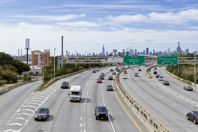
That white truss structure at center of the shot is the Long Island Expressway, which rises over Newtown Creek’s Dutch Kills tributary from its beginnings at the Queens Midtown Tunnel. Dutch Kills intersects with the main body of Newtown Creek about 3/4 of a mile back from the East River, and heads inland for the better part of a mile. The LIE traffic up on that truss bridge is flowing 106 feet over the water. The far right hand side of the shot above shows the construction going on at the intersection of Jackson Avenue and Queens Plaza, on the former West Chemicals Company site. Moving left, the rest of the construction is occurring along Jackson Avenue at Purves, Dutch Kills Street, and so on.
All of it is high end residential, incidentally, except for that squamous curvy faced one directly to the left of the orange one. That’s an office building which the NYC Dept. of Health has based itself in nearby Queens Plaza.

– photo by Mitch Waxman
One of my little adages, which I gleefully relate on my walking tours of the area, is a facet of NYS law – it dictates that if you were about to buy a home which is known to be “haunted by a ghost” by the current owner and or the surrounding community – the haunting needs to be disclosed before closing the sales contract.
If you’re buying a property that used to be a chemical factory, or a copper refinery, or some other heavy industrial pursuit that rendered the site a “brownfield” – you are under no obligation to disclose the environmental history to a buyer, however.
When you meet newer residents of LIC’s Tower Town or Brooklyn’s Greenpoint, and mention a nearby Federal Superfund site defined as “Newtown Creek” – they say “What’s that?”
Upcoming tours and events:
“First Calvary Cemetery” walking tour
with Brooklyn Brainery, Saturday, October 8th from 11:00 a.m. to 1:00 p.m.
Click here for tickets.
“follow” me on Twitter- @newtownpentacle
furtive signs
Triffids at Newtown Creek?

– photo by Mitch Waxman
Last weekend, I was enacting my usual pilgrimage back from Greenpoint to Astoria and since it was a nice day I decided to take the long way home and visit Newtown Creek’s Dutch Kills tributary as it had been a good 72 hours since the last time I was there. That’s the Queens Midtown Expressway truss bridge of the larger Long Island Expressway highway complex at its highest altitude, some 106 feet over the water.
In truth, the Dutch Kills route is actually a bit of a shortcut for me, as the route is a good number of blocks shorter than taking the Greenpoint Avenue pathway eastwards through Blissville and Sunnyside due to the somewhat triangular relationship between Northern Blvd. and GP avenue. I like to cut down 27th street from Borden Avenue, in order to access Skillman Avenue, which runs roughly parallel to Northern Blvd. until 39th street.

– photo by Mitch Waxman
It was on 27th street, right in front of what was once known as Irving Subway Grate, that I spotted this bizarre plant. One would like to imagine two distinct scenarios to describe it – one involving extraterrestrial spores settling down upon LIC and spawning an alien vegetable, the other is that the mutagenic chemicals swirling around in the waters of Dutch Kills have perverted and created a new and debased form of life.
It’s probably something that a botanist would instantly recognize, but please – allow me my little fantasies.

– photo by Mitch Waxman
These seed pods, or perhaps fruit, were heavily armored. They were fairly large, at about 3-5 inches in length.

– photo by Mitch Waxman
Were they not shaped like the pincers of an insect, or crab, I would have produced my trusty pocket knife and cut one open to reveal what was inside. Instead, I was fearful that I might get pinched by some autonomic reaction so I stayed at a safe distance. What if they were man eating Triffids in some juvenile form?
You can’t be too careful around Newtown Creek.

– photo by Mitch Waxman
What were they? Only that impossible thing, which cannot possibly be real, hiding in the cupola of the sapphire megalith of Long Island City that stares down upon the world of men through its three lobed burning eye, can know for sure.
Upcoming tours and events:
“The Untold History of the Newtown Creek (aka Insalubrious Valley)” walking tour
with New York Adventure Club, Saturday, October 1st from 11:00 a.m. to 1:00 p.m.
Click here for tickets.
“First Calvary Cemetery” walking tour
with Brooklyn Brainery, Saturday, October 8th from 11:00 a.m. to 1:00 p.m.
Click here for tickets.
“follow” me on Twitter- @newtownpentacle
tangible miasma
The native art form of Queens, in today’s post.

– photo by Mitch Waxman
Long has one postulated that the native art form of Queens is illegal dumping. It is accomplished with a compositional flair and attention to detail that Brooklyn and the Bronx can only dream of. When you spend as much time as I do around the Newtown Creek and the concrete devastations surrounding it, this becomes obvious.

– photo by Mitch Waxman
I was heading over to Greenpoint recently, to accomplish some sort of folderol, when the tableau above was observed in LIC’s Blissville section. This was on Greenpoint Avenue, incidentally.

– photo by Mitch Waxman
The dumped mattresses exhibited the tell tale signs of a bedbug infestation, so I was using my telephoto zoom lens to capture shots of it – not wanting to get closer to the things than I needed to.
Bedbugs… brrr…

– photo by Mitch Waxman
I’m not sure if bedbugs can leap, or jump, or propel themselves through the atmospheric void in some unknown manner which would indicate that they can fly like Superman, but I wasn’t taking any chances.
Bedbugs, or “vantzen” as my grandmother would have called them, are grotesque human predators. Vampire insects. The stains on the mattress covers are actually produced by their fecal matter and are literally digested human blood.

– photo by Mitch Waxman
Grossed out, I propelled myself across the Greenpoint Avenue Bridge which spans the lugubrious Newtown Creek. Whatever ails you, parasite wise, will likely be cured by the therapeutic poisons of the Newtown Creek. If Newtown Creek doesn’t kill you, it will make you stronger… that’s what I tell myself all the time.
Newtown Creek, is there anything you can’t do?
Upcoming tours and events:
“The Untold History of the Newtown Creek (aka Insalubrious Valley)” walking tour
with New York Adventure Club, Saturday, October 1st from 11:00 a.m. to 1:00 p.m.
Click here for tickets.
“First Calvary Cemetery” walking tour
with Brooklyn Brainery, Saturday, October 8th from 11:00 a.m. to 1:00 p.m.
Click here for tickets.
“follow” me on Twitter- @newtownpentacle
secrets never
Wandering, always wandering.

– photo by Mitch Waxman
One fine and recent day, my steps carried me all over Western Queens. Well, not ALL over. I wasn’t in Elmhurst, Jackson Heights, or the forbidden Northern Shore in Astoria. I was in LIC and Sunnyside, however. There was quite a hullabaloo over on 43rd Avenue, and a massive FDNY deployment which was responding to an apartment fire in one of the multi unit building you’ll observe in the section in the 40’s.
I can’t help it, when I see FDNY going to work, I run down the street like a 5 year old yelling “Firemen, Firemen” at the top of my lungs.Imagine my surprise when I discovered that one of these Firefighters was actually a Firelady.
I have to get with the times and stop using gender specific pronouns lest I be sent for corrective therapy at a reeducation campus by the (self described) militias of progressive social justice warriors who lurk online and monitor the Internet for language violations and who police microagressive offenses.

– photo by Mitch Waxman
That’s the Borden Avenue corridor of LIC in the shot above, which is currently the focal point of the speculative Real Estate shit flies. Everywhere I go, people tell me that the interested shit flies want to convert this M1 heavy manufacturing zone over to commercial zoning, which would allow for the creation of office buildings in the corridor between the Pulaski Bridge and Greenpoint Avenue.
I have to say, this actually isn’t a terrible idea. What LIC needs right now is not more apartment and residential stock, rather it needs places for people to work and a commercial corridor which would certainly have a lower environmental impact on Newtown Creek and its tributary Dutch Kills which is local to this area. The former is to the left (or south) side of the shot, just past Fresh Direct and the other warehouse businesses, and the latter is behind the POV of the shot above.
My only request for this conversion would be that the shit flies encourage the MTA to reactivate the Long Island Railroad station found on the other side of the Pualski Bridge for passenger service, which would not make the commercial tenants of the corridor dependent on the Vernon Jackson stop of the 7 train – which is around a half mile away and already quite crowded due to the residential buildout of the East River waterfront and the area surrounding Court Square and Queens Plaza.

– photo by Mitch Waxman
One thing I have repeatedly noticed in recent months is the startling number of people you find in industrial LIC these days. When this, your Newtown Pentacle, was started up back in 2009 LIC was a ghost town on the weekends. The sense of devastating loneliness and isolation from the surrounding city is what drew me here in the first place, and it’s bizarre to see people wandering around in my happy hunting grounds.
Who are all these people in my safe space?
Upcoming tours and events:
“The Untold History of the Newtown Creek (aka Insalubrious Valley)” walking tour
with New York Adventure Club, Saturday, October 1st from 11:00 a.m. to 1:00 p.m.
Click here for tickets.
“First Calvary Cemetery” walking tour
with Brooklyn Brainery, Saturday, October 8th from 11:00 a.m. to 1:00 p.m.
Click here for tickets.
“follow” me on Twitter- @newtownpentacle
obvious that
More on the proposed Maspeth Homeless Shelter.
– photo by Mitch Waxman
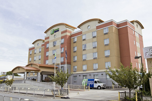
In yesterday’s post, the northern side of the area surrounding the proposed Homeless Shelter in Maspeth was descirbed in somewhat excruciating detail. The proposal put forward from the Mayor’s office calls for converting a Holiday Inn hotel on 55th Road to provide housing for one of NYC’s most vulnerable groups of people, and the location of it seems to be an entirely random choice of venue which City Hall arrived at by throwing a dart at a map of districts which didn’t support the Mayor in the last election cycle. The decision has already caused one long serving local politician to lose her job in an elective primary to an upstart and relative unknown who strongly objects to the placement of this facility, something which I’m sure the political establishment hereabouts will hold against the “Dope from Park Slope” when he attempts to get reelected.
That’s the hotel in the shot above, the tan and coral structure just to the south of the Long Island Expressway.
– photo by Mitch Waxman
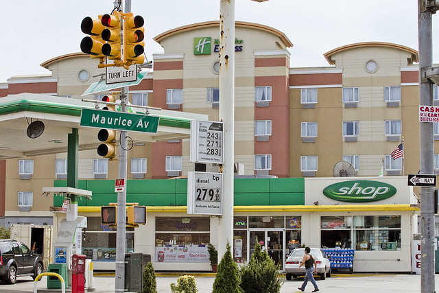
Other than being a bland architectural travesty, the hotel itself is inoffensive. As a note, there is another nearby hotel found to the north on Maurice Avenue across the street from Mt. Zion cemetery – a Comfort Inn branded establishment which, like the Holiday Inn pictured above, exploits the European tourist market and offers lodging at a rate significantly lower than the ones offered at hotels closer to the City center. The shot above is from 55th Road, by the way.
– photo by Mitch Waxman
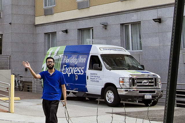
While I was gathering these shots, the fellow above emerged from the hotel. He first informed me that I couldn’t take photos of the structure without a permit, then kind of invaded my personal space while telling me he didn’t want his photo published in a newspaper. This is a web site, incidentally, so I would offer to the gentleman pictured above that he needs to be more specific when stating his prohibitions. I reminded him that I was on the sidewalk of an adjoining property, of course, and that he had no right to attempt to circumnavigate the constitution of these United States on the subject of photography of those things which are visible from the sidewalk. He also sundered his right to privacy by confronting me thusly. Were I assigning any sort of editorial “slant” to this photo, he would have a legitimate beef with me, but since I’m not – he doesn’t.
As I always say, if you don’t me to point a camera at you, don’t hassle me when I’m shooting.
– photo by Mitch Waxman
As stated in yesterday’s post, my objections to the placement of this facility revolve around the actual location of it, which I honestly believe to be a violation of the human rights of a vulnerable population.
The Holiday Inn sits across the street from the Long Island Expressway, which produces a standing wall of high decibel sound. While I was shooting the shot above, I actually called a friend, whom I could not hear even though my headphones were in – and she could barely make out what I was saying despite the fact that I was shouting into the microphone.
– photo by Mitch Waxman
This gas station with a convenience store is directly across the street from the hotel, and would presumptively fill the role of a supermarket for purchasing food and other existential necessaries. As is the case with such locations, everything you can purchase within is priced as high as the market will bear, and food items available are typically highly processed food stuffs designed for a long shelf life.
I guess the Mayor thinks that microwave burritos are good enough for these so called “Homeless” he’s planning on exiling to industrial Maspeth.
– photo by Mitch Waxman
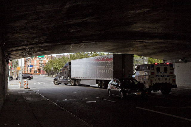
The character of the streets surrounding the hotel can be best described as truck routes. The sidewalks found under the overpasses of the highway have no pedestrian protections like bollards or jersey barriers, and are littered with debris and dead pigeons. There is no lighting, and perpetual shadow exists down in these spaces.
– photo by Mitch Waxman
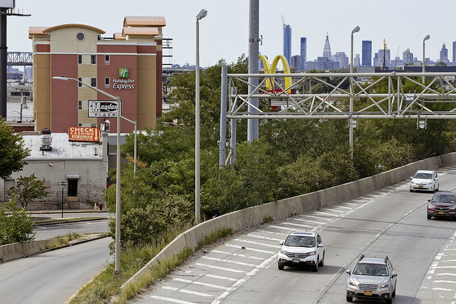
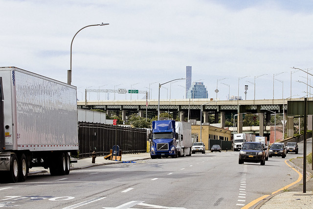
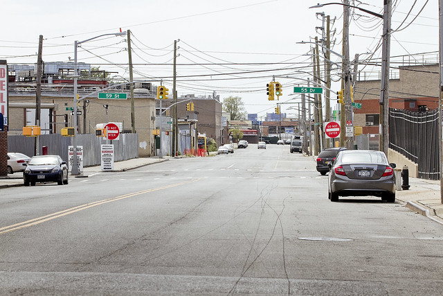
To the west – more highways, cemeteries, and industrial sprawl.
– photo by Mitch Waxman
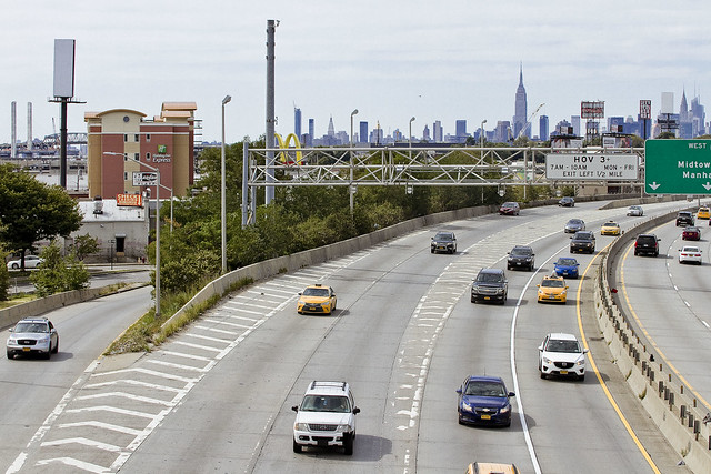
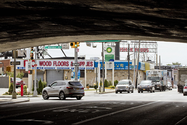
To the south – the roads lead to the industrial zone surrounding the Newtown Creek superfund site.
– photo by Mitch Waxman
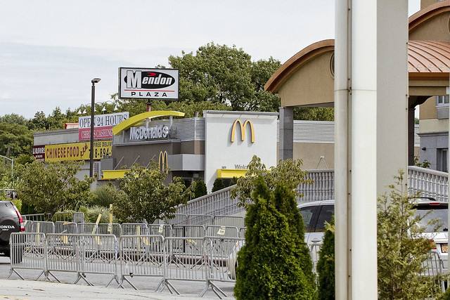
To the east – McDonalds and a Chinese take out restaurant offers an alternative food source to the microwaved burritos and packaged snack cakes found at the gas station convenience store. Luckily, there’s a financial institution in this little strip mall – a check cashing location, which like all examples of such institutions offers high interest payday loans and charges a usurious amount for cashing a check.
The people proposed for exile to this hotel are going to need somewhere to cash their benefit checks, after all, why not ensure that they get to keep as little of it as possible?
– photo by Mitch Waxman
Looking south – up Maurice Avenue. At the top of the hill, around a half mile away, is the Goodfellas/Clinton Diner on Rust Street, if you need a landmark. The businesses located in the area are mainly warehouse operations, and there’s still a bit of manufacturing going on in the area, but it’s highly unlikely that any of the businesses in this area would hire a down on their luck person for an entry level job.
– photo by Mitch Waxman
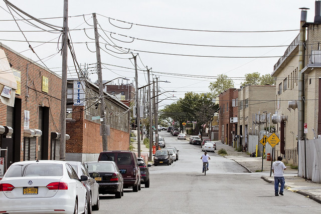
Pictured above is 55th drive, looking east, this street is found behind the hotel property lot. Bleak, this is an industrial street which hosts a few Korean family owned kitchen cabinet manufacturers and a couple of warehouse operations. During the week – the fleets of trucks which carry their wares, and palettes of their products, populate roadway and sidewalk alike.
– photo by Mitch Waxman
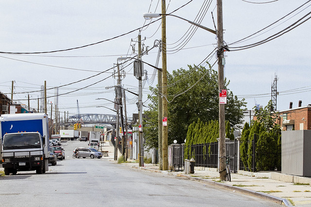
Looking west along 55th drive, the Koscisuzcko Bridge project is visible, but I don’t think that an opportunity for work will manifest itself for the proposed occupants of the Holiday Inn hotel there either.
What are the people that the City wants to move in here supposed to do to fill their days?
– photo by Mitch Waxman
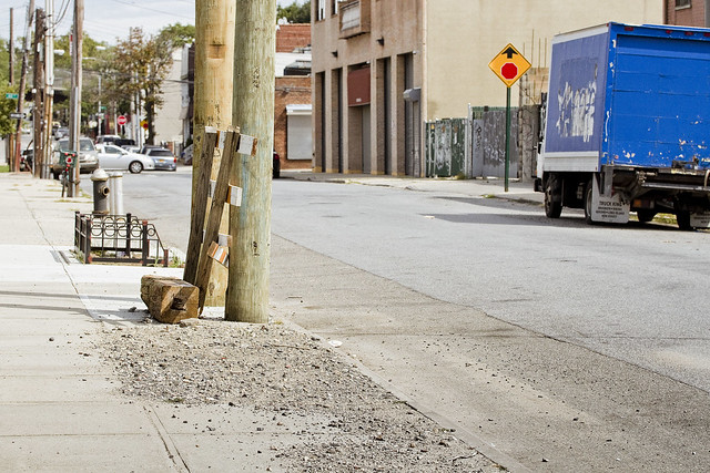
The condition of the sidewalks and streets along 55th drive are fairly crappy. As with all the industrial neighborhood sidewalks you’ll find in Western Queens – illegally dumped junk, debris, and gravel are randomly deposited.
– photo by Mitch Waxman
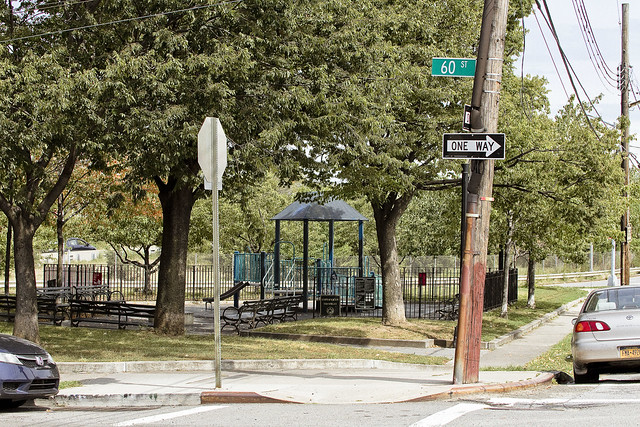
This playground and pocket park is one of the very few public green spaces in Maspeth’s northern section, and will likely become the place where the residents of the Hotel spend their time.
– photo by Mitch Waxman
So, does it make sense?
Is it smart to exile a vulnerable population in an industrial zone found along an elevated highway that carries close to a half million vehicle trips a day and which produces an ear shattering din? Is it ok for these people to be exploited by a check cashing location, and to have to make a choice between eating convenience store food, Chinese take out, or at McDonalds? Or, is it just expedient?
Spotty bus service is a regular complaint for the residents of the surrounding neighborhood, and Maspeth is notoriously a “transit desert.” How will the people housed in this Holiday Inn access medical or social services without a car?
– photo by Mitch Waxman
What do you think?
Upcoming tours and events:
“The Untold History of the Newtown Creek (aka Insalubrious Valley)” walking tour
with New York Adventure Club, Saturday, October 1st from 11:00 a.m. to 1:00 p.m.
Click here for tickets.
“First Calvary Cemetery” walking tour
with Brooklyn Brainery, Saturday, October 8th from 11:00 a.m. to 1:00 p.m.
Click here for tickets.
“follow” me on Twitter- @newtownpentacle


