Posts Tagged ‘East Williamsburg’
approaching locomotive

– photo by Mitch Waxman
On Morgan Avenue in the ancient section of industrial Brooklyn, not far from the legendary heart of darkness which is the English Kills tributary of the Newtown Creek, there may be observed a rail crossing. Part of the so called LIRR Bushwick Branch, recent opportunities have allowed me to fill in a missing piece of the great puzzle.
from wikipedia
The Bushwick Branch, also called the Bushwick Lead Track, is a freight railroad branch that runs from Bushwick, Brooklyn, to Fresh Pond Junction in Queens, New York, where it connects with the Montauk Branch of the Long Island Rail Road. It is owned by the LIRR but operated under lease by the New York and Atlantic Railway, which took over LIRR freight operations in May 1997.

– photo by Mitch Waxman
By no means should it be inferred that any special knowledge of the history of street grade rail in Brooklyn is possessed by your humble narrator, as this is still a subject under study around Newtown Pentacle HQ. If you were to look left (or south west) while on Morgan Avenue and traveling northward, this is what you’d see, way back here in the Cripplebush.
from wikipedia
East Williamsburg is a name for the area in the northwestern portion of the borough of Brooklyn in New York City, United States, which lies between Williamsburg, Greenpoint, and Bushwick. Much of this area has been and still is referred to as either Bushwick, Williamsburg, or Greenpoint with the term East Williamsburg falling out of use until the 1990s. East Williamsburg consists roughly of what was the 3rd District of the Village of Williamsburg and what is now called the East Williamsburg In-Place Industrial Park (EWIPIP), bounded by the neighborhoods of Northside and Southside Williamsburg to the west, Greenpoint to the north, Bushwick to the south and southeast, and both Maspeth and Ridgewood in Queens to the east.
Although the City of New York recognizes East Williamsburg as a neighborhood, there are no official boundaries to East Williamsburg since the City only officially delineates Community Districts and Boroughs, not neighborhoods.

– photo by Mitch Waxman
Looking right, or north east, you’ll see what appears to be a locomotive right of way that terminates at a distant green wall. The Bushwick line has been explored by many others who are braver of heart than I, including Diego Cupolo and Forgotten-NY’s own Kevin Walsh. There’s a missing piece in their accounts (which to be fair, has been off limits to inspection by passerby for some time), however, which recent serendipity allows me to bring to you.
This is, after all, part of Newtown Creek.
from The Eastern District of Brooklyn By Eugene L. Armbruster, via google books
BEYOND THE NEWTOWN CREEK
In the olden times the lands on both sides of Newtown Creek were most intimately connected. County lines were unknown, the creeks were dividing lines between the several plantations, for the reason that lands near a creek were taken up in preference to others, and the creeks were used in place of roads to transport the produce of the farms to the river, and thus it was made possible to reach the fort on Manhattan Island.
The territory along the Newtown Creek, as far as “Old Calvary Cemetery” and along the East River to a point about where the river is now crossed by the Queensboro bridge and following the line of the bridge past the plaza, was known as Dutch Kills. On the other side of Old Calvary was a settlement of men from New England and, therefore, named English Kills. The Dutch Kills and the English Kills, as well as the rest of the out-plantations along the East River, were settlements politically independent of each other and subject only to the Director-General and Council at Manhattan Island, but became some time later parts of the town of Newtown.

– photo by Mitch Waxman
An obsession of mine, let’s just name it a calling, is to photograph every possible corner of the Newtown Creek watershed.
Challenging, most of the shoreline is under lock and key, and many parts of it are under strict supervision by security personnel and police authorities. The spot these shots were gathered from is even hazy ground, and although I never stepped on the tracks and stayed to the extreme sides of the pathway, I was probably violating a “no trespassing” rule which I wear on my sleeve.
The presence of graffiti and a largish homeless camp I know to exist back here made me feel that any rule against taking a look around is lightly enforced by the gendarme and the proverbial dice would be thrown.
Speaking of dice, a locally famous accident occurred on the Bushwick line back in 2004.
from ntsb.gov
LIRR 160 traveled about 1.2 miles on the Bushwick Branch, passing over seven passive highway/railroad grade crossings. The event recorder indicated that the locomotive traveled the total distance of about 11,692 feet (2.2 miles) in 16 minutes 9 seconds and reached a maximum speed of about 31 mph.
During the runaway, LIRR 160 struck an automobile at one grade crossing and pushed it several hundred feet. The two occupants of this vehicle sustained serious injuries and required hospitalization. At another grade crossing, the locomotive struck two more automobiles, resulting in serious injuries to their drivers, who also required hospitalization. Two trucks were parked along the tracks near another grade crossing. The locomotive struck the trucks and pushed them about 800 feet westward beyond the crossing before it stopped. One of the trucks was carrying welding supplies, including acetylene and oxygen cylinders; the cylinders were damaged during the accident and caused a fire. The trucks were unoccupied; however, employees of the trucks’ owner had to jump away from the track to avoid injury.
As LIRR 160 collided with the automobiles and trucks, the struck vehicles were propelled in different directions and struck other vehicles. As a result, the accident damaged five other vehicles and a backhoe.

– photo by Mitch Waxman
Speaking of graffiti, these puzzling bits of signage were observed on a well painted wall. Like the “God’s Gift to Pain” graffiti at the end of English Kills, however, they filled me with some nameless dread.
from wikipedia
The first recorded use of the A in a circle by anarchists was by the Federal Council of Spain of the International Workers Association. This was set up by Giuseppe Fanelli in 1868. It predates its adoption by anarchists as it was used as a symbol by others. According to George Woodcock, this symbol was not used by classical anarchists. In a series of photos of the Spanish Civil War taken by Gerda Taro a small A in a circle is visibly chalked on the helmet of a militiaman. There is no notation of the affiliation of the militiaman, but one can presume he is an Anarchist. The first documented use was by a small French group, Jeunesse Libertaire (“Libertarian Youth”) in 1964. Circolo Sacco e Vanzetti, youth group from Milan, adopted it and in 1968 it became popular throughout Italy. From there it spread rapidly around the world.

– photo by Mitch Waxman
The icon in the tree part of this illustration is meant to be an “anarchy” symbol, but to me it looked like some multi lobed eye, if you know what I mean. Weird things go on around here, and this is no safe place, even while the radiant attentions of the burning thermonuclear eye of god itself are shining down upon the poison shores of English Kills.
from wikipedia
The “three-lobed burning eye” is one of many manifestations of Nyarlathotep, a messenger of the Outer Gods, from fiction penned by H. P. Lovecraft. This particular manifestation is a huge bat-winged creature, with a burning tri-lobed eye. In Lovecraft’s story “Haunter of the Dark,” the character Robert Blake discovers a Shining Trapezohedron in a church steeple in Providence, RI, a place of worship for the Church of Starry Wisdom cult. Narrowly escaping an unseen horror released by the Trapezohedron, Blake realizes the horror can only travel in the dark. When a storm and power blackout envelop the city, he scribbles down his findings, concluding the story with his terrified record of what he can only glimpse of the approaching beast. “I see it– coming here– hell-wind– titan-blur– black wings– Yog-Sothoth save me– the three-lobed burning eye…”

– photo by Mitch Waxman
Speaking of English Kills, this is the rail bridge which the tracks of the Bushwick Branch utilize to cross over it. In the background of the shot is one of the largest CSO outfalls in New York City and behind that is an access a ride parking depot and Johnson Avenue.
This is what it looks like from the water, incidentally, and long have I desired to see the New York and Atlantic crossing it from this perspective.
from habitatmap.org
- Combined Sewer Outfall – Newtown Creek 015
- Address Johnson Ave., Brooklyn, NY
- Neighborhood Newtown Creek
- Owner/Occupant NYC DEP
- Location Details Combined Sewer Overflow Outfall NC-015:
- discharges 344.4M gallons per year into English Kills
- Tier 2 outfall
- Ranked 20 out of over 400 in terms of volume
- located at Johnson Ave

– photo by Mitch Waxman
The bridge, which I’ve always heard referred to as “The Montrose Avenue Rail Bridge” is found some 3.8 miles from the East River, and regains land on the eastern shore of English Kills. Notice the green gate visible in the shot above.
from bushwickbiennial.com
James Riker’s 1706 “Bushwicklands” were separated from the original het dorp site by the estuary wetlands that would evolve from a creek into fetid industrial transportation canals (from the Dutch kil, trans. “body of water”). As the old farms were surveyed and sold as city-block lots, area borderlands became an underbelly serving the 19th century constructions of the “English Kills Canals,” the “Town of Bushwick” to the south, and the westerly “Village of Williamsburgh.” Becoming an offal zone for breweries, slaughterhouses, & chemical manufacturing, glass, rope & bag factories, and coal, oil, & stone distribution: the flatland meadows and canal basins provided business opportunities for waves of 19th century Central European immigrants that was near, but away from, metropolitan domestic life down Bushwick Ave.

– photo by Mitch Waxman
Here is that same gate, from the perspective of the trackway. The property behind that gate is the Waste Management Varick Avenue site, which is pretty much off limits. The fabled garbage train begins its journey to the continent here, as the Varick Avenue facility handles much of the putrescent waste produced in Brooklyn.
from wikipedia
Waste Management, Inc. (NYSE: WM) is a waste management, comprehensive waste, and environmental services company in North America. The company is headquartered in Suite 4000 at the First City Tower in Downtown Houston, Texas, in the United States.
The company’s network includes 367 collection operations, 355 transfer stations, 273 active landfill disposal sites, 16 waste-to-energy plants, 134 recycling plants, 111 beneficial-use landfill gas projects and 6 independent power production plants. Waste Management offers environmental services to nearly 20 million residential, industrial, municipal and commercial customers in the United States, Canada, and Puerto Rico. With 21,000 collection and transfer vehicles, the company has the largest trucking fleet in the waste industry. Together with its competitor Republic Services, Inc, the two handle more than half of all garbage collection in the United States.

– photo by Mitch Waxman
Speaking of Waste Management, the serendipity mentioned above involved your humble narrator joining with a group of students on a tour of the facility, and this is what the rail bridge looks like from the other side of the gate.
Welcome to the unknown country.
from dot.ny.gov
Waste Management has a substantial waste transfer operation located on English Kills upstream from the Metropolitan Avenue Bridge, incorporating all of the east side of the English Kills from Ten Eyck Street to the LIRR bridge near the head of the creek, an area of 24.7 acres. Currently, Waste Management uses the site to transfer commercial and residential refuse to trucks and rail for transport to landfills in New Jersey, as well as to store and maintain their trucks.

– photo by Mitch Waxman
Another posting coming in the near future will discuss the interior workings of this place, but for now, here’s where the Bushwick branch tracks continue on their course. This is where the folks at Waste Management containerize and load up the “garbage train”.
from nytimes.com
For decades, as trash has made its way from transfer stations in Brooklyn to out-of-state landfills, it has been shuttled through the borough’s streets on ground-rattling, smoke-belching tractor trailers.
The result: irritated neighbors and polluted air.
On Wednesday, Mayor Michael R. Bloomberg unveiled a plan to replace those trucks with trains. The city will now transport tons of garbage out of Brooklyn via railroad, which will take thousands of trucks off the street.
Speaking at a trash transfer station in North Brooklyn — with a trash-filled train behind him — Mr. Bloomberg said that the change would eliminate about 13,000 truck trips a year, helping the city meet ambitious goals for cutting carbon emissions.

– photo by Mitch Waxman
The tracks continue northeast across the property, and towards Varick Avenue. They cross Varick at Grade, and continue on their winding course toward the Fresh Pond depot, crossing Flushing Avenue in Maspeth and meeting connections toward Long Island City not far from Rust Street. This Rust Street connection offers access to the tracks which follow Newtown Creek through West Maspeth, Berlin, Blissville, and terminate ultimately at Hunters Point. Once, they carried cargo all the way to the East River, where Gantry Docks loaded them onto float barges for delivery in Manhattan and beyond.
from prnewswire.com
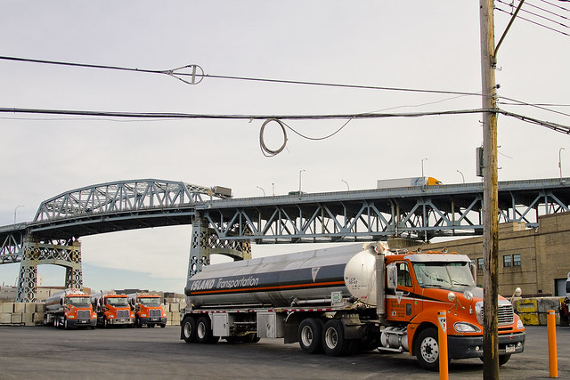
While many people balk at taking out the trash, it’s a job that the New York & Atlantic Railway does gladly — hauling 1.7 million pounds of residential and municipal waste each day, destined to Dixie in sealed containers riding aboard extra-long flat cars.
Monday through Saturday, a NY&A train crew goes over to the Varick Avenue transfer station in East Williamsburg, Brooklyn, where they couple up with 10-to-12 89-ft. flat cars loaded with up to 48 22-ft. long containers. Each has been stuffed with 18 tons of refuse, collected from homes and businesses in North Brooklyn.
The Varick Avenue facility was redesigned recently to accommodate rail shipments. It is owned and operated by Waste Management Inc. — one of the nation’s leading transporters and processors of municipal waste. NY&A began test movements in late January and handled its first regular shipment on February 16, 2009.

– photo by Mitch Waxman
This is the view from inside the gates on the Varick side of the Waste Management property…

– photo by Mitch Waxman
And this is the reversed POV, shot through a gap in the fence on the sidewalk.

– photo by Mitch Waxman
The line continues on the other side of Varick, in the distance, you can see the Scott Avenue Footbridge.
This “trainsarefun.com” page offers detailed schematics and historic shots of the Bushwick line, which are certainly worth a moment of your time.
demoniac alteration

– photo by Mitch Waxman
Fiery concatenation and syncopated horror haunt my steps whenever visting DUKBO.
Sarcastic and conceit laden, the label I give to this place is nevertheless apropos, for it is very much Down Under the Kosciuszko Bridge Onramp.
Welcome to DUKBO on the Brooklyn side of Newtown Creek- beneath the thrice damned Kosciuszko Bridge. It’s the sort of place which might best be described as either an “M1 industrial zone” or as a “literal hell on earth”.
Either way, it has been like this around here since around the Civil War.
from Harper’s weekly, Volume 38, 1894- courtesy Google books
AN INSALUBRIOUS VALLEY.
The city of Brooklyn, having purged itself of the malodorous political institutions that were so long a blot upon its southern border, might well turn its attention to some nuisances of a more literally malodorous kind that flourish along its northern border, a detailed description of which will be found in another column of the Weekly’. It appears that in an early day the valley of Newtown Creek, which is the boundary between Kings and Queens counties, was selected by various manufacturers as an eligible site for the location of factories. The location was then far on the outskirts of the city, and no doubt quite unobjectionable. A great variety of institutions were set iu operation here, including those useful and necessary but unpleasant factories whose purpose it is to transform the animal refuse of a city into merchantable produce. The gases generated by these factories had an odor almost unendurable, as any one can testify who was accustomed to travel on the Long Island Railroad from the Thirty-fourth Street ferry in years gone by.

– photo by Mitch Waxman
Elucidating on J. Rosenberg’s “model tallow rendering factory”, or the infamous Night Soil Dock of Conrad Wissell, or the extant nightmares of the Kings County Chemical works would be superfluous if describing the 19th century industries located on either side of the Newtown Creek as “dirty”.
They were good guys, who at least attempted to reform their industrial practices. It was the smaller operators in the distillery and fat rendering trades who were truly vile, at least according to the historical record.
Describing the transport and storage of rotting butchers scrap, animal waste, rotten eggs, and dead horses- all of which sat stinking in the summer sun while waiting to be weighed by the rendering plant bosses- or envisioning the attendant plagues of insect and rodentine vermin which followed these redolent piles (whose numbers were checked only by the acid rain and those environmental calamities which were caused by unregulated petroleum and chemical interests) from points all over the cities of Brooklyn, Long Island City, and New York would surely be a form of macabre and historical pornography.
However, that’s what the businesses here used as raw materials.
from The Sanitary Era, Volume 1, 1887, courtesy google books
Newtown Creek — No city in the Union has so foul a pest hole at its boundaries as Brooklyn. The sludge acid discharged from the works of the Standard Oil Company seems to possess an ominous potency for stirring up the sewage in the creek, and its black and thickened current seethes with bubbles of sulphuretted hydrogen. The shores, banked with this acid and with nameless filth, empoison the atmosphere at low water, while every rising tide seems to free a new supply of sludge. When to the oil industry is added the manufacture of fertilizers and a plenitude of pigs along Queens County shore, the sources of supply for a great nuisance or a grievous plague are discernible to all but official eyes and nostrils. Newtown Creek should be filled up, though not with sludge acid, and the nuisance makers removed to a distance. Our, Health Commissioner is authority for the statement that “You might as well try to fight the devil as the Standard Oil Company.”

– photo by Mitch Waxman
There have always been jobs here, the sort of jobs which those who cannot find employment in conventional occupations covet. Topical observation of the area reveals the modern presence of scrap yards, abattoirs, warehouse and trucking concerns, and light manufacturing facilities. Of course, the gargantuan National Grid property is nearby, but that’s a horse of a different shade.
There are a LOT of scrap yards in this little slice, this angle between the neighborhoods of Greenpoint and East Williamsburg, which creates a concentrating point for heavy metals. Of course, this is still preferable to the lagoons of sludge acid and animal waste which distinguished the place 100 years ago.
from The City record, Volume 6, Part 4, 1878, courtesy google books
Newtown Creek for many years has been a source of nuisance. It receives the contents of several of the large sewers ot Brooklyn. From above Penny Bridge to the East river are factories of various descriptions, oil refiners, fat inciters, gut cleaners, distilleries, car stables, super-phosphate factories, ammonia works, varnish works, and last, but not least, immense piles of stable manure, stored for future shipment, the refuse from all of which runs into the creek, and polluting the waters to such an extent as to have killed all the fish.
At low tide acres of land, covered to the depth of several inches with fat, the refuse of the oil-stills, are exposed. At high tide the oily portion of this refuse floats on the surface of the water, still giving forth its characteristic tarry odor. To add to this, many oil works, when the storage tanks are full, run their waste alkali and even their sludge-acid into the creek; in the latter case giving rise to the well known sludge smell.

– photo by Mitch Waxman
Faceless, those who labor here find themselves stained with “the colour”, an iridescent sheen permeating the Creeklands that no known detergent can easily remove. These laborers are exposed to precipitate from the endless truck and automotive traffic passing by on the highway and bridge above, a dusty particulate rises from tire shattered roadways, and the very air they breathe is a poisonous fume of industrial chemicals and spent fuel. Live poultry concerns, some quite large, maintain depots here as well. The birds, like the workers, quickly display the colour.
This colour is like no earthly hue, rather it is like something from out of space, and a stark contrast to the Shining City of the western horizon just a few miles away.
from nytimes.com
THE NUISANCES MUST GO; Gov. Flower Says that Newtown Creek Must Be Purified. FIVE FACTORIES ORDERED CLOSED Private Business Not to be Allowed to Jeopardize the Health of Brooklyn and Long Island City
crystal oblivion
– photo by Mitch Waxman
The other day I had the pleasure of some company on one of my little walks, Ms. Heather from NY-Shitty, and together we perambulated the hinterlands of Brooklyn- a no mans land between Greenpoint and East Williamsburg which has long been referred to as DUKBO in postings at this, your Newtown Pentacle.
This is a dusty, worn down, and fairly evocative place, crammed to the gills with industrial yards and century old mill buildings. A palpable evil lurks about the place, and the colour coats every surface. As a boy, when I asked my dad what was down there- he would turn pale, and demand promises that I never visit this area. This is the darkest of the hillside thickets found along the Newtown Creek, after all, legendary homeland of all that might go wrong under the American system of government.
Sorry Pop.
from the “Fellowship of the Ring” by Peter Jackson, et al.
Boromir: One does not simply walk into Mordor. Its black gates are guarded by more than just orcs. There is evil there that does not sleep, and the Great Eye is ever watchful. It is a barren wasteland, riddled with fire and ash and dust, the very air you breathe is a poisonous fume. Not with ten thousand men could you do this. It is folly.

– photo by Mitch Waxman
There was a pretty good reason that I was in the neighborhood, which will be discussed in later postings, but we soon found ourselves traipsing along beneath the rotting steel of the Kosciuszko Bridge. This is a fairly dangerous place, from a pedestrian point of view. Trucks rattle by at full throttle, sidewalks (when they exist) exhibit broken concrete and pooled water. Hideously barbed weeds sprout from the shattered roadbeds, and from every abyss something or someone stares back suspiciously.
There is nowhere to run to, in this abattoir of hope- your best hope is to attempt to fit in.
This clip from the same director’s “Return of the King” neatly encapsulates the sort of day Ms. Heather and I experienced:
w

– photo by Mitch Waxman
Mad stories have been told to me by those who labor in the area about what transpires in the fuligin hours around these parts, tales which I am duty bound not to repeat. Suffice to say that certain “ethnic fraternities” and other “ad hoc associations” maintain a certain presence in this locale, the members of which desire privacy and the cover of night to pursue their crafts. Said privacy is zealously guarded, as much of the City has been denied them by the efforts of an alliance of regional and national law enforcement.
Even during the daylight hours, the sure knowledge of their presence informs and constrains my movements and actions, but I’m from Brooklyn and know that what lurks around these parts both demand and deserves “Respect”.
As I’ve been told in the past by members of these groups- “Don’t ‘eff around back here”. Additionally, scholastic and mainstream critics have accused me of describing this area as “Mordor”, and that its not that bad.
from wikipedia
Three sides of Mordor were bounded by mountain ranges, arranged in a rough rectangle: Ered Lithui, translated as ‘Ash Mountains’ in the north, Ephel Dúath, translated as ‘Fence of Shadow’ in the west, and an unnamed (or was possibly still called Ephel Dúath) range in the south. In the northwest corner of Mordor, the deep valley of Udûn formed the region’s gate and guard house. That was the only entrance for large armies, and was where Sauron built the Black Gate of Mordor, and later where Gondor built the Towers of the Teeth. Behind the Black Gate, these towers watched over Mordor during the time of peace between the Last Alliance and Sauron’s return. In front of the Morannon lay the Dagorlad or the Battle Plain.
Within this mountainous region, Sauron’s main fortress Barad-dûr formed its tower, at the foothills of Ered Lithui. To southwest of Barad-dûr lay the arid plateau of Gorgoroth, forming the region’s keep, and Mount Doom its forge. To the east lay the plain of Lithlad.

photo courtesy wikipedia-
Mount Doom and Sauron’s tower of Barad-dûr in Mordor, as depicted in the Peter Jackson film

– photo by Mitch Waxman
Of course, that’s a ridiculous charge.
When have I ever suggested that there is some disembodied evil, a great eye, lurking at the top of a tower that looks down over some ash blasted wasteland which has a river of poison flowing through it?
…hits the fan

– photo by Mitch Waxman
Council Member Van Bramer sent this out to his mailing list today, regarding Hurricane Irene
As everyone knows by now, Hurricane Irene is expected to hit our area sometime Saturday into Sunday. We should all take precautions to be prepared for a storm of this magnitude. Some areas in our district are in evacuation zones and at high risk for flooding. Those areas of Hunters Point/Long Island City should familiarize themselves with the map below and know that should an evacuation be ordered, Newcomers High School (28-01 41st Ave.), Aviation High School (45-30 36th St.) and W.C. Bryant High School (48-10 31st Ave.) are your nearest evacuation centers. The City will make a decision about whether to order a mandatory evacuation of Zone A for the general public by 8:00 AM on Saturday. The evacuation centers will be open as of 5:00 PM today and the City is strongly recommending that people within these areas immediately make plans to go to alternative locations outside of Zone A starting tomorrow for the duration of the storm. The orange areas are Zone A. The yellow areas are Zone B. The green areas are Zone C.

We are also concerned about significant portions of the district including parts of Sunnyside, Woodside, Astoria and Maspeth that have experienced flooding during several recent storms. Our office has been and will continue to be in contact with the Department of Environmental Protection (DEP) and other city agencies throughout this weekend. Anyone experiencing difficulties as a result of Hurricane Irene should contact me and my office as soon as they occur. We will report problems in real time. For those outside of Zone A areas that have experienced flooding or are concerned that you may, please click on the link below on how to protect your valuables. In addition to calling our office, DEP is asking for reports of flooding to be called in to 311.
http://home2.nyc.gov/html/oem/downloads/pdf/flooding_guide.pdf
I have also been in touch today with NYCHA and the Mayor’s Office to make certain that Queensbridge, Ravenswood, and the Woodside Houses are included in any and all emergency plans including evacuation, should that be necessary. We will continue to be in regular contact with NYCHA throughout the storm.
While we continue to hope for the best, we must prepare for the worst. The city has published some useful information in securing your home during the storm. Please click on the link below for recommendations on how best to prepare for the hurricane.
www.nyc.gov/html/oem/html/ready/hurricane_guide.shtml
Given the high volume of traffic to OEM’s (Office of Emergency Management) website there have been delays and interruptions in gaining access to some of these links. For that reason, we also include the Red Cross’ Hurricane Safety Checklist below. We have also included information from OEM’s Hurricane Guide at the end of this email should that link not respond when you try it.
http://www.redcross.org/www-files/Documents/pdf/Preparedness/checklists/Hurricane.pdf
In advance of the hurricane I wanted to remind you that clogged catch basin grates can aggravate flooding. Although DEP staff – with the help of their colleagues at other agencies – are busy cleaning catch basins now, DEP has asked us to remind homeowners and residents that they welcome assistance in removing leaves, litter or other debris that may prevent water from flowing off the streets and into the catch basins. For any of you that aren’t familiar with catch basins the attached link to a page on DEP’s website has some text and visuals that will help explain why flooding occurs and how citizens can help DEP minimize flooding by removing debris where they see it blocking catch basin grates.
http://www.nyc.gov/html/dep/html/flooding/flooding_causes.shtml
I will be keeping my district office open on Saturday to field questions and concerns from constituents. Needless to say, we will close the office when the storm approaches and will reopen as soon as it is safe to do so. My district office number is (718) 383-9566. I will be in the district throughout the storm and encourage anyone with problems to email me concerns at jvanbramer@council.nyc.gov as well as using social media including Facebook (http://www.facebook.com/jimmyvanbramer) and Twitter (http://twitter.com/jimmyvanbramer) to reach me. You may also call 311. Please only call 911 if you have a very serious or life threatening emergency.
I hope this update and the attached information proves useful to you. Again, my staff and I will be working throughout the weekend and please do not hesitate to contact me should you need assistance.
Sincerely,

Jimmy Van Bramer
Council Member

– photo by Mitch Waxman
Additionally, the Council Member included the following information from the Office of Emergency Management
OEM’s Hurricane Guide
To secure your home if a tropical storm or hurricane watch is issued:
Bring inside loose, lightweight objects, such as lawn furniture, garbage cans, and toys.
Anchor objects that will be unsafe to bring inside, like gas grills or propane tanks. Turn off propane tanks.
Shutter windows securely and brace outside doors.
Place valuables in waterproof containers or plastic bags.
Help Others Prepare
- Check on friends, relatives, and neighbors, especially those with disabilities or special needs, and assist them with their preparation and evacuation.
- If you live outside an evacuation zone, offer to shelter family and friends who may need to evacuate.
If Asked to Evacuate, Do So Immediately
The City will communicate specific instructions about which areas of the city should evacuate through local media. If the City Issues an Evacuation Order for Your Area: Evacuate immediately. Use public transportation if possible.
If you are going to an evacuation center, pack lightly, and bring:
- Your Go Bag
- Sleeping bag or bedding
- Required medical supplies or equipment
- Let friends or relatives know where you are going.
What about my pets?
- Make sure your disaster plan addresses what you will do with your pet if a hurricane requires you to leave your home.
- Plan to shelter your pet at a kennel or with friends or relatives outside the evacuation area.
- Be sure you have supplies ready for your pet in the event of an evacuation, including food, a leash, a muzzle, proof of shots, and a cage or carrier.
Account for your special needs
- Consider your capabilities and make sure your preparedness plan addresses how your special needs affect your ability to evacuate and shelter.
- Determine if you will need assistance and arrange help from friends, family, or neighbors.
- Consider additional supplies and equipment that you may need to bring with you, such as medicine, icepacks, medical devices, and backup equipment. Bring food for your dietary needs.
- Include additional time and evaluate your transportation options.
IF YOU LIVE IN AN EVACUATION ZONE
Prepare A Disaster Plan
Develop a plan with your household members that outlines what to do, how to find each other, and how to communicate if a hurricane strikes New York. If you rent your home, renter’s insurance will insure the items inside your apartment. If you are a homeowner, make sure your home is properly insured — flood and wind damage are not covered in a basic homeowner’s policy.
Know Where You Will Go
The City strongly recommends evacuees stay with friends or family who live outside evacuation zone boundaries. For those who have no other shelter, the City will open hurricane shelters throughout the five boroughs.
To ensure efficient use of resources, the City will ask all evacuees to report to an evacuation center. Once at the evacuation center, evacuees will either be assigned to a hurricane shelter in the same facility or transported to an associated hurricane shelter by bus.
Every household member should have a small Go Bag — a collection of items you may need during an evacuation packed in an easy-to-carry container such as a backpack. A Go Bag should be easily accessible if you have to leave your home in a hurry.
Assemble an Emergency Supply Kit
You may be instructed to shelter in place (stay at home) during a hurricane. Keep enough supplies in your home to survive for at least three days.
If you do not live in an evacuation zone
All areas of the city could face hurricane-related hazards such as high winds, flooding, tornadoes, and loss of utilities. You may be instructed to shelter in place (stay at home) for several days until the hurricane passes.
If you live in a high-rise apartment building
Residents of high-rise apartment buildings may face special risks from hurricanes even if they live outside evacuation zone boundaries. If you live in a high-rise building outside an evacuation zone, be prepared to take shelter on or below the 10th floor. If you live in a high-rise building located in an evacuation zone, heed evacuation orders.

– photo by Mitch Waxman
This looks like it will be a profound event. Personally, I’m preparing for an uncomfortable few days, but that’s because I live inland and uphill in Astoria. Long Island City and Greenpoint on the other hand…
Our friends at liqcity.com have prepared an excellent posting on the Zone A situation, which can accessed here:
http://www.liqcity.com/life/long-island-city-and-hurricane-irene-a-match-made-in-well-well-see

– photo by Mitch Waxman
Newtown Creek Alliance, an organization of which I’m a member, issued this statement earlier today…
Flood Warning for Creek Neighborhoods
Mayor Michael Bloomberg announced on August 25th, 2011 that certain emergency measures will be instituted in low lying coastal districts referred to as “Zone A” (at high risk of coastal flooding) due to the expected arrival of Hurricane Irene in the New York City area late Saturday night. Much of the land surrounding Newtown Creek is designated as “Zone A” on the coastal flooding map prepared by City officials, including large tracts of Greenpoint and Long Island City. For a map of the affected areas, please click here.
Newtown Creek Alliance cautions residents of the affected areas to monitor the situation and be prepared to evacuate should authorities warrant it necessary. If an evacuation is recommended or ordered, information about evacuation centers and hurricane shelters may be found by calling 311 or at by visiting this website. Additionally, be mindful that during such an event, the flood waters could carry a significant load of pollutants and should not be ingested. Care should be taken upon any contact with skin.

– photo by Mitch Waxman
Sources within the City have discussed this storm with me in the most dire tones. If you live in an area designated for evacuation, please comply. I’ll be marching out into the brave new aftermath early Monday morning, if there’s something which you think I should point my camera at, please contact me here. Good luck, and assuming the availability of both electrical power and internet connectivity, I’ll post as the situation develops.
As this post was being prepared, Council Member Van Bramer passed along another message, ordering the mandatory evacuation of Zone A by 5 pm Saturday.

life, matter, and vitality

– photo by Mitch Waxman
Paramount in my apprehensions about this unremembered walk- which began at St. Patrick’s Old Cathedral, continued down Delancey Street, went over the Williamsburg Bridge, staged into Williamsburg, and continued up Grand Street in the direction of that assassination of joy called the Newtown Creek- is the ideation that something happened to me in the ancient church.
Remember, this unknown fellow from the interwebs offered me information which is dearly sought, the location of a certain interment lost in the ghoulish multitudes of Calvary Cemetery which I have spent too much time searching for. When my anonymous assignee walked into the church with two troglodyte ruffians, I panicked and fled… but a nagging suspicion that something else might have happened in there torments me.

– photo by Mitch Waxman
Could a mere intuition have sent me into this flaming paroxysm of cowardly flight, carrying me blind miles in a stupor? A delicate constitution and deep physical cowardice are my hallmarks, yes, but a multiple mile flight which propelled me across most of the eastern districts of Brooklyn? Nevertheless, according to my camera card, I had nevertheless returned to the loathsome lands of the Newtown Creek and was standing upon the Metropolitan Avenue Bridge once again.
The coincidental concurrence of my route with certain long forgotten street car (trolley) routes continues to intrigue me as I write this in the sober and controlled environment of Newtown Pentacle HQ.

– photo by Mitch Waxman
The tugboat which is often noticed here is the “Mary H.” which runs fuel barges from the outer harbor to the Bayside Oil depot located on Metropolitan Avenue itself, near it’s junction with Grand Street. The section of the Creek visible in these shots is actually a tributary, called English Kills. Two ancient pathways, which we call Grand St. and Metropolitan Avenue these days, cross each other here at a sharp angle.
Metropolitan was formerly known as the Williamsburgh and Jamaica Turnpike, and it connected Newtown in Queens with the Eastern District of Brooklyn- Bushwick, Williamsburg, and Greenpoint. The crossing of Grand and Metropolitan was also one of the stops on the New York and Manhattan Beach Railroad, its depot would have found at the foot of Greenpoint’s Quay Street in 1912.

– photo by Mitch Waxman
A theory which guides me of late requires a paradigm shift in thought and perception, simply put- the older communities of western Queens and north western Brooklyn have more in common with each other than they do with the boroughs they reside in. In earlier times, before the bridges, intimate (and railroad) ties knit these communities together and Bushwick has more in common with Astoria than it does with Flatbush.
The unifying principal, the organizing principal in fact, was access to the waterfront not just at the East River- but all along the various creeks and kills which once penetrated inland. The culture which grew along Sunswick and Newtown and Bushwick Creeks is lost to time and shifting populations, buried beneath centuries of concrete and the remnants of long vanished industry.

– photo by Mitch Waxman
It would seem that your humble narrator continued down Grand Street from Metropolitan, toward the border of Brooklyn and Queens at the Grand Street Bridge, and area I dare to call DUGSBO- Down Under the Grand Street Bridge Onramp.
This section of the City of Greater New York, incidentally, is called East Williamsburg by modern cartographers.

– photo by Mitch Waxman
Fear exists in my heart for the noble little Grand Street Bridge, as modern traffic races across it’s delicate mechanisms. Long has it been since boat traffic has crossed it, the last official opening was in 2002. One misstep by a careless trucker and this historic structure would require replacement, no doubt by an economical fixed span.
Who speaks for it, save I? It deserves a better advocate.

– photo by Mitch Waxman
An oddity and relict vehicle appears next in this fever dream found on my camera’s memory card, which is most probably a 1940 Ford Deluxe Coupe. It appears to be a loving restoration, although a powerful and enigmatic auto like this should either be painted black or fire engine red in my eyes.
What do I know, after all, I’m some guy who gets scared of strangers in the City and then wanders around the boroughs in a haze of panic and all the while I’m taking pictures that I don’t remember taking…

– photo by Mitch Waxman
It’s actually funny, considering that in this odd state which I was suffering from, that when seeking a safe haven my subconscious mind bought me here to the Newtown Creek. It has been some time since warnings and admonishments to newcomers about this place have been offered at this- your Newtown Pentacle.
Irresponsible of me, in fact.
This carrion relict of a forgotten age is not the world you know, and those rules and conventions which govern the City that encompasses it’s district do not always apply here. Trucks and railroads operate at high speed along these streets, the very air you breathe is a fume, and there are malign forces long thought dead or neutered which still thrive here. The ground is a broken minefield of powdered glass and tetanus tainted metal, and just below the surface is a writhing agglutination of the very worst stuff that the 20th century ever managed to conjure. Who can guess all there is, that might be buried down there?
Welcome to the Newtown Creek.
Note: apologies for the absent updates this last week, but the City of Water Day Newtown Creek Tour and Magic Lantern Show seriously drained my strength. To be seen by so many diminishes me.


