Posts Tagged ‘Gowanus Expressway’
nitrous vault
Friday

– photo by Mitch Waxman
A few final Friday photos from the far away Gowanus greet you this morning. The shot above looks towards the Union Street Bridge from the Carroll Street Bridge.
Uncharacteristically, I’m sort of at a loss of words today. Obvious reasons, read the news. It’s not like this wasn’t obviously going to happen sooner or later.

– photo by Mitch Waxman
That’s Carroll Street Bridge, which is one of only two retractile bridges in the entire City. The other is Borden Avenue Bridge, crossing the Dutch Kills tributary of Newtown Creek in Long Island City.
I cannot fathom the attempts on social media to rebrand the group of white supremacists who stormed the Capitol as “Antifa.” You broke it, you bought it. Assholes. When you lie down in the street with wild dogs, you get bit.

– photo by Mitch Waxman
On the way home, a quick stop was made to get the shot above, depicting three DSNY trucks on a ramp with the Gowanus Expressway in the background.
Good times, these.
Note: I’m writing this and several of the posts you’re going to see for the next week at the beginning of the week of Monday, January 4th. My plan is to continue doing my solo photo walks around LIC and the Newtown Creek in the dead of night as long as that’s feasible. If you continue to see regular updates here, that means everything is kosher as far as health and well being. If the blog stops updating, it means that things have gone badly for a humble narrator.
“follow” me on Twitter- @newtownpentacle
Buy a book!
“In the Shadows at Newtown Creek,” an 88 page softcover 8.5×11 magazine format photo book by Mitch Waxman, is now on sale at blurb.com for $30.
waking reality
Tuesday.

– photo by Mitch Waxman
After debarking a NYC Ferry at the Brooklyn Army Terminal, with my destination at the Gowanus Canal beckoning, one picked his way northwards along the mean streets of industrial Sunset Park. I’m not going to pretend to be super knowledgable about the area, which was once known as the Bush Terminal but is now called “Industry City” by the fancy pants types in City Hall. I encountered rough streets, some of which were paved in belgian block or “cobblestone” and hosted seemingly defunct rail spurs.
When you’re into NYC History, people ask you the time machine question a lot. The answer for this area’s “if you had a time machine and could travel backwards in time to see it at its height” question would be the years of the Second World War and the decade or so afterwards. Presuming this time machine kept me safe in a bubble which the temporal locals would not be able to see or interact with me, I’d also like to pay a visit to the Bush Terminal sometime in the early 1980’s. This was very much one of the sections of Brooklyn which you’d ensure that the car doors were locked when you were driving through it during the crack years.

– photo by Mitch Waxman
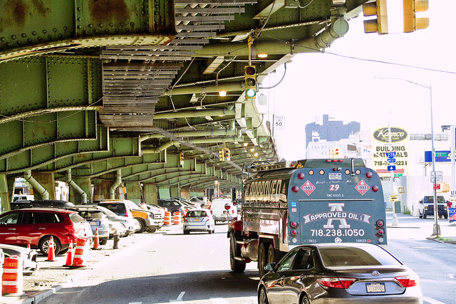
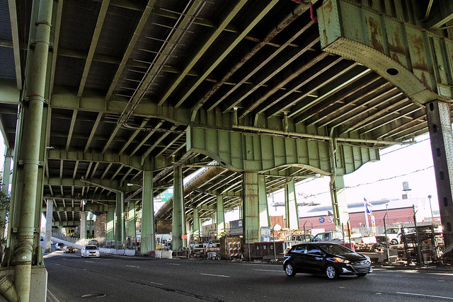
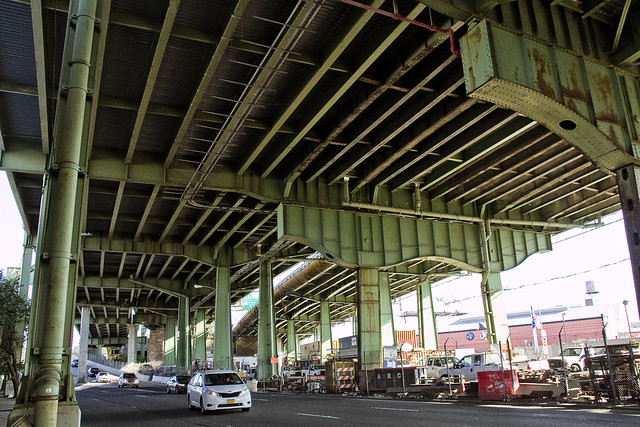
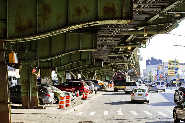
After walking past a series of Industry City buildings which the NYC EDC is in charge of, and a large Federal Prison, one found his way to 3rd Avenue and the elevated Gowanus Expressway. One of Robert Moses’ less popular projects, the Gowanus Expressway is responsible for blighting this area in the 1930’s and reducing it down to a corridor between the Battery Tunnel and BQE on one side and the Belt Parkway and the Verazzano Bridge on the other.
The steel of the Gowanus Expressway is known to be a daytime nest for Vampires. A crew of laborers were getting busy up in the shadowed recesses of the high volume road, which suggests their profession is a risky one. Perhaps the laborers wear necklaces of garlic as a part of their workplace PPE.

– photo by Mitch Waxman
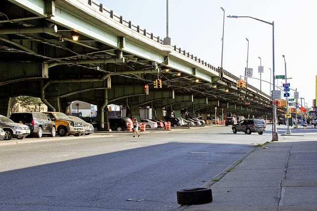
After a brisk walk on a particularly cold morning, one finally arrived at the “Gowanus Zone” where the hazy border of Sunset Park and Red Hook transitions from one neighborhood into another.
This is one of the most pedestrian unfriendly areas in the entire City of Greater New York. Heavy trucks whizzing by on local streets at highway speeds, people driving automobiles in an angry and frustrated fashion, and crossing the street involves making a mad dash across three or four lanes of traffic. It’s also very, very loud.
Given that personal security has become something to be concerned about again, the luxury I’ve enjoyed for years of having an audiobook or music playing through headphones has been largely abandoned in favor of listening for approaching wackadoodles or the slapping sound of sneakers on pavement of those who are running towards me with malign intent. This has added a new perceptual dimension to my walks through the City – unfiltered sound. More tomorrow.
Note: I’m writing this and several of the posts you’re going to see for the next week at the beginning of the week of Monday, January 4th. My plan is to continue doing my solo photo walks around LIC and the Newtown Creek in the dead of night as long as that’s feasible. If you continue to see regular updates here, that means everything is kosher as far as health and well being. If the blog stops updating, it means that things have gone badly for a humble narrator.
“follow” me on Twitter- @newtownpentacle
Buy a book!
“In the Shadows at Newtown Creek,” an 88 page softcover 8.5×11 magazine format photo book by Mitch Waxman, is now on sale at blurb.com for $30.
villainous looking
Happy 77th Birthday, Gowanus Expressway!
– photo by Mitch Waxman
Today is the day that all the children of infinite Brooklyn emerge into the streets and lanes to gambol and celebrate, reveling in a common heritage. October 1st signals to them not just the arrival of “sweater weather,” but also jogs an ancestral memory of the opening of a branch of the House of Moses in South Brooklyn along the fabled Gowanus Canal (Robert Moses, that is). They don’t celebrate the Hamilton Avenue Vampires of course, but… really… who celebrates exsanguinators on the first of October? That’s for the end of the month on Halloween.
The Vampires known to infest this section of the larger Brooklyn Queens Expressway were discussed in two posts from 2017 – “unsigned letter” and “decisive steps.” Read them and take the message of their presence to heart. We’ve got the same problem in Queens Plaza, I’m sorry to say. The City suppresses NYPD statistics on this subject.
– photo by Mitch Waxman
The House of Moses landed heavily in South Brooklyn, and stole the sky. It blighted the ground and blocked the emanations of the burning thermonuclear eye of God itself from ever directly warming the pavement set squamously about the Gowanus. As above, so below – automotive traffic is everpresent and flows heavily in these parts. The exigent needs of pedestrians in the area were abrogated, ignored, and arrogantly discarded.
I seem to recall that – sometime in the late 1980’s or early 90’s – a decades long season of deferred maintenance on the elevated Gowanus Expressway resulted in a truck plunging through it to the streets below. Same thing happened in the City, over on the West Side Highway.
– photo by Mitch Waxman
Construction on this wonder of the Brooklyn world began in 1939, and the consequences for the neighborhood below were dire. If you lived, or worked, in the pathway chosen by Mr. Moses for his marvel… well… you couldn’t stand in the way of progress. The needs of the many outweigh the needs of the few, and you can’t make an omelette without breaking a few eggs. This was called “progress.”
As a note, this is why I argue about semantics with my political friends when they call themselves “progressives” in the 21st century. I usually refer them to a dictionary, because “progressive” doesn’t actually mean what they think it does. Robert Moses was a progressive.
– photo by Mitch Waxman
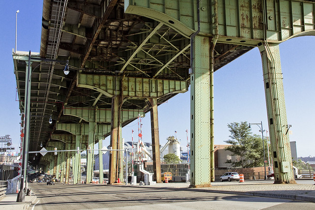
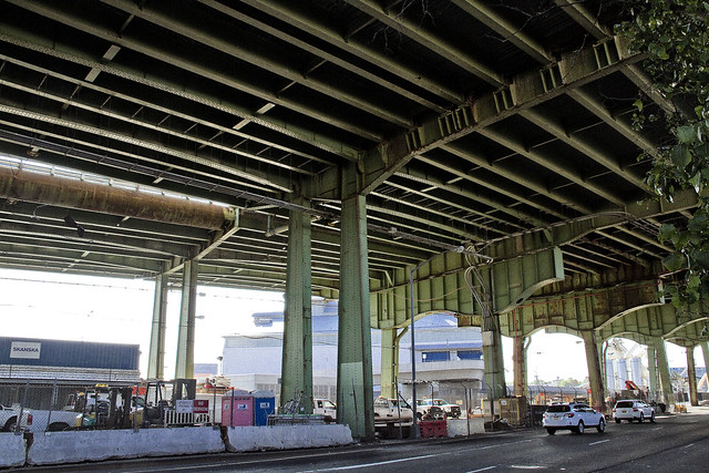
The Gowanus Expressway as viewed from the turgid water of Gowanus Bay, in the shot above. Gowanus Expressway was designed to connect the corridors of Ocean Parkway, Sunset Park, and Bay Ridge with the Brooklyn Battery Tunnel. Concurrently built, the Koscisuzcko Bridge over in North Brooklyn was meant to provide egress to extant sections of Queens, notably the new Grand Central Parkway which fed into the Triborough Bridge. Mr. Moses then made the case that it would all be wasted effort were a connecting highway not created between the structures. He called it the Brooklyn Queens Connecting Highway, which, in the years following the Second World War was widened and improved into becoming the Brooklyn Queens Expressway. The BQE was then extended a bit to the south to meet and join with the Belt Parkway, which – coincidentally – also provided an eastern connection to Triborough via the Van Wyck and Interborough Parkways to the Grand Central.
That’s the Hamilton Avenue Bridge just below the Gowanus Expressway, if you’re curious, and it was discussed in this Newtown Pentacle post from 2014.
– photo by Mitch Waxman
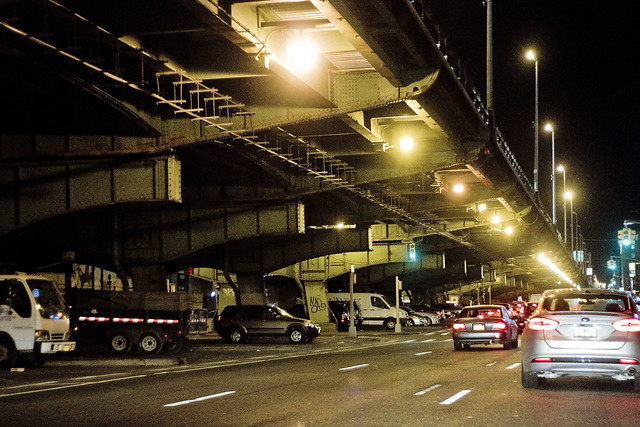
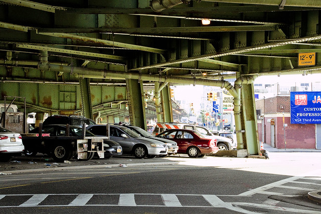
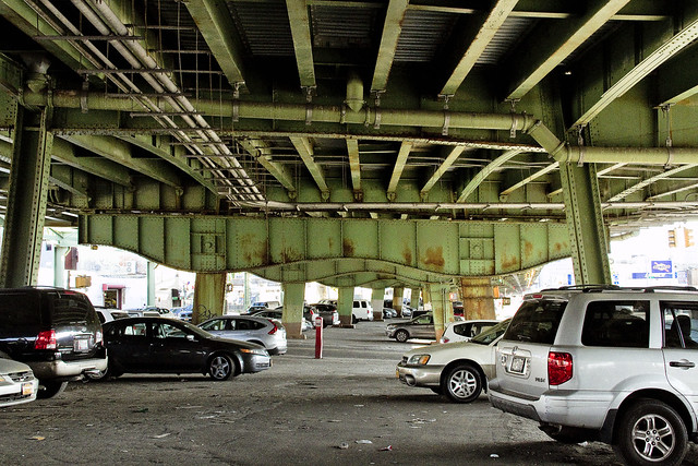
The sections of Brooklyn found under the Gowanus Expressway, in addition to being lousy with vampires, are pretty horrible. The elevated road drips, it hums, it overshadows and overwhelms. It’s not a pleasant experience either driving or walking down here. All is shadowed by the best intentions of the exigencies of the past.
One of the less salubrious corridors of the “House of Moses,” this.
– photo by Mitch Waxman
It’s especially horrible at night.
Anywho – Happy Birthday Gowanus Expressway, you vampire infested nightmare.
Upcoming Tours and Events
Monday, October 1st, 6:30 p.m. – Infrastructure Creek – with Atlas Obscura.
Join Newtown Creek Alliance Historian Mitch Waxman as he leads an exploration of the city’s largest sewer plant, tunnels, draw and truss bridges, rail yards, and a highway that carries 32 million vehicle-trips a year over flowing water.
Tix and more details here.
“follow” me on Twitter- @newtownpentacle
decisive steps
It’s National Hot Fudge Sundae Day, in these United States.
– photo by Mitch Waxman
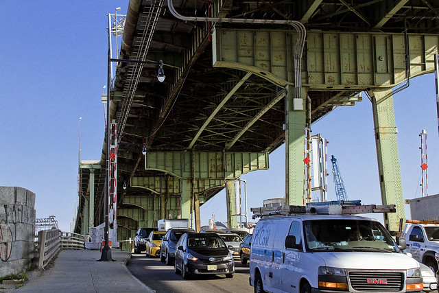
Despite the known presence of a tribe of Vampires lurking in the steel rafters of the Red Hook section’s Gowanus Expressway, the elevated span offers a welcoming respite from the radiate energies of the burning thermonuclear eye of God itself to a humble narrator as well as the revenants – and given the high temperature and humidity levels last week – one was willing to take his chances with the bloodsuckers in pursuance of a bit of shade. This corridor in South Brooklyn is hellacious to drive through, and is also a bit of an adventure whilst on foot.
It’s the “House of Moses” after all.
from wikipedia
Robert Moses (December 18, 1888 – July 29, 1981) was a public official who worked mainly in the New York metropolitan area. Known as the “master builder” of mid-20th century New York City, Long Island, Rockland County, and Westchester County, he is sometimes compared to Baron Haussmann of Second Empire Paris, and was one of the most polarizing figures in the history of urban development in the United States. His decisions favoring highways over public transit helped create the modern suburbs of Long Island and influenced a generation of engineers, architects, and urban planners who spread his philosophies across the nation despite not training in those professions. Moses would call himself a “coordinator” and was referred to in the media as a “master builder”.
– photo by Mitch Waxman
One’s plan was a simple one. Attendance at an event in Sunset Park was on the menu, and a convoluted trip using the subway from Point A in Queens’ Astoria to Point R in Brooklyn’s Red Hook was instituted. From Smith/9th street, I had a distance of about a mile to cover on foot, during which one encountered a series of challenging pedestrian obstacles which made me wish I had called a cab. My plan was to take Hamilton Avenue over to Third Avenue, whereupon I was headed over to 28th street in Sunset Park. Simple?
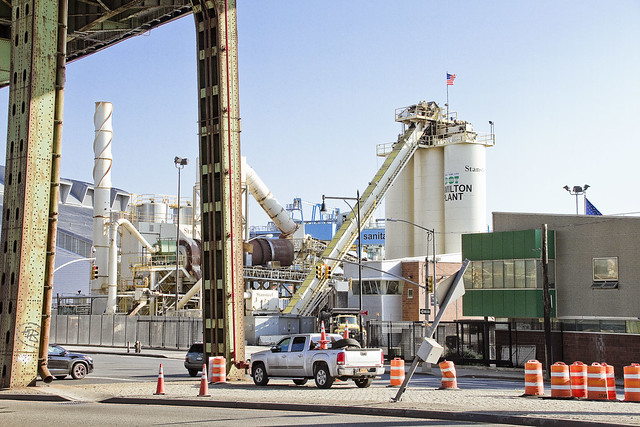
Btw, that’s NYC DOT’s Hamilton Plant pictured above, they do asphalt.
from wikipedia
Asphalt concrete (commonly called asphalt, blacktop, or pavement in North America, and tarmac or bitumen macadam in the United Kingdom and the Republic of Ireland) is a composite material commonly used to surface roads, parking lots, airports, as well as the core of embankment dams. It consists of mineral aggregate bound together with asphalt, laid in layers, and compacted. The process was refined and enhanced by Belgian inventor and U.S. immigrant Edward de Smedt.
– photo by Mitch Waxman
Things got a little hairy for a scuttling narrator as the realization that there was no way to safely cross the street set in and that I was just going to have to “go with the flow” and follow whatever detours Robert Moses left behind for me. Realizing that you’re the only person moving along on foot along a busy road is a bit disconcerting. More so, the unseen eyes staring maliciously down at my gloriously blood swollen body were sensed rather than observed.
My understanding is that this tribe of Nosferatu are nowhere near as organized or aggressive as the ones found around Queens Plaza. Those are the ones who enact a nightly siege at the NY Blood Center facility in Vernon Blvd., but one remained vigilant nevertheless.
As quoted from a 2015 post at this – your Newtown Pentacle – “It is said that the vampires arrived with a grain shipment from Germany in the early 1900’s, quickly established themselves in the neighborhood, and never left.”
from wikipedia
During the 18th century, there was a frenzy of vampire sightings in Eastern Europe, with frequent stakings and grave diggings to identify and kill the potential revenants. Even government officials engaged in the hunting and staking of vampires. Despite being called the Age of Enlightenment, during which most folkloric legends were quelled, the belief in vampires increased dramatically, resulting in a mass hysteria throughout most of Europe. The panic began with an outbreak of alleged vampire attacks in East Prussia in 1721 and in the Habsburg Monarchy from 1725 to 1734, which spread to other localities.
– photo by Mitch Waxman
The diversionary sidewalk path carried me away from Hamilton’s intersection with Third Avenue, and one was forced to vacate the BQE’s shadows – which sheltered both undead army and humble narrator alike from the sky born radiation. One found himself at the veritable angle between the three neighborhoods surrounding the Gowanus Canal, and proceeded along his way.
I kept a close eye on those steel rafters, however.
from wikipedia
Legends of vampires have existed for millennia; cultures such as the Mesopotamians, Hebrews, ancient Greeks, and Romans had tales of demonic entities and blood-drinking spirits which are considered precursors to modern vampires. Despite the occurrence of vampire-like creatures in these ancient civilizations, the folklore for the entity we know today as the vampire originates almost exclusively from early 18th-century Southeastern Europe, particularly Transylvania as verbal traditions of many ethnic groups of the region were recorded and published. In most cases, vampires are revenants of evil beings, suicide victims, or witches, but can also be created by a malevolent spirit possessing a corpse or by being bitten by a vampire itself. Belief in such legends became so rife that in some areas it caused mass hysteria and even public executions of people believed to be vampires.
– photo by Mitch Waxman
Along my path, several gaunt and filthy humans appeared, asking me for things I might have – oddly specific amounts of currency or just random items that they noticed me carrying. Surely, these debased people were the “bled white” servitors of the vampiric powers, enjoying the brief sojourn of freedom which the daytime brings them. Shoving past them with a “harummpf” and a “good day to you madam,” one was nevertheless on a mission, which was arriving at my destination in Sunset Park on time and not quite a perspiring mess due to the uncomfortable atmospherics.
One had arrived at Third Avenue, finally.
from wikipedia
Clinical vampirism is named after the mythical vampire, and is a recognizable, although rare, clinical entity characterized by periodic compulsive blood-drinking, affinity with the dead and uncertain identity. It is hypothetically the expression of an inherited archaic myth, the act of taking blood being a ritual that gives temporary relief. From ancient times vampirists have given substance to belief in the existence of supernatural vampires. Four vampirists, including Haigh, the ‘acid-bath murderer’, are described. From childhood they cut themselves, drank their own, exogenous human or animal blood to relieve a craving, dreamed of blood-shed, associated with the dead, and had a changing identity. They were intelligent, with no family mental or social pathology. Some self-cutters are auto-vampirists; females are not likely to assault others for blood, but males are potentially dangerous. Vampirism may be a cause of unpredictable repeated assault and murder, and should be looked for in violent criminals who are self-mutilators. No specific treatment is known.
– photo by Mitch Waxman
I noticed that the steel rafters of the highway were no longer quite so high relative to my position, but were instead placed far closer to the ground. At this lower height, it would be a simple thing for some glass nailed claw connected to a pale limb by creaking ligaments to swing down and scratch at my skinvelope, causing my bodily juices to spill out and make for easy consumption. The local gendarmes don’t inquire too deeply into exsanguinated corpses around these parts, I’m told, chalking the complete lack of blood up to “extreme dehydration” on official NYPD paperwork.
Yeah… there’s definitely something thirsty hereabouts… I’ll tell you!
from wikipedia
The Oxford English Dictionary dates the first appearance of the English word vampire (as vampyre) in English from 1734, in a travelogue titled Travels of Three English Gentlemen published in The Harleian Miscellany in 1745. Vampires had already been discussed in French and German literature. After Austria gained control of northern Serbia and Oltenia with the Treaty of Passarowitz in 1718, officials noted the local practice of exhuming bodies and “killing vampires”. These reports, prepared between 1725 and 1732, received widespread publicity. The English term was derived (possibly via French vampyre) from the German Vampir, in turn derived in the early 18th century from the Serbian vampir (Cyrillic: вампир).
The Serbian form has parallels in virtually all Slavic languages: Bulgarian and Macedonian вампир (vampir), Bosnian: vampir, Croatian vampir, Czech and Slovak upír, Polish wąpierz, and (perhaps East Slavic-influenced) upiór, Ukrainian упир (upyr), Russian упырь (upyr’), Belarusian упыр (upyr), from Old East Slavic упирь (upir’) (many of these languages have also borrowed forms such as “vampir/wampir” subsequently from the West; these are distinct from the original local words for the creature). The exact etymology is unclear. Among the proposed proto-Slavic forms are *ǫpyrь and *ǫpirь.
Another less widespread theory is that the Slavic languages have borrowed the word from a Turkic term for “witch” (e.g., Tatar ubyr). Czech linguist Václav Machek proposes Slovak verb “vrepiť sa” (stick to, thrust into), or its hypothetical anagram “vperiť sa” (in Czech, the archaic verb “vpeřit” means “to thrust violently”) as an etymological background, and thus translates “upír” as “someone who thrusts, bites”. An early use of the Old Russian word is in the anti-pagan treatise “Word of Saint Grigoriy” (Russian Слово святого Григория), dated variously to the 11th–13th centuries, where pagan worship of upyri is reported.
– photo by Mitch Waxman
One bolted across Third Avenue, seeking safety instead of avoiding the burning gaze of the Thermonuclear Eye of God itself. For one such as myself, it is merely uncomfortable to stand in the radiation of the almighty’s gaze, but for the Vampire folk it is an existential matter. It’s why their kind prefers cold climates with long winters, when’re they can enjoy the ecstasies of freedom and the hunt both unmolested and unrestrained, like the wolf.
I’m told that one of the local South Brooklyn Vampires has recently announced a run for the local City Council seat as an independent. There’s a lot of minor candidates who feel emboldened by Donald Trump’s surprise victory to try and gain elective office who figure that if Trump could do it, why not them too? Watch out Brad Lander.
from wikipedia
Opportunism is the conscious policy and practice of taking advantage of circumstances – with little regard for principles, or with what the consequences are for others. Opportunist actions are expedient actions guided primarily by self-interested motives. The term can be applied to individual humans and living organisms, groups, organizations, styles, behaviours, and trends.
Opportunism or “opportunistic behavior” is an important concept in such fields of study as biology, transaction cost economics, game theory, ethics, psychology, sociology and politics.
– photo by Mitch Waxman
Warehouse and fenceline shadows would now have to be my only shelter from the burning rays of the thermonuclear orb in the sky, and one proceeded south. Now all I had to worry about were those man things which have seemingly never been instructed in how to wear human clothing that are common in this area, the everpresent high speed and randomly directed truck traffic, and a growing crowd of disaffected and heavily tattooed young humans who were riding their bicycles clumsily on the sidewalk while texting on their iphones.
from wikipedia
The hipster subculture is stereotypically composed of youth who reside primarily in gentrifying neighborhoods. It is broadly associated with indie and alternative music, a varied non-mainstream fashion sensibility, vintage and thrift store-bought clothing, generally progressive political views, organic and artisanal foods, alternative lifestyles and snobbery. The subculture typically consists of mostly white young adults living in urban areas. It has been described as a “mutating, trans-Atlantic melting pot of styles, tastes and behavior”.
– photo by Mitch Waxman
Tomorrow, I’ll show you where I was going to in Sunset Park, and why I braved the horrors of the sweating concrete bunkers of the MTA, the pedestrian hating “House of Moses,” and the Vampiric hordes of hoary Red Hook itself.
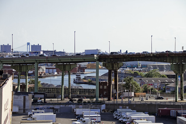
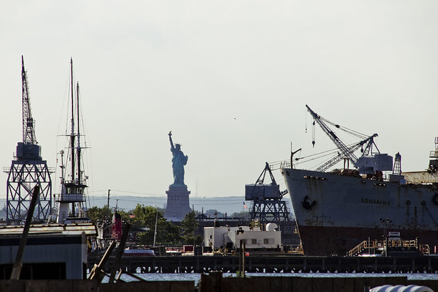
That’s Gowanus Bay above, as seen from my eventual destination in Sunset Park, which was ultimately kind of a trashy experience – but more on that subject tomorrow – at this, your Newtown Pentacle.
from wikipedia
Sunset Park is a neighborhood in the southwestern part of the New York City borough of Brooklyn. It is bounded by Park Slope, Greenwood Heights and Green-Wood Cemetery to the north, Borough Park to the east, Bay Ridge to the south, and Upper New York Bay to the west. Because it was once close to the southern boundary of the City of Brooklyn, Sunset Park is considered to be part of South Brooklyn. However, until the 1960s, the northern part of Sunset Park was considered to be part of Gowanus, and the southern part was included in Bay Ridge. The neighborhood received its own name in that decade.
Upcoming Tours and events
The Insalubrious Valley of the Newtown Creek Walking Tour, with Newtown Creek Alliance – Saturday August 5th, 11 a.m. – 1;30 p.m.
Century old movable bridges, the remains of a 19th century highway between Brooklyn and Queens, and explore two of the lesser known tributaries of the troubled Newtown Creek watershed. For the vulgarly curious, Conrad Wissell’s Dead Animal and Night Soil wharf will be seen and described, with NCA Historian Mitch Waxman – details here.
Brooklyn Waterfront Boat Tour, with Working Harbor Committee – Saturday August 12th, 6 p.m. – 8 p.m.
Explore the coastline of Brooklyn from Newtown Creek to Sunset Park, with NCA Historian Mitch Waxman, Andrew Gustafson of Turnstile Tours, and Gordon Cooper of Working Harbor Committee on the narrating about Brooklyn’s industrial past and rapidly changing present. – details here.
The Poison Cauldron of the Newtown Creek Walking Tour, with Newtown Creek Alliance – Sunday August 13th, 11 a.m. – 1:30 p.m.
Explore the hellish waste transfer and petroleum districts of North Brooklyn on this daring walk towards the doomed Kosciuszko Bridge, with NCA Historian Mitch Waxman – details here.
Two Newtown Creek Boat Tours, with Newtown Creek Alliance and Open House NY – Wednesday August 16th, 5 p.m. and 7 p.m.
The neighborhoods surrounding Newtown Creek are home to the densest collection of these garbage facilities anywhere in the city and collectively, the waste transfer stations around and along Newtown Creek handle almost 40% of the waste that moves through New York. Join Newtown Creek Alliance’s Mitch Waxman and Willis Elkins to learn about the ongoing efforts to address the environmental burden that this “clustering” has caused. – details here.
“follow” me on Twitter- @newtownpentacle
unsigned letter
It’s National Drive-Thru Day, in these United States.
– photo by Mitch Waxman
Ain’t nothing like a heat wave in NYC, huh? Regardless of tropical clime, nor distances involved, a humble narrator nevertheless surged forward into the wilds of Long Island’s western tip recently to gather photographs and experience the truculent realities of our time.
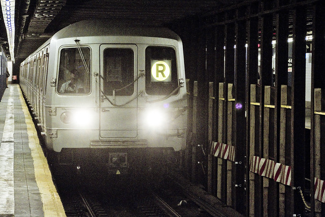
One left Point A in Astoria via the usual means, onboard the so called “R” or Broadway Local Line .
from wikipedia
The R Broadway Local is a rapid transit service in the B Division of the New York City Subway. Its route emblem, or “bullet”, is colored yellow since it uses the BMT Broadway Line in Manhattan.
The R operates local between 71st Avenue in Forest Hills, Queens and 95th Street in Bay Ridge, Brooklyn at all times except nights when it short turns at Whitehall Street–South Ferry in Lower Manhattan from Brooklyn.
– photo by Mitch Waxman
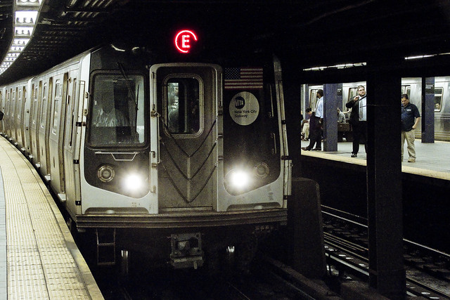
Ultimately, one sought to gain access to the Crosstown or “G” line, which the MTA folks annoyingly force one to enact two transfers to get to from Point A, despite the platform’s location less than a mile and a half from my starting point (and the fact that the G used to run through the same station which I caught the R at). Accordingly, at the sweltering bunker of dripping masonry which the MTA designates as “Queens Plaza,” one debarked the R and vouchsafed a single station ride upon the “E” – or Eighth Avenue Local Line – to the Court Square station where yet another transfer was enacted to access the G.
Urine, it smelled deeply of urine, at the Court Square station.
from wikipedia
The E Eighth Avenue Local is a rapid transit service in the B Division of the New York City Subway. Its route emblem, or “bullet”, is blue since it uses the IND Eighth Avenue Line in Manhattan.
The E operates at all times between Jamaica Center–Parsons/Archer in Jamaica, Queens, and Chambers Street–World Trade Center in Lower Manhattan, running express on the IND Queens Boulevard Line in Queens (except nights when it serves all stops) and local in Manhattan. E trains also serve two local stops in eastern Queens (75th Avenue and Briarwood) on evenings and weekends.

– photo by Mitch Waxman
My penultimate destination, on this particularly warm evening, was Sunset Park – which adjoins the legend choked streets of the Red Hook section of Brooklyn. One does realize, of course, that the R could have taken me all the way to this area which is called “Sunset Park,” but that would have multiplied my travel time due to a circuitous route which transverses all of Manhattan and a good chunk of Brooklyn.
The G discharged a humble narrator, vomiting me forth onto the platforms at the sky flung Smith/9th street station, high over the loathsome and shadow haunted Gowanus Canal. The Gowanus Canal smells of urine (and other things) as well, of course.
from wikipedia
The G Crosstown Local is an 11.4-mile-long (18.3 km) rapid transit service in the B Division of the New York City Subway. Its route emblem, or “bullet”, is colored light green since it uses the IND Crosstown Line.
The G operates at all times between Court Square in Long Island City, Queens and Church Avenue in Kensington, Brooklyn via the IND Crosstown and Culver lines. In Queens, it only serves two stations – Court Square and 21st Street, both in Long Island City – but previously served all stations to and from 71st Avenue in Forest Hills on the IND Queens Boulevard Line.
– photo by Mitch Waxman
My plan was to pass through the “House of Moses” and under the Gowanus Expressway section of the Brooklyn Queens Expressway, exploiting the shaded path which is offered by this elevated roadway, and head south towards Sunset Park. It should be mentioned, incidentally, that this is perhaps the least pedestrian friendly area in all of Brooklyn. Brobigdagnian trucks whiz about at high speed, angry motorists lurch their vehicles to and fro in frustrated bursts, and the pavement is both shadowed by the expressway above and in a delitorious state of repair.
Also, there’s vampires hiding in the rafters of the Gowanus Expressway.
from nycroads.com
The Gowanus Expressway, which serves as the southern extension of the Brooklyn-Queens Expressway, also connects the Brooklyn-Battery Tunnel approach, the Prospect Expressway (NY 27), the Belt Parkway and the Verrazano-Narrows Bridge. Although guide signs and maps refer to this segment of I-278 as the Brooklyn-Queens Expressway, it is known locally as the Gowanus Expressway.
Beginning in 1939, Robert Moses oversaw construction of the Gowanus Parkway, an elevated highway placed on top of the pillars of the old 3rd Avenue BMT Elevated Line through the Sunset Park and Gowanus sections of Brooklyn. It would eventually become part of a limited-access parkway loop encircling four of the five boroughs. Since the Gowanus Parkway was to be constructed atop a pre-existing elevated facility, Moses had little trouble getting his project approved by the New York City Council.
However, the Gowanus Parkway would require more land for a wide roadway and entrance-exit ramps. This required the demolition of many homes and businesses along Third Avenue, a tightly knit block of Northern and Western European immigrants.

– photo by Mitch Waxman
There are charming sights to be found along the Gowanus Canal, I should mention, lest you think I’m prejudiced against the “Superfund Sister to the South” of my beloved Newtown Creek. Abundant waste transfer and oil distribution facilities, endemic pollution, lakes of unknown chemical constitution lurking just below the streets, untreated sewage oozing out of unmarked pipes? These are all the things I love.
One has never understood the appeal of “going to the country” and vacationing amongst the rural yokels. Camping? Are you insane? I’ve got a dry bed and a door that locks here in NYC, where I get to witness a looming infrastructure crisis and unfolding environmental apocalypse whenever I want to.
from wikipedia
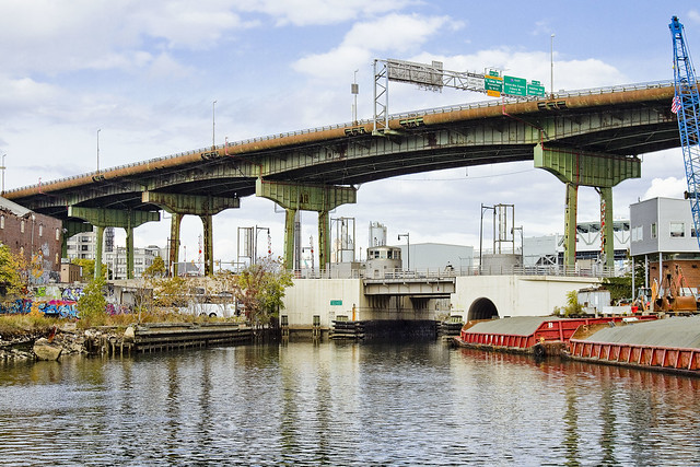
The Gowanus Canal is a canal in the New York City borough of Brooklyn, on the westernmost portion of Long Island. Connected to Gowanus Bay in Upper New York Bay, the canal borders the neighborhoods of Red Hook, Carroll Gardens, and Gowanus, all within South Brooklyn, to the west; Park Slope to the east; Boerum Hill and Cobble Hill to the north; and Sunset Park to the south. It is 1.8 miles (2.9 km) long. There are seven bridges over the canal, carrying Union Street, Carroll Street (a landmark), Third Street, Ninth Street, Hamilton Avenue, the Gowanus Expressway, and the IND Culver Line of the New York City Subway.

– photo by Mitch Waxman
That’s part of the Gowanus Canal, pictured above, as shot from the Hamilton Avenue Bridge and looking back north towards the Smith/9th street station which the G line disgorged me into. Used as I am to the wild expanses and geographic extent of Newtown Creek, my thoughts always turn to compactness when I’m at the Gowanus. Thing is, just like Newtown Creek and its tributaries – two of which the Gowanus would tuck neatly into – the canal interacts with ground water and flows beneath the streets via its connections with the sewer system. Just like Newtown Creek, many of the sewers connected to the Gowanus are in fact former tributary waterways which were converted and buried at the end of the 19th and start of the 20th centuries. Who can guess, all there is, that might be buried down there?
Additionally, both Gowanus Canal and Newtown Creek sport maritime industrial bulkheads along most of their length which are little more than artifacts of the Second Industrial Age, in our modern day NYC.
from nyc.gov
The Hamilton Avenue Bridge is a bascule bridge with two parallel leafs, one carrying the northbound roadway and the other carrying the southbound roadway. Most of the length of Hamilton Avenue runs below the elevated portion of the Gowanus Expressway, including the bridge. The bridge connects Smith Street and Second Avenue over the Gowanus Canal and is the first canal crossing north of the Gowanus Bay.

– photo by Mitch Waxman
Regardless of musings about the wasted space, lack of public access, and utter degradation of the air, water, and soil – one had somewhere to be, and a little bit of walking was required to get there. A humble narrator put his head down, leaned into a southerly declination, and scuttled off into the clouds of auto exhaust mixing with the humid air.
The Gowanus Expressway dwelling Vampires be damned, I needed to get to Sunset Park.
from wikipedia
A vampire is a being from folklore that subsists by feeding on the life essence (generally in the form of blood) of the living. In European folklore, vampires were undead beings that often visited loved ones and caused mischief or deaths in the neighbourhoods they inhabited when they were alive. They wore shrouds and were often described as bloated and of ruddy or dark countenance, markedly different from today’s gaunt, pale vampire which dates from the early 19th century.
Vampiric entities have been recorded in most cultures; the term vampire, previously an arcane subject, was popularised in the West in the early 19th century, after an influx of vampire superstition into Western Europe from areas where vampire legends were frequent, such as the Balkans and Eastern Europe; local variants were also known by different names, such as shtriga in Albania, vrykolakas in Greece and strigoi in Romania. This increased level of vampire superstition in Europe led to mass hysteria and in some cases resulted in corpses being staked and people being accused of vampirism.
Upcoming Tours and events
The Insalubrious Valley of the Newtown Creek Walking Tour, with Newtown Creek Alliance – Saturday August 5th, 11 a.m. – 1;30 p.m.
Century old movable bridges, the remains of a 19th century highway between Brooklyn and Queens, and explore two of the lesser known tributaries of the troubled Newtown Creek watershed. For the vulgarly curious, Conrad Wissell’s Dead Animal and Night Soil wharf will be seen and described, with NCA Historian Mitch Waxman – details here.
Brooklyn Waterfront Boat Tour, with Working Harbor Committee – Saturday August 12th, 6 p.m. – 8 p.m.
Explore the coastline of Brooklyn from Newtown Creek to Sunset Park, with NCA Historian Mitch Waxman, Andrew Gustafson of Turnstile Tours, and Gordon Cooper of Working Harbor Committee on the narrating about Brooklyn’s industrial past and rapidly changing present. – details here.
The Poison Cauldron of the Newtown Creek Walking Tour, with Newtown Creek Alliance – Sunday August 13th, 11 a.m. – 1:30 p.m.
Explore the hellish waste transfer and petroleum districts of North Brooklyn on this daring walk towards the doomed Kosciuszko Bridge, with NCA Historian Mitch Waxman – details here.
Two Newtown Creek Boat Tours, with Newtown Creek Alliance and Open House NY – Wednesday August 16th, 5 p.m. and 7 p.m.
The neighborhoods surrounding Newtown Creek are home to the densest collection of these garbage facilities anywhere in the city and collectively, the waste transfer stations around and along Newtown Creek handle almost 40% of the waste that moves through New York. Join Newtown Creek Alliance’s Mitch Waxman and Willis Elkins to learn about the ongoing efforts to address the environmental burden that this “clustering” has caused. – details here.
“follow” me on Twitter- @newtownpentacle


