Archive for the ‘Walking Tour’ Category
skillfully wafted
– photo by Mitch Waxman
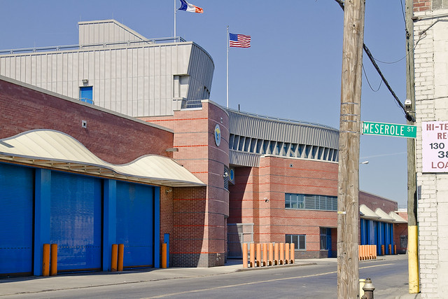
As mentioned in the Newtown Pentacle posting “Approaching Locomotive“, a recent opportunity to visit the gargantuan Waste Management facility on Varick Street in Brooklyn (whose back yard abuts the English Kills tributary of the fabled Newtown Creek) materialized. your humble narrator has long desired to witness the place, so I jumped at the chance.
As a note- I’m a member of Newtown Creek Alliance, and so is one of the subjects of this posting. Said admission is offered in the name of avoiding charges of bias, nepotism, or cronyism.
from wikipedia
Waste Management, Inc. (NYSE: WM) is a waste management, comprehensive waste, and environmental services company in North America. Founded in 1894, the company is headquartered the First City Tower in Houston, Texas.
The company’s network includes 367 collection operations, 355 transfer stations, 273 active landfill disposal sites, 16 waste-to-energy plants, 134 recycling plants, 111 beneficial-use landfill gas projects and six independent power production plants. Waste Management offers environmental services to nearly 20 million residential, industrial, municipal and commercial customers in the United States, Canada, and Puerto Rico. With 21,000 collection and transfer vehicles, the company has the largest trucking fleet in the waste industry. Together with its competitor Republic Services, Inc, the two handle more than half of all garbage collection in the United States.

– photo by Mitch Waxman
Accompanying a class of high school students from “The Green School” on Graham Avenue in Williamsburg, we arrived at the Titan depot early in the afternoon. Early for the diurnal, of course, but late in the day for the Waste Management folks who get more accomplished before sunrise than most do by sunset.
The Green School is a 9th-12th grade learning community that develops science, math, literacy, and social studies skills in the context of New York City’s many environments. Through rigorous interdisciplinary curricula and hands-on experiential projects, students will engage with their environment, participate meaningfully in community life, and prepare for their futures.
While focusing on “green” careers, the school’s primary theme is sustainability, a concept and a practice that incorporates and recognizes the interconnectedness of the environment, the economy, society, and culture and promotes practices with the future in mind. The curricula focus on giving students scientific, historical, and contextual knowledge to make meaningful connections between their lives and the broader world, and the math and literacy skills they need to participate in that world. Students are able to demonstrate mastery of academic work in portfolios, examinations, and reflections by applying it to the world around them, explaining the geometry in the arc of an elevated train, deducing air quality using the scientific method, or designing and carrying out learning experiences for local elementary students. Students participate in community service projects, internships and apprenticeships, and do independent projects based on their interests each year.
The mission of The Green School lends itself to create a school environment open to the diverse needs of ELL, special education, gifted and struggling students. The Green School is committed to provide all students an education and the required skills that are transferable from the classroom to their collegiate and/or professional pursuits.

– photo by Mitch Waxman
The two fellows at either end of the shot above are Newtown Creek Alliance’s Michael Heimbinder and Marc Ottaviani, 11th grade English Language Arts teacher. Michael, in addition to his NCA work, is involved in several other projects- one of which is habitatmap.org.
from habitatmap.org
Michael Heimbinder, Founder & Executive Director
Michael Heimbinder is a writer, researcher, community organizer and information designer. Over the years he has collaborated with a wide range of environmental and human rights organizations including the Newtown Creek Alliance, the United Nations Equator Initiative, the Ghana Wildlife Society and Food First. He is also a Fellow at the Oakland Institute and a technical advisor to the Organization of Waterfront Neighborhoods where he consults on solid waste management issues in New York City. Michael is a graduate of Colorado College and received his M.A. in International Affairs from the New School for Social Research.

– photo by Mitch Waxman
The program which the kids are taking part in, funded by the NYCEF fund of the Hudson River Conservancy, is built around the habitatmap concept, and is described thusly:
“School to develop and teach a ten week course that instructs 11th grade students on maps-based research methods focusing on two facilities adjacent to Newtown Creek: the Newtown Creek Wastewater Treatment Plant and Waste Management’s Varick Avenue Transfer Station. The selected facilities are the starting point from which the students are examining water and waste systems by geographically tracing the material flows and institutional networks that connect these facilities to the larger world. The students’ findings will be documented using HabitatMap’s community mapping platform and integrated into a maps-based research methods toolkit. The toolkit will be used by high schools, both in New York and nationally, to conduct investigations of water and waste systems in their own communities using examples from Newtown Creek.
By developing coursework that combines technology, classroom learning, and field research the curriculum is specifically designed to meet the Green School’s mission, which aims to prepare students for their future studies and employment “through rigorous interdisciplinary curricula and hands-on experiential projects that encourage students to engage with their environment and participate meaningfully in community life.”
also from habitatmap.org
Mission
HabitatMap is a non-profit environmental health justice organization whose goal is to raise awareness about the impact the environment has on human health. Our online mapping and social networking platform is designed to maximize the impact of community voices on city planning and strengthen ties between organizations and activists working to build greener, greater cities. Utilizing our shared advocacy platform participants can:
- Alert the public to environmental health hazards
- Hold polluters accountable for their environmental impacts
- Highlight urban infrastructures that promote healthy living
- Identify future opportunities for sustainable urban development
- Promote policies that enhance equitable access to urban resources

– photo by Mitch Waxman
As such class trips have begun since the dawn of time, we were brought to a room where one of the Waste Management superintendents and staff described the process, and procedural habits, of the transfer station. A transfer station, for those of you unused to such terminology, is a concentrating point for the garbage collected by the DSNY and others for sorting and containerizing. The white collection trucks carry their cargo here, where it is loaded onto train cars for eventual disposition into (usually out of state) landfills.
from wikipedia
A transfer station is a building or processing site for the temporary deposition of waste. Transfer stations are often used as places where local waste collection vehicles will deposit their waste cargo prior to loading into larger vehicles. These larger vehicles will transport the waste to the end point of disposal in an incinerator, landfill, or hazardous waste facility, or for recycling
In the future, transfer stations could be equipped with material recovery facilities and with localized mechanical biological treatment systems to remove recyclable items from the waste stream.

– photo by Mitch Waxman
When the DSNY trucks arrive at the facility, they are weighed on enormous vehicle scales like the ones in the shot above. When exiting the facility, they are weighed a second time, and the differential is recorded as the tonnage of waste which was delivered. My understanding is that in the contract Waste Management enjoys with the City of New York, the fees paid for the handling of this putrescent lahar are assessed on a “per ton” basis.
from gothamgazette.com
Other parts of the city’s solid waste plan have moved forward. Twenty-year contracts have been either negotiated or are in effect with Waste Management of New York to export trash from Brooklyn, the Bronx and Queens. The sanitation department is currently negotiating with the Port Authority of New York and New Jersey for a long-term contract to take the vast majority of Manhattan’s refuse to a waste-to-energy plant in New Jersey.
At the time of the solid waste management plan’s approval, the administration argued long-term contracts would save the city money, and it would get the city’s trash off of dirty diesel trucks. Almost 90 percent of city trash, the mayor promised, would be sent by rail or barge instead.
According to the Department of Sanitation, the cost of exporting the city’s trash has increased per ton from $61.30 in 2000 to $92.80 in 2010 — a 20 percent increase over the rate of inflation. As of April, 33 percent of the city’s trash has been unloaded from trucks and put on rail cars — an increase from 14 percent in 2006, according to the solid waste plan.
None of the city’s waste is currently exported by barge, according to the Department of Sanitation, because those transfer stations have not been completed.

– photo by Mitch Waxman
We were informed that our arrival in the afternoon was fortuitous as Waste Management’s schedule is precisely administered to conclude sorting and containerization by a certain time of day which allows them purchase to clean and disinfect their mill. The representatives explained that they are regularly visited by inspection officers and are contractually obligated to several “best practice” regulations.
from habitatmap.org
In 2006 Waste Management NY 215 Varick handled 652,706 tons of material; this sum represents 5.3% of all waste exported through transfer stations in New York City.

– photo by Mitch Waxman
Late in the night and early morning, fleets of collection trucks arrive here, are weighed, and “tip” or discharge their cargo. Enormous machinery, clawed derricks and jotun sized earth moving equipment, flies into action. This can be an enormously dangerous place to work, were routine safety procedures not strictly observed. Even so, extreme caution was urged as we moved into the relatively empty transfer station.
from nyc.gov
Each week, in Fiscal Year 2010, the Department assigned approximately 4,941 trucks to collect 49,922 tons of curbside residential refuse and scheduled 460 E- Z Pack and Roll-on/Roll-off containerized trucks to collect an additional 8,000 tons. The amount of refuse generated by the 8.2 million residents of New York City is subject to seasonal variations. Each month, the Department allocates weekly truck and tonnage targets to each of its 59 districts to better manage our productivity. These targets are closely monitored to ensure that productivity improvement goals are met. District Superintendents constantly evaluate routes and tonnage in their districts to achieve these targets.

– photo by Mitch Waxman
The extant mound of trash in these shots was huge, but as mentioned by the Waste Management people, represented only a small fraction of what they handle daily. In fact, they were quite nearly finished processing the daily waste of most of Brooklyn when we arrived. They also explained that the relative lack of odor was due to state of the art equipment maintained at the site which accomplished odor control and elimination via technological means.

– photo by Mitch Waxman
For scale, this stitched panorama image is included. That’s Mr. Heimbinder in the foreground, and he’s around six feet tall. The trash pile was roughly thirty to forty feet high, and covered a fairly large parcel of floorspace. Any estimate I could offer would be wrong, as your humble narrator is notorious for overestimation of such matters. Somewhere between a regulation basketball court and a regulation football field would be my best guess.

– photo by Mitch Waxman
The Waste Management crew were waiting for us to exit the facility before they got back to work, and as schedules must be maintained- we were escorted along. Like a lot of the people you meet in the garbage industry, they were really nice and seemingly “regular joes” who took their jobs seriously. A few of the Waste Management and DSNY personnel who were on site also talked to the kids, assuring them that these were “good jobs” with great pay and a full package of benefits.

– photo by Mitch Waxman
Your humble narrator knows quite a few people employed in this industry, at both public agencies and private carting firms. None of them regret their choices, career wise, but for the early start time which is common at such jobs. Most of the folks I know who are engaged in this trade leave home before the sun comes up, arriving at work by 5 A.M. or thereabouts. Often, a change of clothes is kept in the trunk, as their work clothes can become quite soiled as the day goes on. After a shower, you’d never know what they do for a living.
warnings and prophecies
2011’s Greatest Hits:

– photo by Mitch Waxman
In January of 2011, while walking along in knee deep snow, your humble narrator happened across this enigmatic and somehow familiar item sitting in a drift at the NYC S.E.M./Signals Street Light Yard of the DOT at 37th avenue near the Sunnyside and Astoria border. It looked familiar to me, but I didn’t recognize it for what it was until sharp eyed reader TJ Connick suggested that this might be the long missing Light Stanchion which once adorned the Queensboro Bridge’s Manhattan landing.
These two posts: “an odd impulse“, and “wisdom of crowds” discuss the discovery and identification in some detail.
Some good news about this iconic piece of Queens history will be forthcoming, but I’ve been asked to keep it quiet for the moment.

– photo by Mitch Waxman
In February of 2011, “Vapour Soaked” presented a startling concurrence of comparitive detail for the discerning viewer, when the shot above was presented in contrast with a 1920’s shot from The Newtown Creek industrial district of New York City By Merchants’ Association of New York. Industrial Bureau, 1921″, (courtesy Google Books).
Admittedly, not quite as earth shaking as January’s news, but cool nevertheless. I really like these “now and then” shots, expect more of the same to come your way in the future.

– photo by Mitch Waxman
In March of 2011, “first, Calvary” discussed the epic (for me) quest to find a proverbial “needle in a haystack” within First Calvary Cemetery- the grave of its very first interment, an Irish woman named Esther Ennis who died in 1848. I have spent an enormous amount of time searching for this spot, where Dagger John Hughes first consecrated the soil of Newtown.

– photo by Mitch Waxman
In April of 2011, the world lost one of its best people and my official “partner in crime”, Bernard Ente.
He was ill for awhile, but asked me to keep the severity of things quiet. He passed in the beginning of April, and one of the last requests he made of me (along with “taking care” of certain people) was to continue what he had started along the Newtown Creek and all around NY Harbor.
This was when I had to step forward, up my game, and attempt to fill a pair of gargantuan boots. Frankly, I’m not even half of who he was, but I’m trying. That’s when I officially stepped forward and began introducing myself as a representative of Newtown Creek Alliance, and joined the Working Harbor Committee– two organizations which Bernie was committed to. I’m still trying to wrap my head around his loss.

– photo by Mitch Waxman
In May of 2011, while attempting to come to terms with my new roles in both organizations, it was decided that a fitting tribute to our fallen comrade would be the continuance of his annual “Newtown Creek Cruises” and the date of May 21 was set for the event. An incredible learning experience, the success of the voyage would not have been possible without the tutelage of WHC’s John Doswell and Meg Black, NCA’s Katie Schmid, or especially the aid of “Our Lady of the Pentacle” and the Newtown Pentacle’s stalwart far eastern correspondent: Armstrong.
Funny moments from during this period included the question “Whom do you call to get a drawbridge in NYC to open for you?”.
During this time, I also became involved with Forgotten-NY’s Kevin Walsh and Greater Astoria Historical Society’s Richard Melnick and their ambitious schedule of historical tours.

– photo by Mitch Waxman
In June of 2011, the earliest Newtown Creek Chemical Factory which I’ve been able to find in the historical record, so far, was explored in the post “lined with sorrow“- describing “the Bushwick Chemical Works of M. Kalbfleisch & Sons”.
Additionally, my “Newtown Creek Magic Lantern Show” was presented to a sold out and standing room only crowd at the Greater Astoria Historical Society.
This was also the beginning of a period which has persisted all year- in which my efforts of behalf of the various organizations and political causes which I’m advocating for had reduced my output to a mere 15 or fewer postings a month.
All attempts are underway to remedy this situation in 2012, and apologies are offered.

– photo by Mitch Waxman
In July of 2011, another Newtown Creek boat tour was conducted, this time for the Metropolitan Water Alliance’s “City of Water Day”. The “Newtown Creek Magic Lantern Show” was also performed at the Admiral’s House for a packed room.
Additionally, my so called “Grand Walk” was presented in six postings. This was an attempt to follow a 19th century journey from the Bloody Sixth Ward, Manhattan’s notorious Five Points District, to Calvary Cemetery in Queens. Once, this would have been a straightforward endeavor involving minimal connections of Trolley and Ferry, but today one just has to walk. These were certainly not terribly popular posts, but are noteworthy for the hidden and occluded horde of forgotten New York history which they carry.
From the last of these posts, titled “suitable apparatus“- “As the redolent cargo of my camera card revealed- this “Grand Walk”, a panic induced marathon which carried your humble narrator across the East River from St. Patrick’s Old Cathedral in Manhattan into Williamsburg and up Grand Street to Maspeth and the baroque intrigues of the Newtown Creek– wound down into it’s final steps on Laurel Hill Blvd.”

– photo by Mitch Waxman
In August of 2011, “the dark moor” presented intriguing aerial views of the Newtown Creek Watershed, and “sinister exultation” shared the incredible sight of an Amtrak train on fire at the Hunters Point Avenue station in Long Island City. “revel and chaff” explored the aftermath of Hurricane Irene in LIC’s Zone A, and an extraordinary small boat journey around Dutch Kills was detailed in: “ponderous and forbidding“, “ethereal character“, “pillars and niches“, and “another aperture“.
This was an incredible month.

– photo by Mitch Waxman
In September of 2011, a posting called “uncommented masonry” offered this declaration:
” By 1915, there approximately 40,000 automotive trucks plying the streets of New York City.
What’s surprising is that 25% of them were electric.
Lords and ladies of Newtown, I present to you the last mortal remains of the General Electric Vehicle Company, 30-28 Starr Avenue, Long Island City– manufacturer of a substantial number of those electrical trucks.”
I’m particularly fond of this post, as this was a wholly forgotten moment of Newtown Creek and industrial history which I was able to reveal. Organically born, it was discovered in the course of other research, and I believed at the time that it was going to be the biggest story that I would present all year about Blissville.

– photo by Mitch Waxman
In October of 2011, a trio of Newtown Creek Tours (two public and one for educators) were accomplished. The public tours were full to capacity, as were the Open House New York tours I conducted on the 15th and 16th of that Month. Also, the Metropolitan Water Alliance invited me to photograph their “Parade of Boats” on October 11th, and I got the shot below of the FDNY Fireboat 343.

– photo by Mitch Waxman

– photo by Mitch Waxman
In November of 2011, a visit to Lovecraft Country in Brooklyn was described in “frightful pull“, and “vague stones and symbols” came pretty close to answering certain mysteries associated with the sky flung Miller Building found at the foot of the Greenpoint Avenue Bridge in Brooklyn.

– photo by Mitch Waxman
A December 2011 post titled “An Oil spill… in Queens” broke the news that petroleum products are seeping out of the bulkheads of Newtown Creek, this time along the Northern shoreline, which lies in the Queens neighborhood of Blissville.
Rest assured that your Newtown Pentacle is on top of the story of “the Blissville Oil Spill”, lords and ladies of Newtown, and will bring you breaking news as it develops in 2012.
the First Big Announcement

– photo by Mitch Waxman
Your humble narrator will be conducting a walking tour in Long Island City as part of the Open House NY Weekend on October 15 and 16. The tour will be approximately two hours in length, starts at 11 am, and will visit several of the amazing industrial landmarks which distinguish the Queens side of the Newtown Creek Watershed. Much of the walk will follow the Dutch Kills tributary of Newtown Creek. Reservations are required, which can be had by visiting the following link:
http://www.ohny.org/site-programs/weekend/programs/walk-down-newtown-creek
Oh, did I neglect to mention that this walking tour is free, as in gratis, as in no cost to you- Lords and Ladies?

– photo by Mitch Waxman
This is the first of two big announcements, the second is still under wraps and I’m not able to discuss it at this point. Hopefully, within the next couple of days, I’ll be able to say more. Open House NY weekend is a citywide event, and there are multiple opportunities to do cool and unique things. Please check out the rest of their offerings, but you definitely want to come on this exploration of a hidden and neglected waterway which is found less than one mile from midtown Manhattan.

– photo by Mitch Waxman
Bring a camera, of course, but I would be remiss if I didn’t advise you that broken pavement and largish puddles might be encountered- so proper (closed toe) footwear is advised. Additionally, this is as close to an urban desert as you are ever likely to find, so if you are one of the folks who likes to “stay hydrated”, bring a beverage along. Sparks deli on Borden Avenue will most likely be open, but one never can tell. Looking forward to seeing you along the Dutch Kills, and as always-
Want to see something cool?
Bring a camera, and ID…
Follow me…
incalculable profusion

– photo by Mitch Waxman
The dizzying display of industrial and architectural might on display above distracts the eye from the subject of this post. Empire State, Chrysler, the entire shield wall of Manhattan… even that sapphire Megalith which distinguishes modern Long Island City is screaming for attention. At its base is a white building which is a former printing plant, later an Eagle Electric factory, which has been converted over to luxury condominiums known as the Arris Lofts. At the bottom of the shot is Skillman Avenue and the north side of the Sunnyside Yard with a train transiting along the tracks. In the midst of all this manifest wealth and ambition, it is easy to overlook Thomson Avenue The lower right hand corner of the shot depicts a viaduct structure which allows trains to pass beneath a vehicular roadway which it carries.
An enormous concrete and steel bridge, 500 feet long and 100 feet wide, and it is hidden in plain sight.
That’s Thomson Avenue.
from 1877’s “Long Island and where to go!!: A descriptive work compiled for the Long R.R. Co.“, courtesy google books:
Long Island City is the concentrating point upon the East river, of all the main avenues of travel from the back districts of Long Island to the city of New York. The great arteries of travel leading from New York are Thomson avenue, macadamized, 100 feet wide, leading directly to Newtown, Jamaica and the middle and southern roads on Long Island, and Jackson avenue, also 100 feet wide, and leading directly to Flushing, Whitestone and the northerly roads.
Long Island City is also the concentrating point upon the East river, of the railway system of Long Island.
The railways, upon reaching the city, pass under the main avenues of travel and traffic, and not upon or across their surface.

– photo by Mitch Waxman
To begin with, lets start with the end. Thomson disappears into the modern street grid when it is rudely interrupted by Queens Boulevard. This is the actual slam bang intersection where the “automobile city” of the 20th century meets the “locomotive city” of the 19th. Thomson avenue is centered on the other side of this tripartite intersection, where it meets Queens Boulevard and Van Dam Street.
The “Great Machine” slithers past Thomson, and hurtles eastward along the more modern thoroughfare.
from wikipedia:
Queens Boulevard was built in the early 20th century to connect the new Queensboro Bridge to central Queens, thereby offering an easy outlet from Manhattan. It was created by linking and expanding already-existing streets, such as Thomson Avenue and Hoffman Boulevard, stubs of which still exist. It was widened along with the digging of the IND Queens Boulevard Line subway tunnels in the 1920s and 1930s, and in 1941, the city proposed converting it into a freeway, as was done with the Van Wyck Expressway, but with the onset of World War II, the plan was never completed.

– photo by Mitch Waxman
Thomson adjoins Jackson Avenue on the other side of its run, where their junction forms the so called “Court Square”, which is where the Megalith squats squamously. There used to be a hospital where the colossus now stands.
from wikipedia
One Court Square, also known as the Citigroup Building, is a 50-story (209.1 meters or 686 feet) office tower in Long Island City, Queens just outside of Manhattan in New York City. It was completed in 1990 by Skidmore, Owings & Merrill LLP for Citigroup. The tower is tallest in New York City outside Manhattan, and the tallest building on Long Island. WNYZ-LP, also known as Pulse87.7 broadcasts from the top of this building.

– photo by Mitch Waxman
Overwhelming and out of character with its surroundings, the Megalith is the tallest structure on Long Island, and 53rd highest building in New York City- if you’re impressed by that sort of thing.
from nytimes.com
The building, designed by Raul de Armas of Skidmore, Owings & Merrill, is handsome, even somewhat refined; its pale blue-green glass and transparent windows are obviously intended to reduce the impact of the vast tower on Long Island City, and to a considerable extent they succeed. This building would be a lot more overpowering still if it had been sheathed in reflective glass, or garnished with ornament from top to bottom. And the shape – a tower with stepped-back corners that rises straight up for most of its height, with small setbacks at the very top to create a hint of a pyramid where the building meets the sky – helps a bit more in reducing the apparent bulk.

– photo by Mitch Waxman
Across the street from the Megalith is why they call it Court Square, the Long Island City Courthouse. Famously, this is where master criminal Willie Sutton was supposedly asked “Why do you rob banks?” and the master criminal supposedly replied “Because that’s where the money is”. According to Sutton, an urban legend. Funnily enough, the Megalith houses some of the offices of Citigroup, one of the world’s largest banks.
They don’t keep money here, though.
from nyc.gov
The Long Island City Courthouse is located near the corner of Thomson Avenue and Court Square.
In 1870, before the 1898 consolidation with New York City, the Queens county seat moved from Jamaica to the newly-formed township of Long Island City, which was near all of the train lines. Long Island City was made up of the towns of Astoria and Newtown. Abram Ditmars, the first mayor, had the streets surveyed and paved, brought in a pure water supply and established equitable tax assessments and a regular police force.
The Long Island City Courthouse was built between 1872 and 1876, with delays, scandals and cost overruns. At two-and-a-half stories, built of brick and granite in the French Second Empire style, it became one of the most important buildings in Queens. It was designed by Massachusetts architect George Hathorne. (Hathorne designed Walker Hall at Amherst College, the largest building on campus when it was built in 1870. That building was rebuilt after a fire in 1882 and was torn down 80 years later in 1962.)
The Long Island City Courthouse was gutted by a fire in 1904 and Peter M. Coco was selected to redesign it. A prominent Long Island City architect who trained at the Cooper Institute, Coco designed churches, residences and commercial buildings in the area. Using the foundations and original walls, he added two stories and stripped the building of its then-outmoded ornament, transforming it into a neoclassical style courthouse. He added projected paired Ionic columns to each side of the entrance, which support small balconies. Each has a small helmeted head between the scrolls at the top of the column. The two-story-high entrance is arched, with two dates in the spandrels: ‘1874’ and ‘1908.

– photo by Mitch Waxman
Moving in an easterly direction from Court Square, Thomson finds another connection to the automobile city, as one of the off ramps for the upper level of the Blackwell’s Island… Queensboro… Ed Koch… Bridge, allowing tens of thousands of vehicles to vomit onto Thomson’s parabola every day.
The change in grade is quite noticeable to the inveterate pedestrian, it should be mentioned.
from “Bulletin, Volumes 9-10 By Building Trades Employers’ Association“, courtesy google books
The rapid progress being made in the grading of Sunnyside yard in Long Island City, the future great terminal of the Pennsylvania Railroad system in New York, and the rapid construction of the eight massive viaducts to provide for the highway and railroad crossings, insure the completion of that section of the great undertaking early next fall.
The most massive of the overhead highway crossings is the Thomson Ave. steel viaduct, 100 feet in width and 500 feet in length, passing over the network of tracks of the Long Island and Pennsylvania Railroads at a height of 30 feet. The Queensboro Bridge extension viaduct, crossing diagonally to the street system of Long Island City, but at right angles to the railroad, is 80 feet in width, and has massive steel girders. The Thomson Ave. crossing, which will be completed next month, and the bridge extension will provide for the traffic over the main arteries of travel, extending through the borough from north to south.

– photo by Mitch Waxman
Scuttling around on the side streets which dead end off of Northern Blvd., like Dutch Kills or Queens or Purves streets, one can gain an appreciation for the height of the Thomson Avenue Viaduct. These roadway artifacts used to proceed through what is now the rail yard, and the historical record is full of lawsuits brought against the Pennsylvania Rail Road or Long Island Railroad companies for damages based on the grade situation.
These law suits detail and define the complicated questions of who owns what around and above the yards.
from 1913’s “2 years transportation progress, Volume 140“, courtesy google books
“perpetual easement or easements for the rights to continue and maintain the said viaducts or bridges over the following streets or avenues as nowlaid out or proposed: and will thereby grant to the city a perpetual easement or easements sufficient for the use and control by the city of the said viaducts and bridges for the purpose of police regulation and other control contemplated by the city ordinances for the care of streets or highways, excepting and reserving, however, to the said companies the right to construct and maintain, at its or their own expense, such connections between the said viaducts or bridges, or any of them, and the property of the said companies, as shall not interfere with the use of the said viaduets or bridges for street purposes.”
Then are specified several viaducts, and as to the one over Thomson avenue it is said:
“The said viaduct or bridge over the proposed Sunnyside Yard on the line of Thomson avenue, hereinbefore in paragraph 1C, set forth, including the right to the city to increase, at its own expense and without interfering with the operation of the said Sunnyside Yard, the width of said viaduct to beone hundred feet”
The intention of the companies was to enlarge the terminal laterally by acquiring from! the city title to the land in the closed streets wherever necessary, and by acquiring the lands abutting thereon from private owners. To do this it was necessary to close the streets across the right of way as broadened, so that the companies could have the fee and possession thereof for railroad purposes. But in some instances, and among them at Thomson avenue, in the place of the portion of the street closed and agreed to be sold a viaduct over the yard was provided and built, and it was necessarily so high over the tracks that the grade of the avenue at either end was necessarily raised to meet it. In other words, over the space where the avenue was obliterated and its bed agreed to be sold a bridge was built, and the abandoned portion made a part of the terminal facilities.

– photo by Mitch Waxman
The Sunnyside Yard tends to insulate Long Island City from the rest of western Queens, forcing its residents and businesses to pass through narrow or crowded choke points when leaving or entering the locale. The landward passages along the East River are defined by the Queensboro, while the southern ridge that overlooks the yard leads to Sunnyside. The other viaducts which cross the yards- Hunters Point Avenue, Thomson Avenue, Queens Blvd. are all orientated in a mostly easterly direction, while the the 35th street or Honeywell Bridge, and the 39th street or Harold Avenue bridge at Steinway Street offer rare and spread out pinchpoints of north south egress across the facility.
The businesses which set up shop around Sunnyside Yard in the early 20th century didn’t much care, they were part of the locomotive city.
Pictured above, one might observe the traffic barrier and pedestrian shed which manifests itself at roughly the 50% mark on the Thomson Avenue viaduct.
from 1913’s “Greater New York: bulletin of the Merchants’ Association of New York, Volume 2” courtesy google books
After luncheon, which was held in the cosy quarters of the Queens Chamber of Commerce on the Bridge Plaza, Long Island City, the party were taken on an automobile drive of about fifty miles, covering the principal points of Industrial interest in Queens.
Great Industries Established
The first stop was made on Diagonal Street which crosses the Long Island Railroad yards. From this point it is possible to see all the features of the industrial development in that part of Queens, especially the development of the Degnon Terminal Company and the new factory of the Loose-Wiles Biscuit Company.
The party then proceeded along Thompson Avenue to Newtown Creek, passing some of the largest factories in Queens, and also the most important industries in New York City, such as the Nichols Copper Company, the General Chemical Company, the National Enameling and Stamping Company, the General Vehicle Company, which is just erecting a large new building, and the Brunswick-Balke-Collender Company.

– photo by Mitch Waxman (note: for the entire post on this burning Amtrak train, click here)
The tracks which Thomson Avenue forms a bridge over are used by Long Island Railroad, Amtrak, and New Jersey Transit (which stores some of its extra daytime capacity in Sunnyside Yards between rush hours). The shot above, which was originally presented in the post Sinister Exultation, depicts an Amtrak engine having a bit of immolation trouble. The section of the yard between Hunters Point and Thomson is (or at least used to be) referred to as “Yard A”.

– photo by Mitch Waxman
From Skillman Avenue, the structure of the Thomson Avenue viaduct is visible as it’s begins to roughly slouch back to the grade level of the surrounding streets. The Sunnyside Yard allows locomotive access to the New York Connecting Railroad, which connects Long Island to the rest of the continent via the Hell Gate Bridge. Sunnyside Yard continues all the way to Woodside, and sits on an astounding 8,500 feet footprint which consumes 192 acres and offers an unbelievable 25.7 miles of track. Historical records discuss the gargantuan task of reclaiming this swampy land for use as a rail yard, as seen in the snippet below.
from 1910’s “New York tunnel extension, the Pennsylvania railroad: description of the work and facilities, Volume 2“, courtesy google books
Originally, a swamp of 40 acres extended from the present location of Honeywell Street and Jackson Avenue to Thomson Avenue, and comprised a portion of the required Yard area; the remaining 168 acres within that area was rolling ground from 10 to 70 ft. above the swamp. Upon this high ground there were 246 buildings of all kinds, and these were purchased and torn down or removed. A view of the swamp in the early stages of the work is shown by Fig. 1, Plate XLV. A vegetable growth, of the nature of peat, from 1 to 4 ft. in thickness, formed the surface of the swamp, except in the bed of Dutch Kills Creek; beneath this there was a layer of mud, and in the bed of the stream a blue-black clay of the consistency of putty. As this muck and clay would move under the pressure of the filling over it, and produce waves of considerable height, it was specified in the contract that a blanket of earth about 4 ft. thick should be first placed over this part of the Yard area, in order to prevent this wave formation. This proved efficacious, except in one or two places, where, owing to unusual depth of filling, the wave formation broke through this covering and rose to such a height as to require excavation of the peat, muck, and mud, in order to secure proper track foundations. In the bed of Meadow Street, where the embankment was very high, the crest of one of the mud waves rose to an elevation of 28 ft. above the swamp.

– photo by Mitch Waxman
The naming of Thomson avenue has always been a bit of a mystery for your humble narrator. Skillman, for instance, was named for a farmer that supported the British during the American Revolution whose lands were confiscated by the victorious rebels (much like DeLancey over in Manhattan). Apparently, there were one or two LIRR and or Pennsylvania RR executives named Thompson- and certain older documents refer to this road as “Thompson Avenue” but this is a common typographic error which favors the more widespread surname.
There was a Thomson that was an important member of the Queens Chamber of Commerce during the 1920’s but the street dates back to the beginnings of Long Island City and must be named for someone earlier.
from nycroads.com
HISTORY OF QUEENS BOULEVARD: Originally called Hoffman Boulevard, Queens Boulevard dates back to the early years of the twentieth century, when the road was constructed as a connecting route between the new Queensboro (59th Street) Bridge and central Queens. In 1913, a trolley line was constructed from 59th Street in Manhattan east along the new boulevard.
During the 1920′s and 1930′s, New York City began a program to widen Queens Boulevard. The project, which was conducted in conjunction with the building of the IND Queens Boulevard subway line, widened the boulevard to 12 lanes in some locations, and required a right-of-way of up to 200 feet. Once completed, local and express traffic flows were provided separate carriageways.
uncommented masonry

– photo by Mitch Waxman
It all started when I was checking to see if I could find out anything more about the Blissville Banshee.
As the sum total of that which might be gathering dust on library shelves has not yet been digitized, categorized, and assigned metatags- there is an awful lot of stuff which is not available to the prying eyes of primarily nocturnal creatures like myself. Google books is an ongoing project, for instance, and every month or so some new (old) document appears online which is Newtown Creek oriented that I might slaver over.
from wikipedia
Google Books (previously known as Google Book Search and Google Print) is a service from Google that searches the full text of books that Google has scanned, converted to text using optical character recognition, and stored in its digital database. The service was formerly known as Google Print when it was introduced at the Frankfurt Book Fair in October 2004. Google’s Library Project, also now known as Google Book Search, was announced in December 2004.
Results from Google Book Search show up in both general web search at google.com and through the dedicated Google Books site (books.google.com). Up to three results from the Google Books index may be displayed, if relevant, above other search results in the Google Web search service (google.com).

– photo by Mitch Waxman
Hence my periodic searches conducted for topics of which I’ve heard only hints of in the past- Case’s Crew for instance, or the aforementioned Blissville Banshee. It was one of these fishing expeditions into the ever expanding archival universe of the vast inter webs that led me to a certain structure, which sits at 30-28 Starr Avenue, just a couple of blocks from that malignant exemplar of the price of unregulated capitalism known as the Newtown Creek. It’s ordinary enough looking, branded with corporate logos and quite visible from many parts of Long Island City and Brooklyn.
from the Friends’ intelligencer, Volume 35, courtesy google books
The early history of Friends in Newtown and Maspeth Kills is marred by the irregularities of the Ranters, who claimed to be Friends, and intruded on their meetings.
Such was Thomas Case, who (1674) was forbidden by the Court to entertain the wife of William “Smith. His wife, Mary Case, was fined £5 for interrupting Rev. William Leveridge, while preaching, by saying to him: “Come down, thou whited wall that feedest thyself and starvest the people.” Samuel Scudder sent a long, scandalous letter to Mr. Leveridge.
The Court put Case and Scudder under bonds not “to seduce and disturb the people.”

– photo by Mitch Waxman
Let’s start at the beginning, though.
Borden Avenue is one of the older pathways in New York and particularly so for Queens, as the modern street was designated as Borden Avenue in 1868. It allowed egress from the docks at Hunters Point to the incalculably far Newtown and passed by the thriving village of Maspeth along the way. Originally a plank road set roughly into the swampy lowlands which adjoined the Newtown Creek, what would become Borden Avenue eventually progressed to the point of regular horse drawn (and then electric) street car service by the late 19th century and beginning of the 20th. It became a natural place for heavy industries to gather, and in the 1870’s and 80’s, rail road switches and “rights of way” followed their customers here.
The Long Island Railroad terminal at Hunters Point is and was on Borden Avenue, and rail tracks run parallel to Borden Avenue’s path, along what would have once been known as Creek Street. Critically, these were both freight and passenger tracks.
As of 1908, a retractile vehicle bridge crossed Dutch Kills, which we call the Borden Avenue Bridge (and which replaced the earlier wooden plank road drawbridge).
Today Borden is severed and overran by the sprawling girders of the Queens Midtown Expressway section of the much larger “Long Island Expressway”, and most of the tracks which crossed it at grade are cut or buried in the road asphalt.
from wikipedia
The Long Island Expressway was constructed in stages over the course of three decades. The first piece, the Queens–Midtown Tunnel linking Manhattan and Queens, was opened to traffic on November 15, 1940. A highway connecting the tunnel to Laurel Hill Boulevard was built around the same time and named the “Midtown Highway”. The tunnel, the Midtown Highway, and the segment of Laurel Hill Boulevard between the highway and Queens Boulevard all became part of a realigned NY 24 in the mid-1940s. In the early 1950s, work began on an eastward extension of the Midtown Highway. The road was completed to 61st Street by 1954, at which point it became known as the “Queens–Midtown Expressway”. By 1956, the road was renamed the “Long Island Expressway” and extended east to the junction of Queens (NY 24 and NY 25) and Horace Harding (NY 25D) Boulevards. NY 24 initially remained routed on Laurel Hill Boulevard (by this point upgraded into the Brooklyn–Queens Expressway) and Queens Boulevard, however.

– photo by Mitch Waxman
Borden Avenue once formed the border of a community called Blissville (named for it’s founder and designer, Neziah Bliss of Greenpoint) which was meant to be an ideal residence for industrial laborers. It was, for a while.
Calvary Cemetery was sited in Blissville in 1848, which literally ate half the neighborhood, and the industrial concerns which employed the local labor had taken up valuable waterfront properties at the Newtown Creek. These industrial entities were notoriously onerous neighbors whose factories rendered Blissville a stinking slum and literally the wrong side of the tracks.
Dutch Kills and the land surrounding it to the south west were considered to be a pestilential swamp best known for malaria, and upstream from Blissville were the bone boilers and fat rendering factories so conspicuous in the historical record for a wholesale degradation of the environment. Suffice it to say that the population of Blissville declined precipitously from 1850 to 1900, from a residential point of view (although people still live here, even today).
from wikipedia
Blissville is a neighborhood in the New York City borough of Queens. It is part of Long Island City. It is bordered by Calvary Cemetery to the east; the Long Island Expressway to the north; Newtown Creek to the south; and Dutch Kills, a tributary of Newtown Creek, to the west. Blissville was named after Neziah Bliss, who owned most of the land in the 1830s and 1840s. Bliss built the first version of what was known for many years as the Blissville Bridge, a drawbridge over Newtown Creek, connecting Greenpoint, Brooklyn and Blissville. It was replaced in the 20th century by the Greenpoint Avenue Bridge, also called the J. J. Byrne Memorial Bridge, located slightly upstream.
Blissville existed as a small village until 1870 when it was incorporated with the villages of Astoria, Ravenswood, Hunters Point, Dutch Kills, Middletown, Sunnyside and Bowery Bay into Long Island City.

– photo by Mitch Waxman
At the end of the 19th and beginning of the 20th centuries, a Cambrian explosion of “scientific manufacturers” (which is an actual and atavist business terminology from the time) arose within the industrial quarters of the United States and especially around the Newtown Creek. Great corporations were born along the creek, in the fields of chemical manufacturing and metal refining, petroleum refining and distribution, electrical generation and supply, and especially the field of automotive vehicle manufacturing.
There were now machines that could fly, or mechanically navigate the seas, but it was the automobile which struck hardest in the public’s mind and ending up driving the national economy.
from wikipedia
By the early 1880 generators were beginning to power arc lamps in Britain and France, but they generated high temperatures and sparks that prevented widespread adoption. In 1880, Thomas Alva Edison developed and patented a long-lasting incandescent lamp based upon the previous work of many inventors. Like Bell, Edison immediately set about commercializing his invention through a shrewd business plan involving companies that would manufacture the whole technological system upon which the “light bulb” would depend – generators (Edison Machine Company), cables (Edison Electric Tube Company), generating plants and electric service (Edison Electric Light Company), sockets, and bulbs. As in other industries of the era, these companies achieved greater efficiencies by merging to form a conglomerated General Electric company. Lighting was immensely popular: between 1882 and 1920 the number of generating plants in the US increased from one in downtown Manhattan to nearly 4,000. While the earliest generating plants were constructed in the immediate vicinity of consumers, plants generating electricity for long-distance transmissions were in place by 1900. To help finance this great expansion, the utility industry exploited a financial innovation known as the “holding company”; a favorite holding company investment among many was the Electric Bond and Share Company (later much-changed, and known as Ebasco), created by the General Electric company in 1905. The abuse of holding companies, like trusts before it, led to the Public Utility Holding Company Act of 1935, but by 1920, electricity had surpassed petroleum-based lighting sources that had dominated the previous century.

– photo by Mitch Waxman
In an age before refrigeration, being a “locavore” wasn’t an ethical or fashionable choice, it was a necessity.
The speed of a horse and wagon could never be considered dependable though, especially when carrying a heavy load of perishables from say… Bosjwick to Blissville. Whether it was meat, milk, or especially beer- it had a quick shelf life whether it suffered under the gaze of the burning thermonuclear eye of god itself or endured the freezing temperatures of a New York winter.
Additionally, a horse needed rest and food and water, which all needed to be prearranged. Horses also had a tendency to die from overwork. The automotive craze began when the brewers of beer realized what some contrivance called a “truck” could do.
from wikipedia
The word truck might have come from a back-formation of truckle with the meaning small wheel, pulley, from Middle English trokell, in turn from Latin trochlea. Another explanation is that it comes from Latin trochus with the meaning of iron hoop. In turn, both go back to Greek trokhos meaning wheel from trekhein that meant “to run”. The first known usage of “truck” was in 1611 when it referred to the small, strong wheels on ships’ cannon carriages. In its extended usage it came to refer to carts for carrying heavy loads, a meaning known since 1771. With the meaning of motor-powered load carrier, it has been in usage since 1930, shortened from motor truck who dates back to 1916.

– photo by Mitch Waxman
The reason that so many parts of the Newtown Pentacle host a former brewery, not unlike the Ulmer site in Bushwick, is that Beer didn’t used to come in bottles or pressurized kegs but was instead shipped in barrels. These barrels were delivered daily, which meant that the brewer had to be centrally located to service the various saloons, beer gardens, and bars which formed it’s clientele. This called for an eternal struggle against random happenstance, and the relatively shallow load that a horse cart was capable of carrying created high labor and livestock costs and limited growth. Suffice to say that the beer brewers needed a more reliable form of transportation that could handle the heavy products they produced.
The automotive “truck” could work all day and night with one driver, and carry many times the tonnage possible with a carriage.

– photo by Mitch Waxman
Blissville had long ago rebelled against the baronial farmers of Newtown and joined with its ancient sisters in forming Long Island City, which would become an early center for automotive manufacture. The political elites of Manhattan, who had just engineered the consolidation of the City of Greater New York, were anxious to develop western Queens and land was cheap for the well connected. Vast building lots were sold, and an incredible landscape of titan masonry was flung at the sky, with the intention of capturing and controlling vast amounts of treasure and discovering untold possibilities.
from wikipedia
The City of Greater New York was a term commonly used originally to refer to the expanded city created on January 1, 1898 by the incorporation into the city of Richmond County, Kings County, Queens County, and the eastern part of what is now called The Bronx (east of the Bronx River). The west Bronx, west of the Bronx River, had been annexed to the City and County of New York in 1874, and was known as the Annexed District. The City of Brooklyn had also expanded by annexation.
The phrase City of Greater New York was never a legal or official designation as both the original charter of 1898 and the newer one of 1938 use the name of City of New York.
The consolidation movement was the work of several progressive politicians, most prominently Andrew Haswell Green so some opponents derided the effort as “Andy Green’s hobby.” The center of the plan was the consolidation of the twin cities of New York and Brooklyn, whose fire departments had already been consolidated. The addition of Long Island City and various rural areas anticipated the spread of urban sprawl to those areas. With the Republicans historically more powerful in Brooklyn and the Democrats elsewhere, partisan politics played a role, each major political party hoping to dominate the consolidated city.
– photo by Mitch Waxman
By 1915, there approximately 40,000 automotive trucks plying the streets of New York City.
What’s surprising is that 25% of them were electric.
Lords and ladies of Newtown, I present to you the last mortal remains of the General Electric Vehicle Company, 30-28 Starr Avenue, Long Island City– manufacturer of a substantial number of those electrical trucks.
Here’s the way the place looked just before the time of the first World War, courtesy google books
Another historic view can be seen in this nytimes.com archive article

– photo by Mitch Waxman
General Electric Vehicle Company was originally the Electric Vehicle Company, until it was acquired by one of those “scientific manufacturers”- a small but growing firm which called itself “General Electric“. GE was a direct creation of a fellow named Edison, whose little power generating concern in NYC hadn’t quite “consolidated” itself yet.
General Electric Vehicle, like all automotive companies, was in competition with an upstart from the midwest named Ford. Things hadn’t been decided yet, from a consumer point of view, between electric motors or gasoline ones, but there was another company out there which had strong feelings on the subject called Standard Oil.
I’ve read allusions to some deal between Ford and Edison to stay out of each others way, but for awhile Edison was manufacturing (and driving) electric cars.
Here’s A GEVC truck from 1906, courtesy google books

– photo by Mitch Waxman
In the early 20th century, this was the second largest factory space in Long Island City (after the Loose Wiles bakery) sitting on 3 entire blocks of the 19th century street grid and comprising some 8 square acres. 2,000 people worked there. The largest of the structures, which has been conspicuously displayed throughout this post, survives and serves modernity as a gargantuan self storage facility. Other structures of the complex survive, and remnants of the rail spar that served it can be observed on Review Avenue just beyond Borden. Part of its footprint is occupied by the Silvercup Studios East location.
GEVC became the premier manufacturer of Electric Vehicles here, as well as being the only concern in the Untied States licensed to build Daimler’s “Mercedes” gasoline cars and trucks.
from The American review of reviews, Volume 51 By Albert Shaw, courtesy google books
The big principle is that electricity is now the world’s best source of power, and enables business men to “team by electricity.” The Company long ago learned that the work to be performed decides the building of the vehicle. But very interesting is the fact that while all the six G. V. models but one were standardized seven years ago, each truck is built to fit the industry, the locality, and the use it will meet. Starting with a standardized chassis, a body suitable for a given business is built and placed on the chassis, but not before experts have adjusted battery, motor and speed to fit local road conditions. That is, the “power plant” of a 2-ton truck as revealed in battery, motor, etc., is specifically adapted to hilly
Seattle or level Washington, D. C, as the case may be. In the splendid Long Island City plant of the General Vehicle Company the exact facts of the customer’s condition and his locality now determine what that truck must be to succeed. And it does succeed. The haphazard peddling of job-lot trucks must disappear, just as the stock-jobbing era has passed in automobile truck manufacture.
Consequently you can buy an electric truck to-day with the same certainty of what it will do under your particular circumstances as you can buy any other staple commodity. A concern like the General Vehicle Company will actually refuse to sell you a truck which is not what your work requires. It will not promise you all kinds of free service, new tires, free bodies, and free rebuilding. It does not have to do this, as the now bankrupt concerns did have to, in order to try to offset the serious deficiencies in the service a truck was supposed to give. A General Vehicle truck does what it is built to do—and is sold on a business basis, with no secret about what will happen to the man who buys it after he has used it awhile. A table of standard costs to fit various types, conditions and requirements, works out as accurately as a multiplication table.

– photo by Mitch Waxman
General had an interesting scheme to power the trucks, which involved the shipping of batteries to and from a power plant in Connecticut, which would charge industrial base rates for charging them. A series of labor actions and the emerging predominance of the gasoline powered internal combustion engine served to weaken and eventually bankrupt General, and the company was ultimately done in by the first World War because of that Daimler contract.
Nobody wanted German cars or trucks anymore, you see.
In 1918, the War Department of the United States engineered the sale of the plant to the Wright Martin Aircraft company, in order to facilitate the manufacture of airplane engines at the factory. When Wright Martin took over, the payroll skyrocketed to include an astounding 8,000 employees.
from wikipedia
In order to overcome the limited operating range of electric vehicles, and the lack of recharging infrastructure, a exchangeable battery service was first proposed as early as 1896. The concept was first put into practice by Hartford Electric Light Company through the GeVeCo battery service and initially available for electric trucks. The vehicle owner purchased the vehicle from General Vehicle Company (GVC, a subsidiary of the General Electric Company) without a battery and the electricity was purchase from Hartford Electric through an exchangeable battery. The owner paid a variable per-mile charge and a monthly service fee to cover maintenance and storage of the truck. Both vehicles and batteries were modified to facilitate a fast battery exchange. The service was provided between 1910 to 1924 and during that period covered more than 6 million miles. Beginning in 1917 a similar successful service was operated in Chicago for owners of Milburn Light Electric cars who also could buy the vehicle without the batteries.

– photo by Mitch Waxman
Wright Martin Aircraft– Wright as in Wright Brothers, and Martin as in Martin Marietta, departed the place at some indeterminate point in the early 20th century. References have been found which identify the interim tenants of the structure as having been engaged in the manufacture of exotic lithographic and photographic equipment, includes both industrial landscaping and floral supply businesses, and a host of smaller operations involved in warehousing, interstate shipping, and local trucking companies also called this building home base. Ultimately, it became a self storage warehouse.
This is building 3 of the General Electrical Vehicle Complex, there were at least 7.

– photo by Mitch Waxman
Contemporaneous accounts of the place describe it as occupying a spot between Review, Starr, and Borden avenues, bounded by the no longer mapped Fox and Beaver streets. Certain sources and allies were taken aback by my queries about the two streets, thinking that your humble narrator was being ribald, but such profane interpretations of my question were later greeted with scans of a historical map (which I cannot present here for copyright reasons) that confirmed the location and identity of the modern structure.
Suffice to say that Fox and Beaver follow the course set by 30th street and 31st place were they to continue to the Newtown Creek waterfront.

– photo by Mitch Waxman
An effort was made to contact the employees of the self storage warehouse, and though they were thoroughly friendly and attentive, the current staff were somewhat taken aback by my queries. I displayed the historic shot of the building, but they did not have any anecdote to offer about historic remnants or curious machinery, which means that the structure must have been thoroughly gutted before modern times.
You never know what you’re going to find along the Newtown Creek, as I always say, but I’m still wondering about the Blissville Banshee.


