Archive for the ‘Long Island City’ Category
odd debris
It’s National Chocolate Cake Day, here in these United States.

– photo by Mitch Waxman
Progress. That’s what they used to call it. The reclamation of wetlands for profitable municipal or private use, and the installation of some sort of useful industry upon the new land. Here in Queens – Northern Blvd., or Jackson Avenue depending on where you are standing, used to be a raised road that rolled through a swampy lowland. Queens, and LIC in particular, were remarkable in the post Civil War era for the prevalence of water borne diseases suffered by occupants of the various towns and villages found along its route. Typhus, malaria, cholera – all of the mosquito vector illnesses were quite common.
It’s the reason that Queens was so open to large scale development in the early 20th century when technologies emerged that allowed for the draining of swamplands and marshes. In a sudden burst of activity at the start of the last century – you see the emergence of the Queensboro Bridge, the Sunnyside Yards, and the appearance of the subway system.
– photo by Mitch Waxman
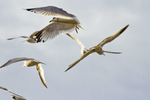
As far as the critters go, they’re still following their old patterns even though the ancestral waters are buried tens of feet below the surface. It’s why you’ll still see clouds of gulls flying around at Sunnyside’s northern border or over in Woodside, miles from the East River or Newtown Creek.

– photo by Mitch Waxman
The automobile represented “progress” to the generations who fought the World Wars. The City was remade and rebuilt by Robert Moses and the armies he led in pursuance of progress. The highways and local streets which divide us also provided the opportunity to raise the level of land over the water table and install sewerage systems. These sewers quicken the flow of water, which in turn did away with the languid puddles and marshes in which the disease spreading clouds of mosquitos could breed.

– photo by Mitch Waxman
There was no more potent symbol of “progress” in the late 19th century however, than the railroad. Unfortunately, it was ruled by opportunist financiers like JP Morgan and predatory capitalists like John D. Rockefeller, both of whom contributed to the industry becoming less and less profitable to operate. Robert Moses was no friend to the railroads either. Ultimately, by the late 1960’s, all of the private rail companies that handled passenger and freight were bankrupt and brought under government control.

– photo by Mitch Waxman
Progress seems to be a forgotten concept in the modern day. It’s about maintaining what we’ve inherited, rather than dreaming big, of what we could have. We no longer reach for the stars, even on National Chocolate Cake Day.
“follow” me on Twitter- @newtownpentacle
open window
It’s National Police Day in the Arab Republic of Egypt.

– photo by Mitch Waxman
Continuing a wintry night time walk to Brooklyn, one prepared to surmount the Pulaski Bridge over Newtown Creek. As you’d imagine, one spends quite a bit of his time walking back and forth over this crossing. Not only does the bridge rise to a fairly high altitude which allows for spectacular views of Newtown Creek, East River, and the skyline of the Shining City of Manhattan – the Pulaski Bridge walk is actually pretty good cardio.

– photo by Mitch Waxman
Mentioned in yesterday’s post was the fact that I was employing my “night kit” lenses. Longtime and frequent commenter Georgtheatheist inquired as to the specifics of my kit, and wondered why I carried both the Sigma 50-100mm f 1.8 and a Canon 50mm f 1.8, given that they replicate each other’s range. Accordingly, I’m “lifting the hood” on today’s post, and talking a little bit about how the engine runs here at your Newtown Pentacle.
Short answer is this – the Sigma lens is BIG, and incredibly heavy. Being a large lens, it gathers a lot of attention to itself, which can be problematic when encountering baser members of the street population – that’s part of it. The other is purely ergonomic – as mentioned above it’s quite heavy, and gets in the way when I’m walking along at my usual brisk pace. George asked why I don’t just use an “extender” on the 50mm prime lens, and part of the answer is that I’d have to sacrifice some of the light gathering wide apertures of the lens if I did. The other is that I’ve timed myself and I can do a lens swap, from in the bag to triggering the shutter, in around 15-20 seconds.
There’s also a difference in the esthetic quality and rendering of the shots, as captured by the individual pieces of glass. The first shot in today’s post was captured using the aforementioned 50-100, while the one above was gathered using a wider angle Sigma lens – the 18-35 f 1.8. The one below is from the Canon 50mm. There are minor differences in exposure times on them, but shots 2 & 3 are within 1/75th of a second of each other, with identical ISO sensitivity and aperture. Just because two lenses have the same specifications doesn’t mean that the shots gathered with them look the same.

– photo by Mitch Waxman
The whole point of what I’ve been working on for a while now is to capture a reasonable amount of image fidelity and quality in low light situations without using camera supports like a tripod. These are all hand held shots, gathered in the same manner which I would employ when the burning thermonuclear eye of God itself is bobbing around in the vault of the sky.
That “manner” is basically me walking along and saying “wow, look at that.”

– photo by Mitch Waxman
Where things get weird with this whole night shooting business is in an area described as “color temperature.” The new LED luminaire heads that NYC DOT has been installing around NYC throw off a bluish light that’s officially “4300 Kelvin” but which the camera will render as orange if you set it to that. In Canon camera world, that 4300K is best reset to about 3100K. If you’re in an area which has a monotypical series of these LED’s, the developing scenario is simple.
It’s when you see the old school sodium lamps on the same street as the LED’s that things go “ass over tits.” Check out the blue LED light meeting the orange sodium lamps in Greenpoint’s DUPBO – Down Under the Pulaski Bridge Onramp.

– photo by Mitch Waxman
A digital image is composed of three “plates” which mix and form a color image. RGB as the color space is known, the Red and Green plates are supplying most of the color information to the image above, and the Blue is where the shadows are being formed. Because of the orange sodium light mixing with the “Pulaski Red” paint color of the bridge, when this image came off my camera card it was practically flourescent.
A problem inherent with high ISO images, this one is 6400, is image noise. It’s produced by the sensor itself during the gathering process, and most of it manifests on the red and green plates. Finding the right balance between color temperature at the time of capture versus the time of developing the digital negative – or RAW format – file is important. Beyond the technical stuff, it’s also important to remember what the subject actually looked like while you were shooting.

– photo by Mitch Waxman
The shot above, depicting a NYC DOT truck parked under the Pulaski, was a difficult one. It’s a yellow truck, bathed in orange sodium light, with blue LED street lights peeking in from behind the fences. The original RAW file was basically a study in orange and black. The color temperature was adjusted down, as was saturation and half a dozen other developing options.
Back tomorrow with something completely different, at this – your Newtown Pentacle.
“follow” me on Twitter- @newtownpentacle
displayed during
It’s National Peanut Butter day, here in these United States.

– photo by Mitch Waxman
Occasion carried me towards Brooklyn recently, at a chronological interval during which the burning thermonuclear eye of God itself had already dipped behind the mysteries of New Jersey. Accordingly, I packed up my “night kit” and headed south from “Point A” in Astoria and down to the flood plains of Williamsburg in Brooklyn.
My night kit, as previously mentioned, are my two Sigma zoom lenses – the 50-100 f1.8, and 18-35 f1.8, as well as a trusty Canon “nifty fifty” 50mm f1.8 prime lens.

– photo by Mitch Waxman
My path was simply scouted. Heading south along Steinway and across the “Carridor” of Northen Blvd., west on Skillman and then south to the Pulaski Bridge, across Newtown Creek, then west on Greenpoint’s Franklin Avenue, and then south to my destination on Williamsburg’s north side near Berry street.
This somewhat photogenic route resulted in the crossing of wonders and landmarks like the Sunnyside Yards, the Skillman Avenue Corridor, and the legendary Newtown Creek. I could have just taken the train, but then you don’t get to see the wonders of Western Queens and North Brooklyn on your way.

– photo by Mitch Waxman
Couldn’t help but utilize one of the many “holes in the fence” at Sunnyside Yards which I’ve mapped and catalogued over the years ,and grabbing some shots of a passing rush hour Long Island Railroad unit heading towards Woodside and points further to the east. Gotta love the interlockings, I always say.

– photo by Mitch Waxman
One turned right (or west) onto the Skillman Avenue corridor, and the incredible horizon of rampant gentrification it displays. In pre industrial times, just a block or two away, you’d have been able to visit a “pest house” where suffers of contagious diseases were quarantined and left to die by their loved ones.

– photo by Mitch Waxman
Skillman Avenue took me to Queens Plaza, where one crossed under the tracks of the 7 Line and across one of the worst pedestrian intersections in all of NYC. Drivers here exhibit the same sort of behavior as stampeding cattle in this spot, moving from the feedlot to the abattoir.

– photo by Mitch Waxman
In my opinion, should the large scale decking of the Sunnyside Yards, as proposed by our Mayor – the Dope from Park Slope – happens, it will encompass the area pictured above will be first, an acreage which spans the area between Thomson Avenue and Queens Plaza. There’s a triangular section found at Jackson Avenue and 21st street which will happen initially, but that will merely be an air raid siren signaling the coming of the Luftwaffe over London. This is where the blitzkrieg will happen.

– photo by Mitch Waxman
Once the “Subway Building,” which housed both the offices of the Borough President of Queens and those of master builder Michael Degnon, the Paragon Oil building is being converted from a documents storage building over to office space as you read this. This seems to be “stage 2” of the LIC buildout, the construction and conversion of former industrial buildings over to commercial – rather than residential – usage.

– photo by Mitch Waxman
The Subway Building overlooks the Hunters Point Avenue stop of the LIRR, and sits astride the Hunters Point stop of the IRT Flushing – or “7” – line. The LIRR station is criminally underused by the MTA, IMHO.
“follow” me on Twitter- @newtownpentacle
veritable ossuary
It’s National Pie Day, thanks to the American Pie Council, in these United States.

– photo by Mitch Waxman
People think I’m exaggerating, all the time, about the poison earth surrounding my beloved Creek.
They say it can’t possibly be as horrible as I say it is along the Newtown Creek. Thing is, they’ve never been here during the workday, but instead visited on some nice Saturday in July. To understand the horror of it all, you need to see it, smell it, experience it – personally. That’s why I do my walking tours, but the walking routes I take the public out on are as safe a set of paths as you can possibly scout through the Newtown Creek Industrial Districts. As a note – whenever I’ve got a regulator or political official out with me, I take them to places which are best described as “hell.” I figure that since these officials, and their forebears, are pretty much responsible for letting all of this happen in the first place that they should experience it in toto.
Before I continue… should you decide to come and explore these areas for yourself, I accept zero responsibility or liability for you doing so. I’m telling you point blank, stay away from the borderland of industrial Bushwick and Ridgewood, and the corner of Scott and Randolph in particular. You can easily get hurt, or worse. It’s Mordor up in here, with giant trucks whizzing around, which scare away rodents of unusual size – critters who are oddly used to being out in the daylight. There’s a whole set of rules around here that you aren’t necessarily privy to either. It’s too late for me, but save yourself.
Stay away from the Scott Avenue footbridge zone, yo, this shit’s nasty.

– photo by Mitch Waxman
That’s the Scott Avenue Footbridge pictured above, incidentally, which provides one with an interesting vantage point to observe the area from. It’s a bit like a hunting stand providing an elevated POV in the middle of some savanna. The bridge itself is typical of the Long Island Railroad footbridge model you’ll find all over Queens. A steel and concrete structure that provides pedestrian egress high over one of their train lines. In the case of this particular bridge, which is quite dilapidated I would add, the train tracks it overflies are the Bushwick Branch of the LIRR.

– photo by Mitch Waxman
Almost every other time that I’ve stood on this footbridge during the last decade, the New York and Atlantic freight operation has had literally hundreds of rail cars lined up along it – which compose the so called “Garbage Train.” Like all of the sections of North Brooklyn which touch the Newtown Creek, gentrification is under way in Bushwick. Large numbers of people are moving in just a few blocks east of here. Flushing Avenue’s intersection with St. Nichols is just a few blocks east of here – the heart of the “Brooklyn thing” which the real estate guys are so into.
Notably, the real estate guys will sometimes refer to this area as Williamsburg, rather than Bushwick or East Williamsburgh, to prospective clients. Eventually, “Williamsburg” will extend into Nassau County.

– photo by Mitch Waxman
This little neighborhood of blue collar laborers, however, is rife with hazard for the unwary. As has often been mentioned, the “working guys” have a protocol for handling themselves around heavy equipment and such, and not being privy to its mores makes you quite vulnerable to random accident. For instance – never, NEVER, cross in front of a piece of equipment – whether it truck, forklift, whatever – without stopping and waiting for the operator to acknowledge you and wave you on. Can’t tell you how many people I see just darting in front of construction equipment.
Also, advice offered to everybody crossing Northern Blvd. back in Queens is to stand behind a pole or something while you’re waiting for the light to change. Same thing applies in Queens Plaza, and the western extent of Queens Blvd. which feeds into it.

– photo by Mitch Waxman
There’s a waste transfer station, or twenty, hereabouts. The garbage guys will tell you “it’s got to go somewhere,” and in the case of the Newtown Creek watershed and surrounding industrial districts, about a third of New York City’s garbage comes here every day. Trucks come in full and leave empty, leaving behind tons and tons of construction debris, recyclables, and putrescent waste.
Have I ever mentioned that I don’t seem to get sick that much, almost as if my immune system is all jacked up and running at maximum speed for some reason?

– photo by Mitch Waxman
Looking north-west (ish) you’ll notice the everpresent Sapphire Megalith of Long Island City.
One navigates about the Newtown Creek via triangulation of position between the Freedom Tower in lower Manhattan, the Empire State Building in midtown Manhattan, and the Sapphire Megalith in LIC.
To wit – if you want to go the waterfront of the East River in LIC from Ridgewood or Maspeth, find a spot where the Empire State and the Megalith seem to line up and head in that direction. Going to Astoria? Keep the Megalith and Empire State on the left. Williamsburg? Freedom Tower at center with Empire State on your right and the Megalith behind you. When they finish all that horrible construction in LIC, I’ll have to decide on a new landmark, as the megalith won’t be the tallest building in Queens much longer.

– photo by Mitch Waxman
Close to the corner of Metropolitan Avenue and Scott is a NYC Department of Public Works access – or manhole – cover embedded in the sidewalk. DPW is one of the many agencies that were compressed into the DEP back in 1983, and out here in North Brooklyn, DPW was the inheritor of the City of Brooklyn’s 19th century sewerage projects which were all consolidated into the City of Greater New York’s holdings in 1898. It’s an intersecting sewer, which my “understanding of” indicates that below will be found some vault like structure that leads into a big pipe on one side, which is fed by a series of smaller pipes located on the other – but I don’t know that because I haven’t been down there.
The smaller pipes do feed in from upland sources, and in the case of this spot, those sources can be as far away as East New York and Canarsie. That’s something I actually do know since I’ve argued about it with officialdom.
The big pipe empties into the East Branch of the Newtown Creek across the street, at a “the size of a semi truck trailer” open sewer that’s called “Combined Sewer Outfall NC-083.” This CSO pollutes the water here with some 586 million gallons of untreated sewage a year, which is a debatable and out of date number that’s attibutable to official sources. It’s amongst the largest of the 400 CSO’s in the City, just as a note. A major contributor, roughly 20%, to the approximately billion and half gallons of raw sewage that flows into Newtown Creek annually, can be accessed below this hatch.

– photo by Mitch Waxman
BPF? A water main cover which is close proximity to the “intersecting sewer” hatch featured above, the “BPF Water” thing torments one such as myself. Does “BP” stand for “Borough President,” and if so, “Borough President” what? Is it “Brooklyn” or something else?
Arghhhhh. Something which I don’t know every detail of around the Creek? I’m a complete failure, and now everybody knows it.
Sometimes, if I didn’t make this “job” of mine up out of thin air, I’d complain about how little I get paid for the sheer angst of not knowing what the legend on some random water main cover means.

– photo by Mitch Waxman
Tittering laughter was heard, carried by an easterly breeeze, as one approached Metropolitan Avenue.
My theory is that some inhuman thing with a three lobed burning eye – housed in the cupola of a sapphire megalith found miles away – made this sound as it giggled at the frustrations of a humble narrator.
Back tomorrow, with something completely different at this – your Newtown Pentacle.
“follow” me on Twitter- @newtownpentacle
hidden laboratory
It’s International Cheese Day, for the industrialized and lactose tolerant nations of this planet.

– photo by Mitch Waxman
3.4 miles from the East River is a spot which one refers to as DUMABO – or Down Under the Metropolitan Avenue Bridge Onramp. The first bridge over the flowing waters of English Kills was erected here (slightly to the west, actually) in 1814 and was privately owned by the Masters brothers, so it was accordingly referred to as the “Masters Bridge.” Historic sources indicate this spot as being, during the colonial to civil war period, the demarcation point between salt and fresh water on the English Kills tributary of the fabulous Newtown Creek. Shellfish were described as being found in “great abundance.” It was once known as White’s Dock, for the vulgarly curious. The precursor of the modern day Metropolitan Avenue Bridge was built in the 1870’s, and the modern bridge (much altered) was erected in 1931.
The fresh water was being fed into English Kills by upland springs and streams in nearby Bushwick that flowed downhill into it, and by ground water entering it from the bottom. Back in 1814, Metropolitan Avenue was just a wooden plank toll road rising up from the swamps, and it was called the “Williamsburgh and Jamaica Turnpike road.” The springs and streams of Bushwick are what attracted beer breweries like the Ulmer people to a then German speaking rural neighborhood to ply their trade, but I digress. The fat renderers and acid factories began to show up in the 1830’s and 40’s around these parts, and notably – Peter Cooper’s “pestilential” glue factory, where Jello was invented, was just a few blocks away.

– photo by Mitch Waxman
NYC DOT has been doing a bunch of work at this spot recently, some sort of construction that they attached to the bridge itself. Unfortunately, they didn’t do anything about the loose soil on the shoreline, nor the decaying wooden bulkheads holding that shoreline in place. Of course, not many people come back here, but it would have been fairly easy to fall into English Kills given the rotting shoreline when the shot above was captured.

– photo by Mitch Waxman
That’s the Mary H. tug, tied up to the Bayside Fuel Depot bulkheads, just east of the Metropolitan Avenue Bridge. This is pretty much the extent of serious maritime access to English Kills given the black mayonnaise/sediment mound situation that gobbles up operational draught and depth. The green wall with all the kit on top is Waste Management’s Varick Street Waste Transfer Station. The Waste Management facility handles predominantly “putrescent” or black bag garbage for the NYC Department of Sanitation, which is processed on site and then loaded onto the so called “garbage train” which travels on the tracks of LIRR’s Bushwick Branch to Fresh Pond and then over the Hell Gate Bridge to points unknown.
Seriously, unknown. I’ve asked and was told “homeland security” precluded the dissemination of where NYC’s garbage is dumped.

– photo by Mitch Waxman
One headed up Varick Street towards industrial Bushwick from Metropolitan Avenue, where this spectacular salt dome structure was encountered. Seriously, no sarcasm is offered, this was a visually interesting and somewhat elegant solution to the problem. The rest of the neighborhood is dull, weathered, depressing. It’s nice to see a bit of color and style on display for something so pedestrian. It’s right next door to the Waste Management facility on Varick Avenue.

– photo by Mitch Waxman
The streets in this section, just south and east of Newtown Creek, are industrial in the extreme. Heavy trucking, the garbage industrial complex… suffice to say that the roadways aren’t exactly bike or pedestrian friendly, and that they are in a sorry state of repair. Watch your step hereabouts, and never cross in front of a driveway without first taking a look. This part of the Newtown Creek watershed is what the band Metallica was likely describing with their “death magnetic” album. There’s “ghost bikes” everywhere you look, the air is a poisonous fume…
Yep, it’s pretty much Tolkien’s Mordor back here.

– photo by Mitch Waxman
Turning off of Varick, I found myself wandering down Stewart Avenue and onto Randolph Street towards the undefended border of Brooklyn and Queens and that hazy industrial borderland which can either be called Ridgewood, East Williamsburg, or Bushwick – depending on whom you ask. Saying that, move quickly through this area, don’t talk to anyone, and certainly do not ask them questions if they speak to you. I would expand on why, but I’d again be told that I’ve seen too many movies, by some rich guy that moved to Hipster Bushwick from Connecticut less than six months ago who is trying to connect with a local art or club scene that they heard about on Instagram.
Of course, I couldn’t have more inconspicuous – the only person for about a square mile not wearing a safety vest and hard hat, and instead clad in a filthy black raincoat flapping about in the poison wind while waving a camera about.

– photo by Mitch Waxman
Speaking of the Bushwick Branch of the LIRR, which carries the garbage train from Bushwick into Queens and its mysterious destination on the continent, it’s just beyond that fence in the shot above. It’s been a while since I wandered through here, and those corrugated fences you see are fairly new, as evinced by a near total lack of graffiti. Back to the implied presence of criminally inclined individuals who are organized into a structure which one might define as a “crew” or a “family,” I’d point out the total lack of graffiti on a visible fence line in North Brooklyn – the high end graffiti capital of these United States.
Go ask someone who grew up in Brooklyn or Queens what that means.
Nevertheless, as is always the case when wandering through the industrial zones surrounding the fabled Newtown Creek, that horrible inhuman thing with the three loved burning eye that cannot possibly exist in the sapphire megalith of Long Island City was watching. It sees all, owns all, knows all.
More to come, next week, at this – your Newtown Pentacle.
“follow” me on Twitter- @newtownpentacle
