Archive for the ‘East Branch’ Category
heavy boots
Yeah, Happy Earth Day.

– photo by Mitch Waxman
Another Earth Day rolls around, wherein large numbers of happy little sophists will gather together in Manhattan Parks and congratulate themselves for separating their trash into “recycling” and “garbage” parcels. They will pat each other on the back, and claim that NYC is the “greenest” and most “resilient” of American cities. You won’t see any of them visiting LIC, or Greenpoint, Maspeth, or Bushwick, or Ridgewood. They won’t think about what happens after they flush their toilets, either.
Few, if any, will find themselves having arrived at the Newtown Creek.

– photo by Mitch Waxman
They won’t see the black waters of Newtown Creek’s tributary Maspeth Creek, or smell the battery acid odor of raw sewage as it is entering the waterway. They won’t comment on the illegal dumping, or the true nature and environmental impact of the recycling industry. Greater good, they would say, were they to leave Manhattan.

– photo by Mitch Waxman
Few will visit Dutch Kills at low tide, over in LIC. If they did, they would be forced to rationalize the rotten egg smell as being produced by anaerobic microbes. They wouldn’t puzzle over the neon colors of this tributary of Newtown Creek, whose mouth is .75 of a mile from the East River.

– photo by Mitch Waxman
They won’t wander through the borderlands of Brooklyn and Queens to Ridgewood, and witness what the recycling process actually looks and smells like. They won’t worry about what they are breathing either.

– photo by Mitch Waxman
The Manhattan people like to feel as if they’re doing something to help the environment, and will do so in front of television cameras. They will make a show of discussing the banning of plastic grocery bags, or demand that NYC begins to compost its organics. They won’t realize that this composting has to be done somewhere within throwing distance of their Borough, and that it will carried by truck to some central receiving facility where it will be collected and stored whilst awaiting processing. They don’t know that this area will be somewhere along the Newtown Creek.

– photo by Mitch Waxman
They certainly won’t visit the tracks of the LIRR’s Bushwick Branch line, and see the hundreds of filled cargo boxes that compose the “garbage train.” They won’t care that the concentrating point of roughly 30-40% of NYC’s garbage is found on the corner of Varick Street and Johnson Avenue, nor about the thousands of trucks which descend upon it daily.
So – Happy Earth Day, from Newtown Creek.
“follow” me on Twitter- @newtownpentacle
Upcoming Tours –
May 3, 2015 –
DUBPO, Down Under the Pulaski Bridge Onramp
with Newtown Creek Alliance Historian Mitch Waxman, a free tour offered as part of Janeswalk 2015, click here for tickets.
May 31, 2015 –
Newtown Creek Boat Tour
with Working Harbor Committee and Newtown Creek Alliance Historian Mitch Waxman, click here for tickets.
possible opportunities
My beloved Newtown Creek, at the currently undefended border of Brooklyn and Queens.

– photo by Mitch Waxman
The spot which this shot was captured from is definitively in Queens, although it is quite close to the Brooklyn border which is currently somewhere on the Grand Street bridge in DUGSBO. Said border has moved around a bit over the years, as the political classes of both Boroughs vied for advantage over each other. Nearby Ridgewood has been claimed by both municipal entities over the years, for instance, as each attempted to increase its Congressional delegation or share of tax revenue from State or Federal government. This border dispute has become violent in the past, and it’s just a matter of time until another conflict springs up around the legislative demarcation. It would be a war of alliances, and entrenched positions, a grinding slaughterhouse which future generations might call – Brooklyn Queens War One, or BQW1.

– photo by Mitch Waxman
It has long been my supposition that were hostilities to break out between the two sides, the neighborhood of the Grand Street Bridge would form up the front line, functioning as a stand in for the Ardennes Forest as the setting for an unwanted but inevitable conflict. I’m sure that alliances would figure into this, eventually drawing the Bronx and Staten Island in. Manhattan would likely act as a war profiteer, selling weapons and intelligence to all sides. The random possibility of volunteer regiments from White Plains or Jersey City volunteering to fight is slim, but is definitively something for the Generals of both Borough Halls to figure into their strategic calculations. Last thing you’d want is a few hundred thousand fresh “Doughboys” showing up from Albany.

– photo by Mitch Waxman
Eventually, even Nassau County would find itself having to choose sides, as refugees from Canarsie and Jamaica seeking to escape the shelling flooded into the relative safety of the eastern suburbs. The Brooklyn aligned forces would have a naval advantage, I’m sure, as Queens has been stripped of much of her maritime infrastructure. With the Bronx at her back, however, Queens aligned forces would make it quite costly for the BKSI soldiery or naval forces to capture even an inch of ground. Don’t forget, Queens has the rails, which means that large scale troop deployments and even rail based guns are possible. The Battle of the Queensbridge Houses would surely be reminiscent of Stalingrad, and the Battle of Breezy Point remembered as a tragedy for both sides. Perhaps the blasted heaths of crater scarred Hunters Point and an artillery blasted Greenpoint might serve as a cautionary tale for future generations.
Also, Queens has all the airports.
“follow” me on Twitter- @newtownpentacle
The 2013 Spring and Summer Tours Schedule
“follow” me on Twitter at @newtownpentacle
– photo by Mai Armstrong
Want to see something cool?
Odds are that a bunch of the folks who will be reading this might have no idea who Mitch Waxman is, why they should come along with him on a tour of some weird neighborhood in Brooklyn or Queens or Staten Island, nor what a Newtown Creek or Kill Van Kull are- let alone where. Who is this weirdo?
Check out the “bio” page here at Newtown Pentacle, or this profile of me from the NY Times published in 2012. My tours of Newtown Creek have garnered no small amount of interest from the fourth estate- whether it be DNAInfo, untappedcities.com, Queens Chronicle, newyorkview.net, the 22blog, photobycateblog.com, or Queensnyc, and I’ve turned up in a bunch of media reports, documentaries, and been interviewed for multitudinous reports on the lamentable history of the Newtown Creek.
Most recently, it was National Geographic and Curbed. Attendees on my tours come from a variety of backgrounds- photographers, history and rail buffs, maritime enthusiasts, and there always seems to be an odd and welcome concentration of elected officials and journalists about.
What is with this guy?
I’m the Newtown Creek Alliance Historian, Official Photographer and Steering Committee member of the Working Harbor Committee, a member of the Newtown Creek Monitoring Committee and the Newtown Creek CAG, and am also a member of the Kosciuszko Bridge Stakeholders Advisory Committee. Newtown Pentacle, this blog, has been steadily published since 2009. I live in Astoria, Queens with my wife and our little dog, Zuzu.
In just the last few years, I have exposed thousands of people to the Newtown Creek, and its incredible history. This is where the industrial revolution actually happened, along this 3.8 mile long waterway that defines the border of Brooklyn and Queens.
– photo by Mai Armstrong
In 2013, continuing relationships with Atlas Obscura, Newtown Creek Alliance, and the Working Harbor Committee (as well as friends like the Metropolitan Waterfront Alliance, and others) allow me to offer the following schedule. Live ticketing links will be made available as they come online, and all dates are subject to cancellation or rescheduling due to weather or unforeseen circumstance. There are 6 unique walking tours listed here, and one boat trip in which I will be the principal speaker.
Private tours are possible, schedule permitting, and can be arranged by contacting me here. Last year, for instance, several private University classes engaged me for a day at the Creek, as did a few private groups. As mentioned, contact me and we will figure something out if you’ve got a meetup group, college class, or special request.
Here then, is my official schedule as it stands right now. There will likely be a few additions as time goes on, which I will let you know about as they occur. Best to subscribe to this blog (top right, email subscription) or “follow” me on Twitter @newtownpentacle for news.
In April, 2013- There will be a brand new tour of Greenpoint debuted, which I call “Glittering Realms.”
Glittering Realms– Saturday, April 20, 2013
Newtown Creek walking tour with Mitch Waxman and Atlas Obscura, tickets now on sale.
In May, 2013- We start off with 13 Steps around Dutch Kills, go to the Insalubrious Valley, visit DUKBO, and finish off the month with a Working Harbor boat tour.
13 Steps around Dutch Kills– Saturday, May 4, 2013
Newtown Creek walking tour with Mitch Waxman and Atlas Obscura, tickets now on sale.
Parks and Petroleum- Sunday, May 12, 2013
Newtown Creek walking tour with Mitch Waxman and Newtown Creek Alliance, tickets on sale soon.
The Insalubrious Valley- Saturday, May 25, 2013
Newtown Creek walking tour with Mitch Waxman and Atlas Obscura, tickets on sale soon.
Hidden Harbor: Newtown Creek tour with Mitch Waxman – Sunday, May 26,2013
Boat tour presented by the Working Harbor Committee,
Limited seating available, order advance tickets now. Group rates available.
– photo by Mai Armstrong
In June, 2013- We visit the Poison Cauldron, return to the Insalubrious Valley, and check out the Kill Van Kull.
The Poison Cauldron- Saturday, June 15, 2013
Newtown Creek walking tour with Mitch Waxman and Atlas Obscura, tickets on sale soon.
Kill Van Kull- Saturday, June 22, 2013
Staten Island walking tour with Mitch Waxman and Working Harbor Committee, tickets on sale soon.
The Insalubrious Valley- Saturday, June 29, 2013
Newtown Creek walking tour with Mitch Waxman and Newtown Creek Alliance, tickets on sale soon.
In July, 2013- We visit Queens’s Hunters Point with a brand new tour. I might have another offering or two for you, but nothing I can speak about quite yet.
Modern Corridor- Saturday, July 13, 2013
Newtown Creek walking tour with Mitch Waxman and Atlas Obscura, tickets on sale soon.
– photo by Mai Armstrong
In August, 2013- We return to the Poison Cauldron, repeat the 13 steps, and the Kill Van Kull walks.
Kill Van Kull- Saturday, August 10, 2013
Staten Island walking tour with Mitch Waxman and Working Harbor Committee, tickets on sale soon.
13 Steps around Dutch Kills- Saturday, August 17, 2013
Newtown Creek walking tour with Mitch Waxman and Newtown Creek Alliance, tickets on sale soon.
The Poison Cauldron- Saturday, August 24, 2013
Newtown Creek walking tour with Mitch Waxman and Atlas Obscura, tickets on sale soon.
There are a few other dates coming in the fall, and a couple of more summer events which are still being discussed, but I’ll let you know more about them in coming posts.
Also, I will definitely be onboard but not on the microphone during the Working Harbor Committee “Beyond Sandy” Hidden Harbor tours on Tuesday nights, all summer. Hope you can come along.
strange narratives

– photo by Mitch Waxman
Work is under way on certain subjects of a rather esoteric nature around HQ this week. A good amount of my attention is being focused on the particular section of Newtown Creek bulkhead pictured above, an area whose street facing side adjoins 47th street between Grand Avenue and 58th road. This was part of the aluminum manufacturing operation conducted by the ALCOA corporation during the second world war, spoken of at length by the departed Frank Principe. A general call for information is put forward to surviving Maspethicans and Blissvilians for any information which they might possess on the area- contact me here if you’ve got any tales to tell about the place which you can share.
I’m aware that the “office” to the plant was on the corner of 49th street at 47-10 Grand Avenue, incidentally, and know a bit about the heavy FBI presence during the 1940’s which area wags commented upon contemporaneously.

– photo by Mitch Waxman
Crossing over from Queens to the Brooklyn side of the bridge, where Grand Avenue transmogrifies into Grand Street, one finds first a large shipping hub commensurate with dozens of trucks and then the Charles J. King scrap metal operation. The truck yard, it seems, occupies the footprint of a factory which built and sold prefabricated houses- a novel concept in the early 20th century. They would assemble an entire dwelling on site and then ship it out via truck or rail to all points of the compass.
An operation of some size and reputation, this is another part of the story here in DUGSBO which is in the process of research and production.

– photo by Mitch Waxman
Additionally, it would seem that the enormous Feldman lumber operation on Grand Street has been a lumber yard for literally more than a century- the business and parcel merely changing hands over the years. I’ve seen photos!
The process of discovering the history and presenting the same in a cogent fashion isn’t something which one commits to in the fashion of a police detective, at least not for your humble narrator.
It is odd sometimes, for the Newtown Creek seemingly does not like giving its secrets up easily, nor in a timely fashion that is suitable for publication.
The story of the place instead oozes out of the pages of wormy newspapers and elder tomes, suggesting rather than describing an answer to the eternal question- “who can guess, all there is, that might be buried down there?”.
Also- Upcoming Newtown Creek tours and events:

for an expanded description of the October 20th Newtown Creek tour, please click here
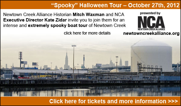
for more information on the October 27th Newtown Creek Boat Tour, click here

for more information on the November 9th Newtown Creek Magic Lantern Show, click here

for an expanded description of the November 11th Newtown Creek tour, please click here
antique bridge

– photo by Mitch Waxman
To be seen by so many diminishes me.
Seeking solace, one such as myself can only find succor and peace in those hinterland angles found between neighborhoods- or boroughs. Neither tick nor tock, Brooklyn nor Queens, the concrete devastations found in these places are nepenthe. Often do I find that my steps have carried me in some inexorable and unconscious fashion to the Grand Street Bridge, spanning the lamentable waters of the Newtown Creek itself.
DUGSBO has been calling to me (Down Under the Grand Street Bridge Onramp) again.
from nyc.gov
The bridge is located between Gardner Avenue in Brooklyn and 47th Street in Queens. The Grand Street Bridge is a 69.2m long swing type bridge with a steel truss superstructure. The general appearance of the bridge remains the same as when it was opened in 1903. The bridge provides a channel with a horizontal clearance of 17.7m and a vertical clearance, in the closed position, of 3.0m at MHW and 4.6m at MLW. The bridge structure carries a two-lane two-way vehicular roadway with sidewalks on either side. The roadway width on the bridge is 6.0m and the sidewalks are 1.8m wide. The height restriction is 4.1m. The approach roadways are wider than the bridge roadway. For example, the width of Grand Avenue at the east approach to the bridge (near 47th Street) is 15.11m.
The first bridge on this site, opened in 1875, quickly became dilapidated due to improper maintenance. Its replacement, opened in 1890, was declared by the War Department in 1898 to be “an obstruction to navigation.” Following a thorough study, a plan was adopted in 1899 to improve the bridge and its approaches. The current bridge was opened on February 5, 1903 at a cost of $174,937.

– photo by Mitch Waxman
This is close to the cartographic end of the actual “Newtown Creek”, although the English Kills tributary slithers forth into Brooklyn and slouches roughly toward Bushwick from this spot. Truncated wetlands, the canalized bulkheads and present shape of the waterway were established by the Army Corps of Engineers in the early 20th century, eradicating any semblance to what the Mespat, Dutch, or English knew the place to look like.
There used to be a nearby island, called Mussel, which the Federal authorities spent no small amount of effort on eradicating from common memory, for instance.
The East Branch, as the water on the eastern side of the Grand Street Bridge is called, continues a short distance and terminates in a complex of sewage infrastructure which underlies Metropolitan Avenue.
from 1920’s Port of New York Annual, courtesy google books
Newtown Creek is a tidal arm of the East River, and forms the boundary between the Boroughs of Brooklyn and Queens, New York City. The mouth of the creek is nearly opposite 34th Street, Manhattan, and 4 miles northeast from the Battery. Its length is about 4 miles, with width varying from 125 to 200 feet.
About 2.75 miles above its mouth it divides into two branches, termed the East Branch and English Kills, or West Branch. About 4,000 feet above the mouth a tributary, Dutch Kills, 4,450 feet long, enters the creek from the east, and almost directly opposite another tributary, Whale Creek, 2,000 feet long, enters it from the west. Maspeth Creek, 3,550 feet long, branches off to the southward 2.25 miles below the mouth of the creek. Mussel Island, included in the existing project for removal, is situated just above the junction of Maspeth Creek with the main stream. The drainage area embraces about 7 square miles, for the most part densely built up along the banks of the creek.
Previous projects.—The original project was adopted by the river and harbor act of June 14, 1880, and was modified and extended by the river and harbor acts of July 5, 1884, and June 3, 1886. A total of $527,530.58 had been expended on the modified project prior to the adoption of the existing project on March 2, 1919.
The amount spent for new work and maintenance can not be separately stated with accuracy, the division in the early years being intermediate. An approximate estimate is that $401,260.51 were applied to new work and $126,270.07 to maintenance.
Existing project.—This provides for a channel 20 feet deep at mean low water in Newtown Creek, including Dutch Kills, Maspeth Creek, and English Kills, and of the following widths: 250 feet wide at the entrance to Newtown Creek, narrowing to 150 feet, and continuing with this width to the Grand Street Bridge on the East Branch, and thence 125 feet wide to Metropolitan Avenue on said branch, including the removal of Mussel Island; 150 feet wide in English Kills, or West Branch, to the Metropolitan Avenue Bridge across said branch, including the easing of bonds; 100 feet wide for a distance of 2,000 feet up Maspeth Creek; and 75 to 100 feet wide for a distance of 2,800 feet up Dutch Kills, with a turning basin at the head, and for the collection and removal of drift. The total length of channel included in the project is about 25,000 feet.

– photo by Mitch Waxman
Traffic, of an automotive sort, courses through and defines this locale. On the Brooklyn side, the neighborhood is called East Williamsburg and on the Queens side it’s an ancient community called Maspeth. There used to a light electric rail running through here and across the bridge, which contemporaneous sources referred to as “a streetcar” (trolley to we moderns), along Grand Street. It allowed for expansion of the great human hive in both directions, which allowed workers to get to and from the dark satanic mills of the industrial age.
Today, there’s a city bus which follows an ancient route of cart and horse, later travelled by streetcar and trolley.
Back during the days of industry, however, the preferred methodology for shipping freight was either rail or barge, not inefficient automotive conveyance.
also from nyc.gov
The highest volume Brooklyn-Queens highway was the Kosciuszko Bridge on the Brooklyn-Queens Expressway, with two-way daily volume of 190,800 vehicles, 32.0% of all traffic on the monitored thoroughfares and 71.4% of Newtown Creek crossings. Belt Parkway (Shore Parkway) was second with 155,600 vehicles per day, 26.1% of the total recorded screenline traffic.

– photo by Mitch Waxman
One of the great shames about the modern era along the Newtown Creek, often remarked upon at this- your Newtown Pentacle, is that so few of the industries based along the water utilize the bulkheaded shorelines lining their properties for their intended purpose.
Instead, the vast majority of stakeholders in the watershed are truck based businesses.
Soot paints the walls, and a bizarre “colour“- not part of any familiar palette or wholesome hue- but instead like something from outer (or perhaps out of) space- stains the vegetation and building stock with a queer sort of iridescence.
from nyc.gov
During the 47 years from 1963 to 2010, daily traffic crossing Newtown Creek increased 66.5%, to 267,100 from 160,400. Volumes increased on all four facilities: Kosciuszko Bridge up 86.7% to 190,800 from 102,200; J.J. Byrne Memorial Bridge up 51.5% to 26,700 from 17,600; Pulaski Bridge up 29.5% to 37,000 from 28,600; Grand Street Bridge up 5.3% to 12,700 from 12,000.

– photo by Mitch Waxman
Overheard murmurs, carelessly spoken in my company by the Manhattan elites, have revealed that -as early as 2004 (see page 75)– plans to replace this centenarian structure were being drawn. Statisticians have compiled numerical data, engineers have produced dire reports, and described the need for a newer, wider, and distinctly static vehicle bridge to be installed on this spot. Heavy trucks, the presence of a nearby MTA bus garage, and an ever increasing number of automobiles are cited as causatives.
Personal experience offers that when a city bus or fully loaded truck speeds across the structure, often far in excess of the posted speed limit, the 1903 vintage swing bridge cavitates, trembles, and vibrates tremendously.
from Mayor Low’s Administration in New York at Google Books.

– photo by Mitch Waxman
Given that which flows, lugubrious and languid, below- the kinetics of the Grand Street Bridge dancing in its casements can be quite disconcerting. It is something which one grows used to, however, despite the sure knowledge that when confronting the water and sediments of this part of the Newtown Creek- a single question crowds out all other thoughts in the minds of vehicle borne transient, pedestrian, or casual visitor alike…
Who can guess, all there is, that might be buried down there?
from Annual report of the State Department of Health of New York. 1896, courtesy google books
_______________________________________________________________________________
Also:
June 23rd, 2012- Atlas Obscura Thirteen Steps around Dutch Kills walk

– photo by Mitch Waxman
The “Obscura Day” Thirteen Steps around Dutch Kills tour proved that the efficacy and charms of the Newtown Creek’s least known tributary, with its myriad points of interest, could cause a large group to overlook my various inadequacies and failings. The folks at Atlas Obscura, which is a fantastic website worthy of your attentions (btw), have asked me to repeat the tour on the 23rd of June- also a Saturday.
for June 23rd tickets, click here for the Atlas Obscura ticketing page
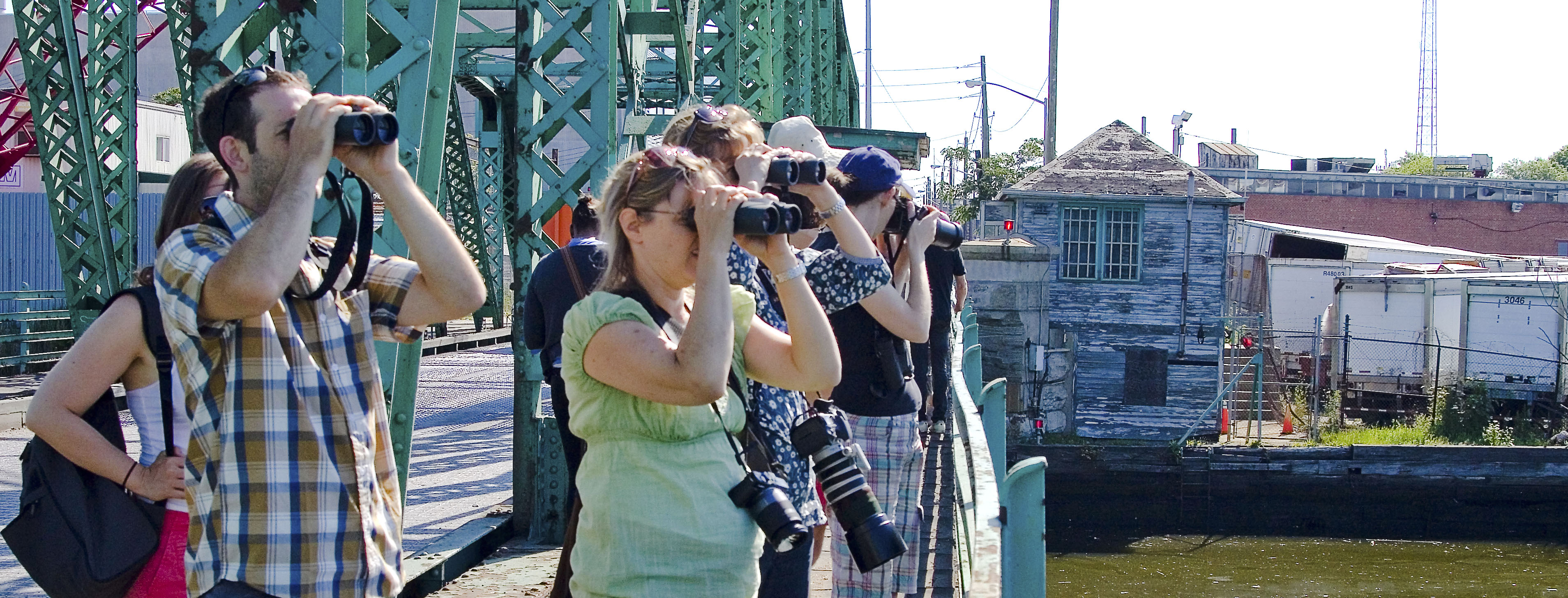
June 30th, 2012- Working Harbor Committee Kill Van Kull walk

– photo by Mitch Waxman
My various interests out on the sixth borough, NY Harbor, have brought me into association with the Working Harbor Committee. A member of the group’s Steering Committee- I also serve as the “official” group photographer, am chairman and principal narrator of their annual Newtown Creek Boat Tour, and occasionally speak on the microphone during other tours (mainly the Brooklyn one). This year, the group has branched out into terrestrial explorations to compliment the intense and extant schedule of boat tours, and I’m going to be leading a Kill Van Kull walking tour that should be a lot of fun.
The Kill Van Kull, or tugboat alley as its known to we harbor rats, is a tidal strait that defines the border of Staten Island and New Jersey. A busy and highly industrialized waterfront, Working Harbor’s popular “Hidden Harbor – Newark Bay” boat tours provide water access to the Kill, but what is it like on the landward side?
Starting at the St. George Staten Island Ferry terminal, join WHC Steering Committee member Mitch Waxman for a walk up the Kill Van Kull via Staten Islands Richmond Terrace. You’ll encounter unrivaled views of the maritime traffic on the Kill itself, as well as the hidden past of the maritime communities which line it’s shores. Surprising and historic neighborhoods, an abandoned railway, and tales of prohibition era bootleggers await.
The tour will start at 11, sharp, and you must be on (at least) the 10:30 AM Staten Island Ferry to meet the group at St. George. Again, plan for transportation changes and unexpected weirdness to be revealed to you at MTA.info.
for June 30th tickets, click here for the Working Harbor Committee ticketing page
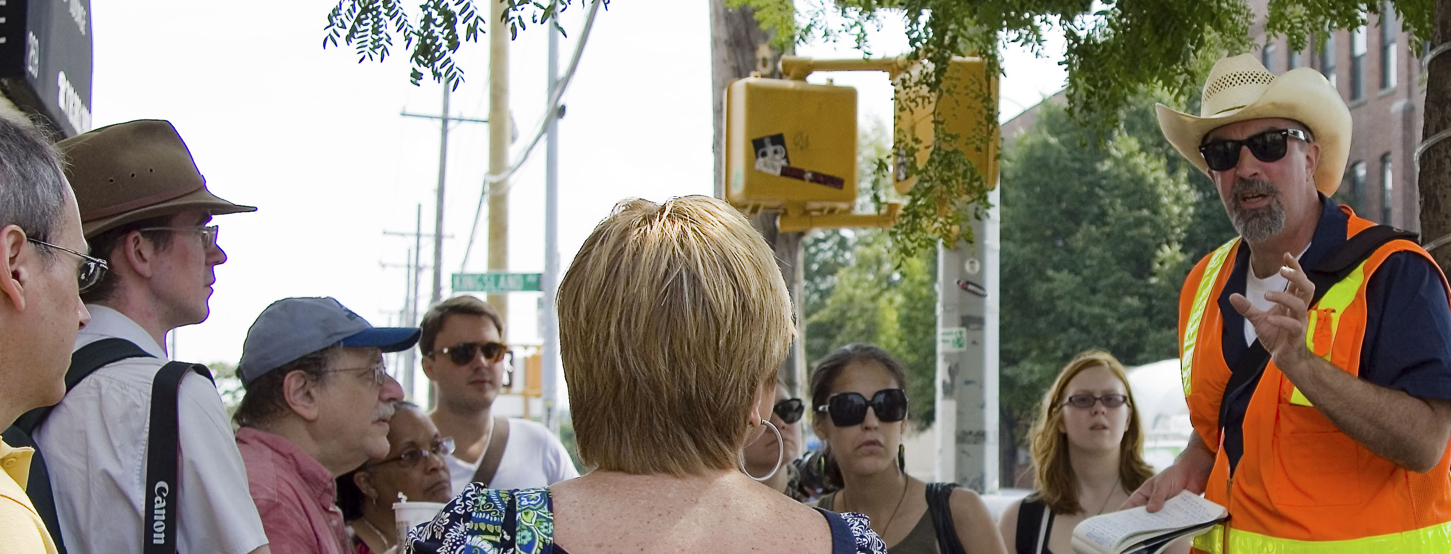
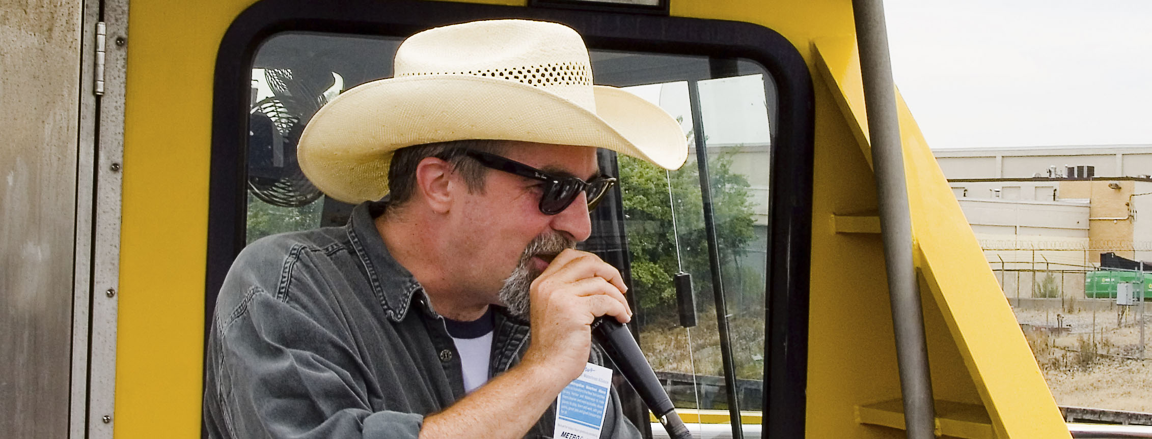
July 8th, 2012- Atlas Obscura Walking Tour- The Insalubrious Valley

– photo by Mitch Waxman
Newtown Creek Alliance historian Mitch Waxman will be leading a walk through the industrial heartlands of New York City, exploring the insalubrious valley of the Newtown Creek.
The currently undefended border of Brooklyn and Queens, and the place where the Industrial Revolution actually happened, provides a dramatic and picturesque setting for this exploration. We’ll be visiting two movable bridges, the still standing remains of an early 19th century highway, and a forgotten tributary of the larger waterway. As we walk along the Newtown Creek and explore the “wrong side of the tracks” – you’ll hear tales of the early chemical industry, “Dead Animal and Night Soil Wharfs”, colonial era heretics and witches and the coming of the railroad. The tour concludes at the famed Clinton Diner in Maspeth- where scenes from the Martin Scorcese movie “Goodfellas” were shot. Lunch at Clinton Diner is included with the ticket.
Details/special instructions.
Meetup at the corner of Grand Street and Morgan Avenue in Brooklyn at 11 a.m. on July 8, 2012. The L train serves a station at Bushwick Avenue and Grand Street, and the Q54 and Q59 bus lines stop nearby as well. Check MTA.info as ongoing weekend construction often causes delays and interruptions. Drivers, it would be wise to leave your vehicle in the vicinity of the Clinton Diner in Maspeth, Queens or near the start of the walk at Grand St. and Morgan Avenue (you can pick up the bus to Brooklyn nearby the Clinton Diner).
Be prepared: We’ll be encountering broken pavement, sometimes heavy truck traffic as we move through a virtual urban desert. Dress and pack appropriately for hiking, closed-toe shoes are highly recommended.
Clinton Diner Menu:
- Cheese burger deluxe
- Grilled chicken over garden salad
- Turkey BLT triple decker sandwich with fries
- Spaghetti with tomato sauce or butter
- Greek salad medium
- Greek Salad wrap with French fries
- Can of soda or 16oz bottle of Poland Spring
for July 8th tickets, click here for the Atlas Obscura ticketing page
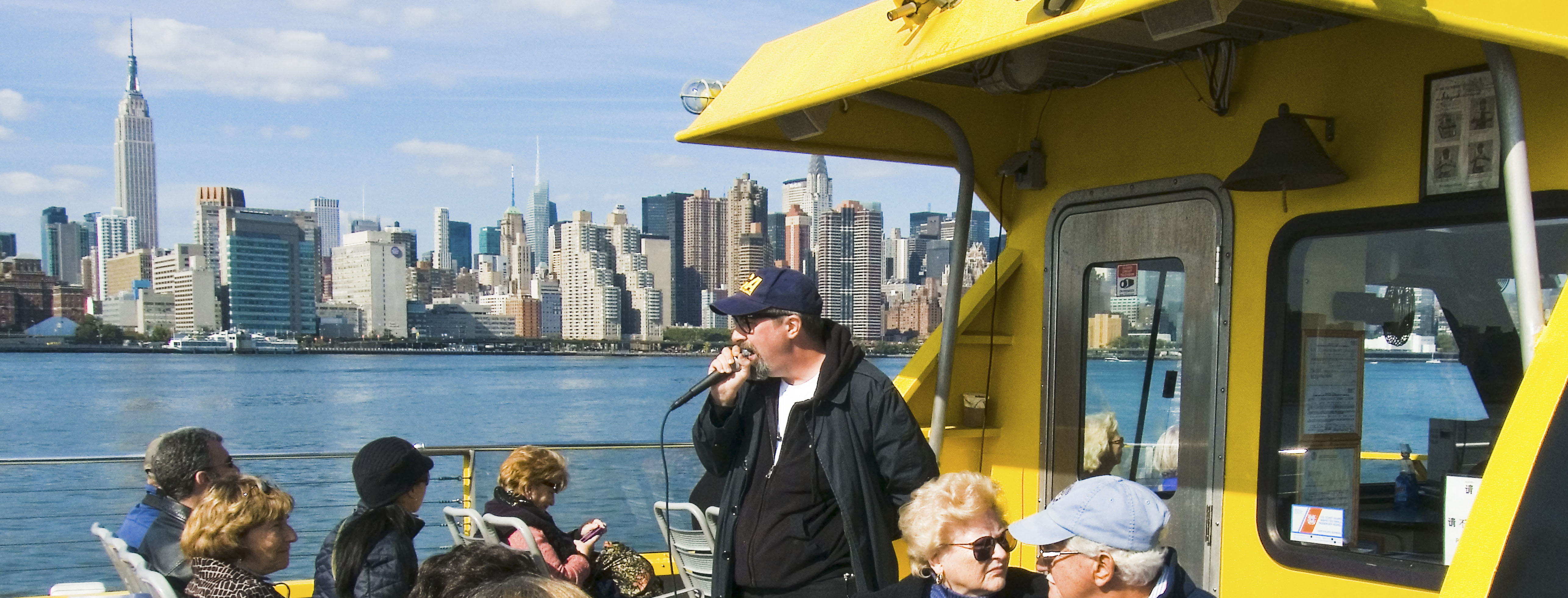
July 22nd, 2012- Working Harbor Committee Newtown Creek Boat Tour
 |
Many people know about the environmental issues facing Newtown Creek, but did you know that the Creek was once the busiest waterway in North America, carrying more industrial tonnage than the entire Mississippi River?
You’ll learn much more when Working Harbor Committee’s maritime historians and harbor experts
put it all in context during a Hidden Harbor Tours: Newtown Creek Exploration.
The heart of industrial New York, Newtown Creek was home port to hundreds of tugboats (one of which is the historic WO Decker). It was also an international destination for oceangoing ships and a vast intermodal shipping and manufacturing hub that employed hundreds of thousands of people. Forming the border of Brooklyn and Queens for nearly three miles, five great cities grew rich along the Newtown Creek’s bulkheads — Greenpoint, Willamsburg, Bushwick, Long Island City and Manhattan itself. The waterway is still a vital part of the harbor and the Working Harbor Committee (WHC) is proud to present this tour as part of the celebration of their tenth anniversary year.
Mitch Waxman, a member of WHC’s steering committee and the group’s official photographer, also serves with the Newtown Creek Alliance as its group Historian. In addition to working on WHC’s boat tours of the Creek, Mitch offers a regular lineup of popular walking tours, and presents a series of well-attended slideshows for political, governmental, antiquarian, historical and school groups. His website — newtownpentacle.com — chronicles his adventures along the Newtown Creek and in the greater Working Harbor.
He was recently profiled in the NY Times Metro section, check out the article here.
Upcoming tour: Hidden Harbor Tours: Newtown Creek Exploration.
On July 22nd, Mitch shares his unique point of view and deep understanding of the past, present and future conditions of the Newtown Creek as the narrator and expedition leader for this years Hidden Harbor Tours: Newtown Creek exploration.
Our NY Water Taxi leaves from South Street Seaport at 11 a.m. (sharp) on a three hour tour of the Newtown Creek. From the East River we’ll move into the Newtown Creek where we’ll explore explore vast amounts of maritime infrastructure, see many movable bridges and discover the very heart of the Hidden Harbor.
Limited seating available, get your tickets today.
 |
|||||||||||||||
|
|||||||||||||||


