Archive for the ‘Skillman Avenue’ Category
The 2013 Spring and Summer Tours Schedule
“follow” me on Twitter at @newtownpentacle
– photo by Mai Armstrong
Want to see something cool?
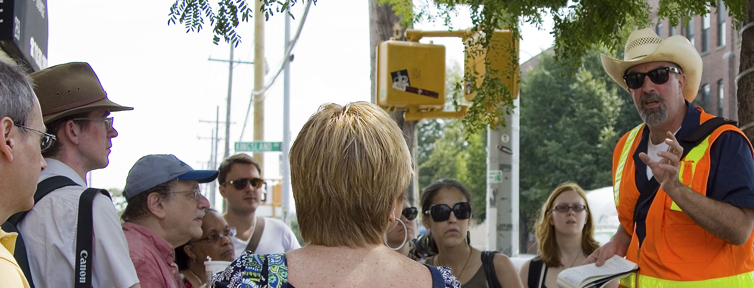
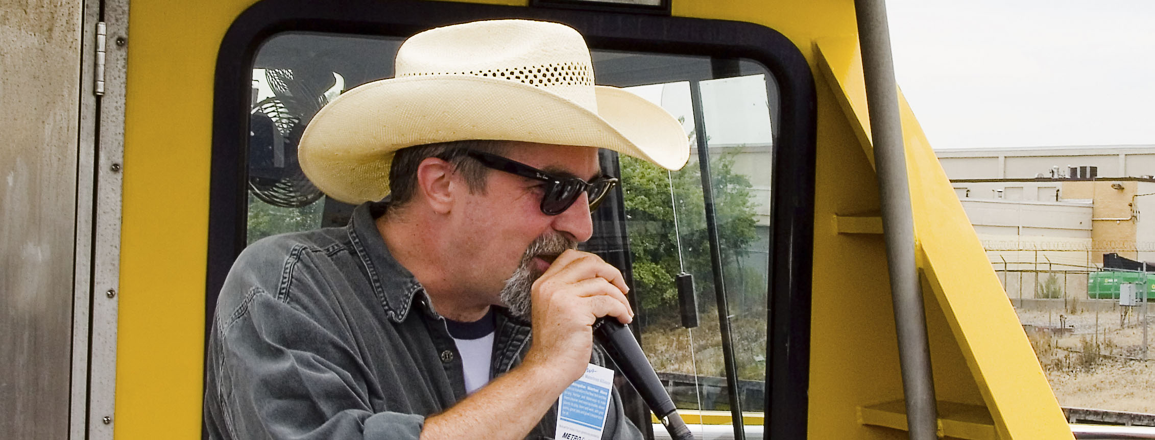
Odds are that a bunch of the folks who will be reading this might have no idea who Mitch Waxman is, why they should come along with him on a tour of some weird neighborhood in Brooklyn or Queens or Staten Island, nor what a Newtown Creek or Kill Van Kull are- let alone where. Who is this weirdo?
Check out the “bio” page here at Newtown Pentacle, or this profile of me from the NY Times published in 2012. My tours of Newtown Creek have garnered no small amount of interest from the fourth estate- whether it be DNAInfo, untappedcities.com, Queens Chronicle, newyorkview.net, the 22blog, photobycateblog.com, or Queensnyc, and I’ve turned up in a bunch of media reports, documentaries, and been interviewed for multitudinous reports on the lamentable history of the Newtown Creek.
Most recently, it was National Geographic and Curbed. Attendees on my tours come from a variety of backgrounds- photographers, history and rail buffs, maritime enthusiasts, and there always seems to be an odd and welcome concentration of elected officials and journalists about.
What is with this guy?
I’m the Newtown Creek Alliance Historian, Official Photographer and Steering Committee member of the Working Harbor Committee, a member of the Newtown Creek Monitoring Committee and the Newtown Creek CAG, and am also a member of the Kosciuszko Bridge Stakeholders Advisory Committee. Newtown Pentacle, this blog, has been steadily published since 2009. I live in Astoria, Queens with my wife and our little dog, Zuzu.
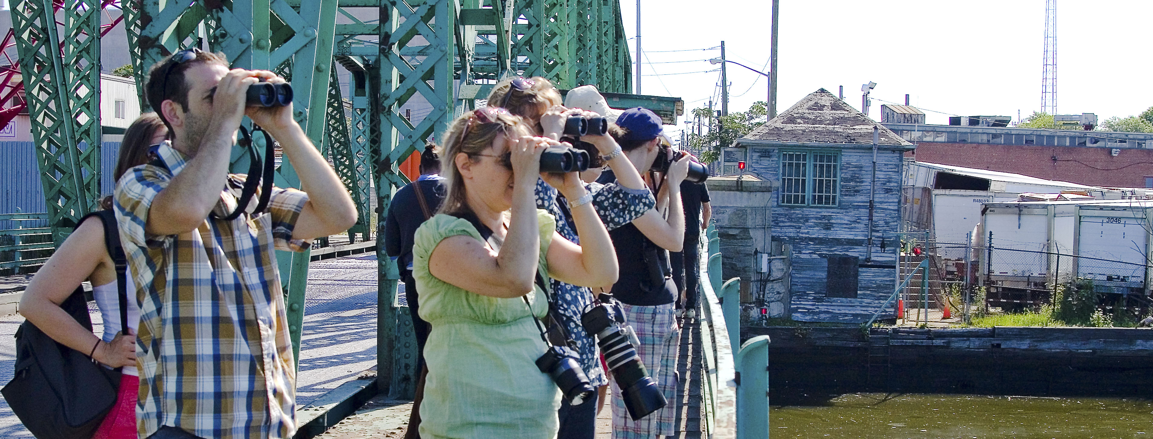
In just the last few years, I have exposed thousands of people to the Newtown Creek, and its incredible history. This is where the industrial revolution actually happened, along this 3.8 mile long waterway that defines the border of Brooklyn and Queens.
– photo by Mai Armstrong
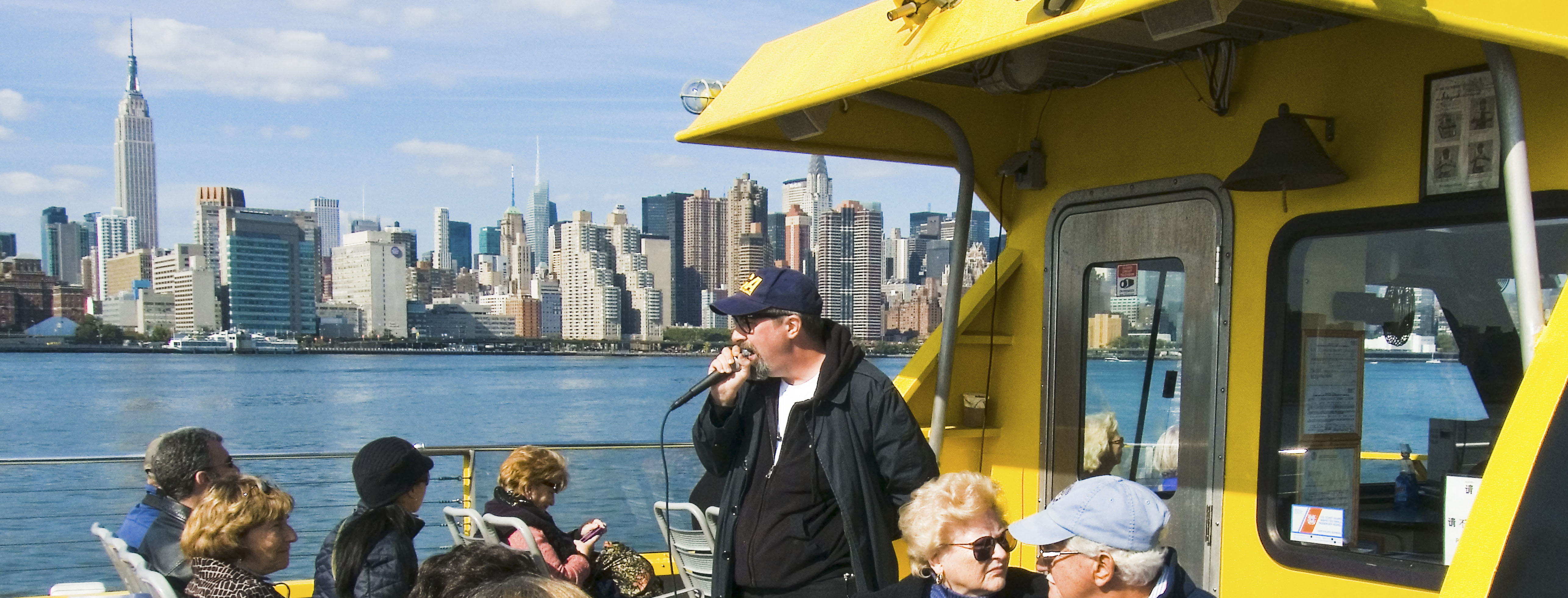
In 2013, continuing relationships with Atlas Obscura, Newtown Creek Alliance, and the Working Harbor Committee (as well as friends like the Metropolitan Waterfront Alliance, and others) allow me to offer the following schedule. Live ticketing links will be made available as they come online, and all dates are subject to cancellation or rescheduling due to weather or unforeseen circumstance. There are 6 unique walking tours listed here, and one boat trip in which I will be the principal speaker.
Private tours are possible, schedule permitting, and can be arranged by contacting me here. Last year, for instance, several private University classes engaged me for a day at the Creek, as did a few private groups. As mentioned, contact me and we will figure something out if you’ve got a meetup group, college class, or special request.
Here then, is my official schedule as it stands right now. There will likely be a few additions as time goes on, which I will let you know about as they occur. Best to subscribe to this blog (top right, email subscription) or “follow” me on Twitter @newtownpentacle for news.
In April, 2013- There will be a brand new tour of Greenpoint debuted, which I call “Glittering Realms.”
Glittering Realms– Saturday, April 20, 2013
Newtown Creek walking tour with Mitch Waxman and Atlas Obscura, tickets now on sale.
In May, 2013- We start off with 13 Steps around Dutch Kills, go to the Insalubrious Valley, visit DUKBO, and finish off the month with a Working Harbor boat tour.
13 Steps around Dutch Kills– Saturday, May 4, 2013
Newtown Creek walking tour with Mitch Waxman and Atlas Obscura, tickets now on sale.
Parks and Petroleum- Sunday, May 12, 2013
Newtown Creek walking tour with Mitch Waxman and Newtown Creek Alliance, tickets on sale soon.
The Insalubrious Valley- Saturday, May 25, 2013
Newtown Creek walking tour with Mitch Waxman and Atlas Obscura, tickets on sale soon.
Hidden Harbor: Newtown Creek tour with Mitch Waxman – Sunday, May 26,2013
Boat tour presented by the Working Harbor Committee,
Limited seating available, order advance tickets now. Group rates available.
– photo by Mai Armstrong
In June, 2013- We visit the Poison Cauldron, return to the Insalubrious Valley, and check out the Kill Van Kull.
The Poison Cauldron- Saturday, June 15, 2013
Newtown Creek walking tour with Mitch Waxman and Atlas Obscura, tickets on sale soon.
Kill Van Kull- Saturday, June 22, 2013
Staten Island walking tour with Mitch Waxman and Working Harbor Committee, tickets on sale soon.
The Insalubrious Valley- Saturday, June 29, 2013
Newtown Creek walking tour with Mitch Waxman and Newtown Creek Alliance, tickets on sale soon.
In July, 2013- We visit Queens’s Hunters Point with a brand new tour. I might have another offering or two for you, but nothing I can speak about quite yet.
Modern Corridor- Saturday, July 13, 2013
Newtown Creek walking tour with Mitch Waxman and Atlas Obscura, tickets on sale soon.
– photo by Mai Armstrong
In August, 2013- We return to the Poison Cauldron, repeat the 13 steps, and the Kill Van Kull walks.
Kill Van Kull- Saturday, August 10, 2013
Staten Island walking tour with Mitch Waxman and Working Harbor Committee, tickets on sale soon.
13 Steps around Dutch Kills- Saturday, August 17, 2013
Newtown Creek walking tour with Mitch Waxman and Newtown Creek Alliance, tickets on sale soon.
The Poison Cauldron- Saturday, August 24, 2013
Newtown Creek walking tour with Mitch Waxman and Atlas Obscura, tickets on sale soon.
There are a few other dates coming in the fall, and a couple of more summer events which are still being discussed, but I’ll let you know more about them in coming posts.
Also, I will definitely be onboard but not on the microphone during the Working Harbor Committee “Beyond Sandy” Hidden Harbor tours on Tuesday nights, all summer. Hope you can come along.
harnessed shadows

– photo by Mitch Waxman
To begin with, you will be hard pressed to find someone who is a bigger supporter of the efforts of the NYPD than your humble narrator. Vast physical inadequacies and a timorous constitution render one a “victim waiting to happen” and the presence and oversight of the gendarme is the only reason that you haven’t heard about finding my corpse lying in the street somewhere, as we live in a community cursed with predators and a criminal element which threatens all. Saying that, I recently attended a meeting of the 114th pct. community council here in Astoria, and one of the speakers was a representative of the “Anti Terror” squad. I have long been a proponent of the single truth of a “Terror War” which is that the side which most scares the shit out of the other is the one who wins. Apparently, the other guys have the upper hand at the moment, as we continue to be a reactionary and terrified opponent given to wild flights of fancy about the capabilities enjoyed by the enemy- including the deadly martial art of photography.

– photo by Mitch Waxman
This unit is tasked with subverting and detecting terrorist plots, gathering intelligence on “bad actors”, and performing a role few would ask for. The representative who spoke at this meeting, however, informed the community that should they witness- for example, someone taking photographs of bridges or other “odd” things- that they should call the police and report it as suspicious behavior. After his statement was concluded, the Lieutenant was suddenly faced with an odd mendicant named Mitch who confronted him on this. I asked “Did you actually just tell the room that photography is a precursor to terrorism”?

– photo by Mitch Waxman
I let the Lieutenant know that I ran a blog, and was speaking to him in the manner of a journalist. “Other than the fact that there is no documented evidence of this, and that google maps would actually be a far more effective tool to scout a potential target than sending out an operative with a dslr, there are specific orders curtailing the harassment of photographers issued by Chief Kelly” I continued. Then, I asked him about the glaring lack of security and holes in the fences around the Sunnyside Yard and the energy infrastructure around Newtown Creek. I asked about the boats tied off to the Buckeye pipeline at Vernon Blvd. street end, the ferry boat on English Kills, and several other choice spots for undocumented and uncommented deviltry to occur. Additionally, did he know that there are websites which claim that anyone can find a free berth on Newtown Creek and that boats regularly show up there these days from unknown points carrying who knows what? I had to remind him where Newtown Creek and the largest rail yard in New York City was, as he seemed rather focused on Manhattan.
Also- Upcoming Newtown Creek tours and events:

for an expanded description of the October 20th Newtown Creek tour, please click here
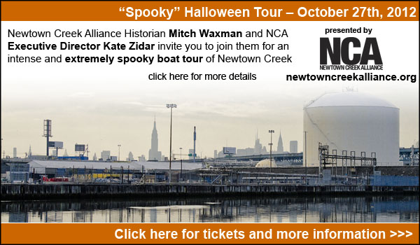
for more information on the October 27th Newtown Creek Boat Tour, click here

for more information on the November 9th Newtown Creek Magic Lantern Show, click here

for an expanded description of the November 11th Newtown Creek tour, please click here
high doors

– photo by Mitch Waxman
Let’s get two thing straight at the start of this, ok? Van Alst Avenue and Hunters Point Avenue translates into 21st Century lingo as 21st Street and 49th Avenue- that’s the first. Second, during the four years between 1916 and 1920, this was the absolute center of Long Island City.
Whilst lingering or loitering near 2100 49th Avenue in Long Island City, you may notice that it is the former Paragon Oils and Burners building- a 108,000 square foot, 6 story former factory and manufacturing facility which serves as a document storage warehouse and pedestal for advertising billboards today.
That is, you might notice it, if you aren’t distracted by the busy train tracks and rail station it sits on top of, or the manifest wonder of the skyline of that Shining City of Manhattan which frames the scene.
from wikipedia
Paragon Oil was founded by brothers Henry, Irving, Robert, Benjamin, and Arnold Schwartz. The brothers, and their sister Bess Schwartz Levy, were first-generation Americans, all born between 1896 and 1909 in Brooklyn, New York.
Their parents were Sholem or “Sam” (Chernofski) Schwartz, born circa 1868, and Lena Krakofsky, born circa 1874, who were Jewish immigrants originally from the town of Belaya Tserkov (Bila Tserkva), near Kiev, Ukraine, who had immigrated to the United States around 1895.

– photo by Mitch Waxman
Many of the monolithic constructions of the early 20th century abide in this neighborhood, which is largely given over to industrial pursuits, even today.
As is often repeated in these postings- This is where the industrial revolution actually happened, and Long Island City was not just the workshop of New York City, but America itself (!).
This view is from Skillman Avenue, by the way.
also from wikipedia
…the family was poor upon arrival in New York. Sam worked once again as a blacksmith, but now in eastern Brooklyn. When they were young, elder brothers Henry and Irving went door-to-door in Brooklyn carrying around sacks of coal on their backs, peddling it to the nearby homes and residential buildings to earn extra money for their family. At that time, some large commercial buildings had oil-fired furnaces, but residential buildings did not. A combination of factors, including the equipment available at their father’s blacksmith shop and the experience of their relatives back in Ukraine who were involved in the whale oil business, led to the brothers experimenting, designing, and finally building the first oil heaters designed for residential buildings, which eventually earned the family several patents on the design.

– photo by Mitch Waxman
One of the things which kept on popping up in my research on the place is the name “Queens Subway Building”.
The white structure which seems to be a seventh floor, according to online documentation, is some sort of “cellular telephonic” or other electronics installation.
Paragon Oil is a familiar name to some of you who may be acquainted with the story of that tortured cataract of urban infamy known to most as the Newtown Creek.
from nysdecgreenpoint.com
The former Paragon Oil Terminal property is bordered by Newtown Creek to the north, Meeker Avenue to the east, Bridgewater Street to the south, and the Apollo Street Creek parcels to the west. Beginning in 1886, two companies operated on this property; the Locust Hill Refining Company and Greenpoint Oil Refining. Both of these companies ended operation by 1905. From 1905 to 1921, a portion of the property operated as a cement works company. By 1929, a portion of the property was being operated as a petroleum storage terminal by Supreme Oil, which later became known as the Petroleum Terminal Corporation. The other portion of the property was privately owned until 1928 when it became the Brooklyn Ash Removal Company. In 1934, all operations throughout the entire property were either run by or affiliated with the Paragon Oil Company, which operated the site as petroleum storage terminal. Paragon Oil was purchased by Texaco Oil, now is known as the Chevron/Texaco Corporation, in 1960. The property was sold to Peerless Importers (now known as Empire Merchants) in 1968, which now operates the property as a liquor distribution warehouse. According to a 2005 consent agreement made with the NYSDEC, Texaco is responsible to delineate and remediate the portion of the free product plume underlying the Former Paragon Oil Terminal and control seepage of petroleum into Newtown Creek at this location.

– photo by Mitch Waxman, and HOLY MOLY, don’t miss this photo that nycsubway.org has.
About the “Queens Subway Building” angle-
It seems that Degnon Terminal and Realty, the folks who built the subway tunnels which the Paragon building stands over, and who later went on to build the vast industrial complex which began at Thomson and Skillman Avenues which ran all the way to Newtown Creek (the white building in the shot above is just one of the many gargantuan structures still extant) maintained offices at a “Queens Subway Building” for some period.
Add in the presence of the Borough President of Queens, a fellow named Maurice E. Connolly, who moved his offices to a “Queens Subway Building” in 1916 and there’s a whole lot of power and money all under one roof.
The use of the structure, known as “Queens Subway Building”, by both parties is confirmed by multiple sources. I just haven’t been able to ascertain if the Paragon Oil Burner building was indeed, the aforementioned “Queens Subway Building” also located at Van Alst Avenue and Hunters Point Avenue.
From “The Steinway Tunnels”, at nycsubway.org
At 2100 49th Ave., a 7-story office building was erected over the station during its construction and is known as the “Queens Subway Building” and was the former offices of Queens County & Borough. It is occupied today by the Paragon Oil Co.
Check this nycsubway.org shot out as well– WO! Is that the Paragon building going up?

– photo by Mitch Waxman
Children in the streets of Long Island City take no notice of the building. Within it are stored pedantic records of business and law, not the lost ark of the covenant or a magick sword or some wizard’s cloak. Charming, the structure is often noticed by passerby that comment on quirky and quaint calligraphic advertisements which surely harken back to golden times of economic splendor and memory of a clear conscience.
from a 1987 report at nytimes.com
FLOOR after floor, row after row, thousands of cardboard boxes full of business memorabilia sit in the old Paragon Oil building two subway stops away from Manhattan in Long Island City, Queens.
Under fire sprinklers and the watchful eyes of security attendants, millions of documents and records wait for their day of destruction or, perhaps, for retrieval back to an office tower across the East River.
The seven-story building at 2100 Hunters Point Avenue is one of dozens serving as giant file cabinets for Manhattan service-sector industries.

– photo by Mitch Waxman
The most detailed information on the place which I can pass on to you, lords and ladies, is the following link. It seems to be a 2005 report or proposal of some kind involving a brownfield remediation scheme, but is fairly well focused, and specific enough to claim veracity.
from aux.zicklin.baruch.cuny.edu, and fast forward to page 54
The Paragon Oils and Burners building was built in 1916 to house its growing petroleum products business. Occupied by Paragon through the 1950’s, it was used for production, warehousing, and distribution of petroleum-based products. Since the early 1960’s the building has been used primarily as a warehouse facility and most recently, a mini-storage company. The owner also generates a sizeable annual rent from exterior signage, which faces the entrance to the Midtown tunnel and the Long Island Railroad.
…hits the fan

– photo by Mitch Waxman
Council Member Van Bramer sent this out to his mailing list today, regarding Hurricane Irene
As everyone knows by now, Hurricane Irene is expected to hit our area sometime Saturday into Sunday. We should all take precautions to be prepared for a storm of this magnitude. Some areas in our district are in evacuation zones and at high risk for flooding. Those areas of Hunters Point/Long Island City should familiarize themselves with the map below and know that should an evacuation be ordered, Newcomers High School (28-01 41st Ave.), Aviation High School (45-30 36th St.) and W.C. Bryant High School (48-10 31st Ave.) are your nearest evacuation centers. The City will make a decision about whether to order a mandatory evacuation of Zone A for the general public by 8:00 AM on Saturday. The evacuation centers will be open as of 5:00 PM today and the City is strongly recommending that people within these areas immediately make plans to go to alternative locations outside of Zone A starting tomorrow for the duration of the storm. The orange areas are Zone A. The yellow areas are Zone B. The green areas are Zone C.

We are also concerned about significant portions of the district including parts of Sunnyside, Woodside, Astoria and Maspeth that have experienced flooding during several recent storms. Our office has been and will continue to be in contact with the Department of Environmental Protection (DEP) and other city agencies throughout this weekend. Anyone experiencing difficulties as a result of Hurricane Irene should contact me and my office as soon as they occur. We will report problems in real time. For those outside of Zone A areas that have experienced flooding or are concerned that you may, please click on the link below on how to protect your valuables. In addition to calling our office, DEP is asking for reports of flooding to be called in to 311.
http://home2.nyc.gov/html/oem/downloads/pdf/flooding_guide.pdf
I have also been in touch today with NYCHA and the Mayor’s Office to make certain that Queensbridge, Ravenswood, and the Woodside Houses are included in any and all emergency plans including evacuation, should that be necessary. We will continue to be in regular contact with NYCHA throughout the storm.
While we continue to hope for the best, we must prepare for the worst. The city has published some useful information in securing your home during the storm. Please click on the link below for recommendations on how best to prepare for the hurricane.
www.nyc.gov/html/oem/html/ready/hurricane_guide.shtml
Given the high volume of traffic to OEM’s (Office of Emergency Management) website there have been delays and interruptions in gaining access to some of these links. For that reason, we also include the Red Cross’ Hurricane Safety Checklist below. We have also included information from OEM’s Hurricane Guide at the end of this email should that link not respond when you try it.
http://www.redcross.org/www-files/Documents/pdf/Preparedness/checklists/Hurricane.pdf
In advance of the hurricane I wanted to remind you that clogged catch basin grates can aggravate flooding. Although DEP staff – with the help of their colleagues at other agencies – are busy cleaning catch basins now, DEP has asked us to remind homeowners and residents that they welcome assistance in removing leaves, litter or other debris that may prevent water from flowing off the streets and into the catch basins. For any of you that aren’t familiar with catch basins the attached link to a page on DEP’s website has some text and visuals that will help explain why flooding occurs and how citizens can help DEP minimize flooding by removing debris where they see it blocking catch basin grates.
http://www.nyc.gov/html/dep/html/flooding/flooding_causes.shtml
I will be keeping my district office open on Saturday to field questions and concerns from constituents. Needless to say, we will close the office when the storm approaches and will reopen as soon as it is safe to do so. My district office number is (718) 383-9566. I will be in the district throughout the storm and encourage anyone with problems to email me concerns at jvanbramer@council.nyc.gov as well as using social media including Facebook (http://www.facebook.com/jimmyvanbramer) and Twitter (http://twitter.com/jimmyvanbramer) to reach me. You may also call 311. Please only call 911 if you have a very serious or life threatening emergency.
I hope this update and the attached information proves useful to you. Again, my staff and I will be working throughout the weekend and please do not hesitate to contact me should you need assistance.
Sincerely,

Jimmy Van Bramer
Council Member

– photo by Mitch Waxman
Additionally, the Council Member included the following information from the Office of Emergency Management
OEM’s Hurricane Guide
To secure your home if a tropical storm or hurricane watch is issued:
Bring inside loose, lightweight objects, such as lawn furniture, garbage cans, and toys.
Anchor objects that will be unsafe to bring inside, like gas grills or propane tanks. Turn off propane tanks.
Shutter windows securely and brace outside doors.
Place valuables in waterproof containers or plastic bags.
Help Others Prepare
- Check on friends, relatives, and neighbors, especially those with disabilities or special needs, and assist them with their preparation and evacuation.
- If you live outside an evacuation zone, offer to shelter family and friends who may need to evacuate.
If Asked to Evacuate, Do So Immediately
The City will communicate specific instructions about which areas of the city should evacuate through local media. If the City Issues an Evacuation Order for Your Area: Evacuate immediately. Use public transportation if possible.
If you are going to an evacuation center, pack lightly, and bring:
- Your Go Bag
- Sleeping bag or bedding
- Required medical supplies or equipment
- Let friends or relatives know where you are going.
What about my pets?
- Make sure your disaster plan addresses what you will do with your pet if a hurricane requires you to leave your home.
- Plan to shelter your pet at a kennel or with friends or relatives outside the evacuation area.
- Be sure you have supplies ready for your pet in the event of an evacuation, including food, a leash, a muzzle, proof of shots, and a cage or carrier.
Account for your special needs
- Consider your capabilities and make sure your preparedness plan addresses how your special needs affect your ability to evacuate and shelter.
- Determine if you will need assistance and arrange help from friends, family, or neighbors.
- Consider additional supplies and equipment that you may need to bring with you, such as medicine, icepacks, medical devices, and backup equipment. Bring food for your dietary needs.
- Include additional time and evaluate your transportation options.
IF YOU LIVE IN AN EVACUATION ZONE
Prepare A Disaster Plan
Develop a plan with your household members that outlines what to do, how to find each other, and how to communicate if a hurricane strikes New York. If you rent your home, renter’s insurance will insure the items inside your apartment. If you are a homeowner, make sure your home is properly insured — flood and wind damage are not covered in a basic homeowner’s policy.
Know Where You Will Go
The City strongly recommends evacuees stay with friends or family who live outside evacuation zone boundaries. For those who have no other shelter, the City will open hurricane shelters throughout the five boroughs.
To ensure efficient use of resources, the City will ask all evacuees to report to an evacuation center. Once at the evacuation center, evacuees will either be assigned to a hurricane shelter in the same facility or transported to an associated hurricane shelter by bus.
Every household member should have a small Go Bag — a collection of items you may need during an evacuation packed in an easy-to-carry container such as a backpack. A Go Bag should be easily accessible if you have to leave your home in a hurry.
Assemble an Emergency Supply Kit
You may be instructed to shelter in place (stay at home) during a hurricane. Keep enough supplies in your home to survive for at least three days.
If you do not live in an evacuation zone
All areas of the city could face hurricane-related hazards such as high winds, flooding, tornadoes, and loss of utilities. You may be instructed to shelter in place (stay at home) for several days until the hurricane passes.
If you live in a high-rise apartment building
Residents of high-rise apartment buildings may face special risks from hurricanes even if they live outside evacuation zone boundaries. If you live in a high-rise building outside an evacuation zone, be prepared to take shelter on or below the 10th floor. If you live in a high-rise building located in an evacuation zone, heed evacuation orders.

– photo by Mitch Waxman
This looks like it will be a profound event. Personally, I’m preparing for an uncomfortable few days, but that’s because I live inland and uphill in Astoria. Long Island City and Greenpoint on the other hand…
Our friends at liqcity.com have prepared an excellent posting on the Zone A situation, which can accessed here:
http://www.liqcity.com/life/long-island-city-and-hurricane-irene-a-match-made-in-well-well-see

– photo by Mitch Waxman
Newtown Creek Alliance, an organization of which I’m a member, issued this statement earlier today…
Flood Warning for Creek Neighborhoods
Mayor Michael Bloomberg announced on August 25th, 2011 that certain emergency measures will be instituted in low lying coastal districts referred to as “Zone A” (at high risk of coastal flooding) due to the expected arrival of Hurricane Irene in the New York City area late Saturday night. Much of the land surrounding Newtown Creek is designated as “Zone A” on the coastal flooding map prepared by City officials, including large tracts of Greenpoint and Long Island City. For a map of the affected areas, please click here.
Newtown Creek Alliance cautions residents of the affected areas to monitor the situation and be prepared to evacuate should authorities warrant it necessary. If an evacuation is recommended or ordered, information about evacuation centers and hurricane shelters may be found by calling 311 or at by visiting this website. Additionally, be mindful that during such an event, the flood waters could carry a significant load of pollutants and should not be ingested. Care should be taken upon any contact with skin.

– photo by Mitch Waxman
Sources within the City have discussed this storm with me in the most dire tones. If you live in an area designated for evacuation, please comply. I’ll be marching out into the brave new aftermath early Monday morning, if there’s something which you think I should point my camera at, please contact me here. Good luck, and assuming the availability of both electrical power and internet connectivity, I’ll post as the situation develops.
As this post was being prepared, Council Member Van Bramer passed along another message, ordering the mandatory evacuation of Zone A by 5 pm Saturday.

pillars and niches

– photo by Mitch Waxman
You might recall, Lords and Ladies of Newtown, that back on December 11th of 2010 the 100th anniversary of the Hunters Point Avenue Bridge was commemorated by the New York City Bridge Centennial Commission and that I was one of the two Parade Marshalls for the celebration.
There were a few postings about the bridge found here, at your Newtown Pentacle, which detailed the storied history of the structure and it’s environs. Additionally, more than once has the Degnon Terminal been mentioned in prior posts, and appropriately so.

– photo by Mitch Waxman
Also mentioned in prior postings (parts one and two), the Newtown Creek Alliance had tasked a small group of it’s members (myself included) with attempting a photographic catalogue of the bulkheads of Newtown Creek and it’s smaller tributaries. Noble in it’s aspirations and massive in capability and resources, Riverkeeper sent a vessel and captain from it’s vast fleet to shepherd us through these very murky waters. These shots were captured from a small launch boat capable of crossing both low ceilings and containment booms which was little more than rowboat with an outboard motor.

– photo by Mitch Waxman
Beneath the Hunters Point Avenue Bridge, the waters of the long neglected industrial canal called Dutch Kills have been silting up with the worst sort of filth for decades, knowing not the presence of dredging or channel depth engineering. Here, the sediments pile up and erupt from the water.
The only flow of water here comes from rain and sewage, this is a stagnant and forbidding place.

– photo by Mitch Waxman
There is only a trickle of dry weather discharge dripping from this combined sewer outfall hidden away beneath the bridge. It hadn’t rained for a couple of days, but still, there was some flow. Though minor, this sort of discharge can add up to hundreds of gallons a day, carrying- for instance- the mop water that a Chinese restaurant on Broadway in Astoria might dump into the corner sewer drain nightly (yup, actual thing, observable every single day).
The reason I mention Astoria is that most of the drains on the Queens side resolve back to the Bowery Bay Wastewater Treatment Plant.

– photo by Mitch Waxman
In this posting, which led up to the Hunters Point Avenue bridge event mentioned above, some logic is offered as to how to decode the DEP “SPDES” signs which are required to be displayed above CSO discharge points. Like all things government, a bizarre nomenclature and specific system of numbering applies to the CSO’s.
It took your humble narrator a little bit to dope it out, so it is offered to save you from having to do so.

– photo by Mitch Waxman
Vehicle traffic was rattling by overhead on Hunters Point Avenue, and we observed the surprisingly good condition of the bridge anchorages. Notice the extreme high tide line of encrusted sediment lining the structural elements of the bridge. It would interesting to know what sort of organisms exist in that slime and residue, and what they could tell us about the true nature of the water here.

– photo by Mitch Waxman
The bubbles of mephitic gas which had been been popping all around the boat since we entered Dutch Kills began to subside at this point, perhaps it is the permanent shadows beneath the LIE and the two rail bridges which allow the methane producers in the sediment to thrive. The Hunters Point Avenue Bridge’s roadway is a grate which allows quite a lot of light to filter down to the surface.

– photo by Mitch Waxman
It must be admitted that long have I desired to see what might be hiding down here, and observe the understructure of this bridge. As it might be guessed, your humble narrator is a bit of an infrastructure geek, and the lesser bridges of New York City often surprise the observer.
This used to be a double leaf bascule, you see, whose mechanism was replaced in relative modernity.

– photo by Mitch Waxman
This shot is from the December 11th Centennial event and shows the other more easterly orientated shoreline, where the bascule hinge and bridge house are located, showing the Hunters Point Avenue Bridge in an open position. The spot I shot it from was the abutment seen in the prior shot.

– photo by Mitch Waxman
The head of Dutch Kills is a straightaway and engineered canal with a widened terminus, and the term for it is a “turning basin”. Overall, it’s shaped like a giant letter “T”. Heavy industrial concerns all around Dutch Kills built and maintained docks with which they could transfer materials which came to them by barge to rail (and truck, but rail was the key), and then to factory floor for processing. The manufactured product of these industries not destined for the local market would also then be shipped out via these docks.
Today, nothing much happens on the waters of Dutch Kills, and nearly all of the rail infrastructure is relict and abandoned- or purposed solely for passenger service to and from Manhattan.

– photo by Mitch Waxman
The benefits, costs, and upkeep of an intermodal transportation hub like this are massive. Unfortunately, most of the modern business in the area is oriented toward an automobile and truck culture rather than to the locomotive or maritime city, and thse docks are abandoned and rotted away. The once mighty rail lines are interrupted or orphaned, and the great factories which they once supplied are either empty, used for warehousing, or carved up into a hundred smaller spaces.
Where titans once thrived, ants now scratch by.

– photo by Mitch Waxman
Tomorrow, the Dutch Kills turning basin at this… Your Newtown Pentacle.


